

The Trek in a snapshot
Location
Ogden Utah – Northern Utah
Managing Agency
Government and private ownership
Pets
Allowed
Fees
None
Restrooms
Yes, at parking lot
Camping
Not allowed
Trail Condition
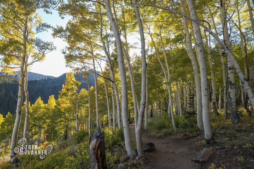
Trail is clear and visible. You will follow Bonneville Shoreline Trail until you turn up the canyon to the waterfall.
Sights
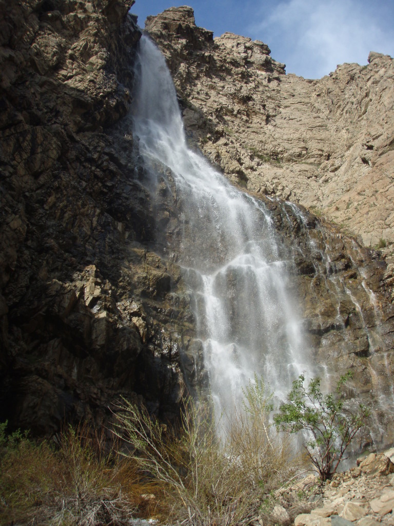
300+ foot waterfall cascade called Malan’s Waterfall
Water Info
Bring at least 1 liter. You will follow the creek for the last 1/2 mile to the waterfall
Best Season
Spring, fall, winter. Summer is hot and too crowded.
Distance
2.4 miles roundtrip
Time Required
1-2+ hours
Parking Elevation
4772 ft
Summit Elevation
5815 ft
Elevation Difference
1043 ft

Trek Planner Maps
Trailhead: 41° 12.637’N, 111° 55.917’W
Climbing Training Area: 41° 12.176’N, 111° 55.602’W
Malan’s Waterfall: 41° 12.017’N, 111° 55.206’W

Experience. Discover. Explore.
Follow along on our adventure then go out on your own!


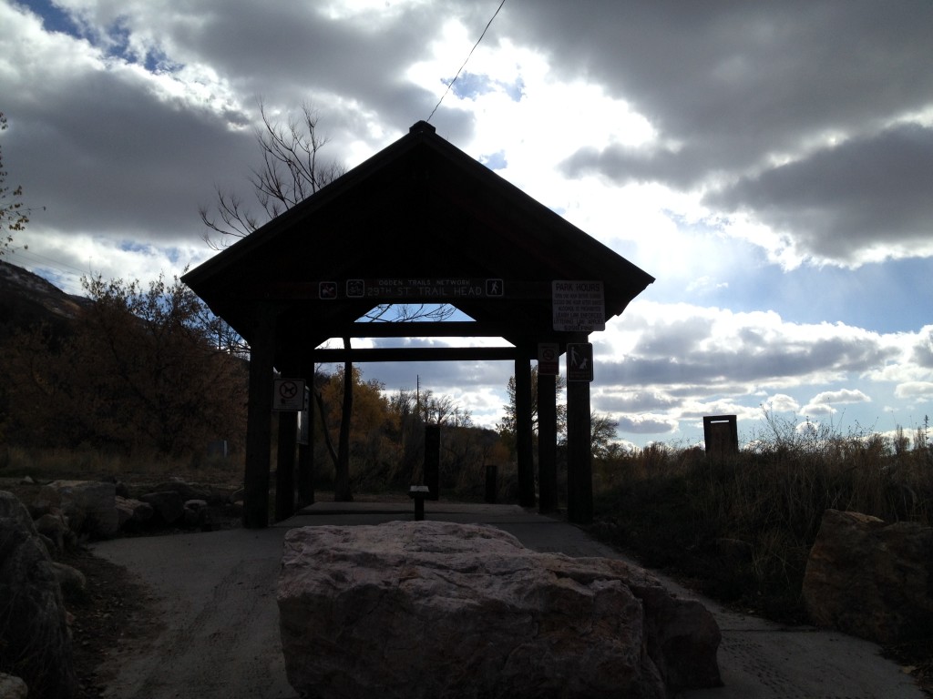
The trail starts off in a fairly large parking lot that is next to a residential tower. The bathrooms are located on the north side of the parking lot where you entered.
There is a small pavilion with information about the area and settlers in general. You will also see several trails starting at this location.
To get on the trail that goes to Waterfall Canyon you will want to follow the trail that goes up to the BST (Bonneville Shoreline Trail).
Just outside the pavilion you will see a sign that points you to the left which hugs a fence for a little ways then curves up the mountain side.
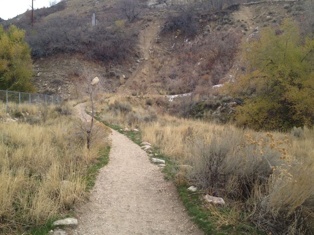
The trail from this point is visible and wide enough to let hikers and bikers pass by.
As you go up the trail you will see several splits from the main trail. As long as you keep going up the mountain to the canyon and NOT down it you will be on the right path.
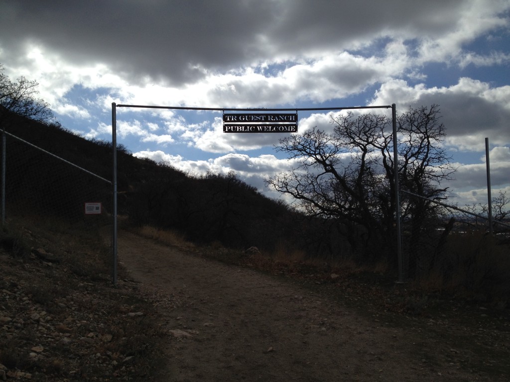
After about a 1/4 mile you will come to a fence and gate area where a sign dangles in the center “TR GUEST RANCH – PUBLIC WELCOME”.
You will see a sign to the left on the fence that lets you know that you are entering private land. I listed the website that it lists on the sign below:
www.OgdenFootHillPrivateLand.com
The above link goes to the Facebook page of the owners of the land that you are hiking on. They have rules that you need to follow such as picking up after your dogs, don’t litter and be respectful of their land. But basically, you are allowed to be on their land due to their generosity – so be respectful!
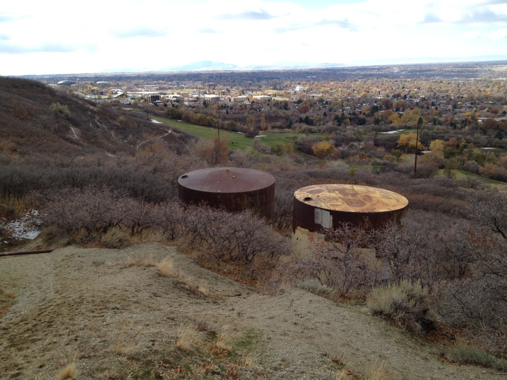
Continue on a few hundred yards and you will see on your right hand side old water silos. The trail now turns directly towards the mountains from here and follows the creek.
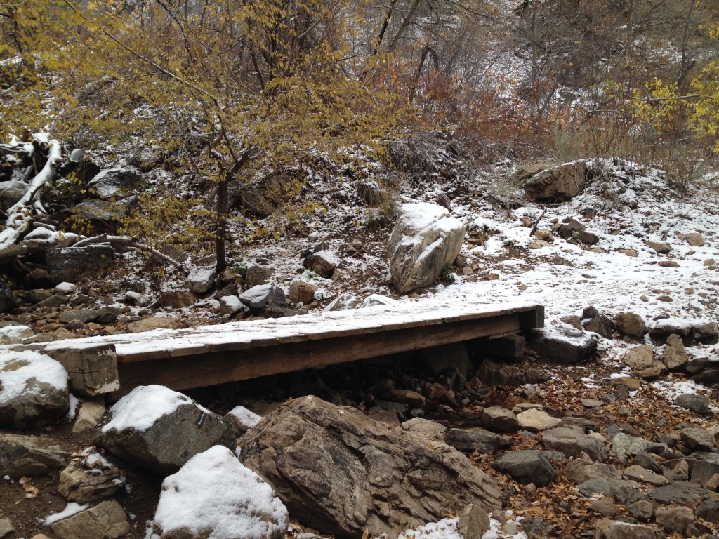
You will soon come to a wooden bridge. Cross over the bridge and the trail will split. The right trail leads you down the mountain side on the Bonneville Shoreline Trail and the trail to your left, about 20 feet from the bridge, leads you up to the waterfall.
Before you go up the canyon you may notice a few green containers near the bridge. These containers are property of the local police authorities. The adjacent rock face is an area for climbing training.
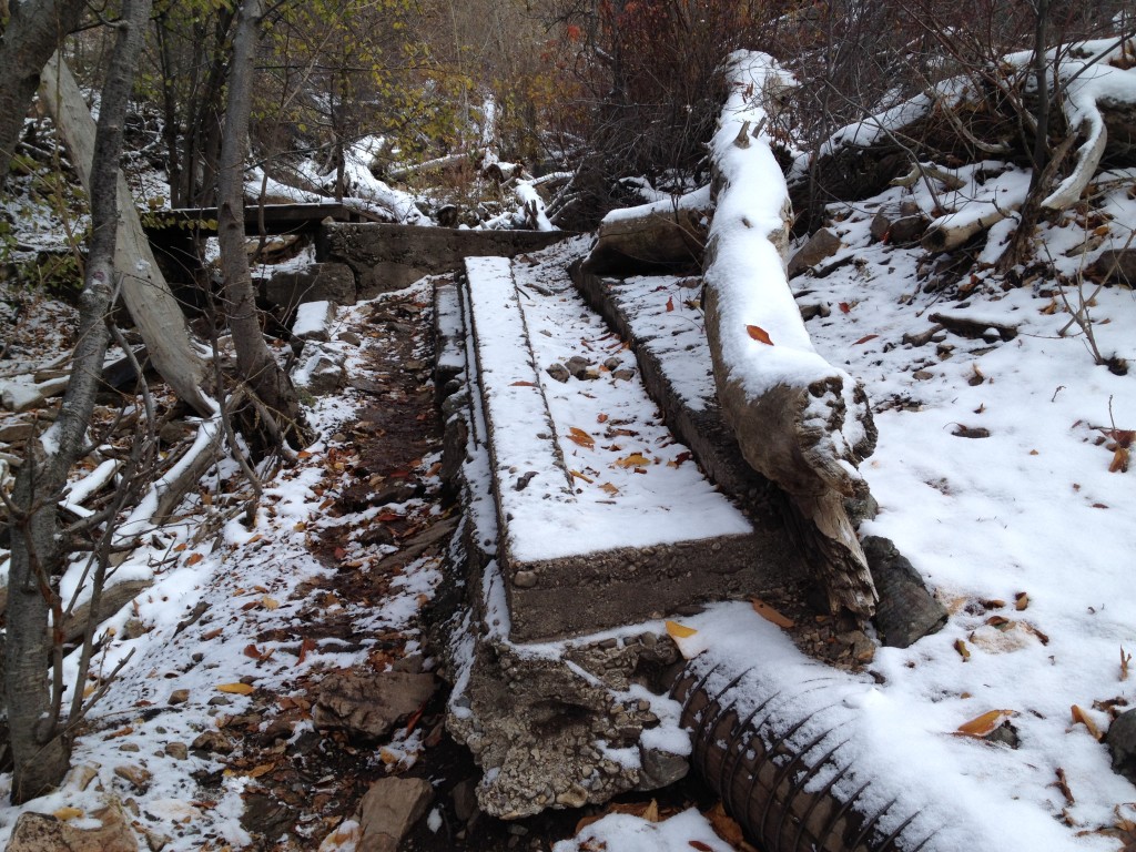
As you go up the canyon, the trail closely follows the creek until you come to the actual waterfall which is about another 1/2 mile up. You will pass several concrete structures that were used to channel water down the mountain.
You will see another wooden bridge, cross it, and continue up the path.
You will see signs of disrespectful people in forms of graffiti, trash, diapers and other items all along the way up the trail – it is really sad because this area is really beautiful.
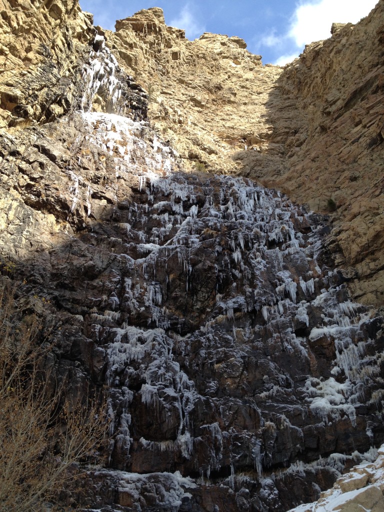
After 1/2 mile of hiking, you will come to the Malan’s waterfall. The waterfall is very unique as it is over 300 feet high – I don’t think there are many over 300+ feet in Utah.
I have a friend who tried to rappel down this waterfall and he used a 200 foot rope but apparently he was short about 120+ feet or so and he had to climb back up the rope. I have heard he and others say that this waterfall is about 310+ feet in total length.
If you come in the cooler months like I did, you will see that the waterfall has pretty much frozen. Be careful around this area as ice WILL fall down.
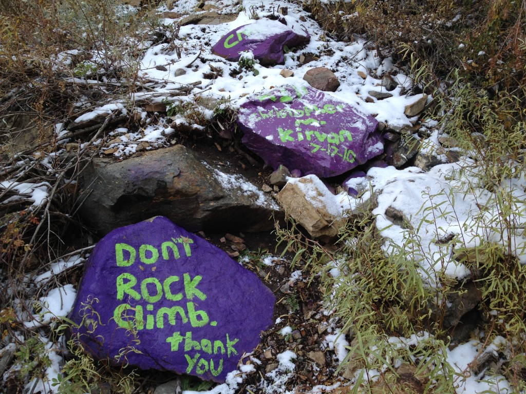
Just below the falls you will see a makeshift memorial of a boy who was killed while climbing up the side of the waterfall back in 2010 – he fell down about 100 feet. The rocks are painted purple for the school’s colors where the boy went to High School.

Personal Thoughts
This is a beautiful hike that will reward you with an amazing view of a 300+ foot waterfall cascade. Expect to see many others making the trek up to the top as well. I recommend doing this hike in early spring or late fall so you don't follow tons of people struggling to make their way to the waterfall. Also, parts of the canyon have been heavily vandalized. This really hurts the experience for everyone else. Pick up some trash on your way out like we do, and who knows...we could make a difference.


We tried unsuccessfully the 1st time as the rope was too short. The 2nd time, our 400ft rope reached the bottom. The “rappel” not “repel” was 305ft from the lip of the waterfall. Here is a link to Jeff Guest’s and group’s descent – http://youtu.be/AAWnOwGdYeg