

The Trek in a snapshot
Location
Spanish Fork Canyon, Utah
Managing Agency
Unknown
Pets
I wouldn’t bring any pets on this adventure
Fees
None
Restrooms
None
Camping
Yes, you could camp here
Trail Condition
1-4 rappels. One mandatory that is 45 feet long from a single-bolt. The conglomerate rock could “crumble” (get it?) anytime and bounce of your or your face, especially at the last rappel. Make sure to wear helmets!
Sights
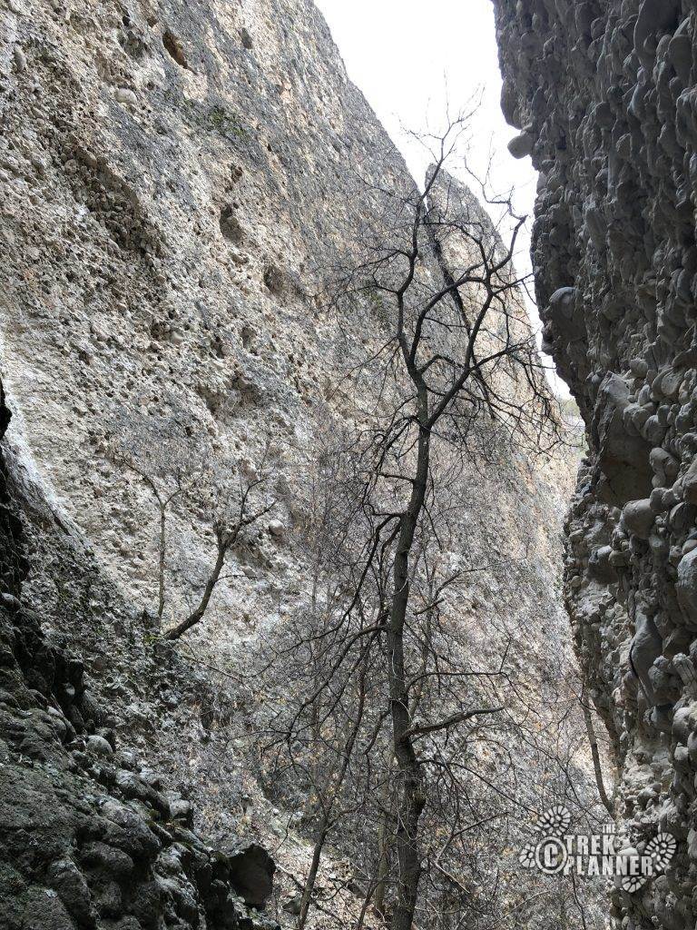
Conglomerate slot canyon
Water Info
1 liter of water. It’s not hard. In the heat, you may consider a 2-liter.
Best Season
spring, summer, fall
Distance
1 mile roundtrip
Time Required
2-3+ hours depending on the skill and size of your group
Parking Elevation
5575 ft
Summit Elevation
6350 ft
Elevation Difference
775 ft

Trek Planner Maps

Turn off from Highway 6: N39°59’48.32″, W111°24’21.19″
Park in this area, just not on the road: N40° 0’5.09″, W111°24’25.28″
Entrance canyon: N40° 0’12.62″, W111°24’20.55″
Ridge: N40° 0’24.83″, W111°24’16.48″
Canyon: N40° 0’22.65″, W111°24’12.81″
Exit: N40° 0’16.99″, W111°24’11.76″

Experience. Discover. Explore.
Follow along on our adventure then go out on your own!


I was first told about this conglomerate slot canyon from one of my rock-climbing friends on an outdoor online forum that I frequent daily. He sent me a PM (private message) about if I have heard anything about it – I haven’t. And that’s surprising – even by me.
(I know a LOT of canyons, narrows, and cracks in Utah. It is a hot passion of mine to find them out. To toot my own horn – I created a personal project of mirroring Climb-Utah.com’s routes in a personal Google Earth KMZ file. This was a 3 year project where I would mirror every gps coordinate for every hike, canyon, etc., BUT I would also draw the approach, the hike/canyon itself, and exit paths for each route. Doing this for 3 years, I learned to read maps very well. I became obsessed with finding more some of my own as a “first descent”. It is addicting to find “nature’s best kept secrets”. And so I became VERY familiar with each route and canyon in every area. A year or so after I showed a “sample” online of my work, another outdoor member created what’s called “The Super Amazing Canyoneering Map”. Created by Bob Allen, aka “Slot Machine” on Bogley.com, he put together an exhaustive list of every slot canyon that has be discovered (and published). But even within his Google Earth file, it definitely doesn’t list every canyon or route. And thus the exploration quest continues!
Back to my Google Earth file, it made it very visually impressive to see every trail/canyon for a certain region. Later on, I released this KMZ file to Shane at Climb-Utah.com for him to use on his website. I never sold it, released it to the public, or etc. It was basically an ode to his website in creating a huge desire in me for Canyoneering back when I was 16 years old (I’m 34 now). So if you visit his website and see a route that contains a .KMZ file for the route – that was me. There have been recent addtions where he hasn’t asked for my updated file, which means he figured out how I do it now. And that’s okay too. I did it as a tribute to his website anyway. More of like a thanks.)
Now that you know the context of why I said that it was surprising, even to me, made it even more appealing. He also attached the beta for it which listed 4 rappels up to 45 feet and the gps coords for the entrance, drop-in, and exit. He also included two pictures. It definitely got my attention. When I first saw the pictures, it looked like the famous Box Canyon in Maple Canyon, near the Manti area. It wasn’t, he assured me when I asked him.
There was no name for it for what he could see, thus our name “Crumbling Canyon”. And to be clear, this is NOT a first descent. The last rappel is bolted. My guess is that it was placed fairly recent. Maybe within the last 5 years. And so I know for sure, people have also explored it, rappeled it and possibly even named it. But I’m not sure of what they call it. Even a Google Search of “spanish fork rappelling” or “spanish fork technical canyons” or “spanish fork slot canyon” results in nothing.
I’m sure as this grows in popularity it was also develop other names. I called it “Noob Canyon” because it was quite easy, fun, but short. If you are an experienced leader but want to take a bunch of noobs, this would be a good location to have some hands-on experience with what real canyoneering is somewhat about: bushwhacking, down-climbing, going through an *actual* slot canyon and a rappel (of 45 ft). This would be a treat for them. If you have kids who enjoy this stuff too, they will think it’s the coolest stuff ever.
I believe this is the closest “technical” canyon to Salt Lake City now. It is about a 25 minute drive from Provo.
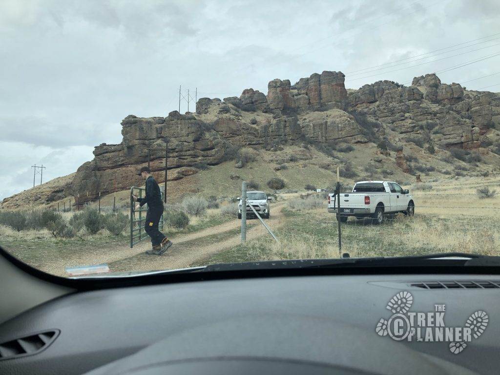
From Highway 6 on this road, be sure to close the gate behind you. That’s all what the sign says “please close gate”. Please respect the area, as it appears to be private property and could be closed off. I’ll have to double-check of the property though.
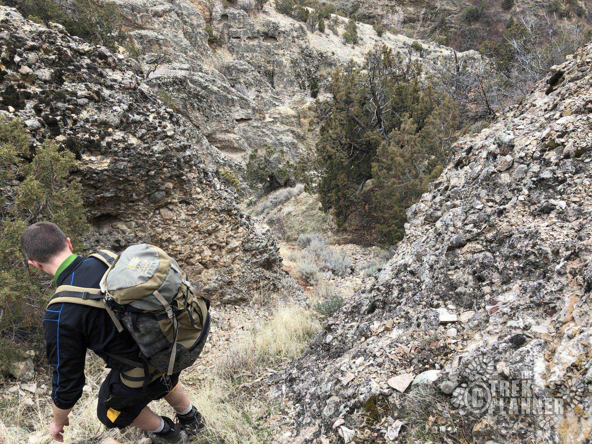
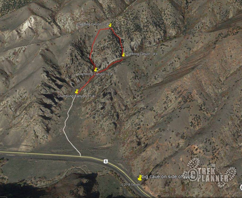
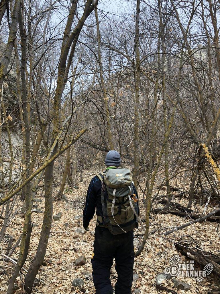
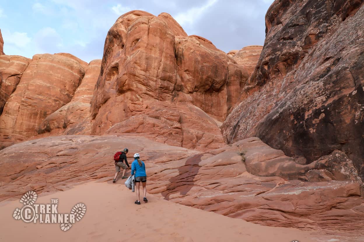
From the parking area (just find a spot that isn’t block the road), head up the “road” for 0.15 miles until you see what I have called “the two towers”. This small box canyon your entrance. Take this all the way through (with no technical challenges) up until you hit the ridge line to your north). It’s steep and time consuming, but it no-time you will be there.
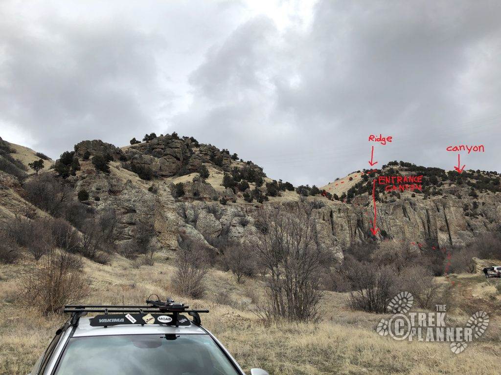
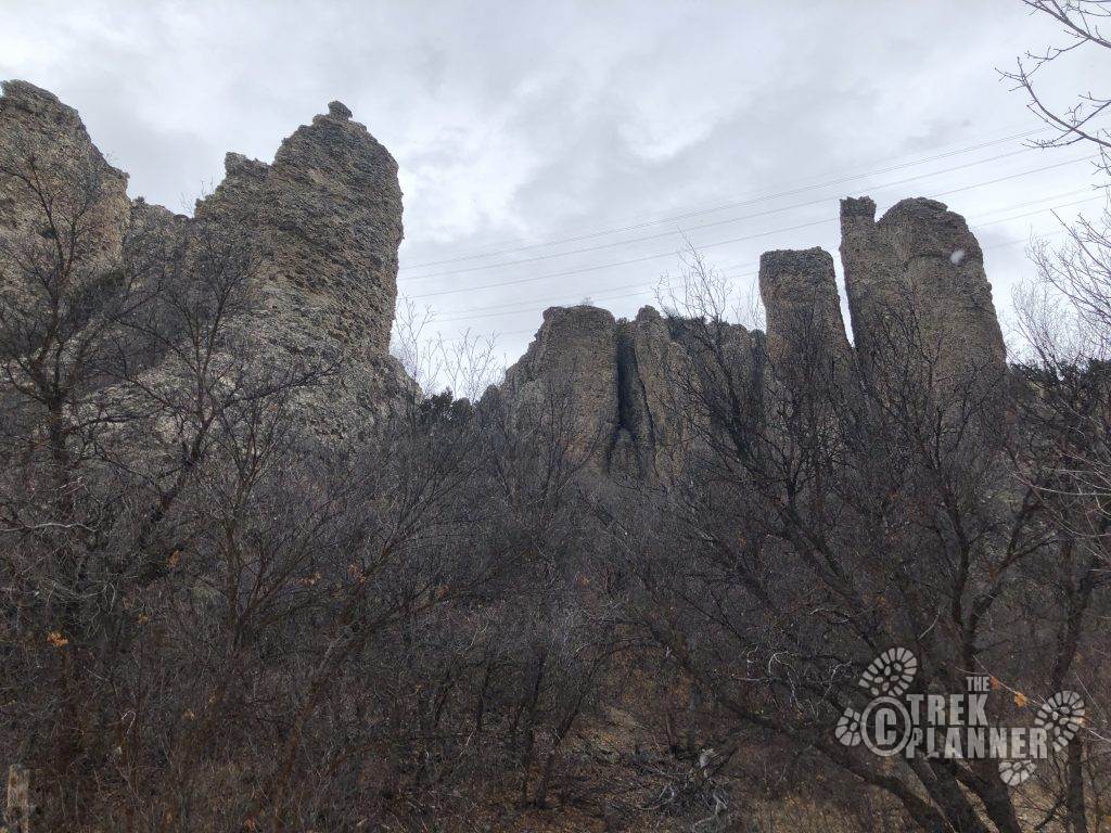
Look for the “The Two Towers” on both sides of the entrance canyon
Follow the box canyon up, which has no technical challenges, to the north to the top of the ridge.
Once you hit the ridge line, head east to the top.
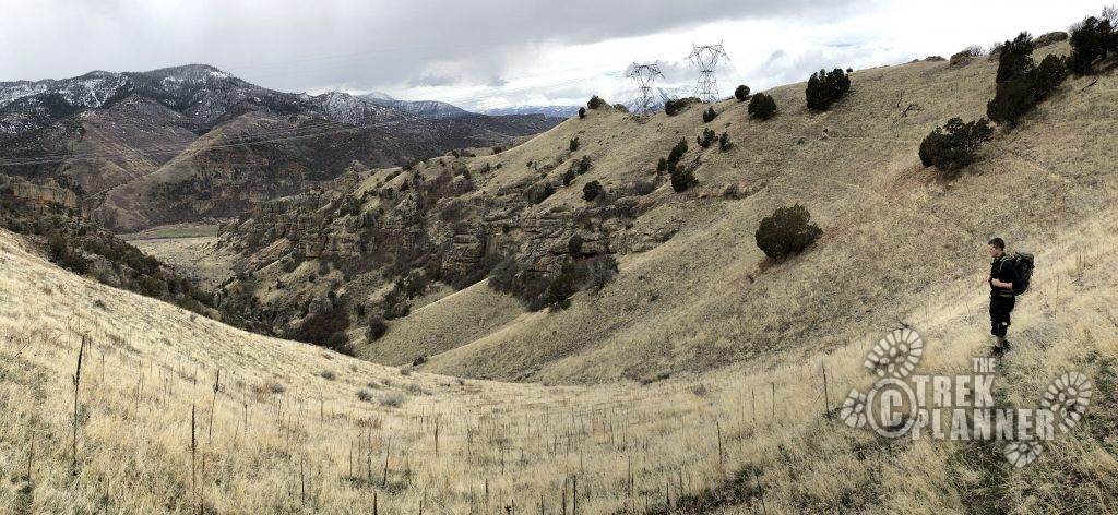
Once at the top, head back down into the next drainage over to your east.
**We will warn you and say you that you must choose the best path for you and your group’s ability.**
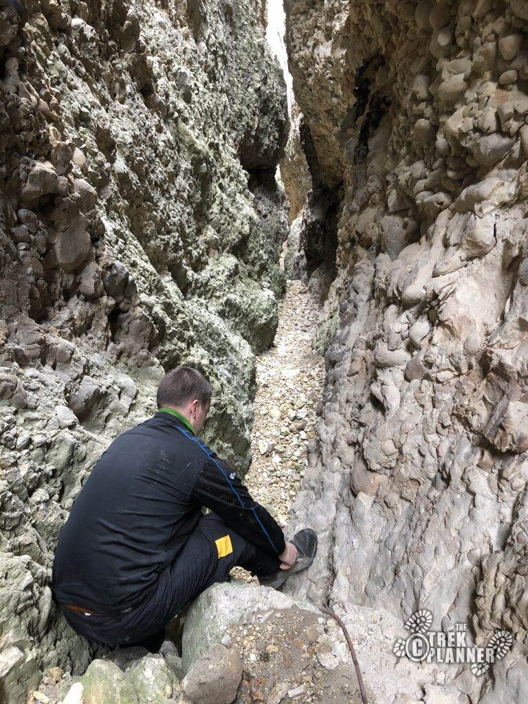
My rock climbing friend said that people would rappel into the canyon. We didn’t. We down-climbed. And while it wasn’t overly difficult, there were some exposure along with many tripping hazards (conglomerate rock). Be alert, especially if you have young kids. Perhaps pull out a 50-ft hand-line here or find a natural anchor to rappel into. Choose your own adventure!
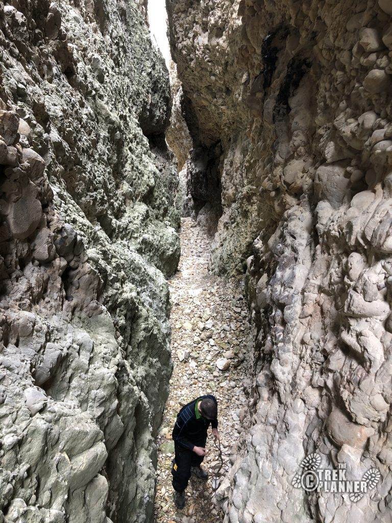
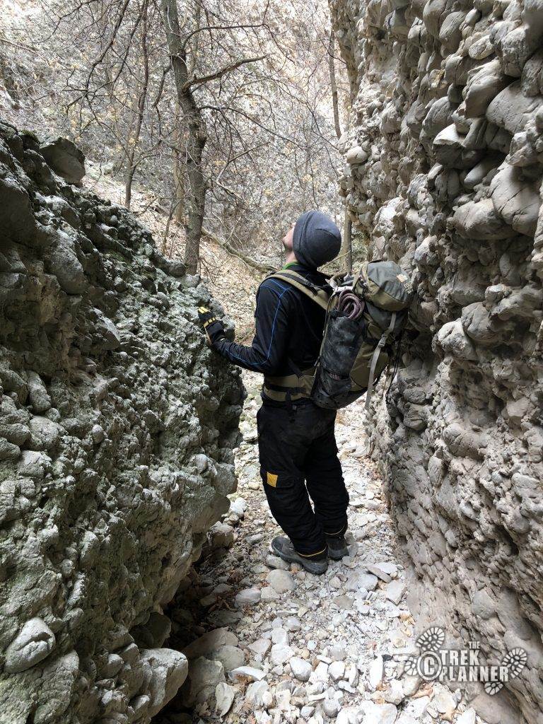
Chris navigating us down a path.

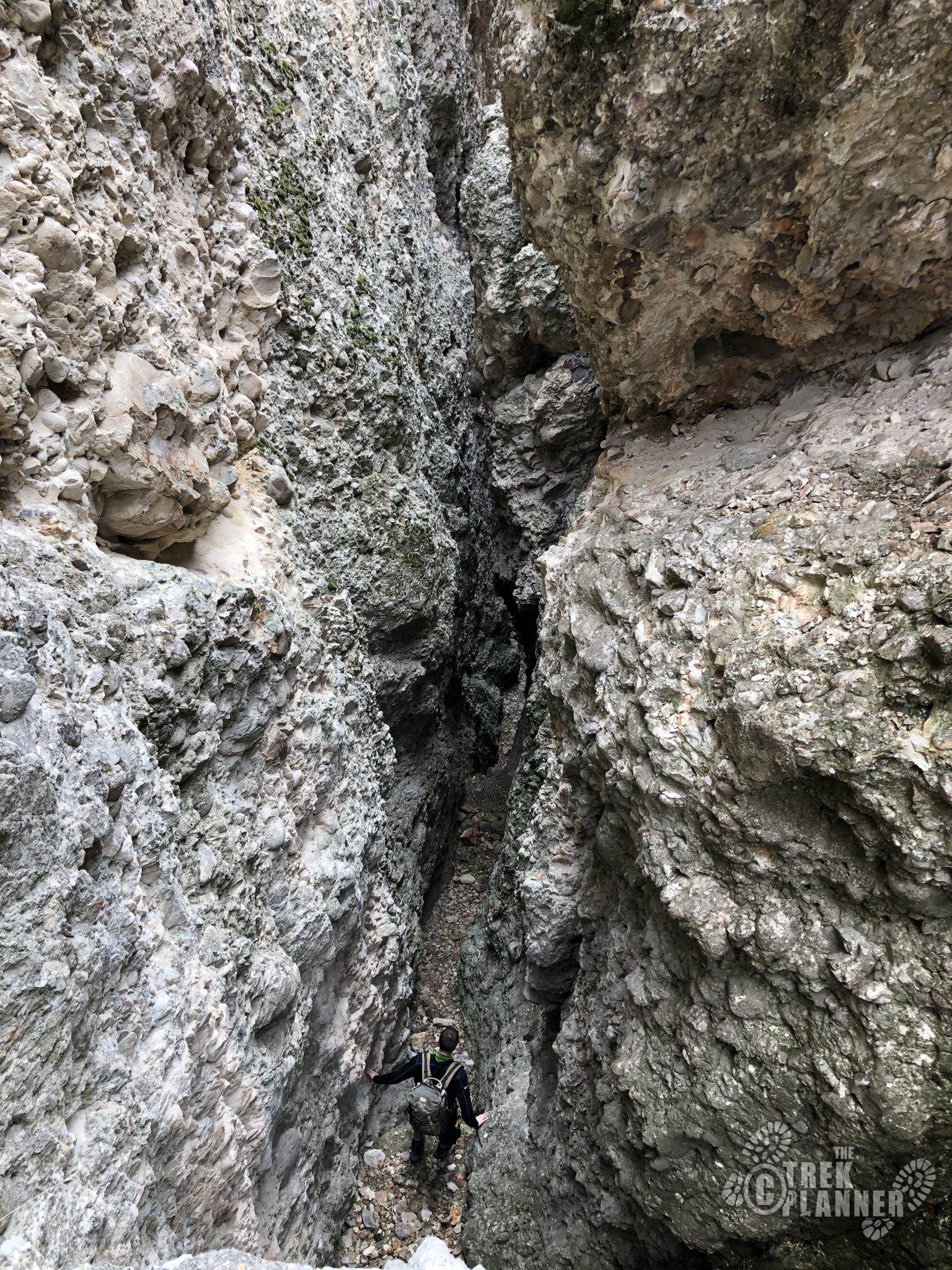
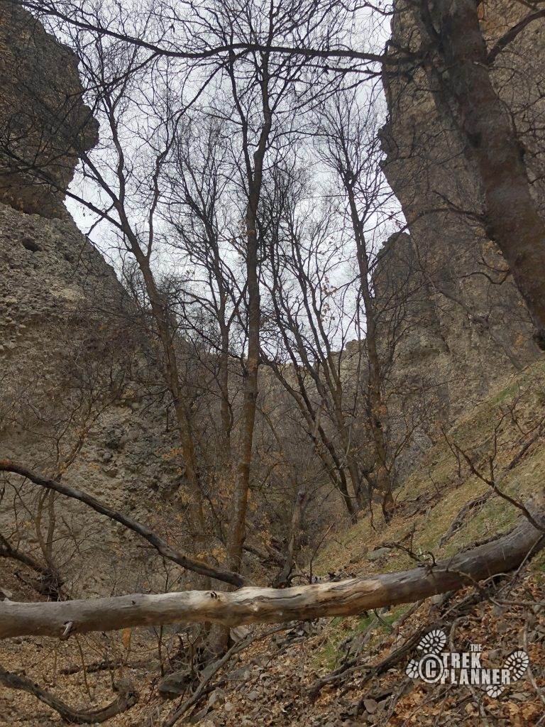
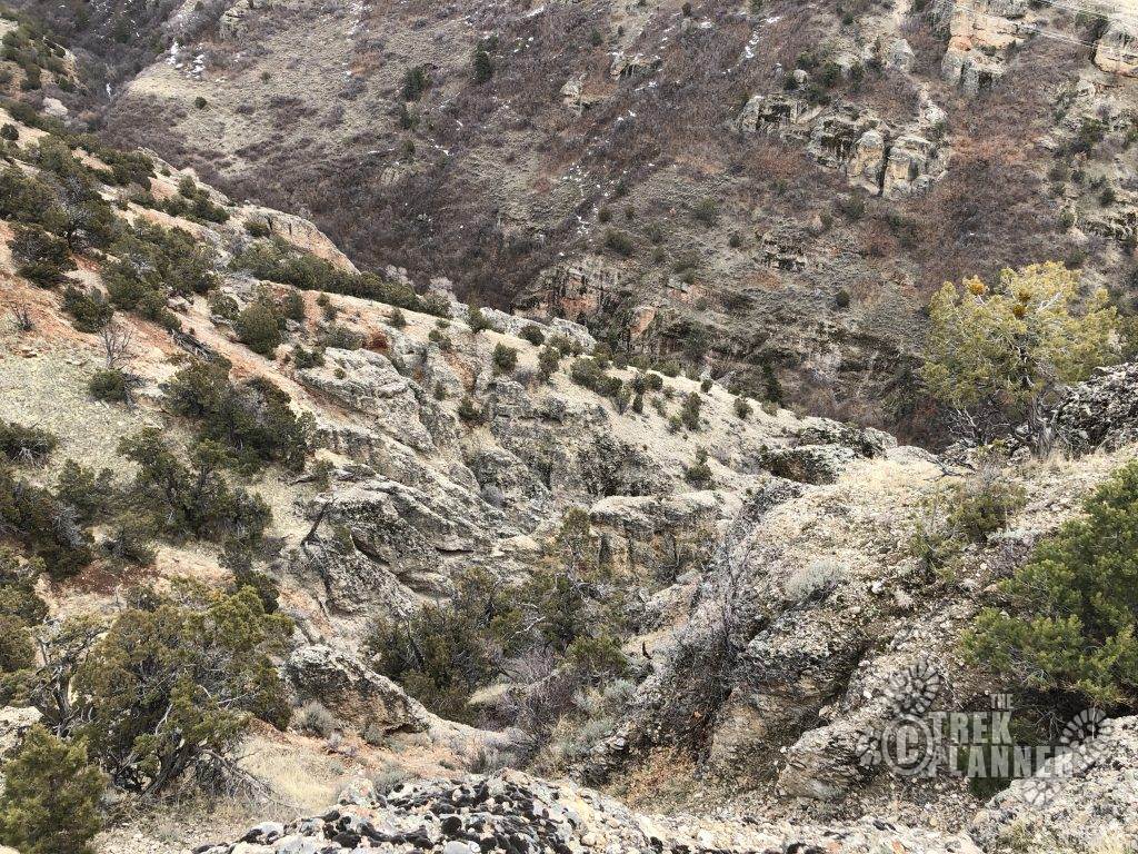
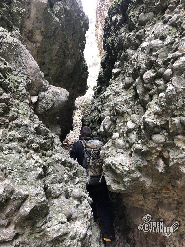
The conglomerate slot. Hidden in plain sight. Look closely. About two hundred feet from the entrance.
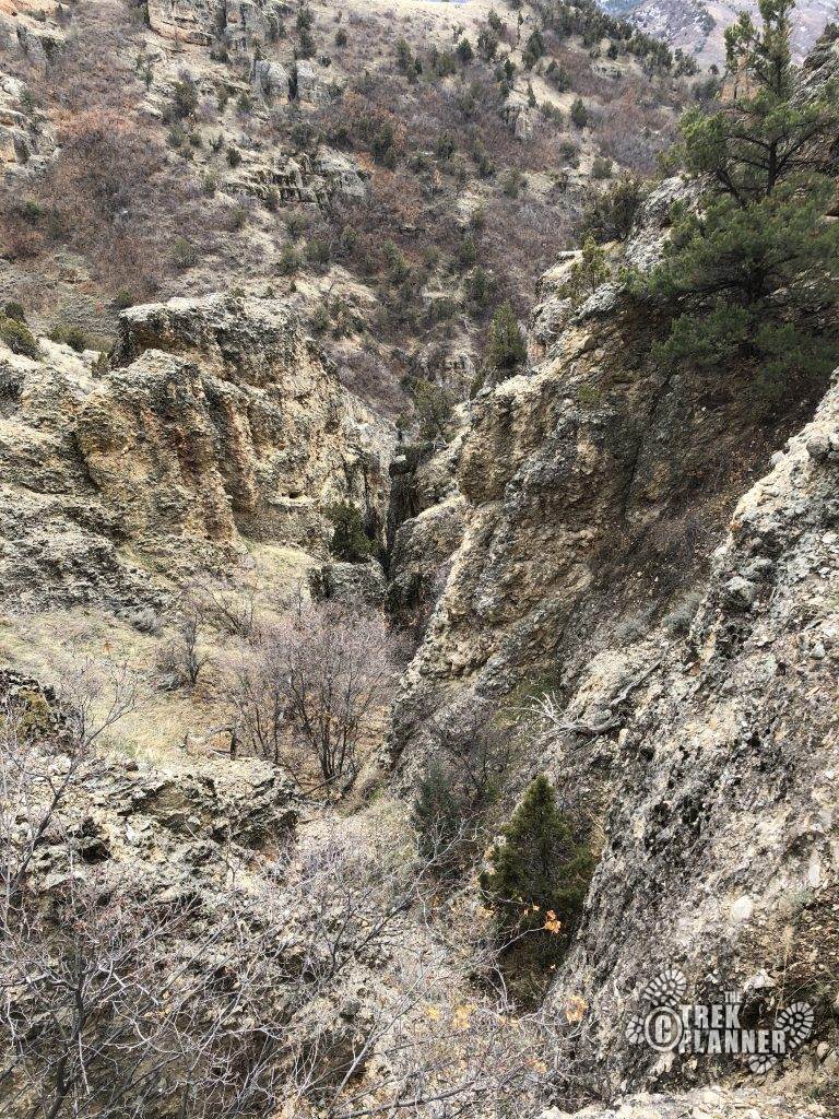
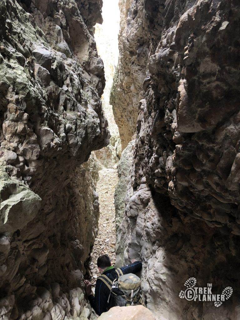
At the entrance!
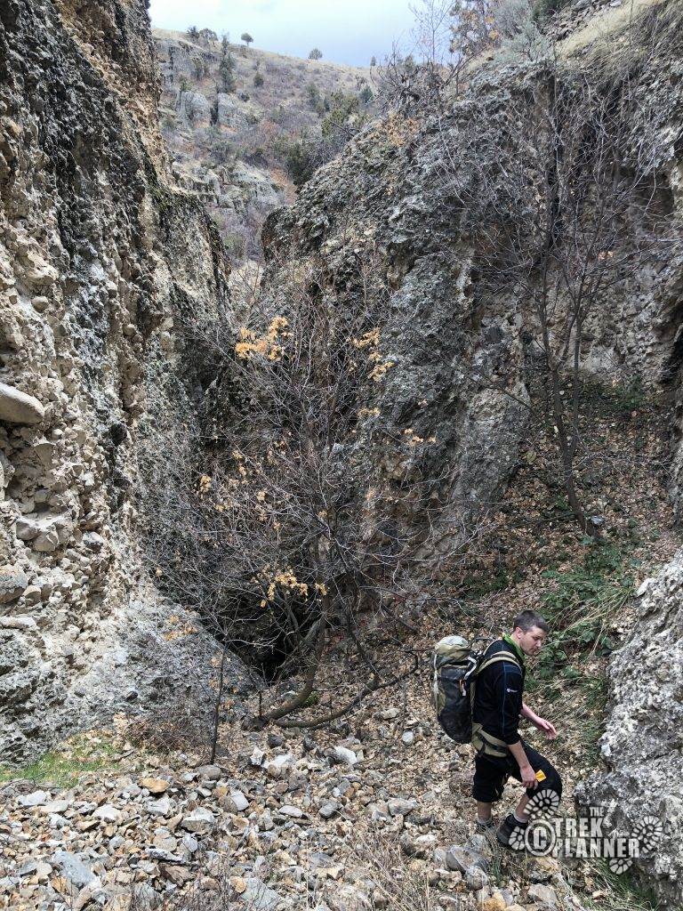
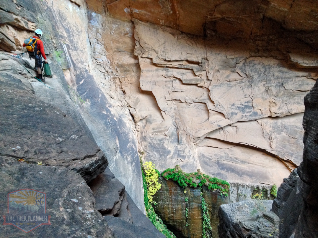
For us, we down-climbed the entire canyon except for the last rappel. If you want to down-climb, it’s straightforward and easy. If not, this tree that guards the entrance could be used as a natural anchor to rappel from. Keep in mind, rappelling a large group will take a large amount of time. Consider down-climbing to keep people moving in that scenario. If not, do what’s best for you and your group. (The picture below is kind of misleading, the down-climb is not pictured but is located to your right. It’s a 6 ft down-climb onto a ledge, followed by another 6-ft down-climb.)
Crumbling Canyon isAwesome!
At downclimb #2. This was about 6ft and straightforward. Chris used a rope to lower his backpack.
At the bottom of downclimb #2.
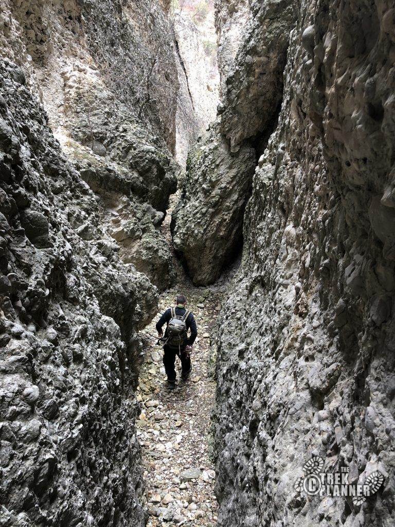
Past this, walk another 30ft to the next downclimb (#3). This one is about 6 ft as well. Fun!
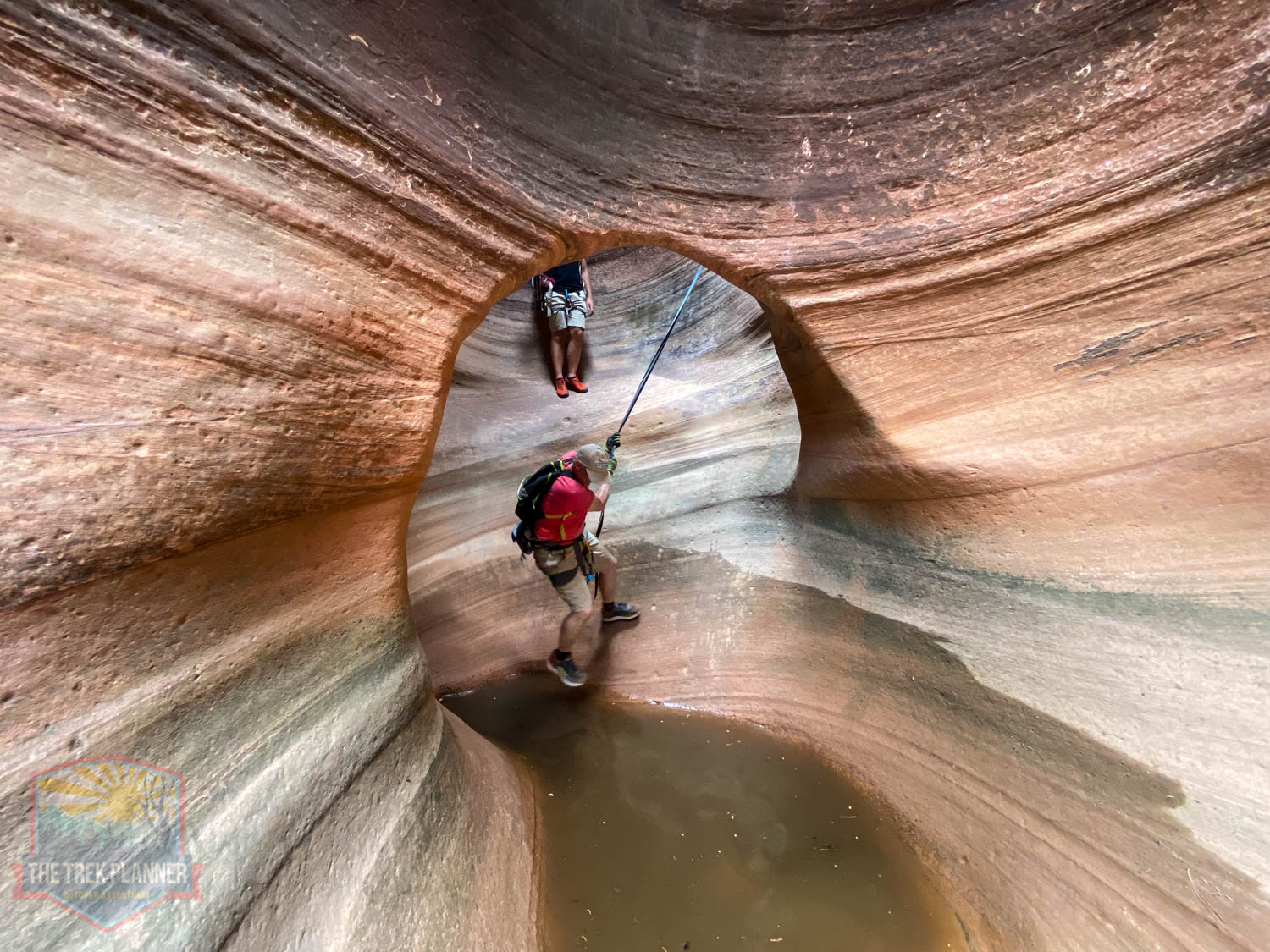
20 feet past the downclimb (#3) is a squeeze in the canyon in which you have to crawl under. Not tight at all.
“The Squeeze”
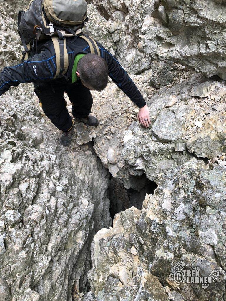
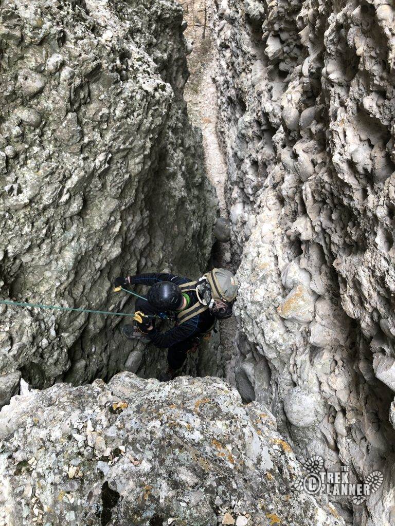
From here it was about another 50 feet to the end of the canyon, however there is a giant hole in the ground. Oh…it only drops 35+ feet to the canyon floor! So yes, be very careful in this area of your footing. Especially if you bring younger kids. They could easily fall through and bang their heads all the way down like a ping-pong ball. You *could* die if you weren’t careful in this particular spot. And part of the rappel is a bombay section, which means while it might be narrow at the top, it opens up at the bottom and drops you however many feet. Don’t be stupid and pay attention as you hook everyone up for the rappel.
The end of the canyon is marked by a single-bolt located on the left side of the canyon. The rappel was 40feet and our 100ft rope double-stranded reached the bottom with just the perfect amount. The rope pull was easy so no issues here.
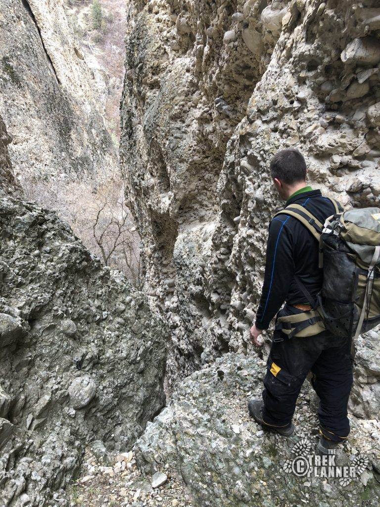
This marks the end of the canyon.
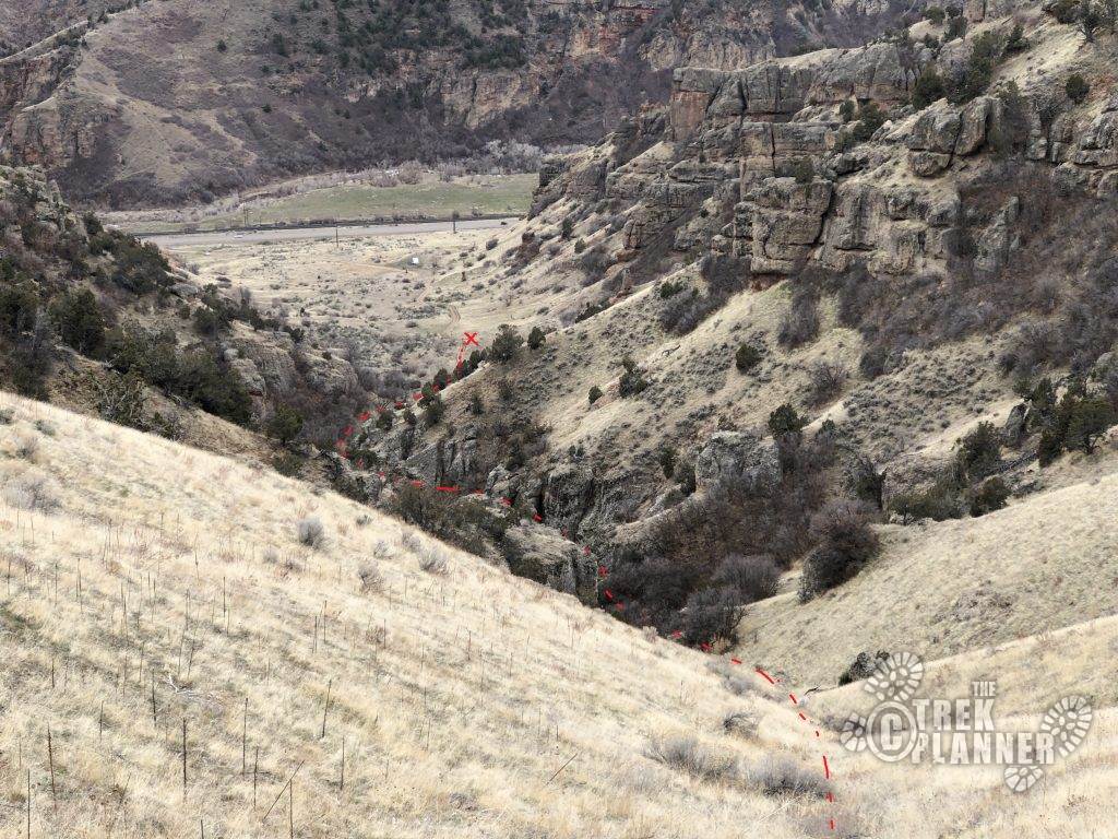
From here, follow the drainage back for 0.30 miles back to your vehicle where you can recount your stories of heroism, bravery, courage, and to the clapping of “hundreds of spectators cheering you on” (canyoneering inside-joke). Or you could just tell them that you did an “ok” canyon and keep this secret to yourself.
At the end of the canyon. Follow the drainage back down the road for 0.30 miles back to your car. Simple as that.

Personal Thoughts
This was an "ok" canyon. It's not something you would do everyday or weekend, but for variety it is good. And considering the closeness to Salt Lake City of an *actual* slot canyon, this is probably the best that we will get. Unless of course, you want to drive down to the Swell or Robbers Roost. But for a 1/2 day adventure, it's not bad at all.
Cool find Brett! Glad I let you guys figure out the bushwhacking ahead of time 😉
Thanks Josh! I was fun. I hope you get the chance to explore it. Take Kylie too.
I took two of my friends yesterday 3/30/2018. we explored a few of the side canyons and they were interesting but lots of loose rocks which resulted in a few bruises… getting up to that ridge is a workout and getting down to the slot was a true adventure, once in the slot it was EPIC! my personal thoughts are its great that its so close but the approach would scare off most first timers , if they want to get into canyonerring they will need to get used to the long drive so take then to the swell or… Read more »
Thanks for sharing your experience! It’s a neat area to explore, with plenty of it. Did you see the side-canyon next to this one? It looks more like a downclimb route with no significant rappels, but interesting. And yes, the ridge hike is invigorating! lol And I agree to a point that real canyoneering is in a slot canyon found on the Colorado Plateau, but what you described is EXACTLY like canyoneering. Route-finding, the approach (which can suck), navigating to the slot canyon, the slot canyon, and the exit. And you find all of that here, minus the long drive….and… Read more »
I believe this canyon is also called Horse Cock Canyon. Others call it Hodgson’s Hollow. There might even be other names….