
The Trek in a snapshot
Location
Alta, Little Cottonwood Canyon, Utah
Managing Agency
National Forest Service
Pets
Not allowed. Pets aren’t even allowed in cars in Little Cottonwood Canyon according to the Forest Service
Fees
Free or $8. To be able to drive your personal vehicle it costs $8 to get access to Alta property and hikes on their property. If you don’t want to pay it’s an additional 2 1/2 miles of hiking and you simply park at the guard station at the entrance to Alta. If you are coming to Alta to take photos for weddings or family photos there are other fees too
Restrooms
Yes. At trailhead in the campground but operated seasonally
Camping
Allowed 200 ft from any water source (lakes, streams, creeks, rivers, etc). Albion Basin Campground at the trailhead is operated seasonally. For more information follow this link: https://www.recreation.gov/camping/campgrounds/232010
Trail Condition
Good dirt and gravel trail up until Cecret Lake. Once you get past the lake the trail narrows and once you get near the summit of Sugarloaf you will be hiking on small to medium sized rocks
Sights
Water Info
Bring 2 liters of water. Cecret Lake is about 4 acres in size
Best Season
spring, summer, fall
Distance
3.3 miles roundtrip
Time Required
5+ hours
Parking Elevation
9429 ft
Summit Elevation
11051 ft
Elevation Difference
1622 ft

Trek Planner Maps
Guard Shack: 40.59209, -111.62825
Trailhead: 40.57758, -111.61318
Cecret Lake: 40.57175, -111.62169
Sugarloaf Mountain: 40.56591, -111.62484
Pika Meadow: 40.5654, -111.62082
Wind Shelter: 40.5652, -111.62031

Experience. Discover. Explore.
Follow along on our adventure then go out on your own!


Note: It costs $8 to get into Alta with your own vehicle in the summer months. You can park at the guard station to avoid the fee but it’s a 2 1/2 mile walk to the trailhead from here.

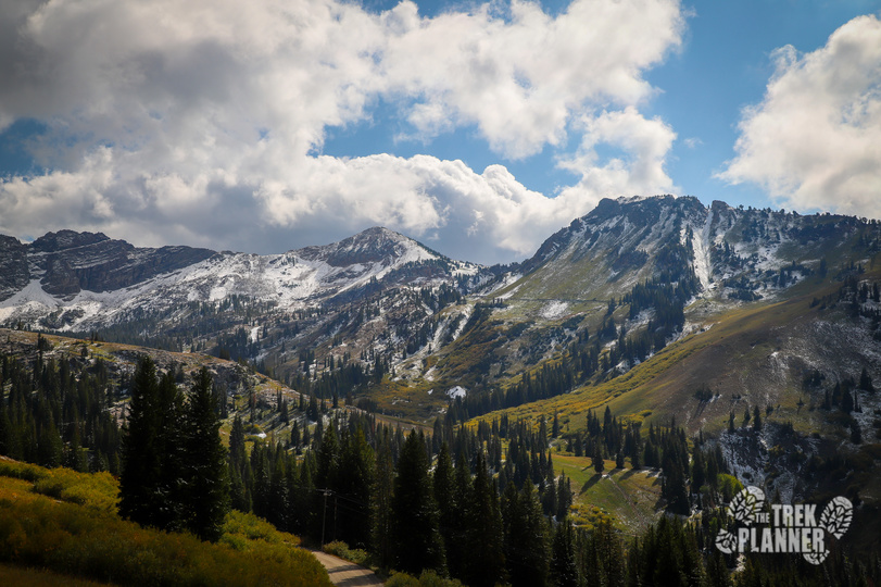
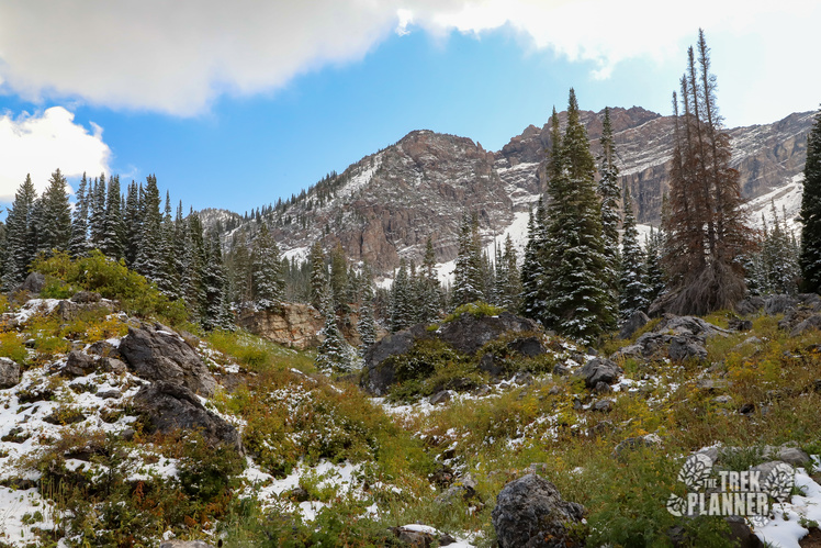
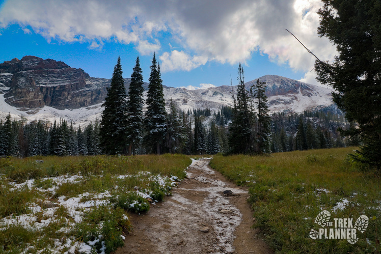
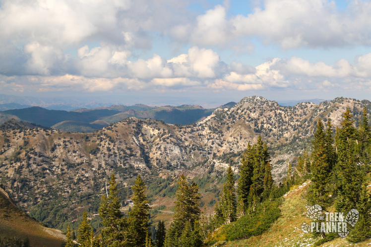
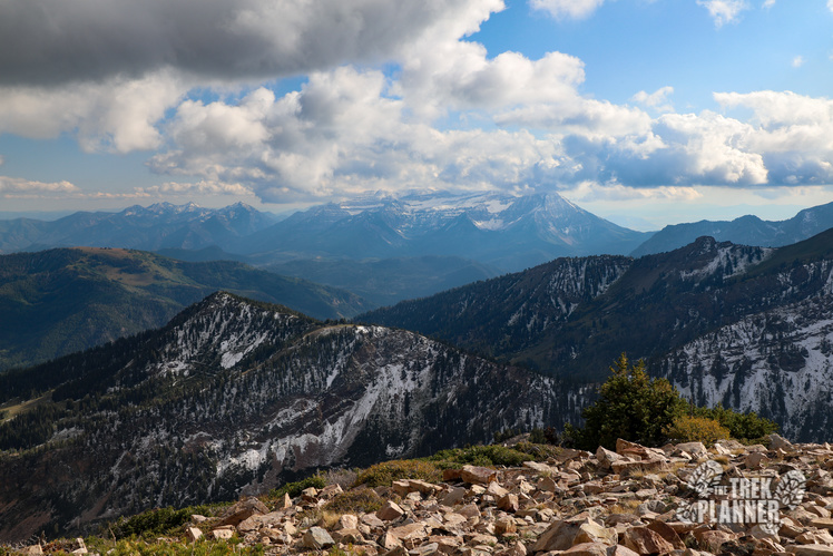
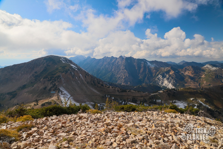
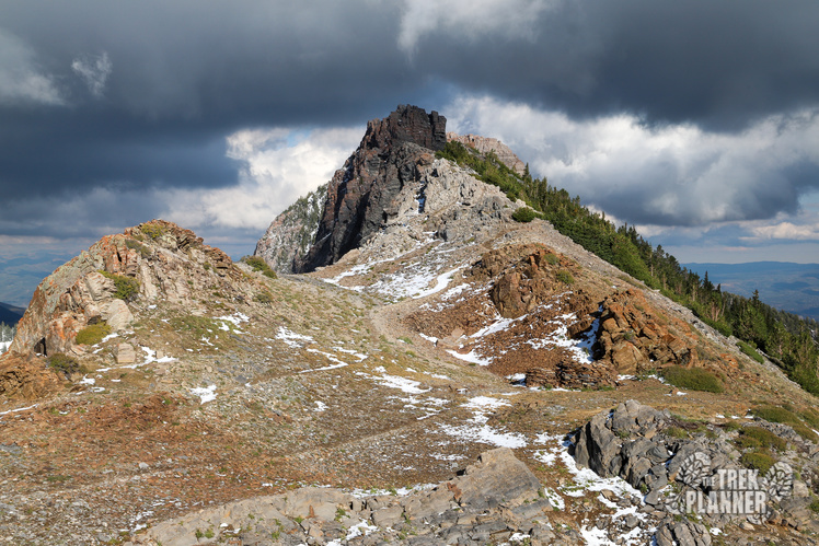
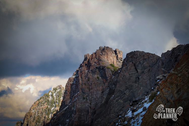
Sugarloaf Mountain is the mountain in the middle of the above picture.
In order to get to Sugarloaf you will need to hike to Cecret Lake. The trail to Cecret Lake is an amazing hike that travels in a basin underneath tall skyscraper mountains like Devils Castle and Sugarloaf Mountain. The trail is pretty easy and only gains about 460 ft for the 0.8 mile it takes to get to the lake. For the full guide on Cecret Lake click here.
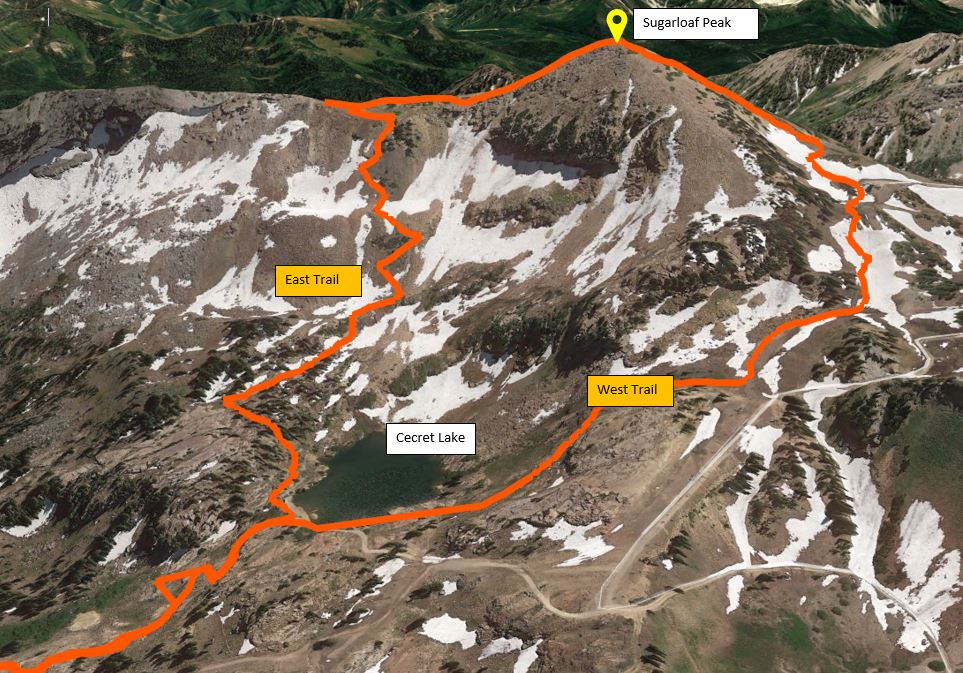
Once you get to Cecret Lake, you can decide to hike the steep narrow way to Sugarloaf (east trail) or to hike the steep wide way (west trail).
I chose to do the full loop of Sugarloaf to get the entire experience. I recommend you do the same if the east trail is not completely covered in snow. If you aren’t comfortable with steep and somewhat exposed steep trail then just hike up and down the west side trail.
East Trail
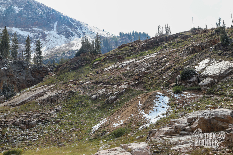
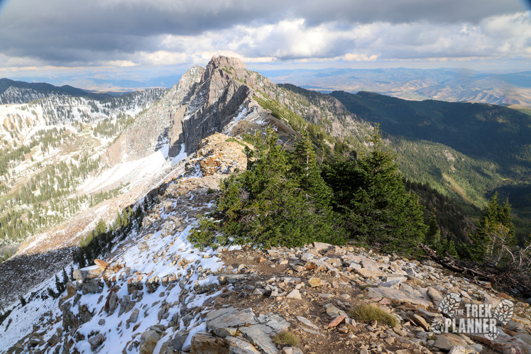
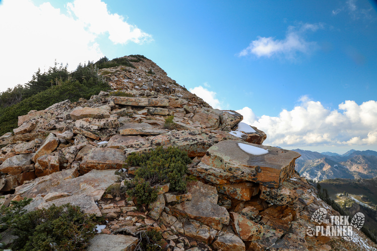
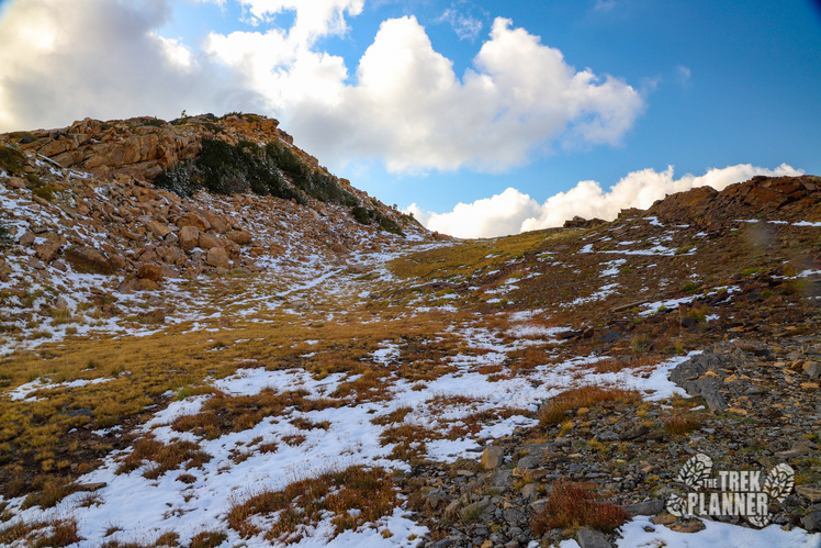
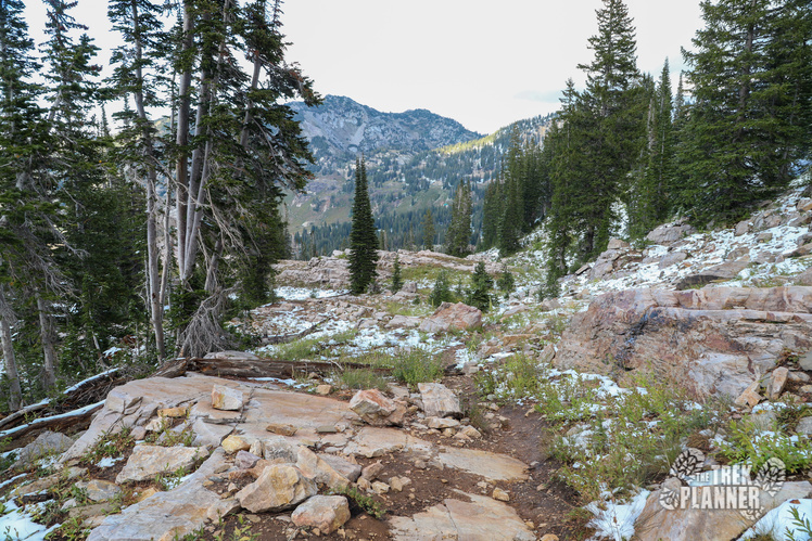
The east trail is steep and narrow until it comes to what I dubbed the Pika Meadow. From here you will then hike up to the summit and be walking on small and medium sized rocks. You can see the summit while you are hiking up.
West Trail
The west trail is steep and wide and follows a ski slope for about 1/2 mile until you hike nearly straight up on small and medium sized rocks until the summit. The summit isn’t in view until you see the large white cross and a few cairns.
I chose to hike the west trail first then come down the east trail.
But, let’s hike to Cecret Lake first!
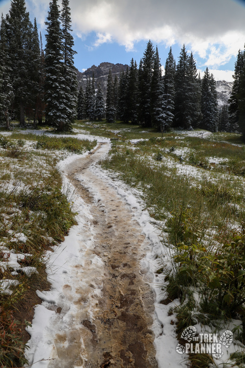
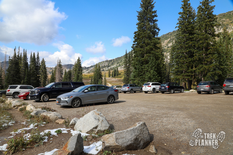
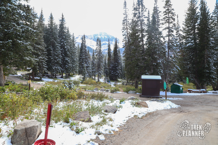
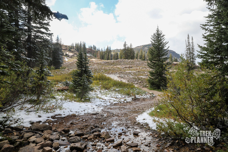
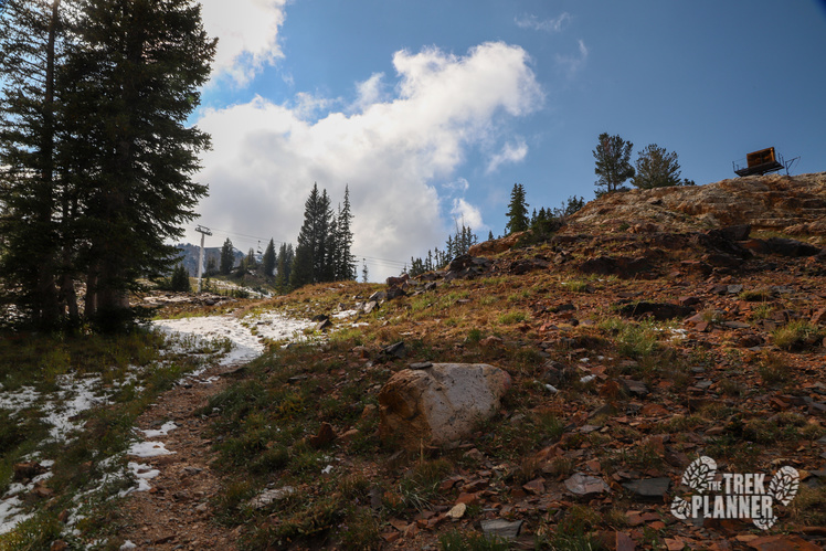
The trailhead for Sugarloaf Mountain is the same trailhead for Cecret lake: the Albion Basin Campground. The campground was closed for the season when I visited but I could see that the campground would be a great place to stay. Tall white pine trees and even aspens provide tons of shade and there is even a creek nearby. The trail was a little muddy but it really didn’t make the hike more difficult.
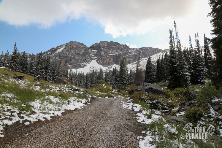
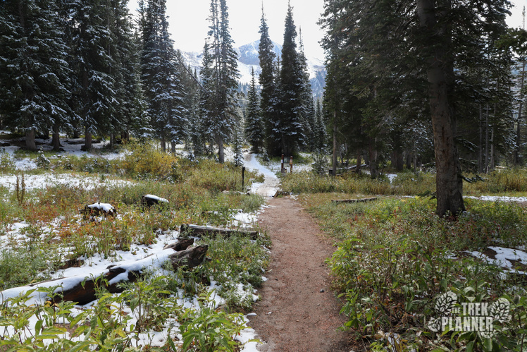
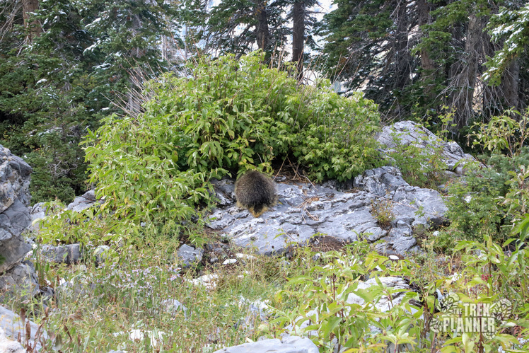
The trail passes through the campground and goes in and out of forest and meadow until you come to Cecret Lake. On the way to the lake I saw the biggest porcupine I have ever seen in my entire life! It was eating some plants on a rock and wouldn’t turn around for pictures but it was huge!
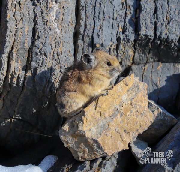
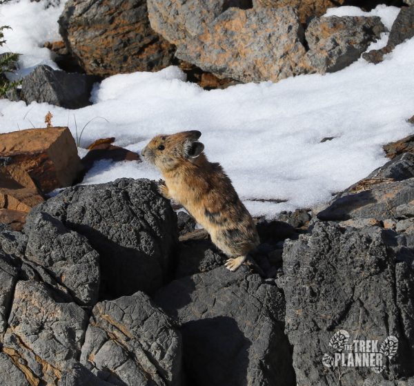
Other wildlife you have the chance to see is moose, deer, squirrels, chipmunks, pika, and possibly a bear. This is a very popular trail so the chances of seeing a bear are slim but still possible, so always be prepared! Pika love the rocky areas where they can hide in their safe spots. They are about the same size of a squirrel without the bushy tails.
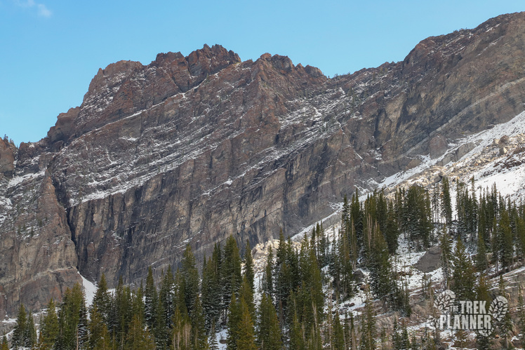
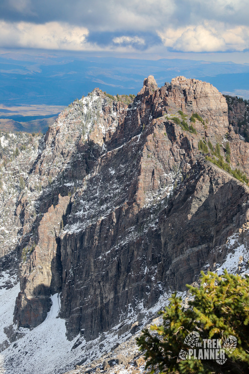
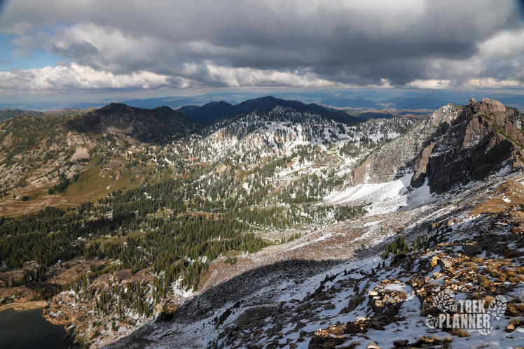
Directly to the south of the trail is Devils Castle. It does look like a place a devil would build a castle! The mountain is steep, rugged, sharp, and awesome! There is a trail to Devils Castle and we already have a Trek guide for it.
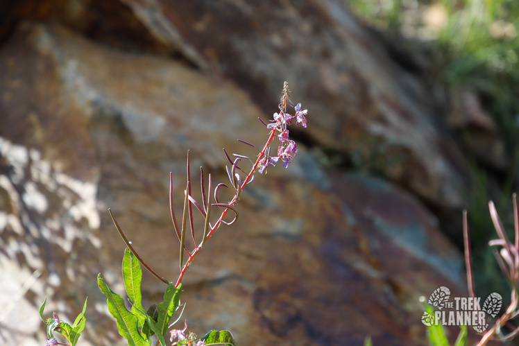
The Cecret Lake trail will cut south west and slowly gain elevation. If you are hiking in summer months you will probably notice all the wildflowers! Even in September this fireweed had some petals left.
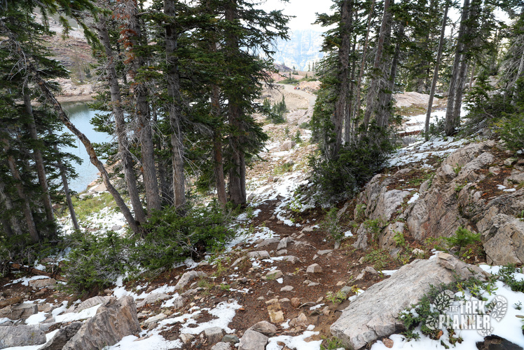
You will pass by an abandoned mine and the trail will make a few switchbacks until you reach Cecret Lake.
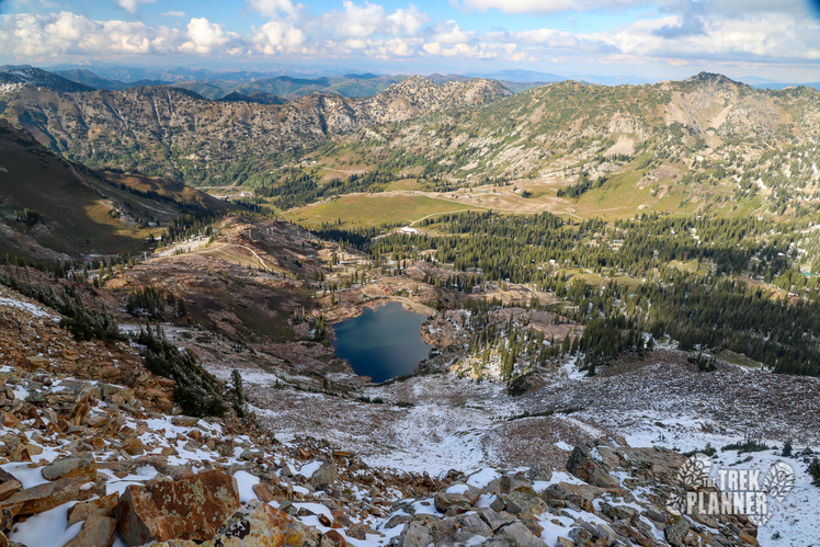
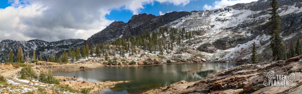
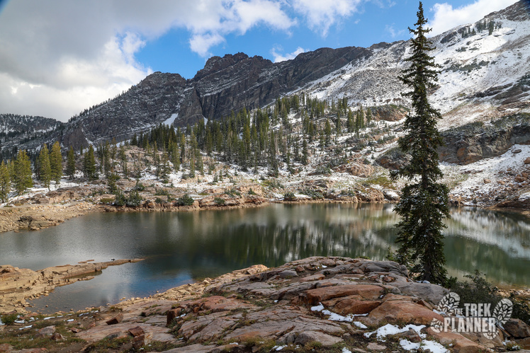
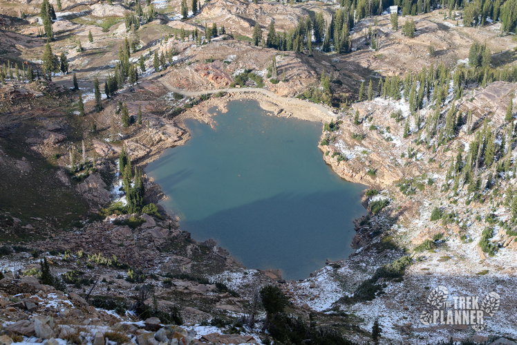
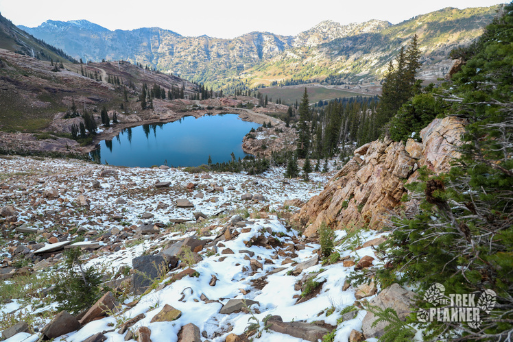
 Cecret Lake isn’t that large of a lake but it provides the setting to some of the most scenic views in all of the Cottonwood Canyons! You can hike around the lake if you want but I found some of the best views are on the west side.
I think I came at just the right time when there was lots of cloud cover to the west making the sunlight just perfect for some pictures!
Cecret Lake is part of the Salt Lake City Watershed meaning you aren’t allowed to swim or camp within 200 ft of it.
It was here that I did an inventory on my food and water and found that I had plenty left and so I decided to continue the hike up to Sugarloaf Mountain. Don’t you just love spontaneous adventures! Once you are at Cecret Lake you are about halfway to the summit (about another 0.86 mile).
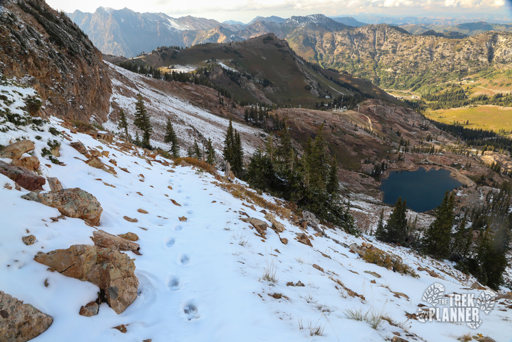
I chose to hike up the west side trail which follows just under the ridgeline to the west until you come up and see some ski lifts. This ski lift is called Sugarloaf and you will follow the lift up to the top. Once at the top you will hopefully see a faint rocky trail that goes back east to the top of the Sugarloaf. You can’t see the summit from this point so you just hike until you see the white cross on top. From the top of the lift you will have about another 1/3 mile to go.
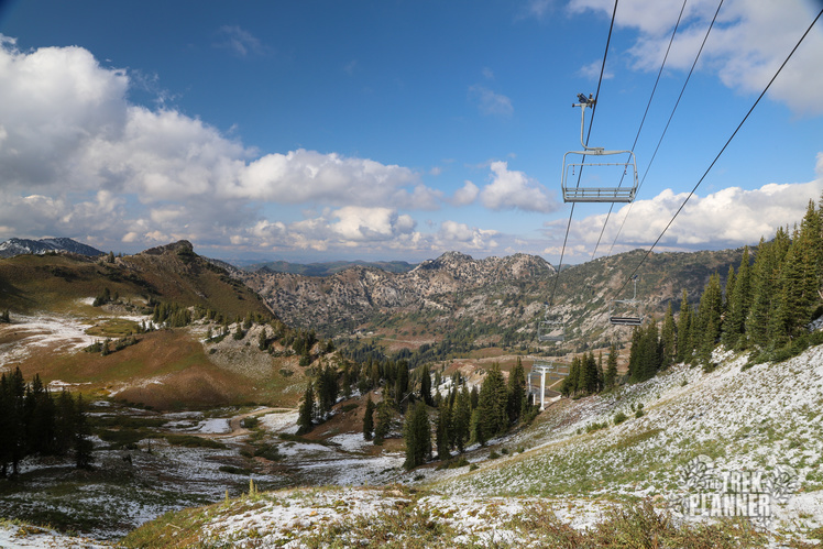
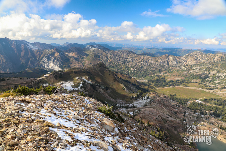
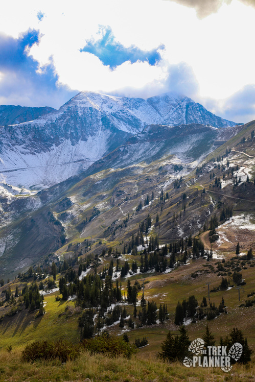
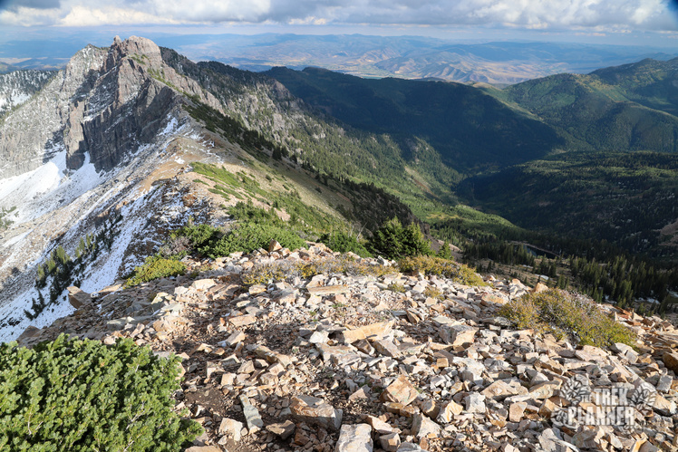
From this side of the trail you can see Twin Peak and even Mt. Timpanogos to the south!
This trail is very steep, yet not exposed so you are still relatively safe. Just keep hiking up until the top!
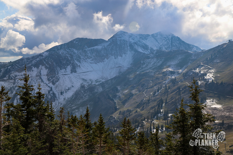
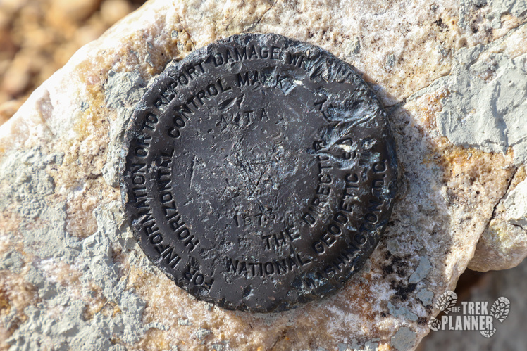
You made it! At the top of Sugarloaf you can see for many miles! You can see Mt. Timpanogos to the south and Francis Peak to the north west. Sugarloaf is just a rocky bald mountain and doesn’t compare in splendor to Twin Peaks or even Devils Castle. But, I really enjoyed hiking this trail and I think the vantage point that Sugarloaf has is one of the best in the area!
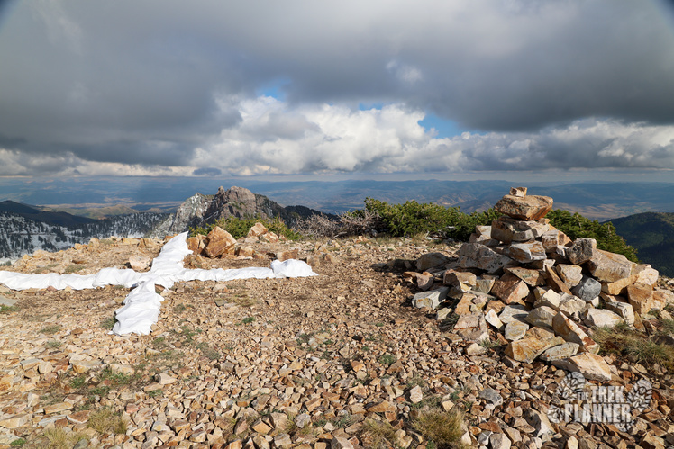
The cross is for navigation purposes for aircraft.
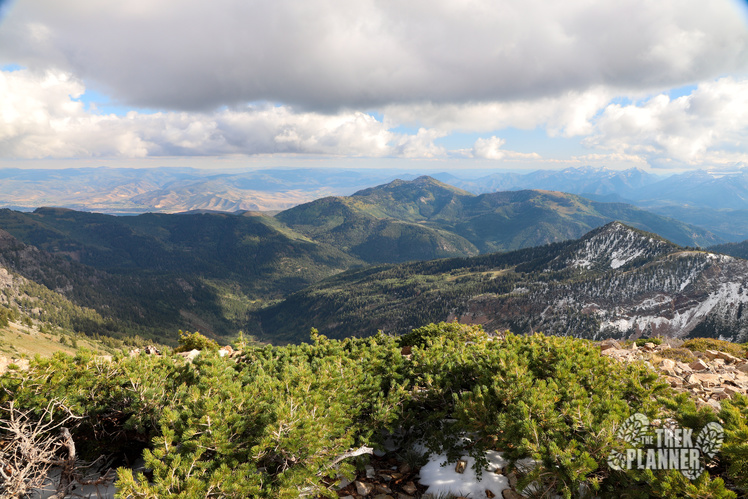

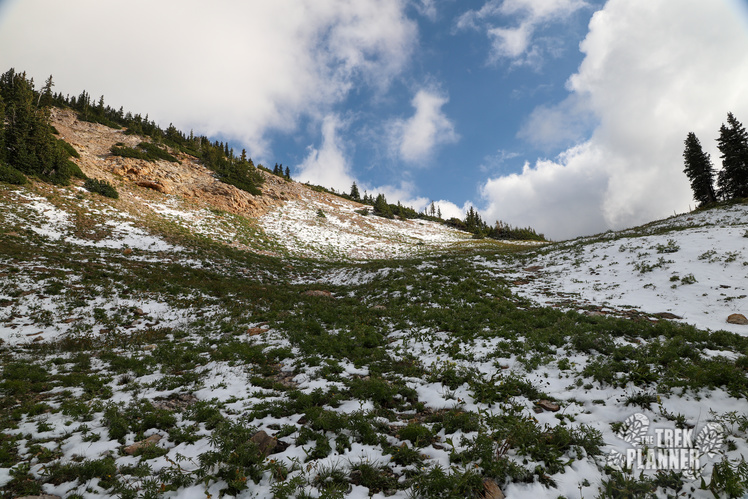
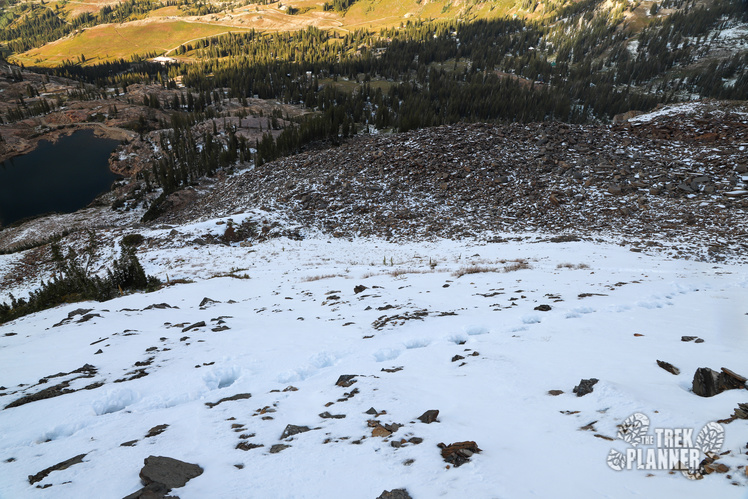
When you are done admiring the beauty of Little Cottonwood Canyon and beyond it’s time to decide if you will go down the west or east trail. I decided to go down the east trail for kicks and giggles. The trail is still on uneven rocks until you come to Pika Meadow.

It was here that I saw five pika scurrying around. As I was trying to take pictures of one of them, another appeared right in front of me. It would stop and get a little closer then disappear in the rocks. Then, it would reappear behind me and take another peek. Pika are related to rabbits and love being high in the mountains.
You can see a wind shelter here too and you can use it if needed.
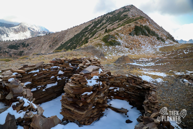
The trail goes to the north west through Pika Meadow and then back down many switchbacks to Cecret Lake.
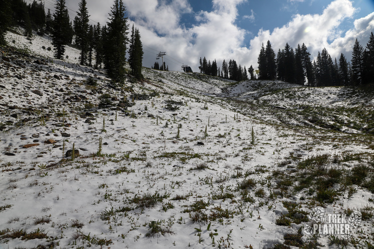
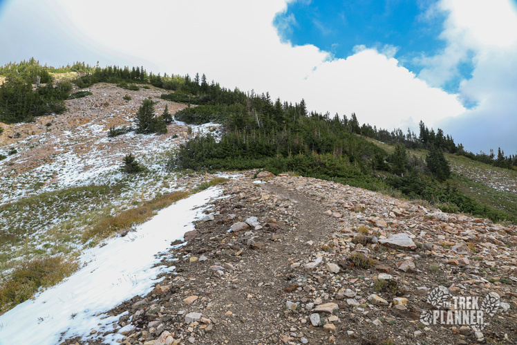
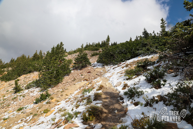
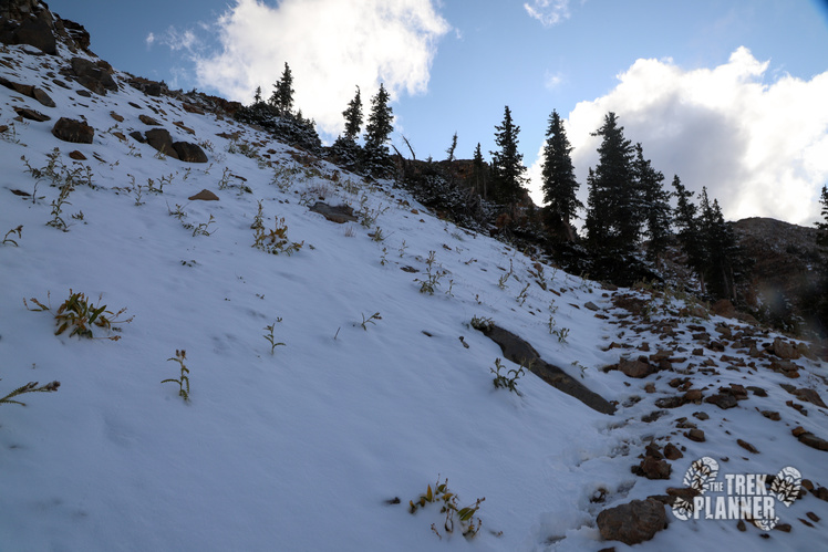
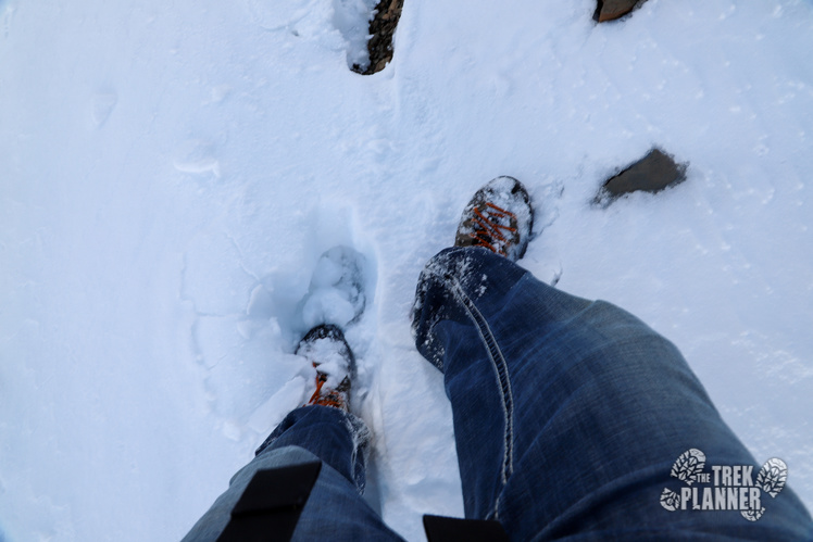
There was lots of snow when I hiked and luckily another hiker before me had paved a trail or I would have turned around and gone back down the west side, for safety reasons. The trail is steep but I found plenty of rocks just beneath the snow offering good traction. This trail would be more fun if there wasn’t snow here. I wanted to enjoy the views and not just focus on careful stepping, but I still did enjoy this way.
Should have wore boots! Oh well!
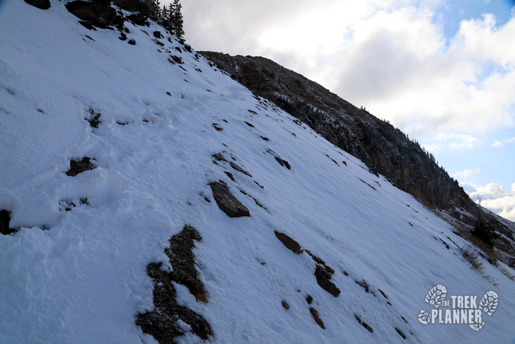
You can see just how steep this hike really is!
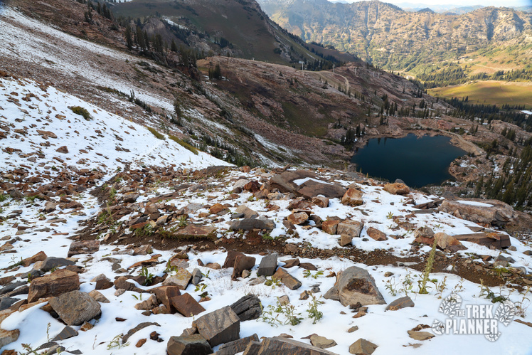
After what seemed like forever I finally got down to Cecret Lake again. This is truly a thigh and bun burner of a hike! Luckily the trail from Cecret Lake to the parking lot is easy.

Personal Thoughts
Overall, hiking to sugarloaf doesn't cover much distance. You will barely hike over 3.3 miles but the steep inclines and declines are what make this hike difficult! If you are ready for the challenge of Sugarloaf then come prepared for an intense workout! This is a great half day adventure!


[…] If you look down in the valley to the north west, you will see a small portion of Sundial Peak where Lake Blanche is located. If you look to the south west, you can see views of Devils Castle and also Sugarloaf Mountain. […]