
The Trek in a snapshot
Location
North of Green River, Utah
Managing Agency
Unknown
Pets
Allowed
Fees
None
Restrooms
Yes. At some of the boat ramps and campgrounds along the way
Camping
There are campgrounds nearby. Fees are required for these.
Trail Condition
The road is rocky and dirt to the very end. Some parts would have been better with a high-clearance vehicle. If there was recent rain/snow I wouldn’t come down this road without four-wheel drive. Make sure you are prepared for anything including a flat tire
Sights
Petroglyphs, interesting historical sites, Green River
Water Info
Bring a liter of water per person
Best Season
Summer or fall
Distance
40 miles roundtrip
Time Required
2-3 hours
Parking Elevation
4113 ft at canyon entrance
Summit Elevation
4167 ft
Elevation Difference
54 ft

Trek Planner Maps
Nefertiti Rock: 39.1937, -110.08089
Rock Cabin: 39.14191, -110.10085
The GPS coordinates to the petroglyphs and other sites are for Insider Members Only
This content is only for Insider Members


Experience. Discover. Explore.
Follow along on our adventure then go out on your own!


Note: You can only access the Unexpected Rock Art Panel and the Short Panel by drone or by using a raft. If you have a telephoto lens, you may be able to see them from the other side
Additional Trail Maps
This content is only for Insider Members
Driving Directions
The road to Nefertiti Rock is very rocky. I got to the end of the road in my Impala, but I was going pretty slow in most spots trying to avoid the rocks. If you have a truck or high clearance vehicle you will have little problems. The road is dirt past Swasey’s Beach. The road can be very narrow at points, so please use caution.
I have known that there are rock art sites out along Hastings Road for a long time now. It just happened to work out that I had a free half-day on my way home from Moab and I decided to finally make the trek out to find them. In the back of my mind I thought I remembered where they were, but as I got closer to the end of Hastings Road, I realized I had completely forgotten!
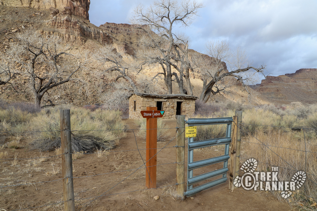
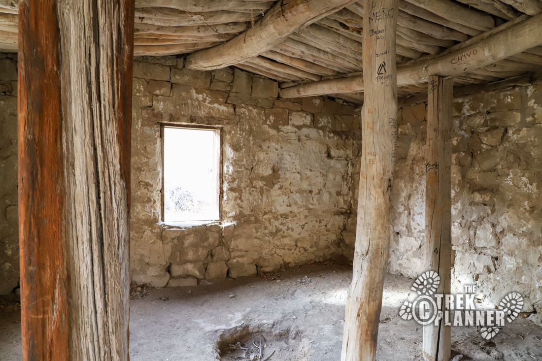
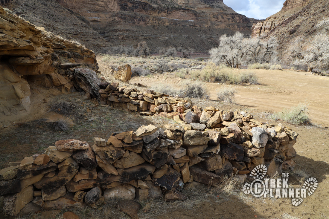
On the way you will pass by a stone cabin. The stone cabin doesn’t have any information signs, but you are free to enjoy visiting it. Please be respectful and do not climb through the windows or damage this historical relic or write your name on the inside wood posts like some have previously did.
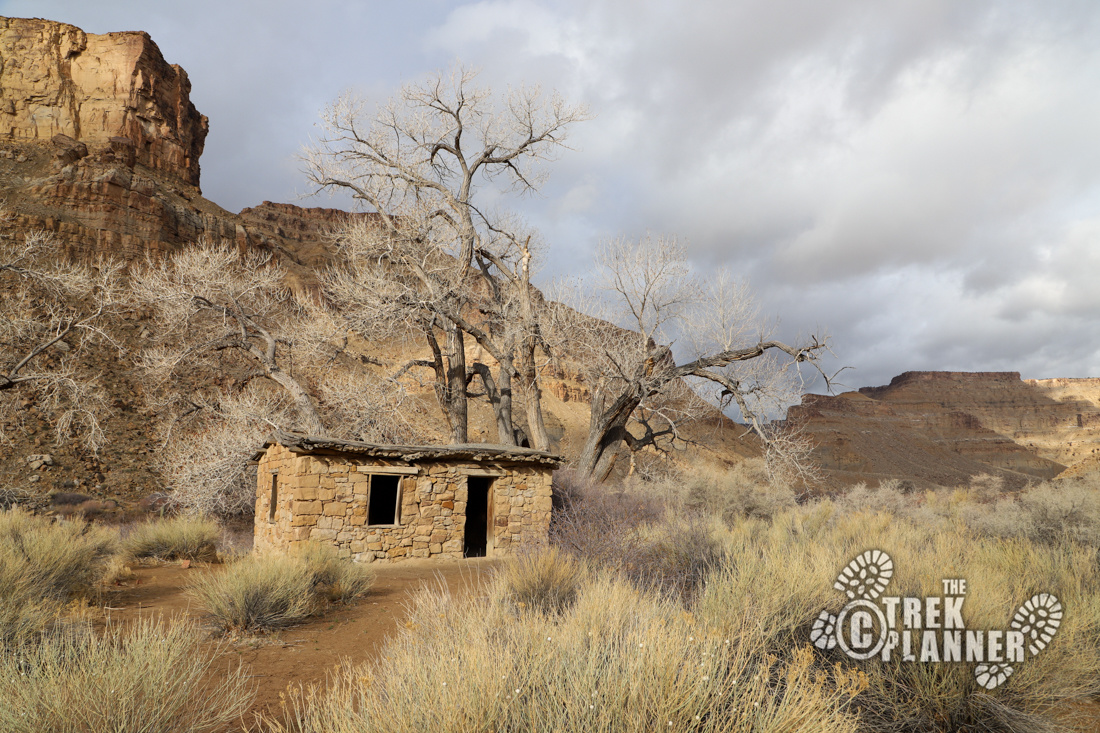
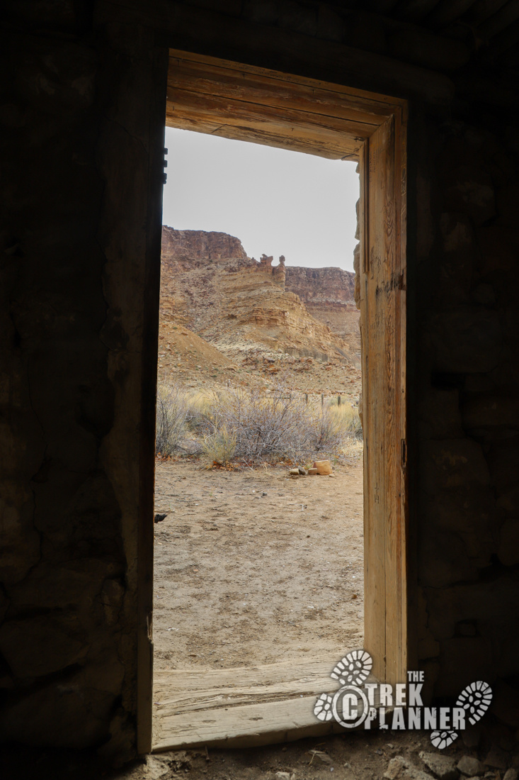
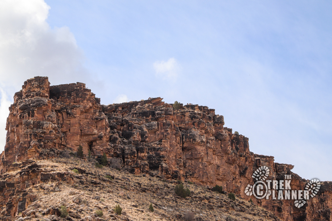
The drive on Hastings Road is long, winding, and beautiful. You will encounter skyscraping cliffs along a narrow canyon with the Green River in its center. The water levels in spring were still low and I found ducks and geese along the banks. As I was driving along, I got the impression that not many people drive to the end of the road. I only encountered two hunters on ATVs and then there was a family who were camping in their trailer near the end.
I stopped many times to take pictures and tried to spot any petroglyphs on big boulders, but didn’t see any. I thought I remembered that there would be some rock art at the end of Hastings Road, so I focused mostly on driving until I got there.
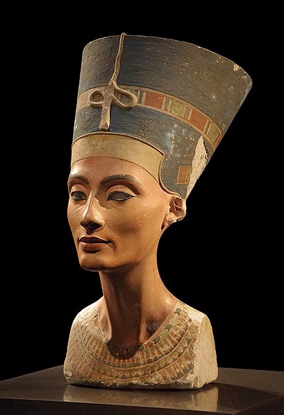
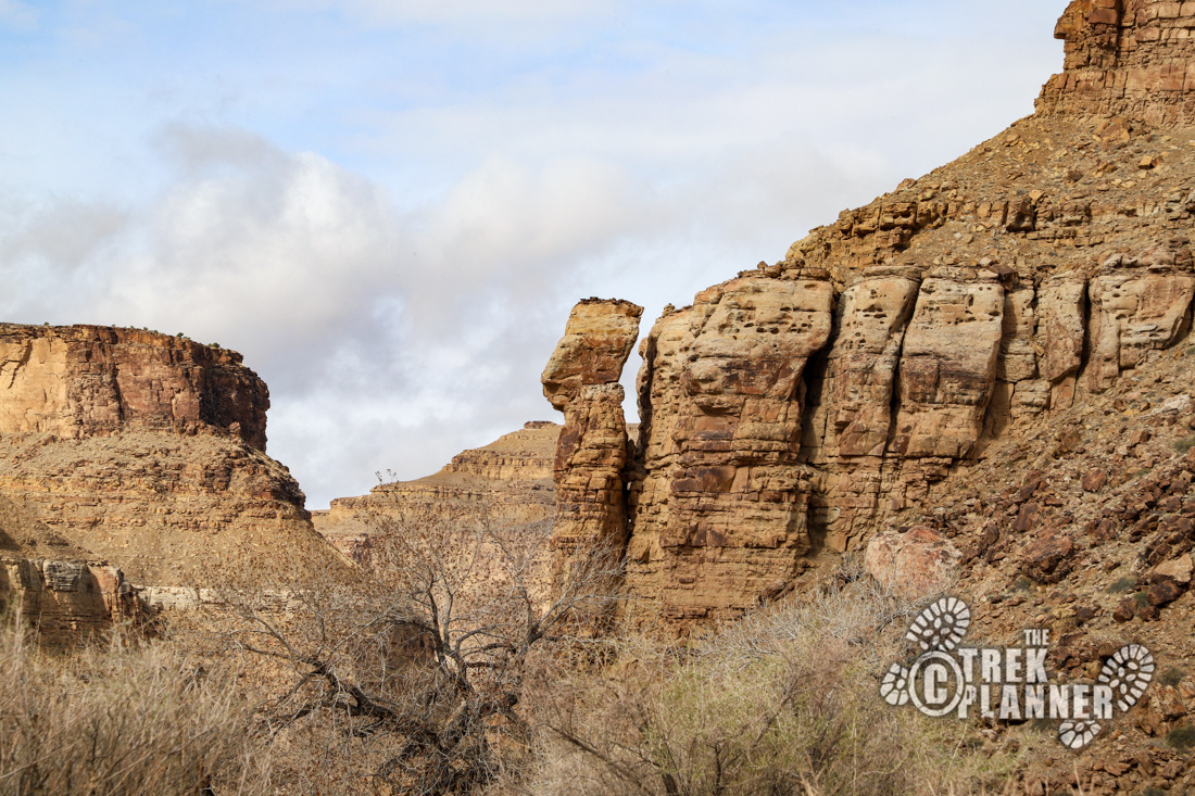
You can see Nefertiti Rock before you get to the end, but the rock is on the other side of the Green River. The shape is that of the Egyptian Queen’s bust and it does indeed have a resemblance.
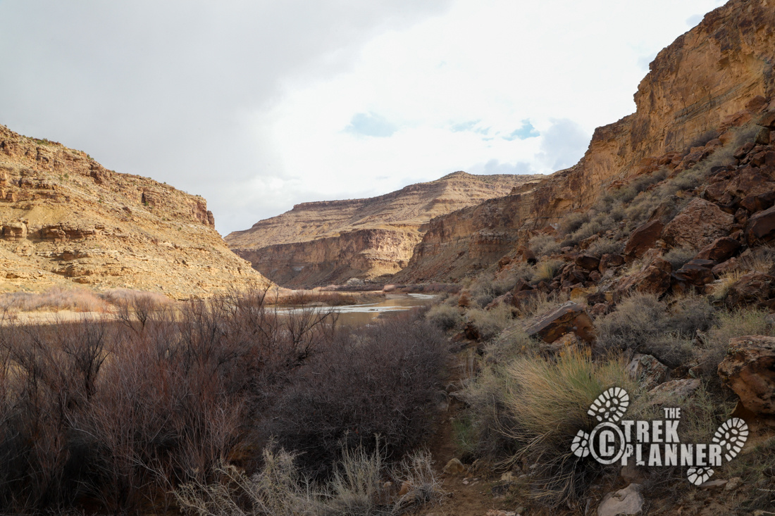
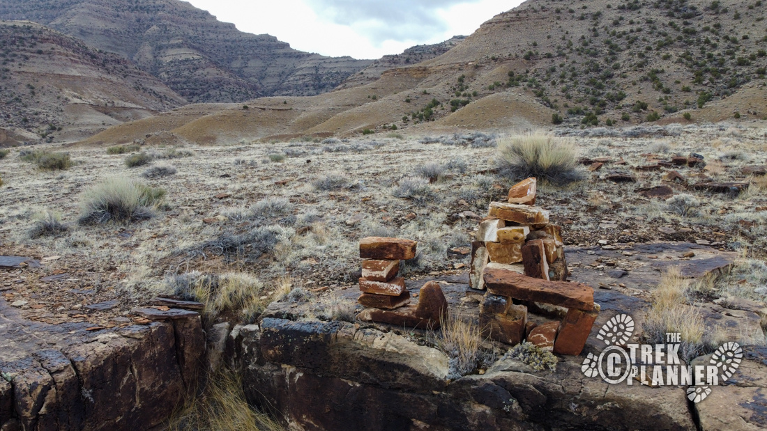
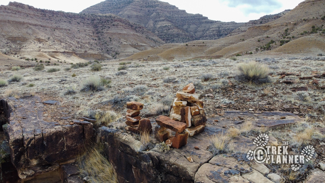
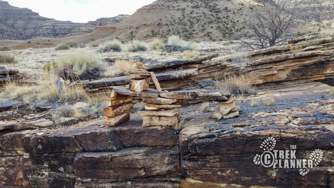
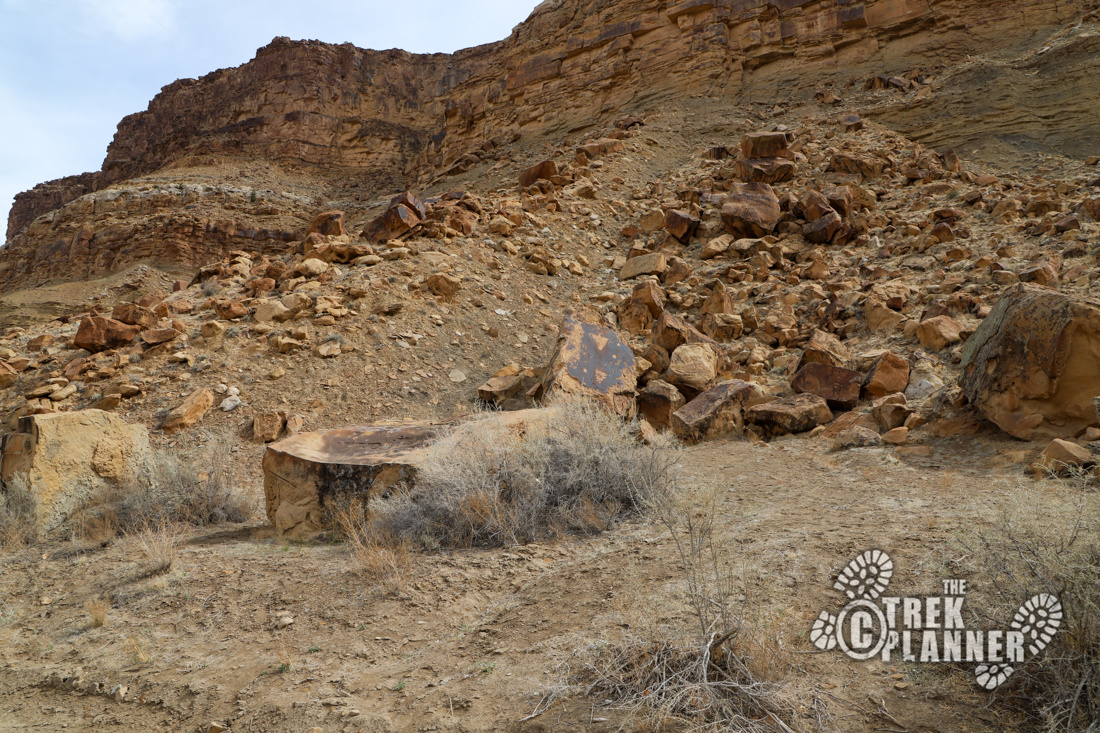
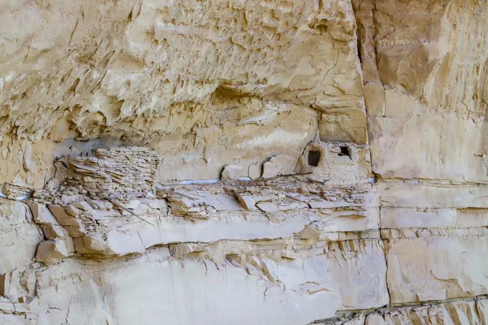
At the end of the road, you will find two outhouse style bathrooms, boat ramp, and a few trails. There is a trail that continues north to Rattlesnake Canyon. There is a trail that heads east up an unnamed canyon. I hiked both of these trails for a ways trying to find the petroglyphs, but I was out of luck! You can see a rock structure right from the parking area too. Was this a modern creation by ranchers or hunters? Or was it an ancient structure built by the Fremont Indians who were living in nearby Range Creek, or was it other some groups?
At this moment, I remembered I had my satellite messenger in my backpack and I pull it out to text my brother to see if he could tell me where the petroglyphs were. The canyon walls were very steep and narrow and I doubted a GPS signal could be reached at this point – I was wrong!
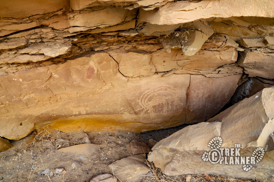
Please respect the ancient rock art by not touching or carving your own name on them. Just take pictures and enjoy!
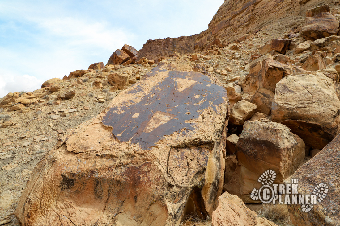
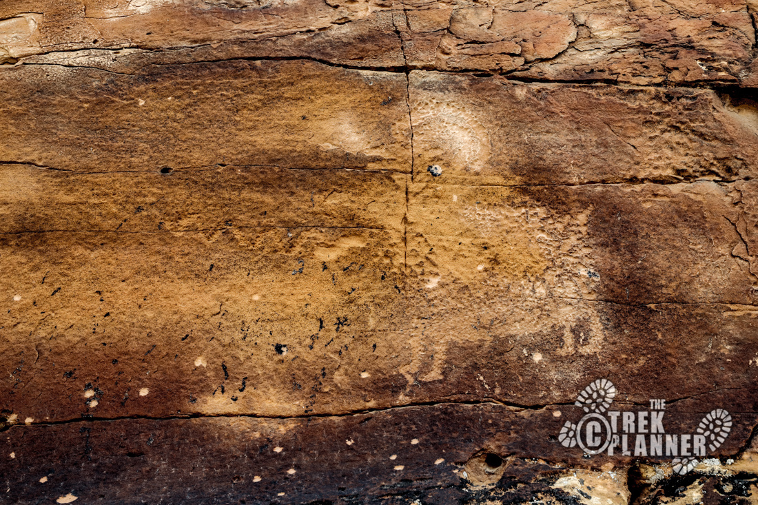
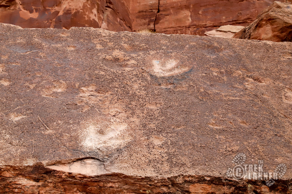
After a few minutes I got a text back from my brother with some GPS coordinates! I found one of them, near the last parking area. This panel was located under a ledge and it’s very faded. You can see a few big horn sheep and other figures.
I went back to my car to get my DSLR camera and I saw a lady, who was camping in the trailer, walking around the area. I asked her where the other petroglyph panels were located. She was very friendly and told me that the “Elk Panel” was located just down from where I parked. She also told me how to locate another panel that I missed coming up the canyon.
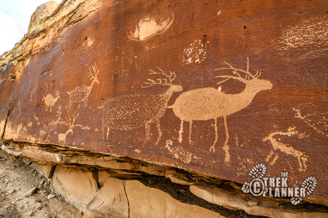
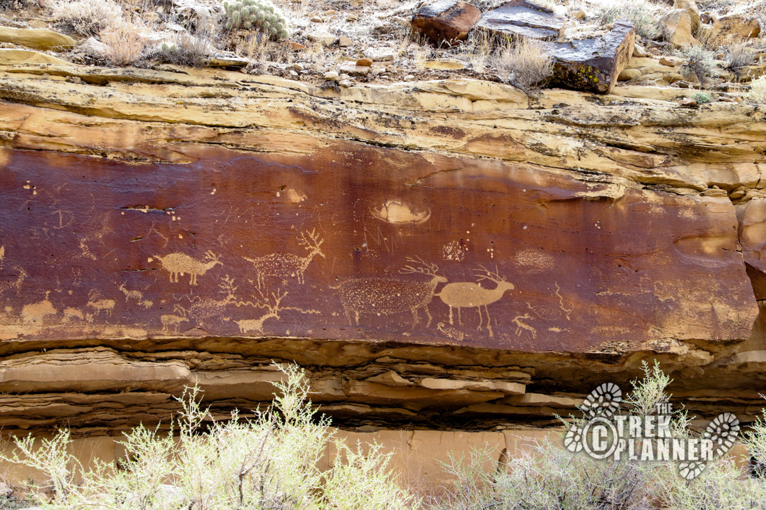
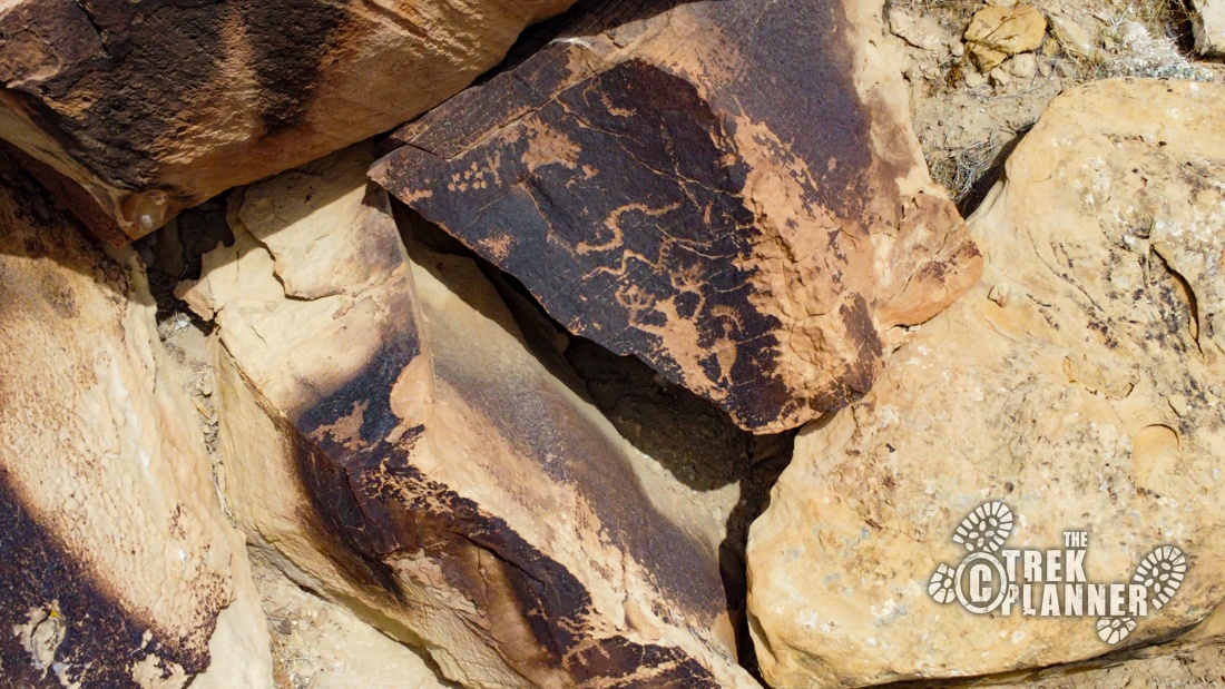
The Elk Panel is very easy to see and only located about 20 ft. from the road. I had completely missed it on the way up, since I was so worried I wouldn’t find it! The Elk Panel has many depictions of Elk and other figures. The Elk are huge and beautifully carved! These are some of my favorite depictions of elk I have seen.

I was eating lunch and noticed some small rock monuments on top of the mesa area. I’m not sure what they were used for, but I flew my drone up to get better pictures. There are several of them and I wonder if they are markers for the old pack trail which was nearby – who knows!
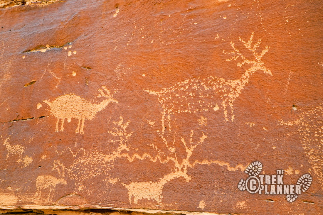
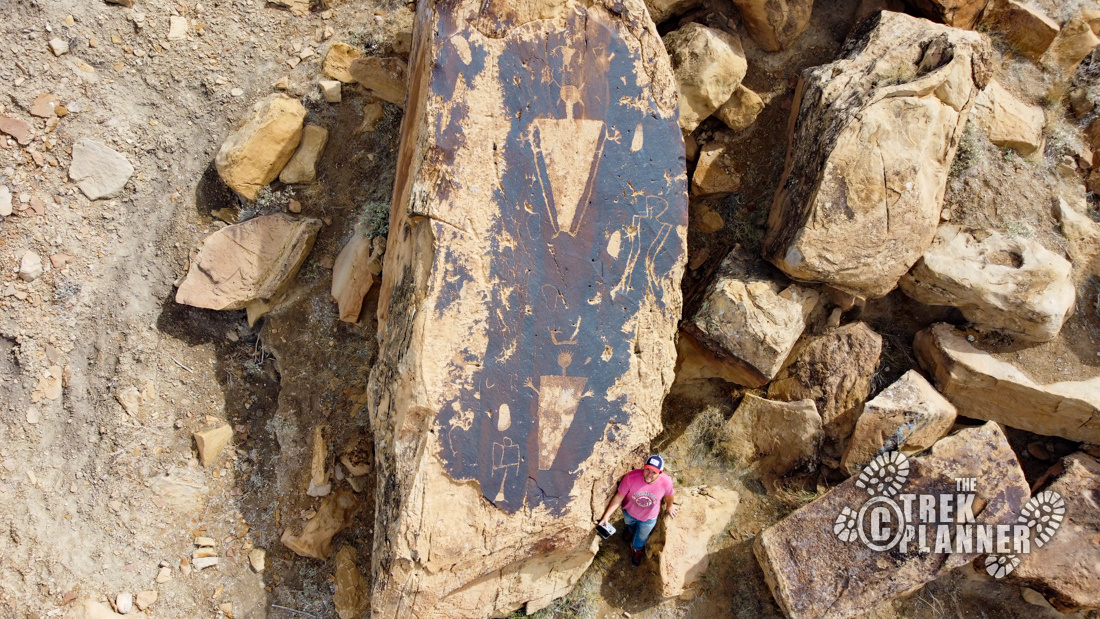
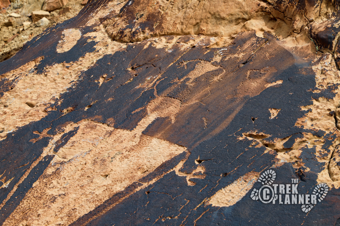
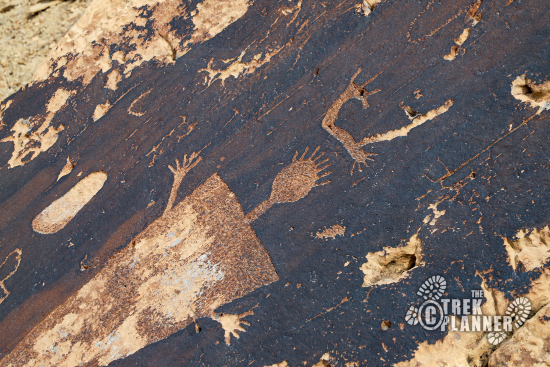
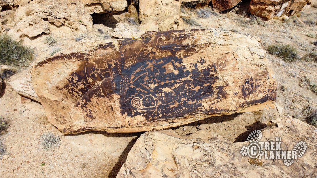
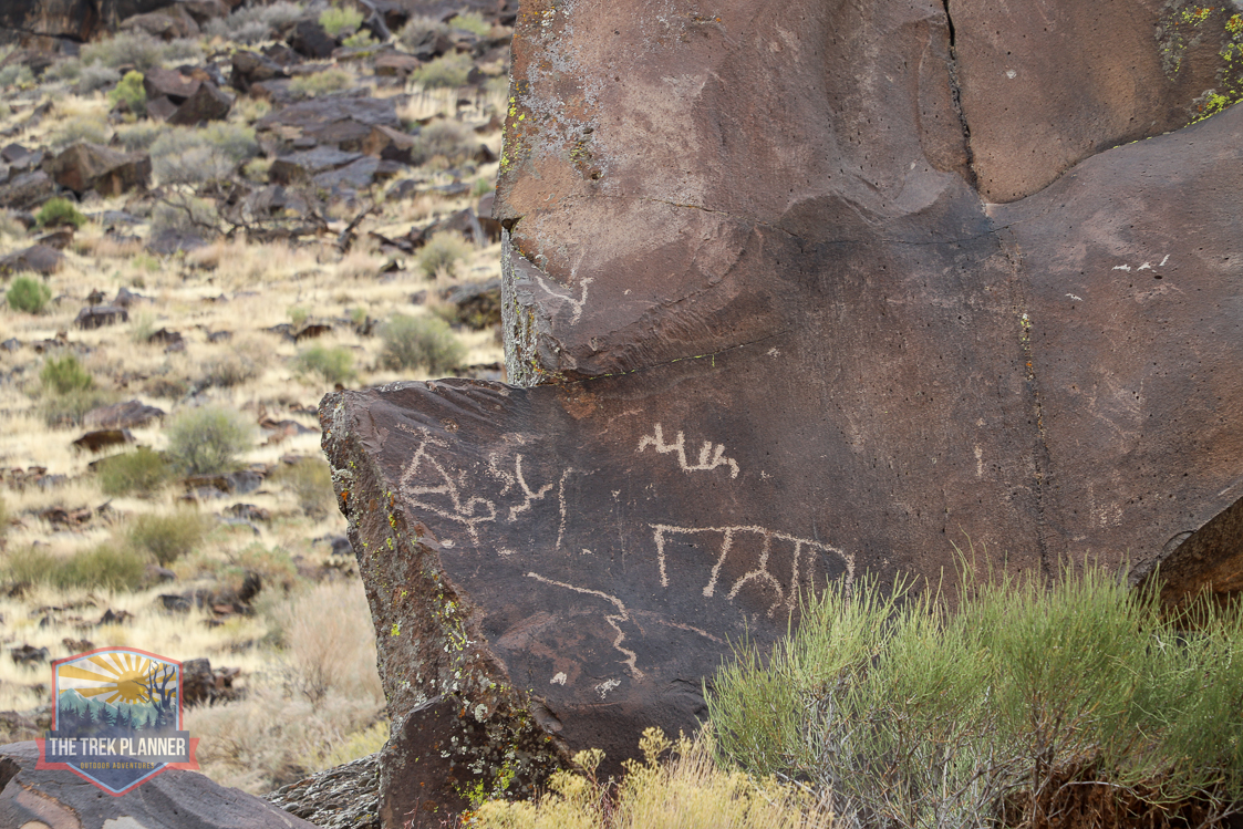
Next, I followed the lady’s perfect directions and got to the next panel exactly as she described. This large beautiful panel is located on a slanted boulder. There are several anthropomorphs (human-like figures), and a few other designs. The top figure has a crown or some antennae or horns on it. The bottom figure has many points sticking straight up. These petroglyphs seem to be VERY old and have seen better days. I loved this panel and loved admiring the work the original artist(s) did. These were worth the drive.
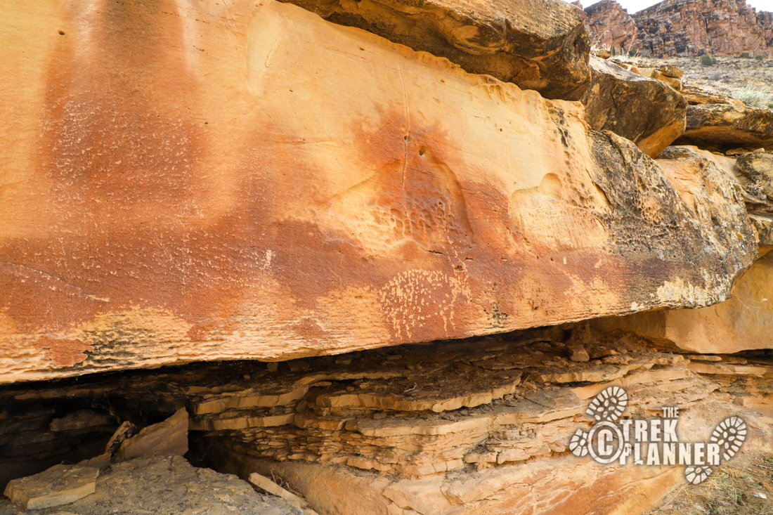
They are slightly faded and you can tell there were others but they have succumbed to the sun, rain, and erosion. These were fun to photograph and I thought it would be fun to use my drone to take a picture from above.

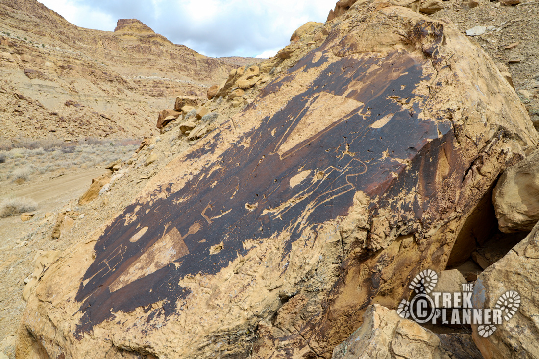
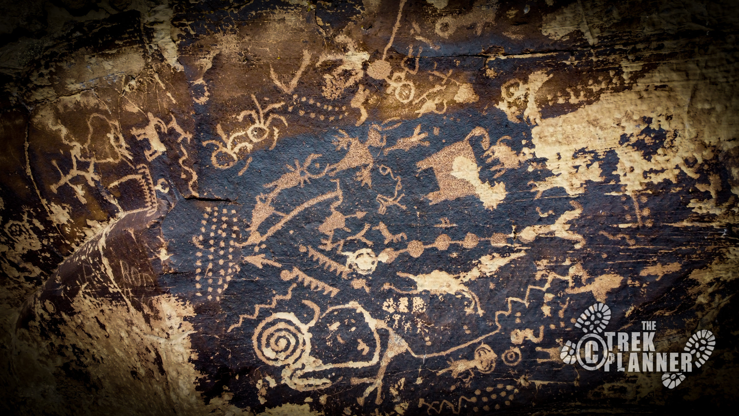
It was at this moment that I decided to get some shots with my drone of the Green River. I was flying around and I decided to check out some of the boulders on the other side of the river. As I was coming in close to this one boulder in particular, I began to see things that resembled petroglyphs. The closer I got I could make out the carvings and was surprised to find this boulder COVERED in petroglyphs!
I call this panel the Unexpected Panel because, well, it was completely unexpected! There are lots of shapes and figures on this one that make me think it is a map or guide of some kind. It could be telling a story, or it’s simply just ideas, thoughts, dreams, or anything else. We have no idea, but it’s really fun to admire! It makes me think: “what else is out there?”

I flew the drone around some more and found another smaller panel nearby. I call this panel the Boulder Panel, since it’s nestled between a few boulders.
You can see a trail next to the Unexpected Panel in my video below. This trail is an old pack trail and it seems that modern rafters have stopped here to see these panels too. It appears that these two panels can only be reached by drone or by using a raft. You can see them if you hike up high on the east side of the river and use binoculars or a telephoto lens.
I spent the remainder of my drone battery trying to find other petroglyphs, but was getting leery of flying on the other side of the river and didn’t want to run the risk of losing it over there. I flew it back and continued my drive down the canyon back home!
Personal Thoughts
This was such a fun adventure! I loved the drive through the canyon, seeing the petroglyphs, and flying my drone around exploring! The drive was very quiet and every time I stopped to take pictures I enjoyed the peace of it all. Seeing the rock art on the other side of the Green River was definitely a highlight of this trip and something I will never forget.

[…] After this, I went back to the petroglyph panel that I missed before. These are incredible and worth the visit alone! The rock the petroglyphs are on are angled kind of weird, so I pulled out the drone and got some aerial photos. I figured it would be nice to fly my drone along the river for some nice photos and I had the passing thought that maybe there would be petroglyphs on the other side of the river. I flew the drone over and scanned some of the larger boulders. On one boulder in particular, I saw some… Read more »