
The Trek in a snapshot

Trek Planner Maps
Trailhead: 38.29009, -113.14323
Milford Arch: 38.295, -113.14814

Experience. Discover. Explore.
Follow along on our adventure then go out on your own!


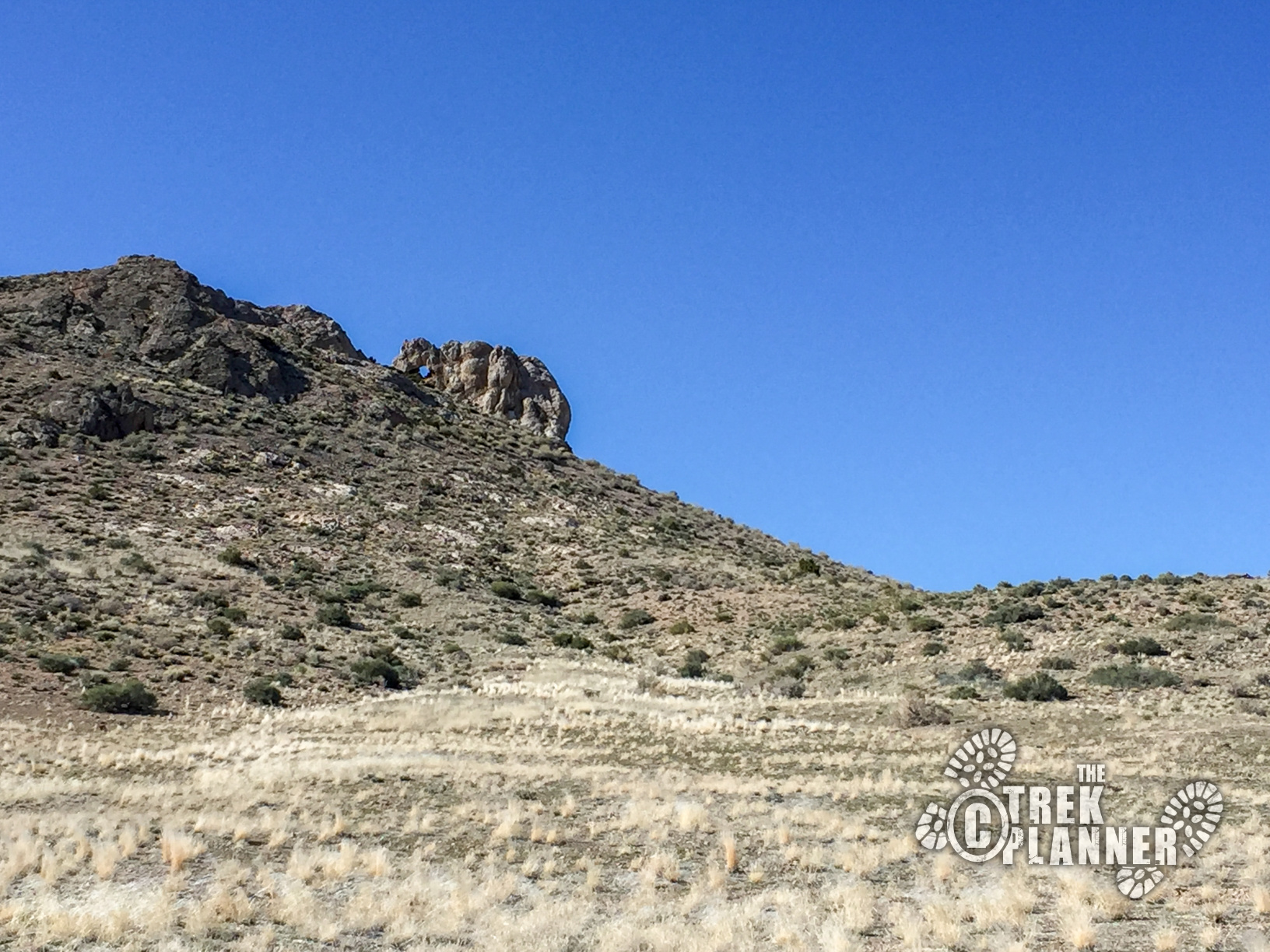
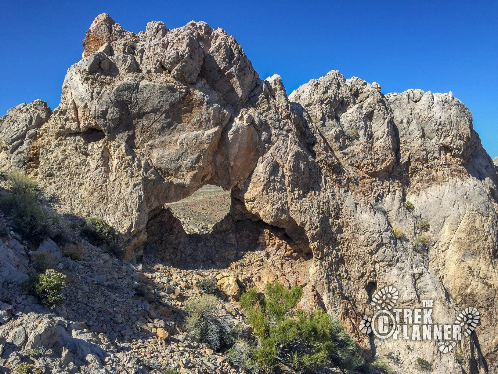
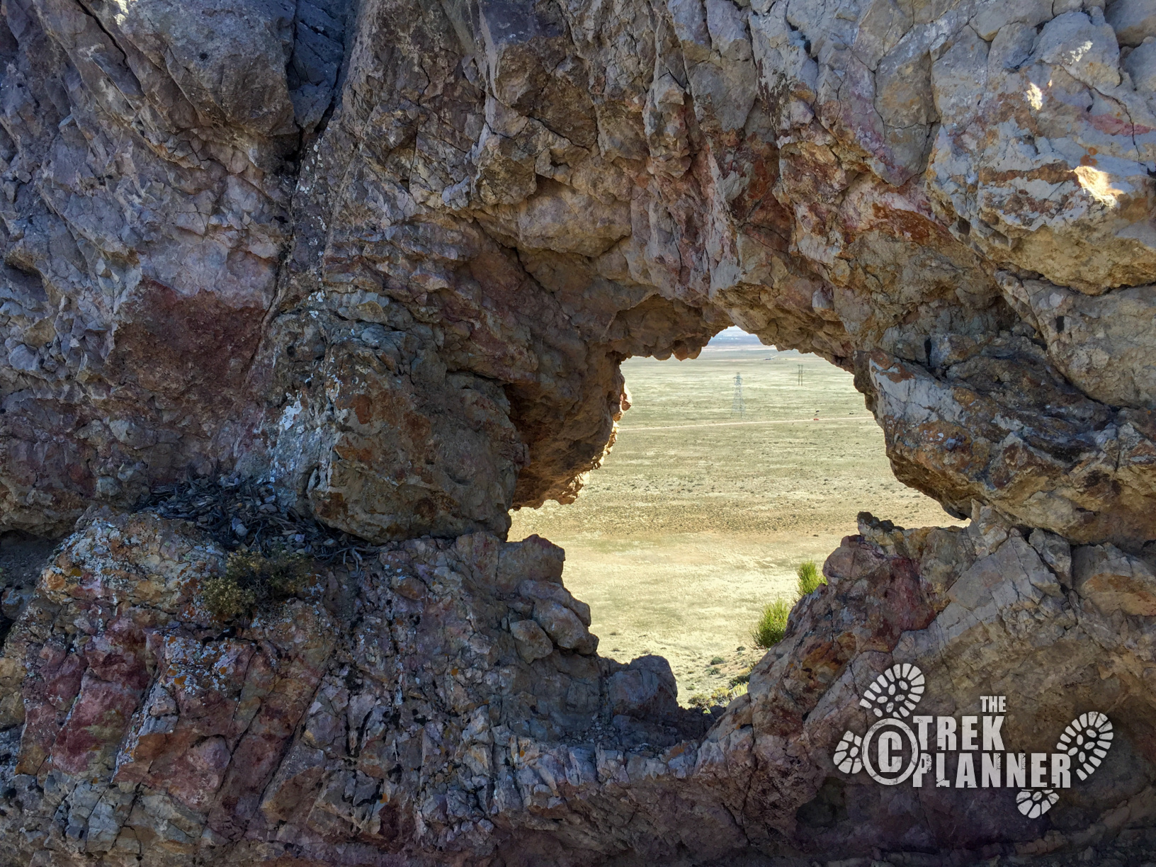
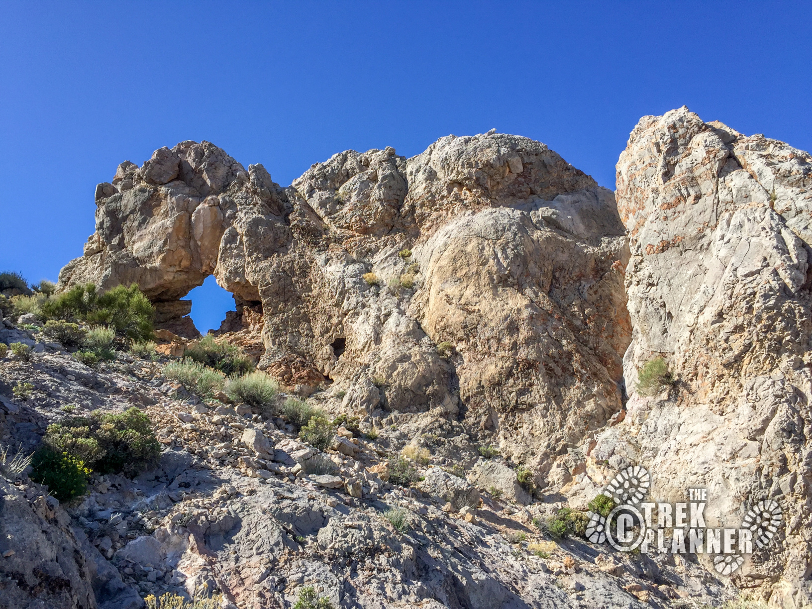
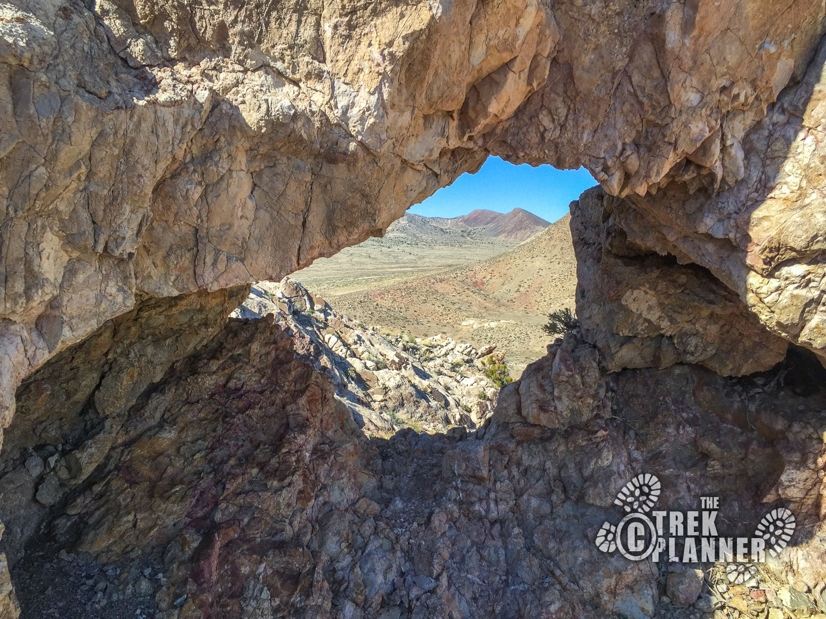
While I was exploring some nearby mines, I saw this small natural arch that seemed to be fun to hike to. The arch, more like a window, can be viewed from the road, but can easily be hiked to if desired. There isn’t much to see at this arch. Since it was near some abandoned mines, I thought there would be some type of mining or artifacts near it since it seemed like a good marker for the area. I didn’t see anything that hinted mining was done at the arch though or that artifacts were left here.
The arch doesn’t have a name that I have found. I’m sure the locals would probably have a name for it though. I have chose to name it after the nearby town of Milford.
The Milford Arch is small, yet you can still go through it. There isn’t a set trail and I found that I was hiking along mule deer (?) trails for a portion of the hike. The rest will be hiking through brush and weeds.


Personal Thoughts
This isn't the most exciting adventure, but if are in the area and want to see the arch, I recommend at least driving along the road to view it.


