
The Trek in a snapshot

Trek Planner Maps
Trailhead: 38.52825, -109.59655
Magic Theater Arch: 38.52804, -109.58878

Experience. Discover. Explore.
Follow along on our adventure then go out on your own!


Due to recent vandalism on the nearby Birthing Scene Petroglyphs, we are removing the GPS coordinates for this post and will have them available to Insider Members
GPS coordinates to the petroglyphs:
All vehicles can access the trailhead. There is a large parking/staging area for all the biking and off-road trails, park here. The trailhead begins on the southeast side of the parking area.
Note: as of the publishing date on this Trek, Magic Theater Arch is mislabeled on Google Maps. If you follow the map point for the arch, you will not see it.
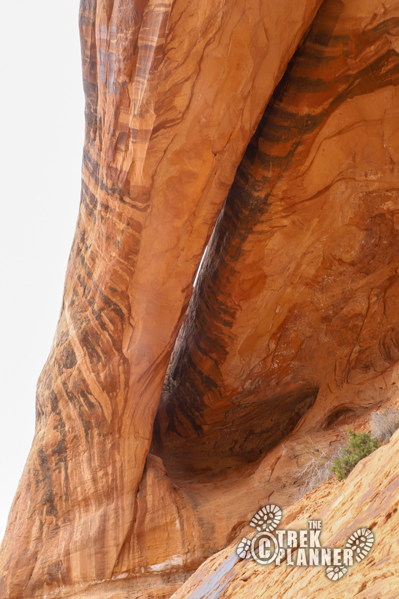
Magic Theater Arch is not the most beautiful or picturesque arch in Moab, but it’s a fun adventure complete with a ruin and petroglyphs. The reason why the arch isn’t photogenic is because you cannot tell it’s an arch until you are right under it. And, the trail does not go right under it. Yet, I still enjoyed this hike for the petroglyphs and the scenic views!
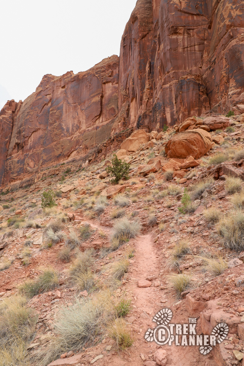
The trail begins on the southeast side of the large parking and staging area along Kane Creek Road. There are lots of biking and off-road trails that begin near here, so the parking lot will always have a good amount of vehicles in it. Across the street from the parking area is a nice rock lined trail that zigzags up to the cliffs you see in front of you. There are several switchbacks that make the hike easier. Climb to the top of the switchbacks until the trail evens out.
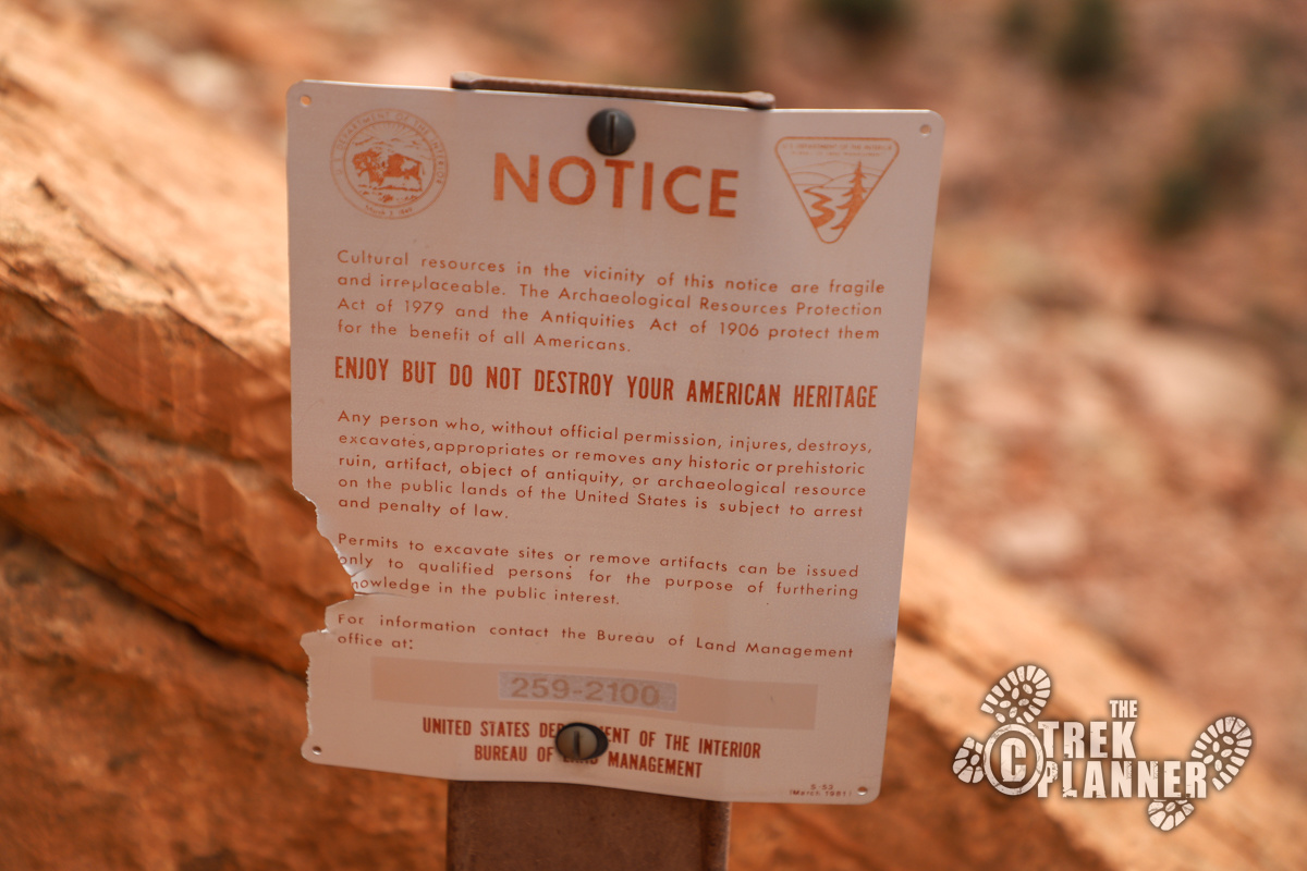
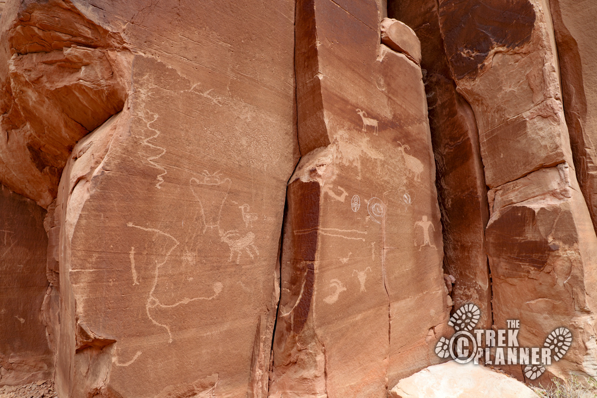

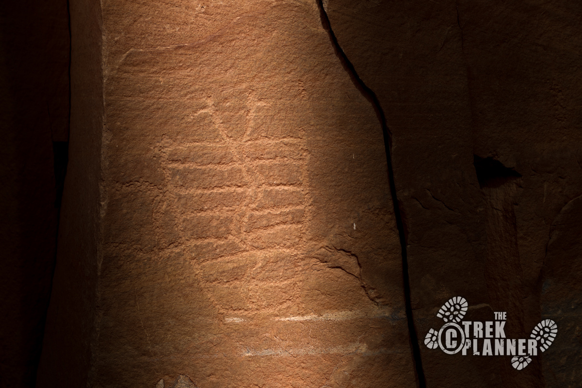
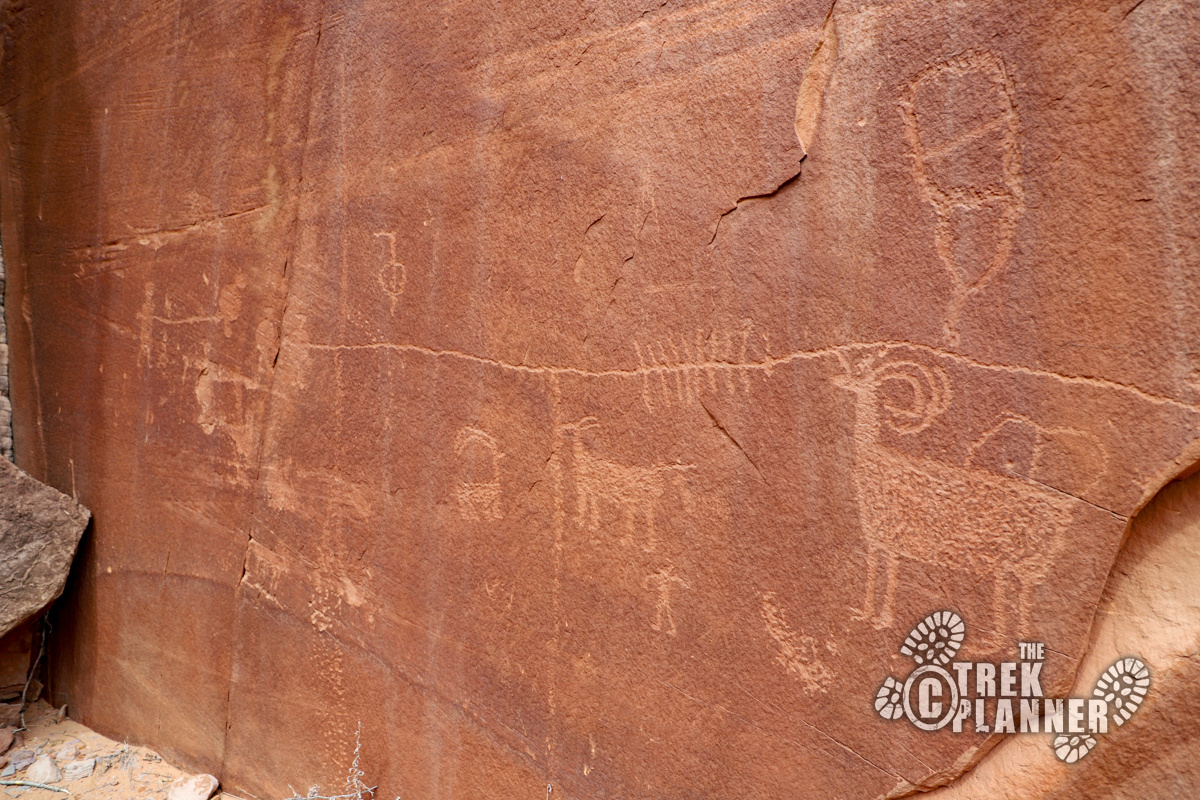
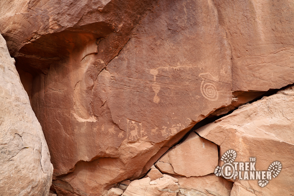
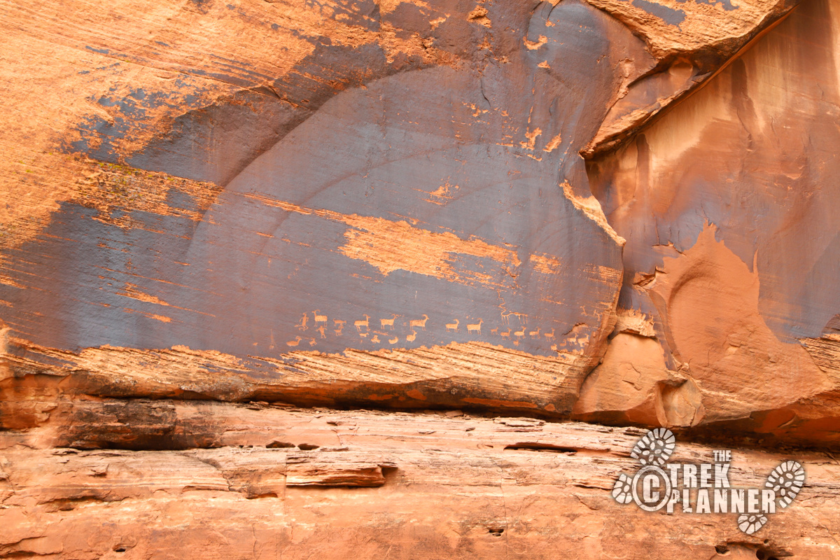
Take notice of the cliff walls. You will begin to see many petroglyphs right off the side of the trail. Be careful where you step too since there appears to be an ancient ruin. Please do not touch the petroglyphs or the ruin. Just admire them from a distance and take all the pictures you want. You can see previous careless and selfish hikers carved their names or initials on the rocks. This is a historically significant area full of rich history. Please help preserve it by respecting this place.
The rock art is fascinating! You will see big horn sheep, ambiguous shapes and symbols, anthropomorphic figures, other animals, circles, and more! Petroglyphs of big horn sheep are a very classic symbol in the southwest United States. On just about all the petroglyph panels in the area, you can almost always bet there will be figures of big horn sheep. Big horn sheep are still in the area to this day.
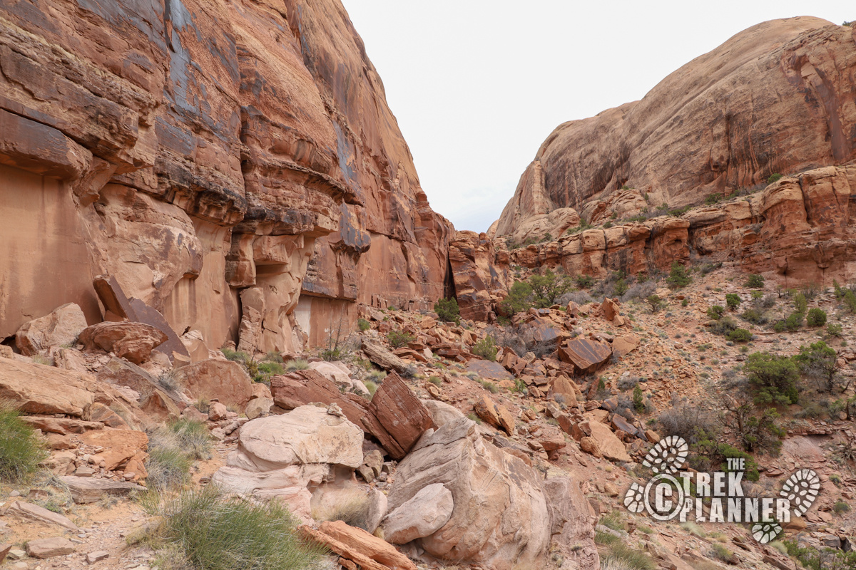
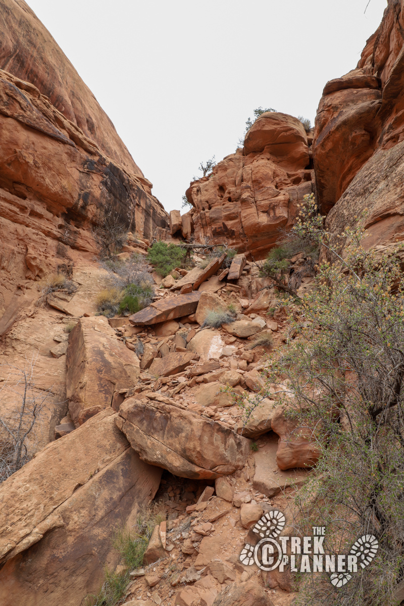
The trail goes right at the base of the cliffs to the east. You will scramble all over the boulders and I found that there are many different paths to get to the canyon above where Magic Theater Arch is located.
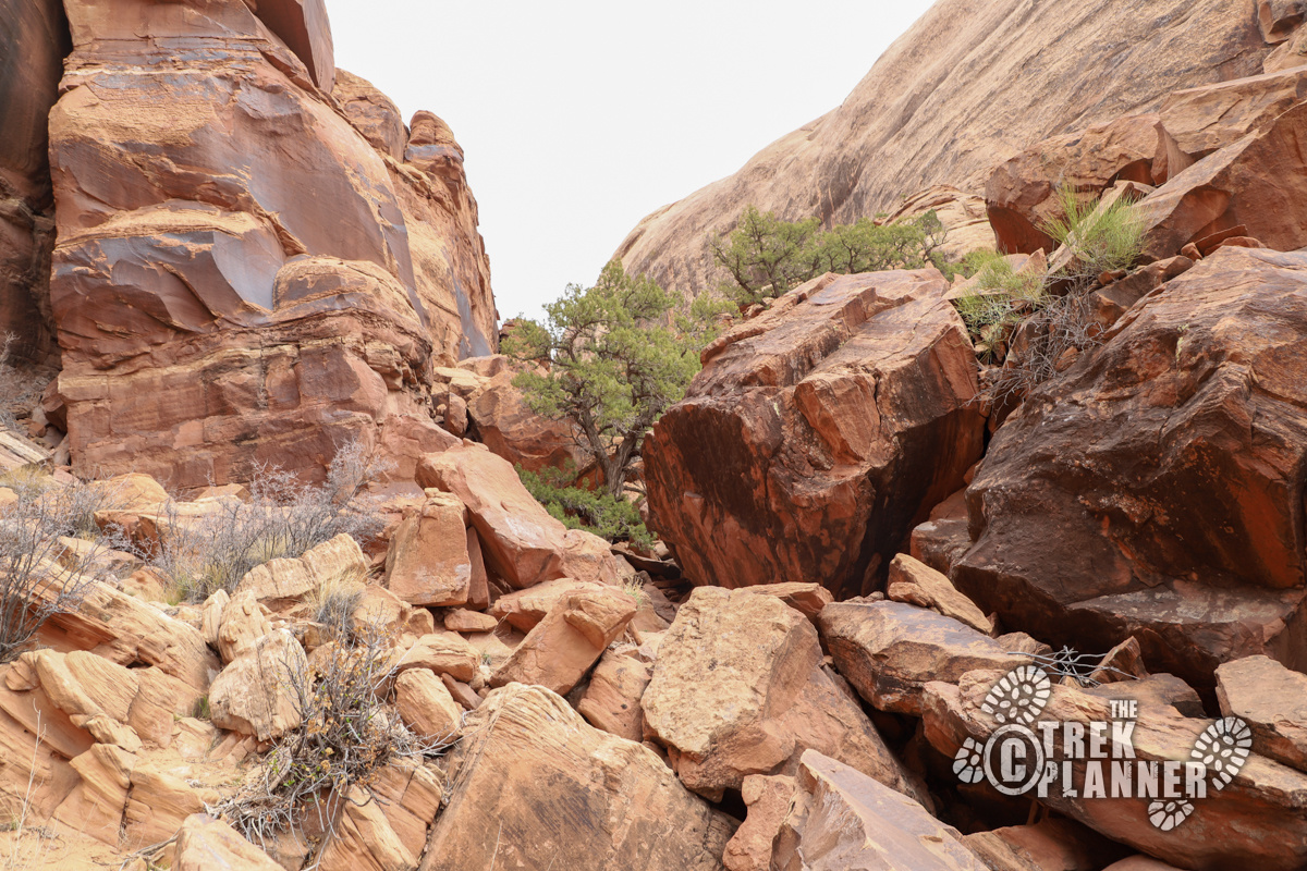
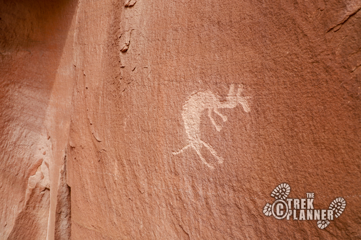
Once you make the short and easy scramble to the next canyon above, look directly to your left. You will see some very distinct and clear big horn sheep petroglyphs.
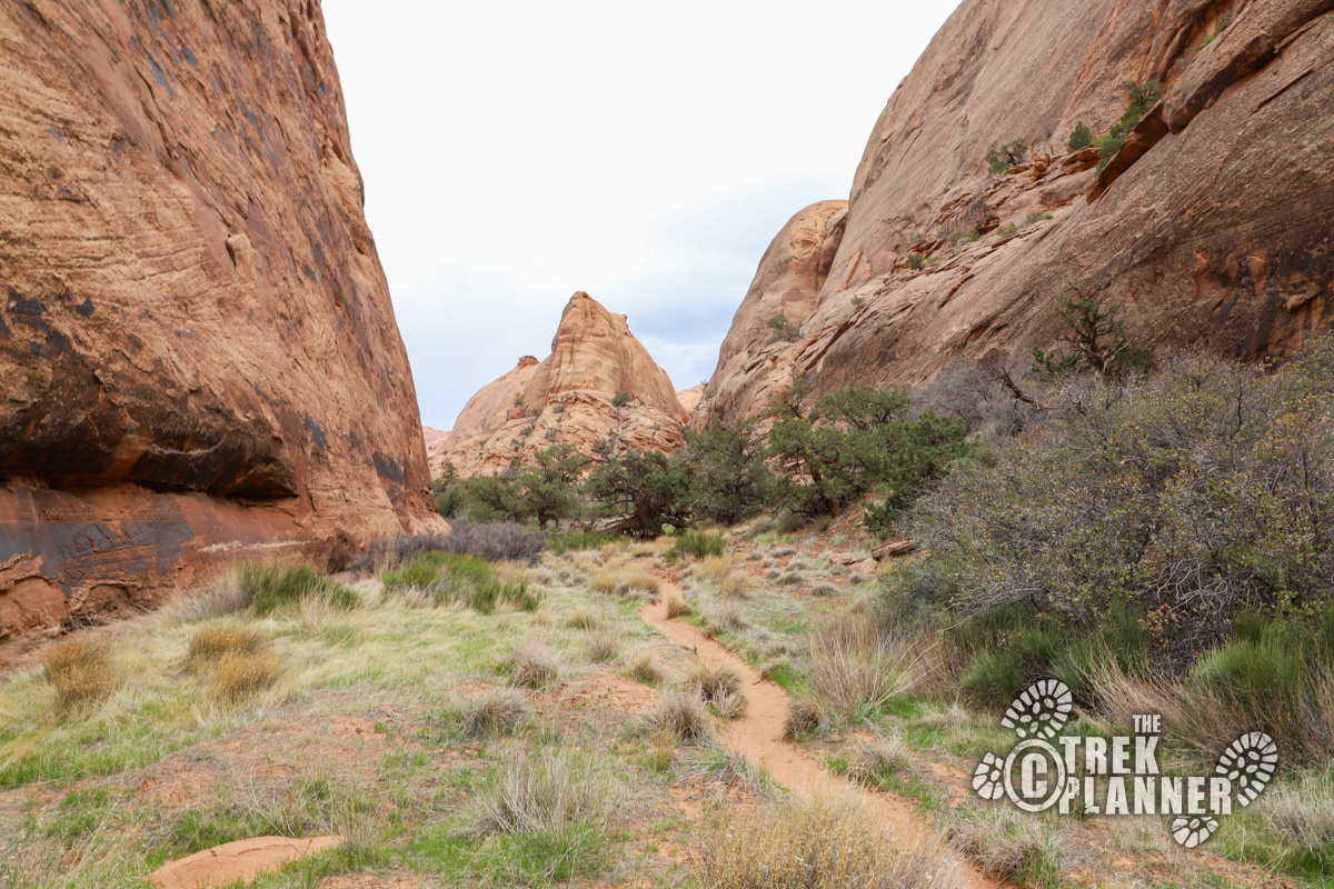
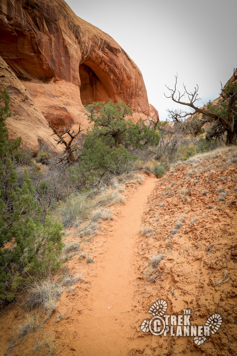
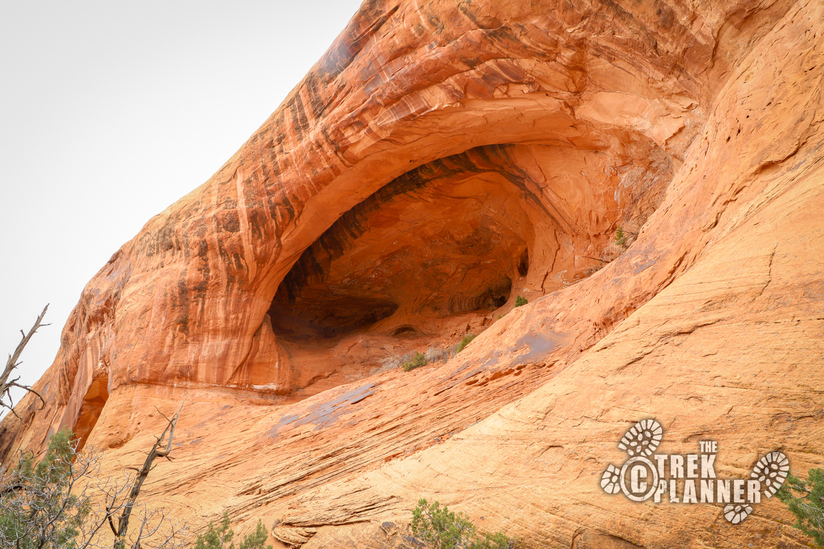
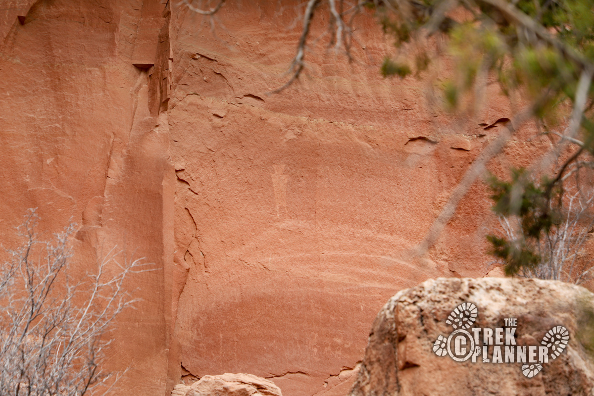
It isn’t too much farther to the Arch. You will wind around small scrub oak grove and over and through a few dry washes. You will see a giant alcove on your left side and that is Magic Theater Arch. You can’t quite tell it’s an arch unless you hike up a little bit and see the light shining through. I would not recommend hiking into the alcove because the rock you are standing on crumbles easily and you do not want to slip and slide down it. This is why I say this arch isn’t the most photogenic.

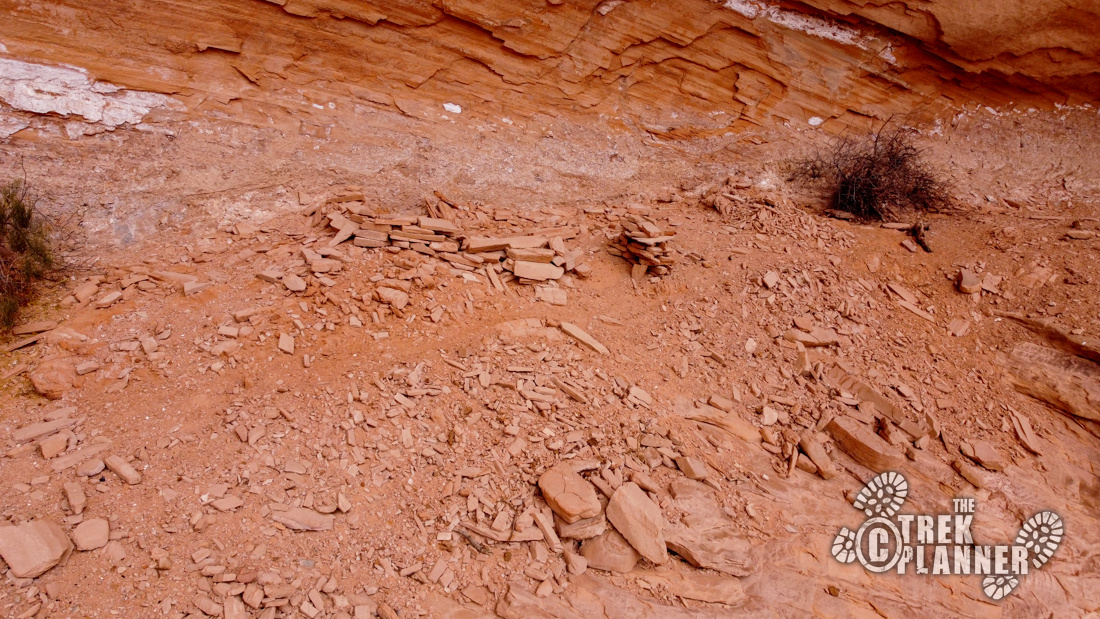
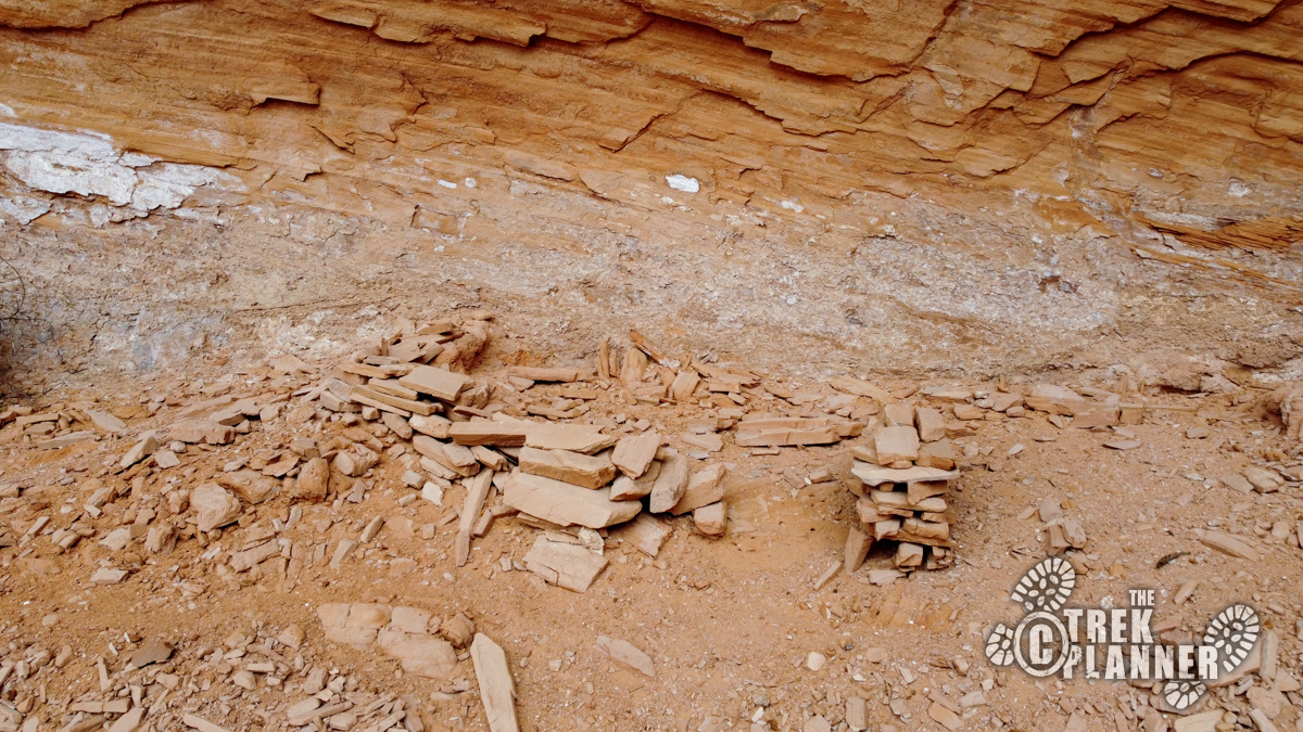
I flew my drone around here for a bit to scout out the other alcoves for ruins and petroglyphs. I didn’t find much except in one of the alcoves I found an ancient ruin! It would take quite the climb to get to the ruin. The rocks were deliberately stacked this way to make an outline of a small structure. It would have been larger when it was created, but time and erosion have worn it down to its current form.
I will post the GPS coordinate to the ruins for Trek Planner Insider Members only.
This content is locked
(memberships are currently unavailable)
You can continue on up the trail. It goes up a little ways and its fun to explore in this area. I hiked up a little bit farther and then came back down the same way.

Personal Thoughts
While Magic Mystery Arch isn't the most photogenic, this is still a fun and quick adventure to a very large arch. I think I enjoyed the rock art more than the arch.


