
The Trek in a snapshot

Experience. Discover. Explore.
Follow along on our adventure then go out on your own!


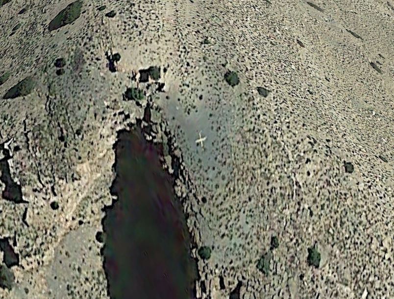
Before a recent trip to Nine Mile Canyon, I was scouting on Google Maps and located a strange cross or X on top of a very steep mountain inside the canyon. I had no idea what it was, but I was hoping I could find a route to the top and see it for myself.
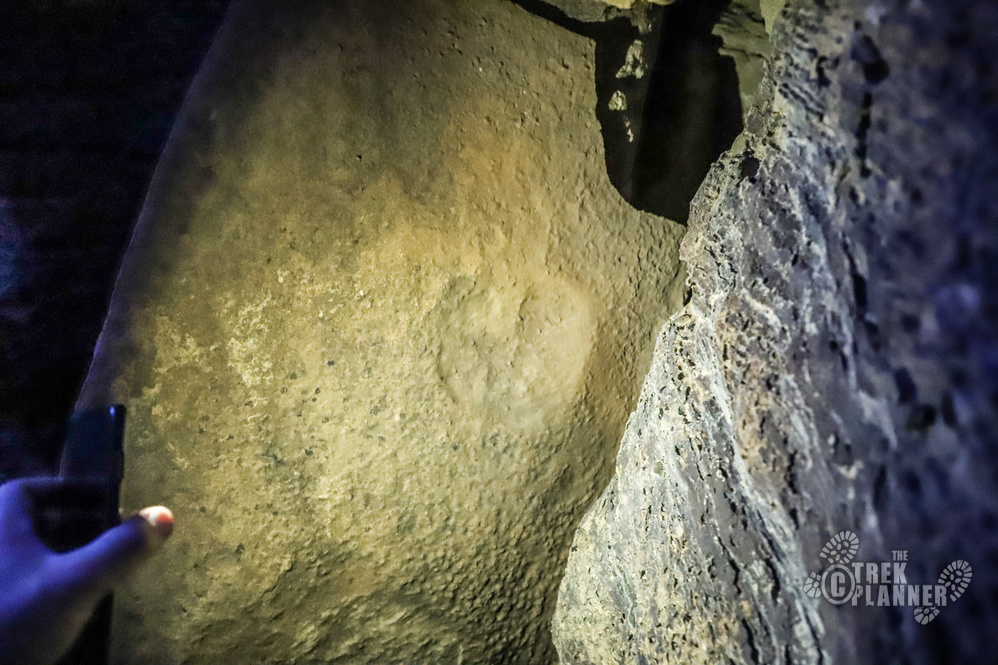
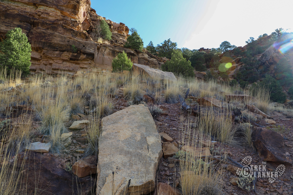
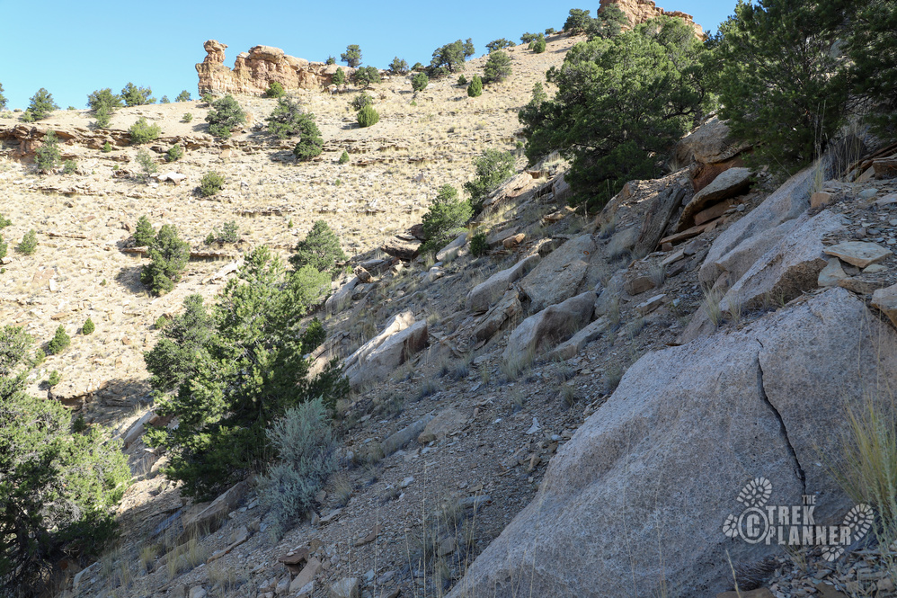
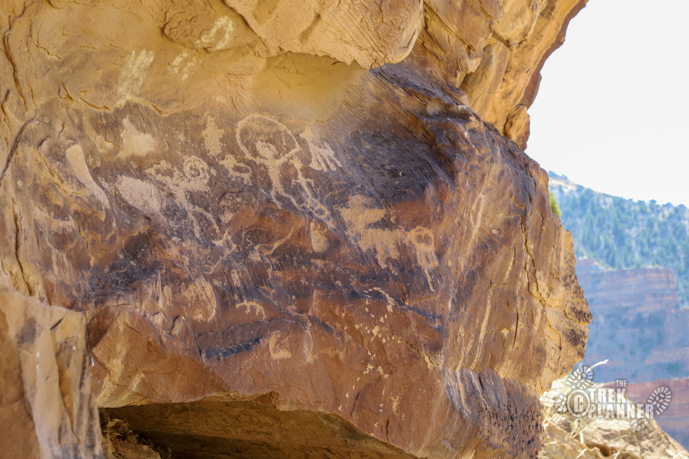
I drove down one day to Nine Mile Canyon and tried to find a good route to the top. On the east side of the X there were very steep cliffs that would make it impossible to climb to the top of the canyon. I tried to find a route on the west side and found it nearly as steep as the east side. However, I did find a steep yet doable hike on the west side and I started hiking around 5pm at night. Well, to my dismay, the route was a little more tricky and I ended up exploring some rock ledges that I thought I saw some granaries under. Pretty soon it was getting dark and all I had was my phone flashlight with me and that is when I saw a rock propped up in a weird way with two carved circles on it.
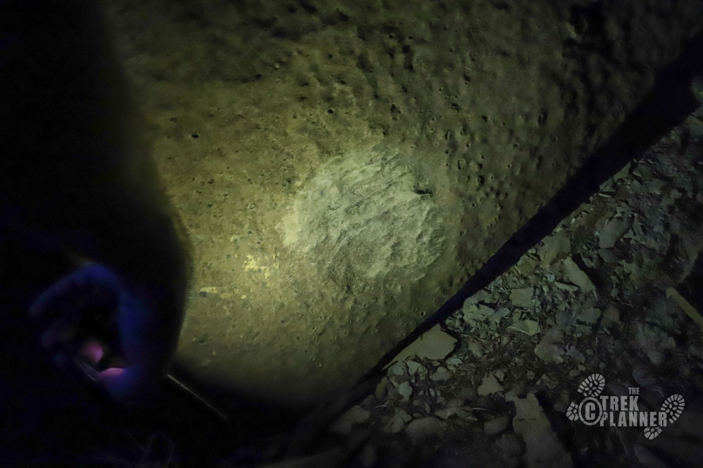
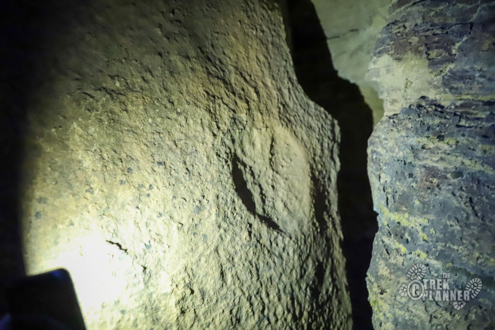
At first I didn’t think anything of it, but the more I shined my light on it, casting shadows in different directions, I realized that these circles were indeed carved by someone. Both of the circles were on the east side of the rock. I spent about 10 minutes there trying to figure out their purpose or gain any sort of perspective, but then I had to make my way back down before it got too dark. I marked the spot on my GPS and got back to my car safely.
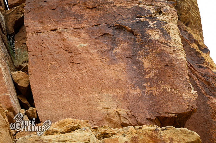
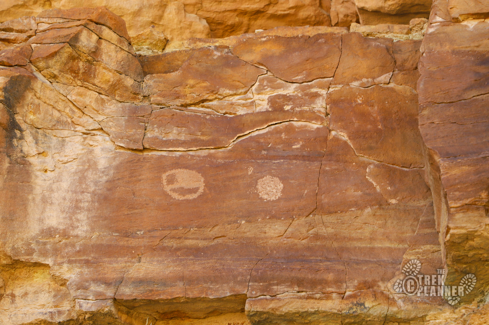
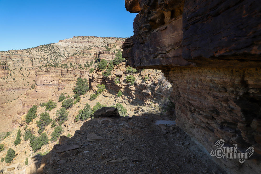
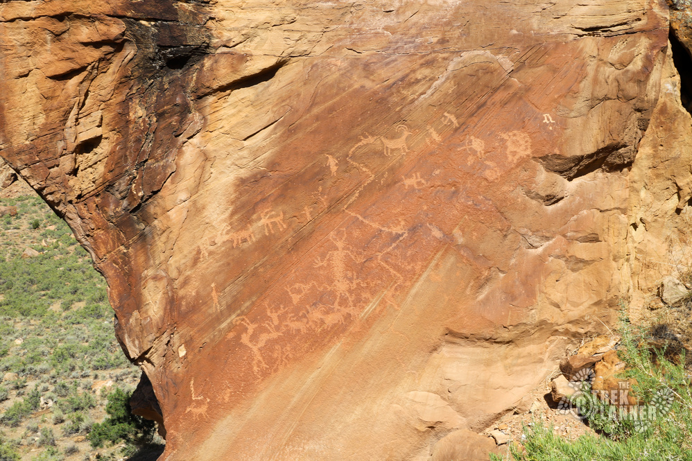
I spent the night in Wellington and then came back in the morning to hike to the top of the canyon again. I followed my same route and since it was daylight I could see that I missed some petroglyphs and pictographs the night before. There were circles and other shapes under a rock ledge.
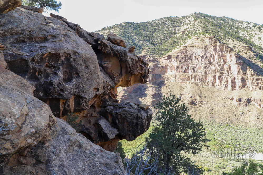
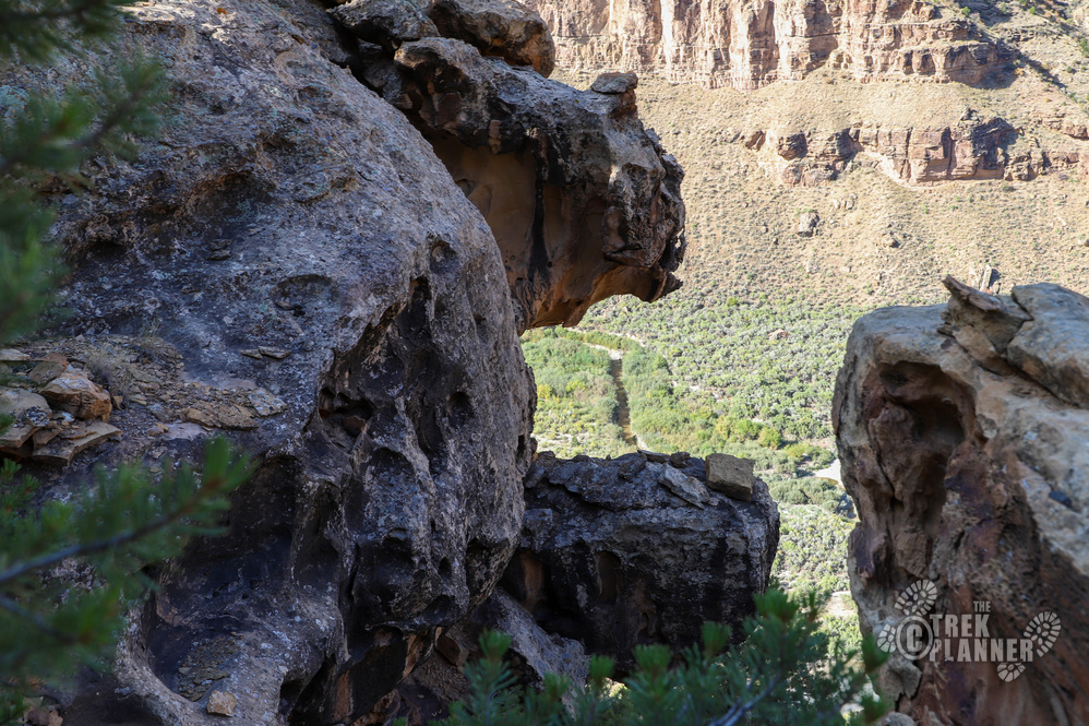
I kept hiking higher and found a rock that looked like a T-Rex jaw with its mouth wide open. So I named it…T-Rex Jaws! Gotta keep things fun and interesting, right? 🙂
The trail was steeper than I thought in parts, but nothing too bad that would require a rope. I wouldn’t recommend doing this if you don’t have the most basic climbing skills such as stemming, down climbing, and how to locate good hand and foot holds. Overall, the hike is just steep.
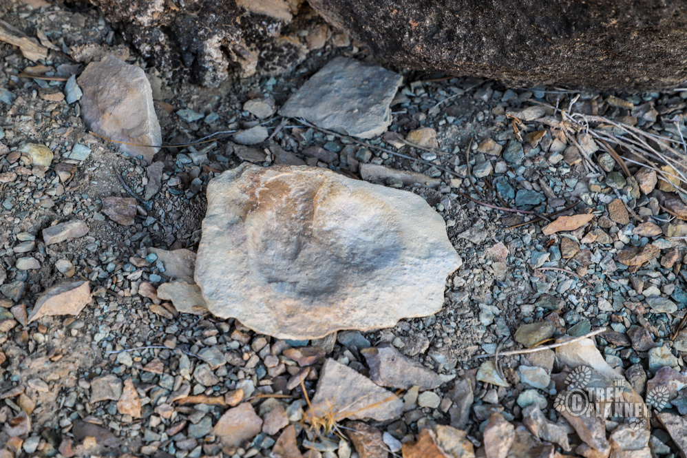
A little ways before I reached the top, I found a few rocks that look like animal tracks in the rock.
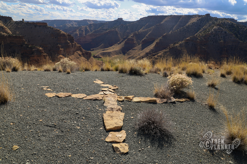
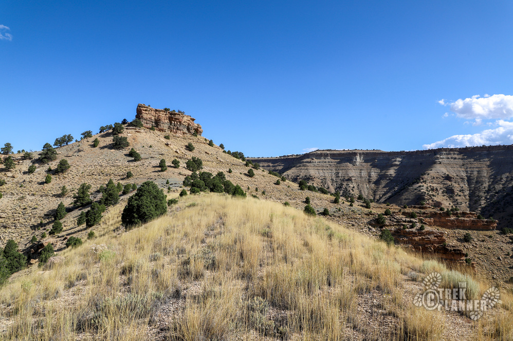
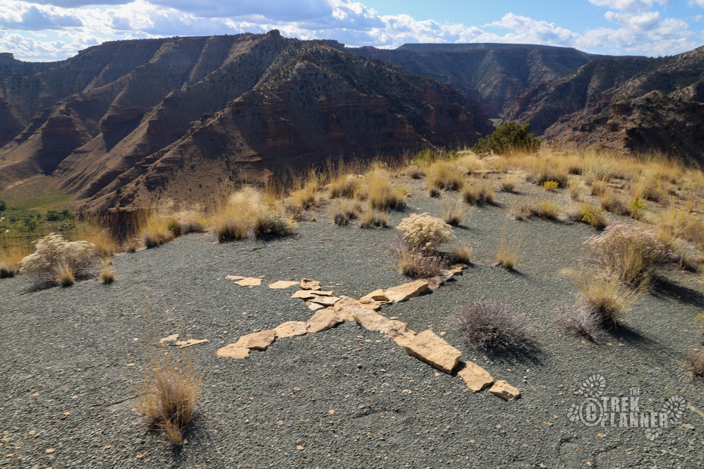
At the top, I had enough GPS signal to locate the X to know that I was within a few hundred feet of it. I continued hiking to where it was located to finally get a view of it.
It is simply just a cross or an X on top of the canyon that is made out of rocks. The east and west arms of the cross follow the openings of the canyon with the road and the north and south arms of it follow the canyons to the north and south. I realized that this cross follows the north, south, east, and west directions exactly. This tells me that this could be an old navigation symbol for airplanes, which is why I am calling this the Nine Mile Canyon Compass. If you get lost in here, you could easily tell which way was north and south if you’re flying above it.
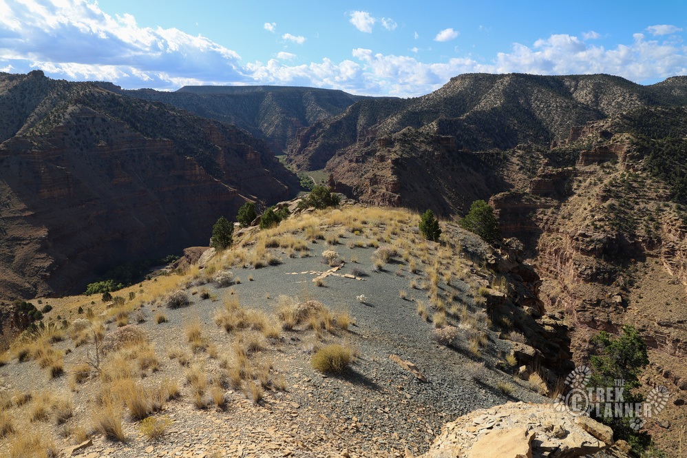
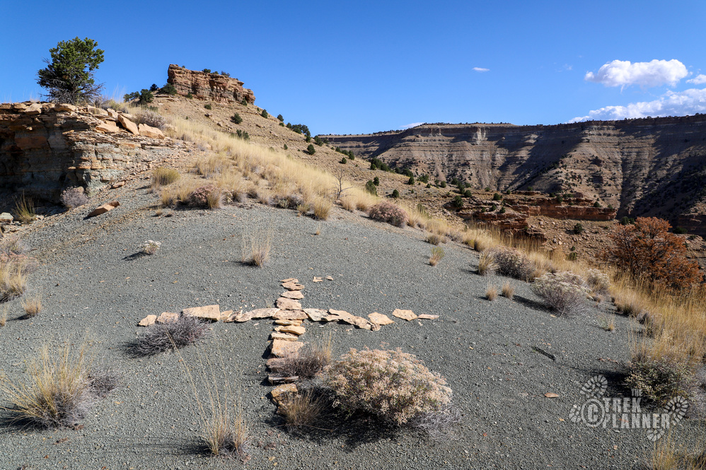
However, one side of the X is longer than the other so it made me have a random thought that a Spanish missionary piled the rocks like this in honor of their beliefs. Could one of the ancient Native American inhabitants created this? Who knows! But, I am thinking it is probably a navigation marker for airplanes back in the day.

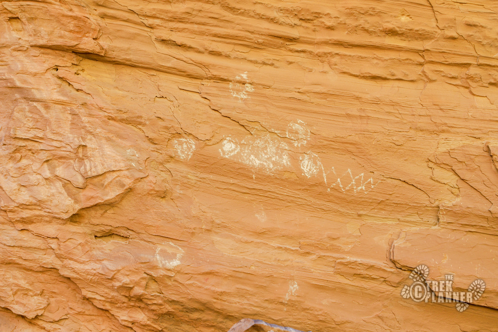
I hiked more on the top and then I came down the same way. I found some more very cool petroglyphs while on the way down to my car.

Personal Thoughts
Even though this hike was very steep, I did enjoy seeing the cross in person and then also seeing the petroglyphs. This hike isn't for everyone because of the technical and steep aspects, but if you're an adventure seeker who is capable, why not give it a shot!


