
The Trek in a snapshot

Trek Planner Maps
Trailhead: 39°4’9.8414″ N 111°1’44.1901″ W
The Box Overlook: 39°5’32.5279″ N 111°1’54.8646″ W
Trek Planner Insiders will have access to 9 additional GPS Coordinates
(memberships are currently unavailable)This content is locked

Experience. Discover. Explore.
Follow along on our adventure then go out on your own!


User Update: This information is from Bill, one of The Trek Planner’s subscribers.
A stock 4×4 Jeep (or similar) absolutely could not make it past the Trail Junction (see GPS points and Trail Map above) and I think a lifted and modified one would have serious problems. Just north of that point (Trail Junction), 16-19” rock steps have developed making the top of the steepest part of the trail impassable to all but monster trucks and (possibly) side by side ATVs. (We saw some recent tire tracks. And indications that rocks had been piled to build a ramp to the steps.)
It sounds like you may have to just get out and walk to the petroglyphs from this point! Thank you, Bill for the update!
If you have a high clearance vehicle with four-wheel drive then you can easily drive very close to the rock art. If not, be prepared for a 2 mile hike just to get to the Overlook.
This trail would be so much easier if you had a high clearance and 4 wheel drive. I had to hike about 5.5 miles because my low clearance vehicle couldn’t make it past some of the beginning obstacles. It was nothing serious, but even just a high clearance vehicle would let you make it to right to The Box. If not, be prepared for a 2 mile hike before you get to The Box Overlook.
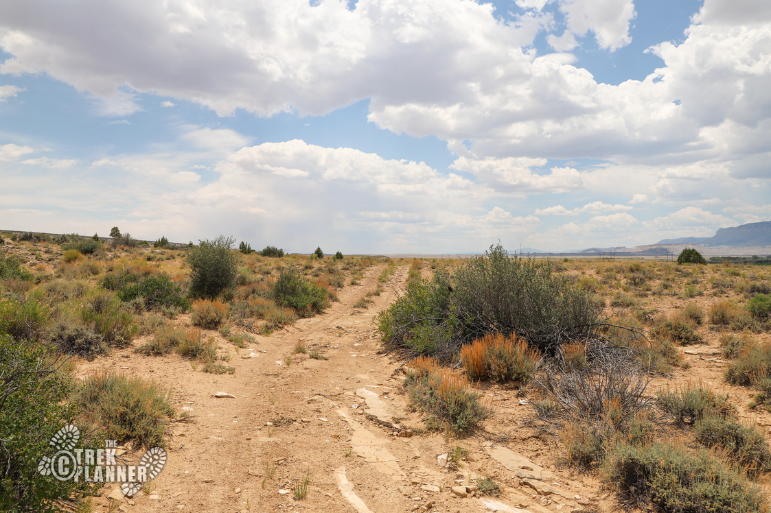
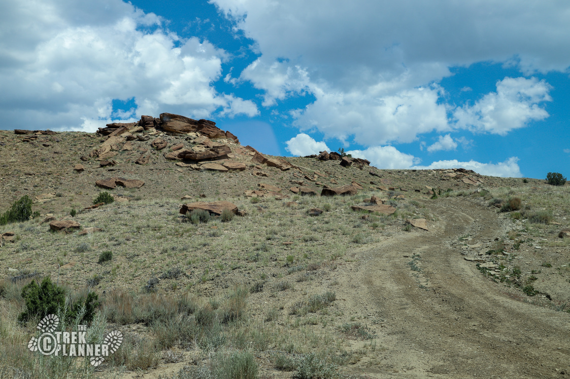
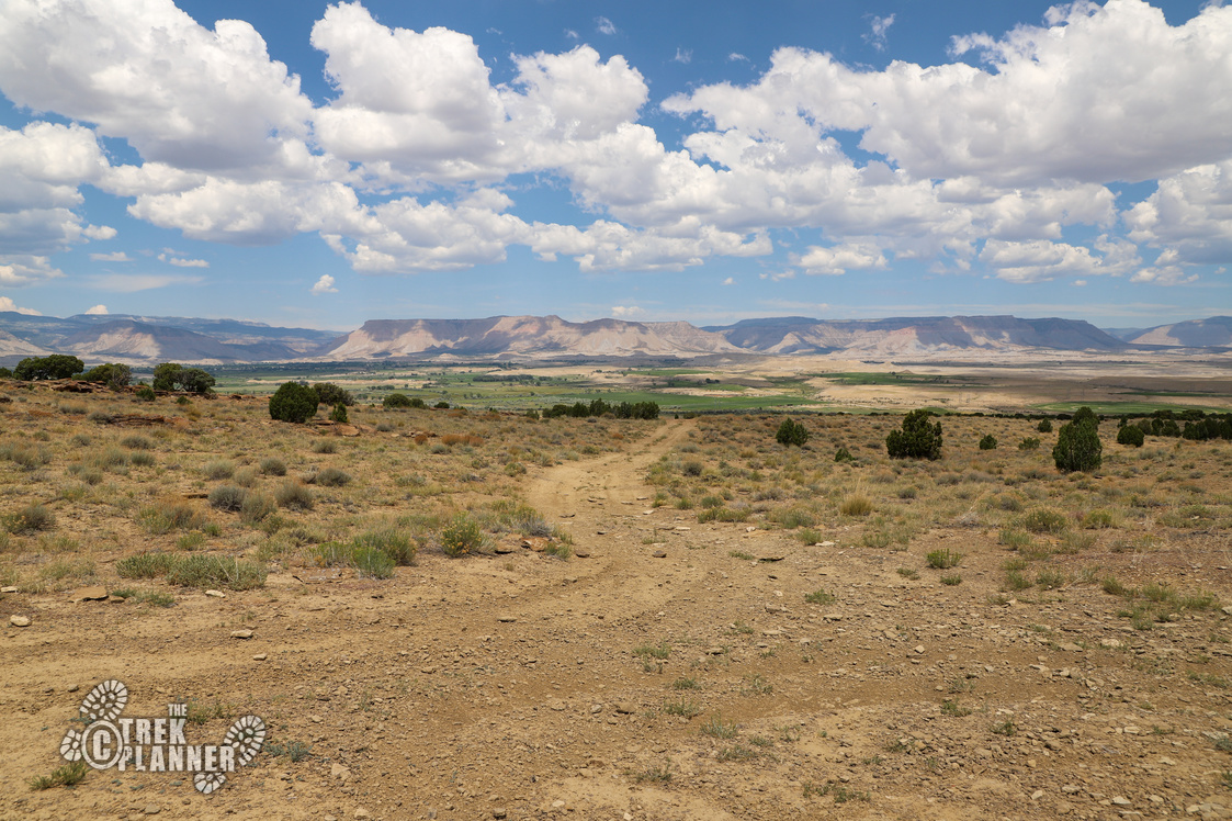
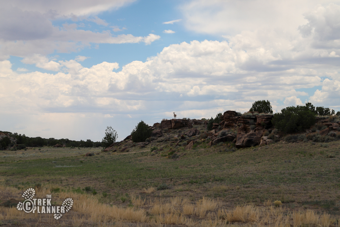
I parked in some bushes right off the side of Dutch Flat Road and began hiking towards the rock art. The hike was pretty easy and mellow for most of it and I saw lots of pronghorn antelope and even some mule deer.
At about 1.27 miles you will come to a junction. This is where the loop trail ends and or begins. You don’t have to hike the full loop trail, but you will miss some amazing petroglyphs if you don’t hike to the left. For this Trek, I continued to the right.
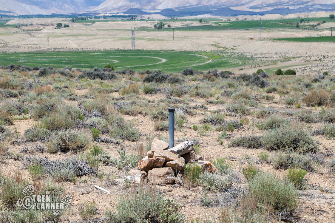
At mile 1.70 I noticed a metal pole sticking out of the ground. As I got closer, I realized it was a survey marker called a cadastral survey marker. Cadastral survey markers are used to figure out land ownership rights.
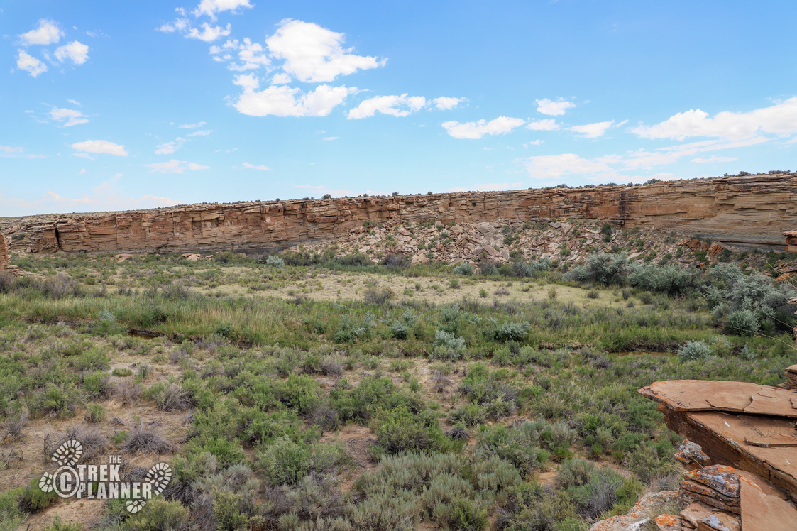
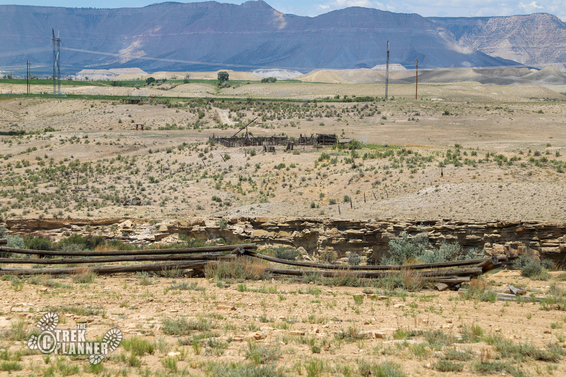
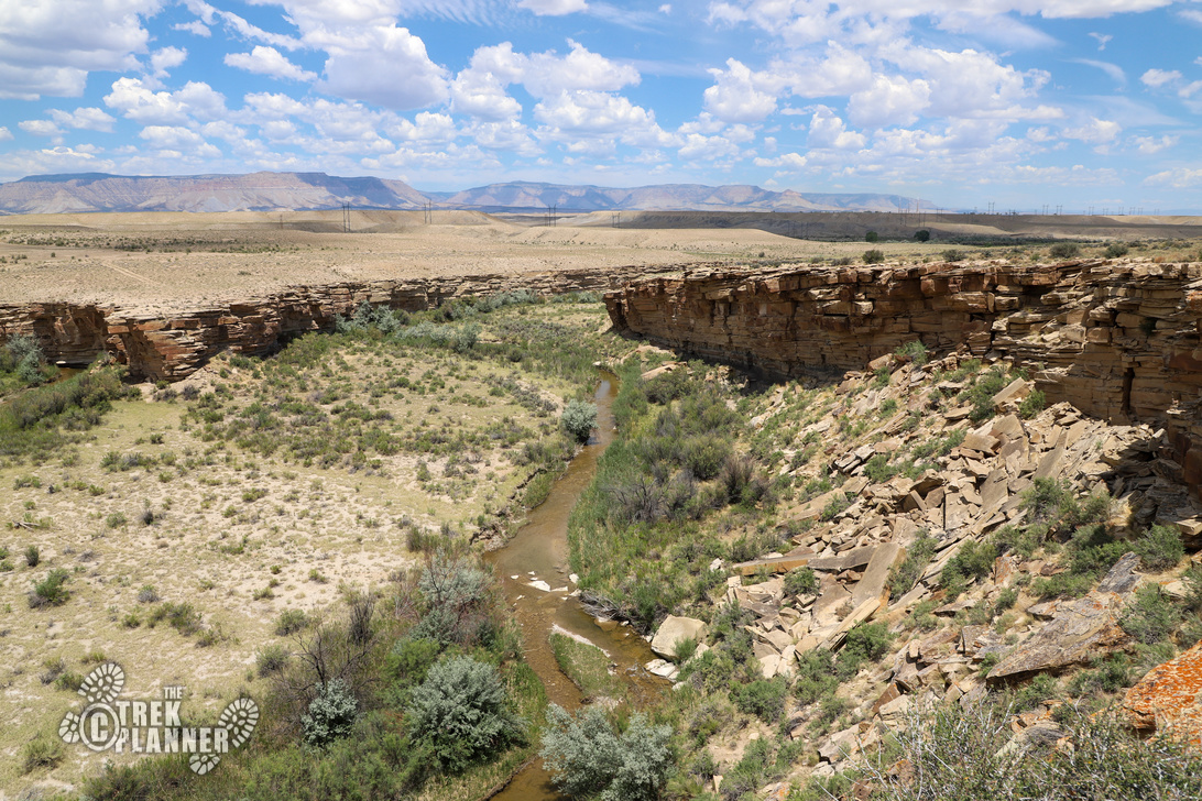
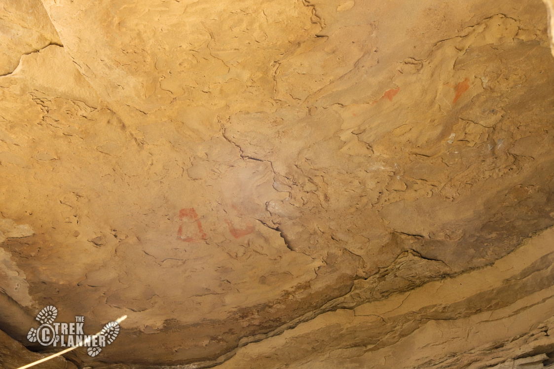
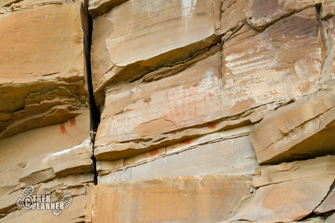
At mile 2.0 you will come to The Box Overlook (see GPS coordinate above), and you will see a log barricade here too. You can see that Ferron Creek carved out this nice big “box” area that is full of thick vegetation. If you look to your right, you might be able to see some of the pictographs including the Rainbow Panel. Across the creek on the other side, you will also see some red pictographs. This is private property so be careful not to cross over, but admire the rock art with a telephoto lens or I guess with your regular eyes!
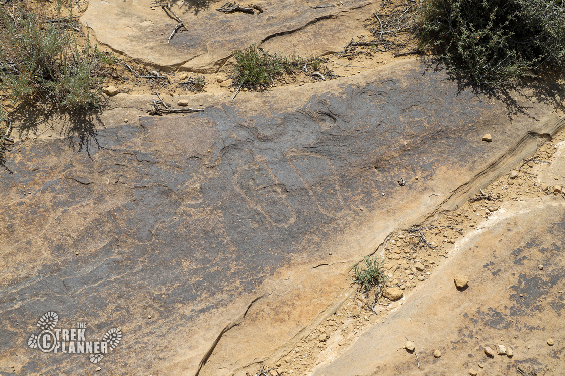
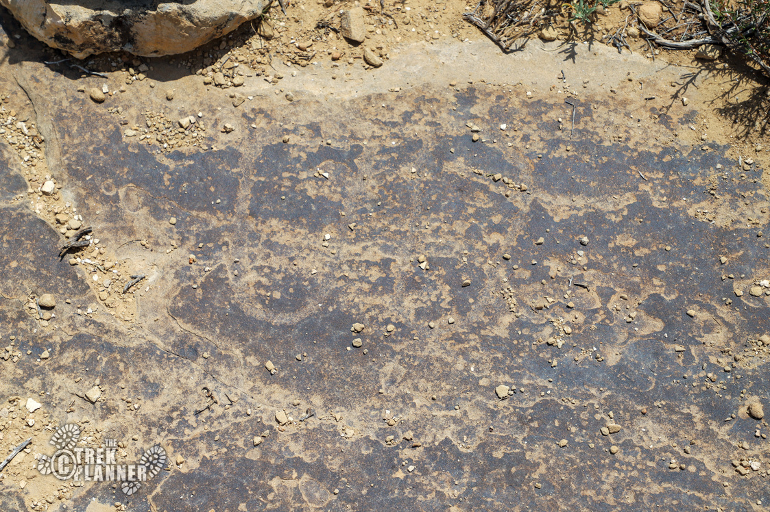
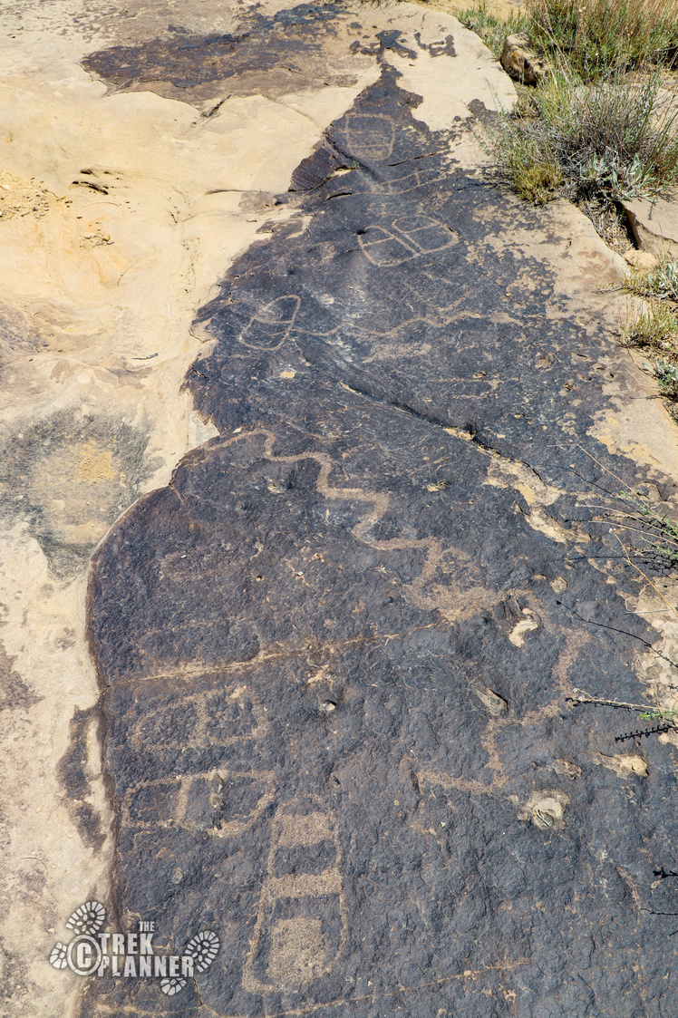
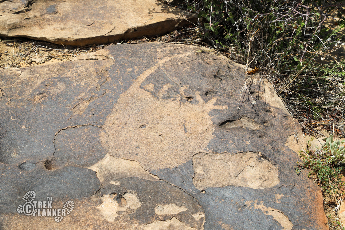
Just before you go down in the box, scan the ground for some moccasin or footprint petroglpyhs. There are a few here and you may need to use my GPS coordinates to help you out if you can’t find them.
Now follow the wash to where you can easily hike down into The Box. The trail will now skirt right under the cliffs to the right side.

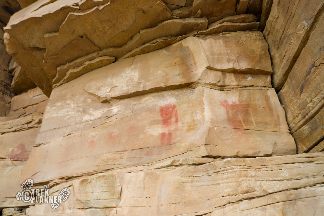
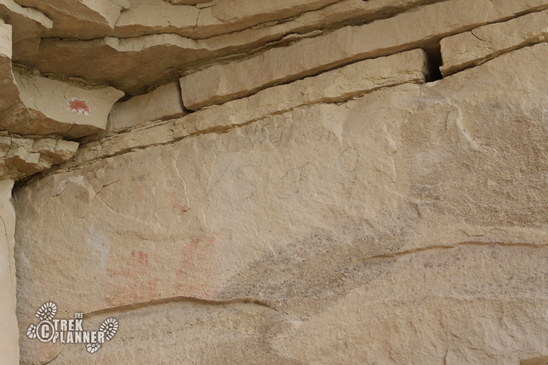
I found the trail was overgrown and the thick brush cut up my legs nice and good. Pretty soon, the trail will lead you above the brush and you will then hike on brushfree ground. Keep your eyes on the walls to your right, there are pictographs and petroglyphs scattered around. You may also see some historic settler names on the walls too.
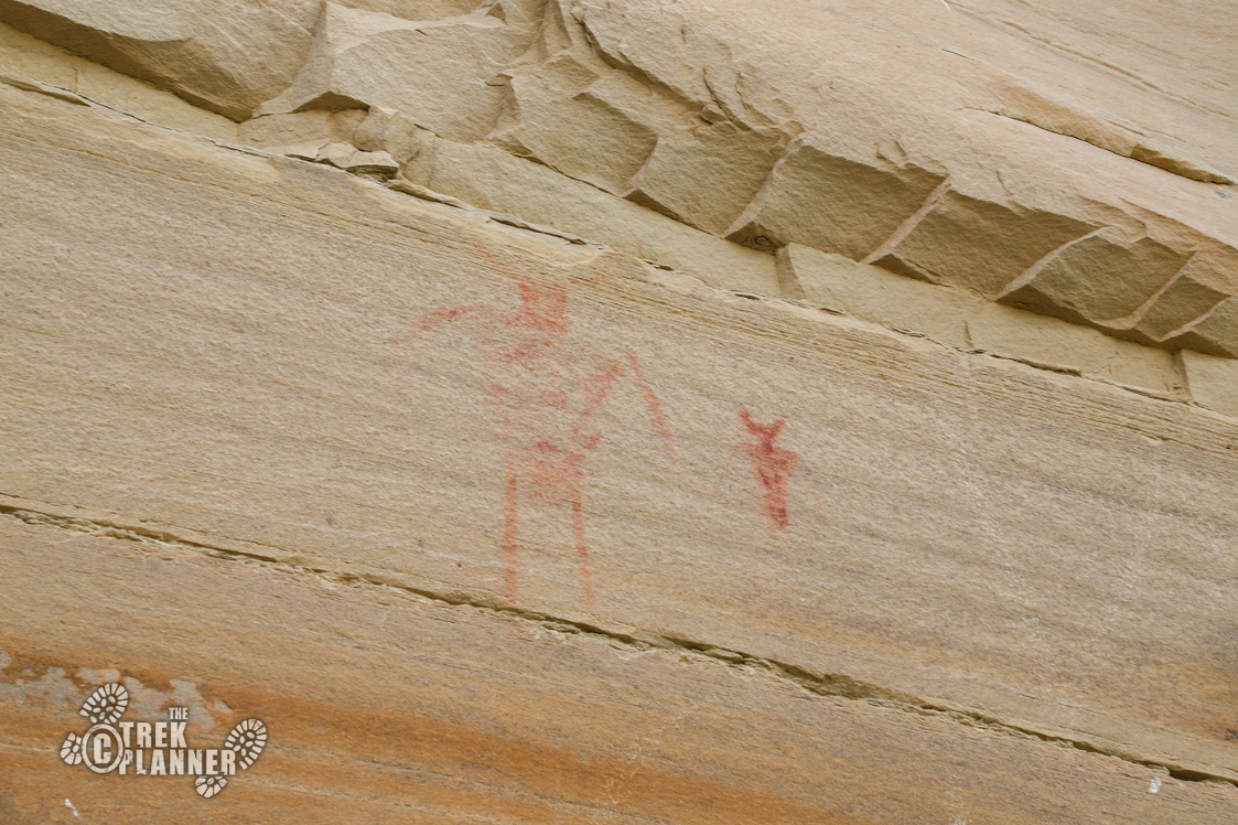
Before you come to the main panels, you will want to look to your right and scan for a small alcove. The alcove has two foot prints painted on the ceiling along with some other faint red pictographs.
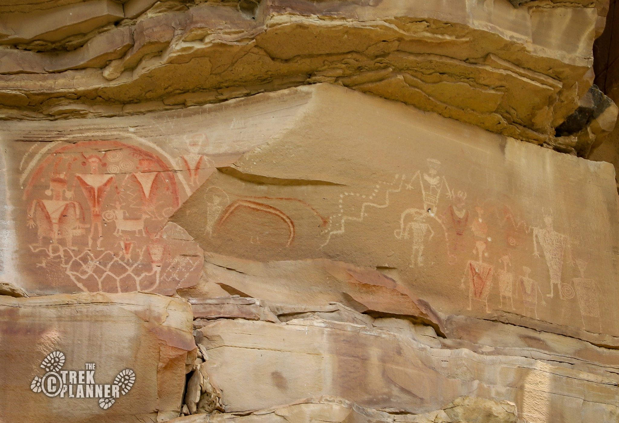
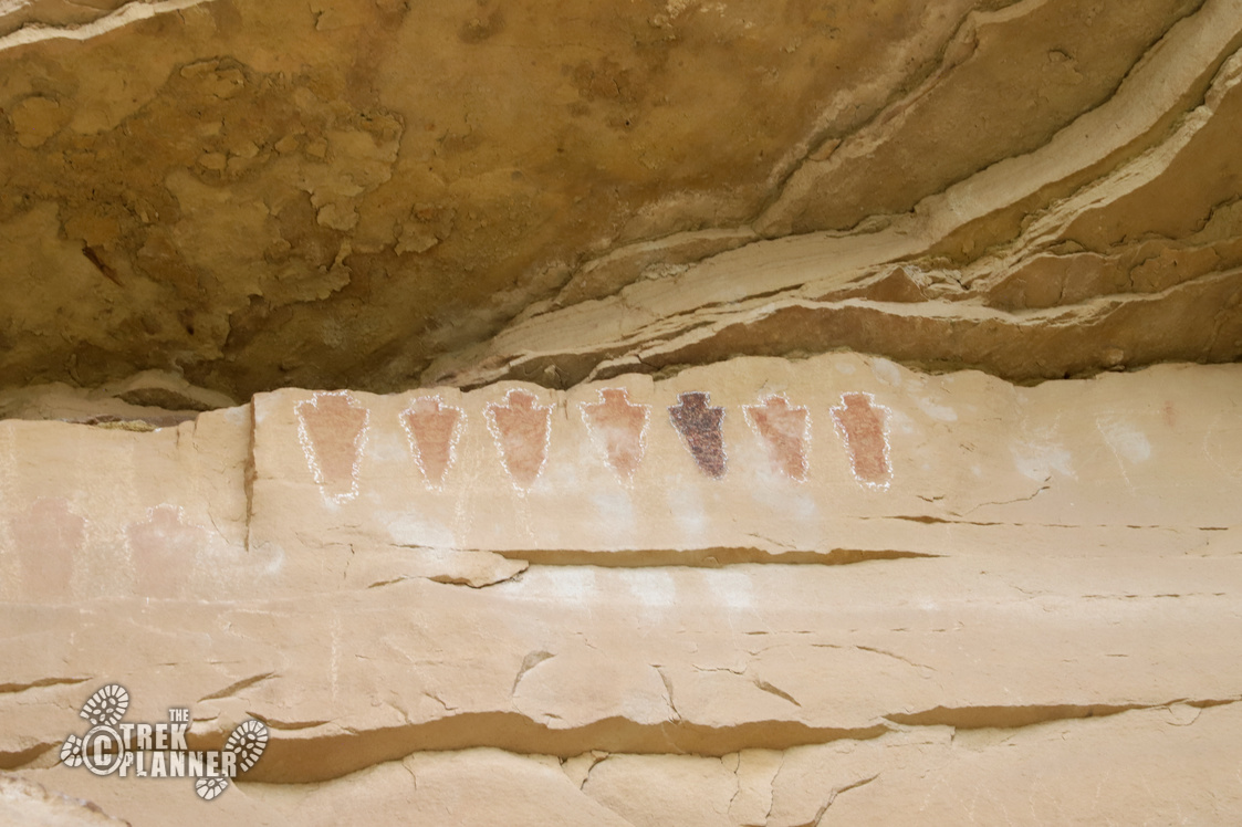
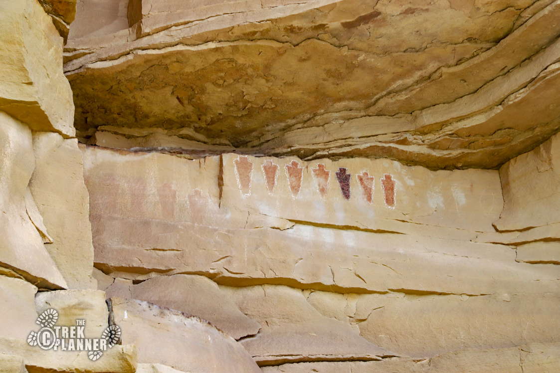
The next major panel is the so-called “Segregation Panel”. It shows figures painted in a long row high up. Some of them are very faded, but this little panel is really neat to see!
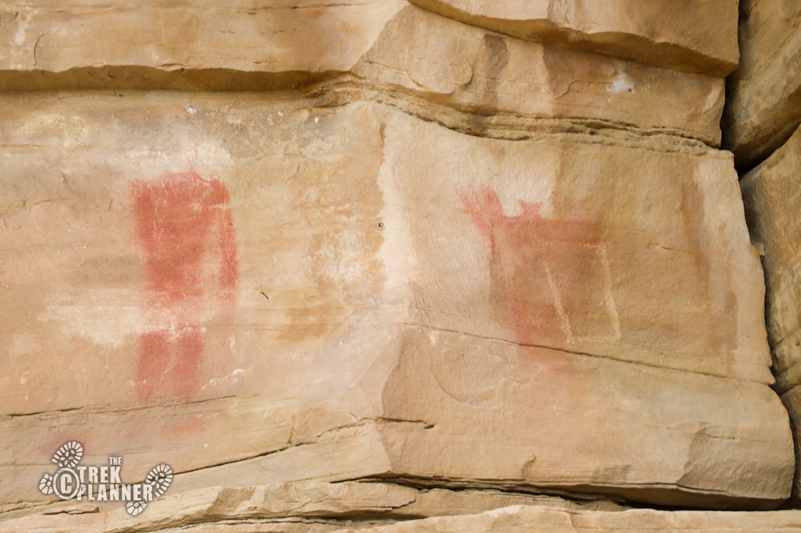
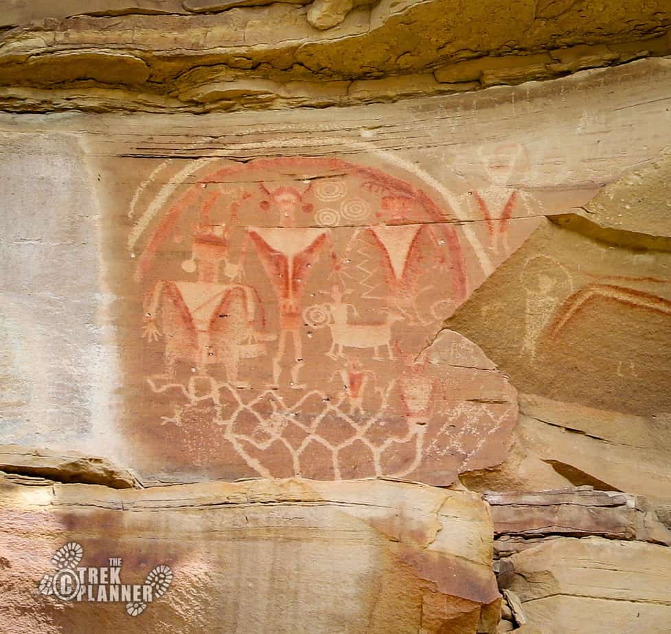
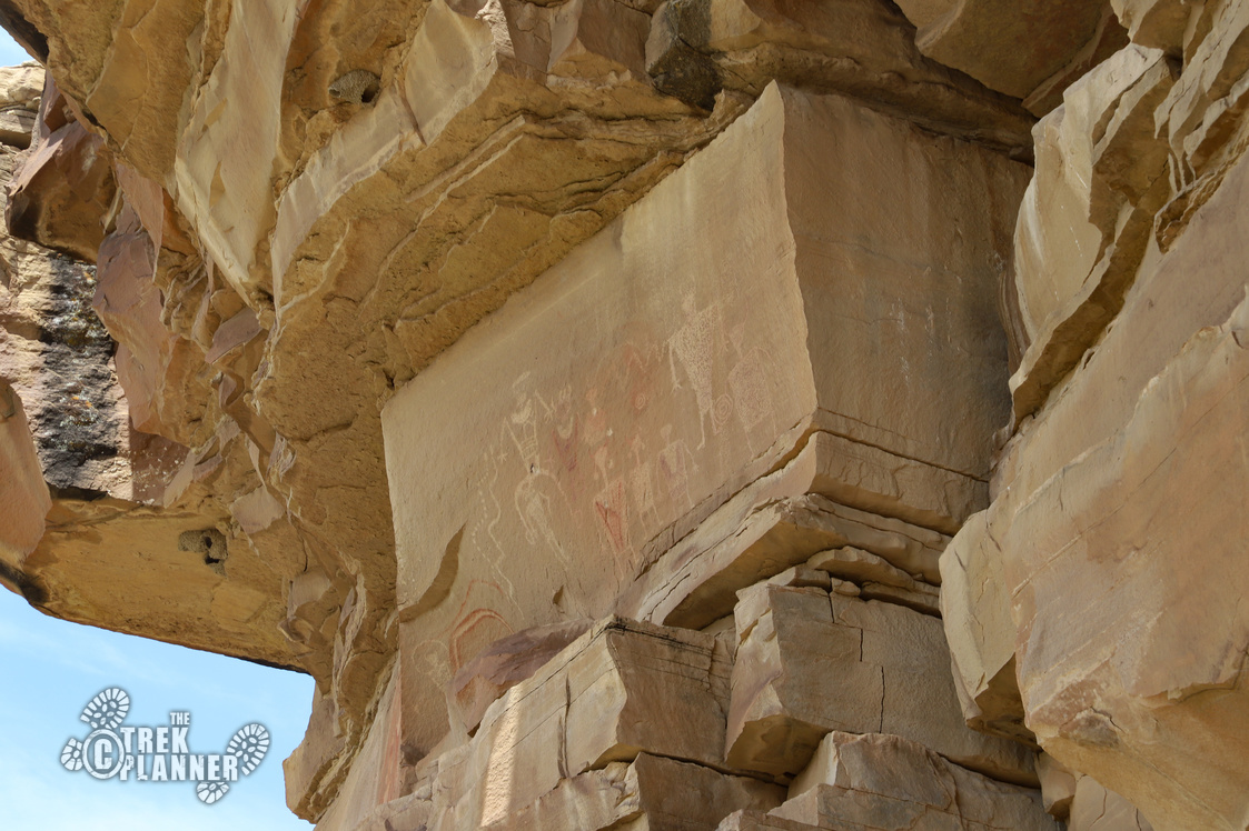
Look to your left and you will see the Rainbow Panel. This panel has a couple rainbows, anthropomorphs (human-like figures), symbols, depictions of animals, shapes and more! It’s an incredible panel and it was fun to sit down and surmise its meaning. The red figures are still quite vivid and I was glad to have arrived before the morning light shown directly on it.


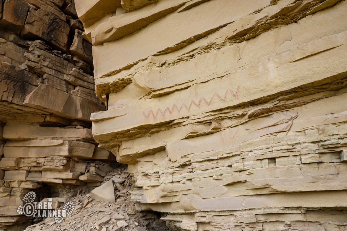
There are other petroglyphs and pictographs to the left going all the way down to the north side of The Box. I found a snake or zig-zag pattern pictograph.
The way out was pretty easy. You just hike up the north side and circle back around to where the log barricade was and continue south. Or you can head back the same way you came, but you will miss out on another moccasin panel.
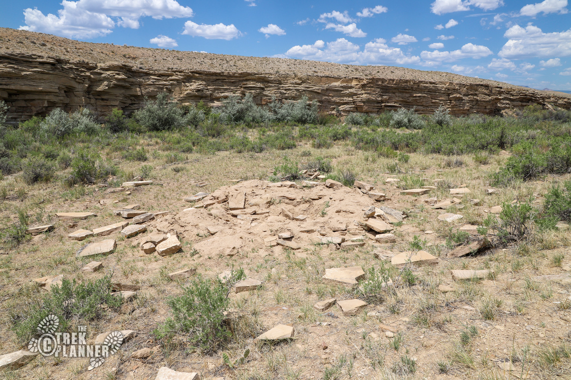
While I was hiking out, I was looking at my map and I noticed what appeared to be ruins to a pit house!
Now, hike south for about 0.55 mile until you come to another trail junction. There will be a nice wide trail to follow.

The trail left goes back to where that junction was and the way to where I parked. But, continue straight for a bit and keep your eyes on the ground. You will find another moccasin and footprint panel that spreads about 40 ft in length! There are other petroglyphs here too. I’m not sure if these petroglyphs are literally foot tracings or people’s moccasins or if they are figurative – either way, they are very neat to see!
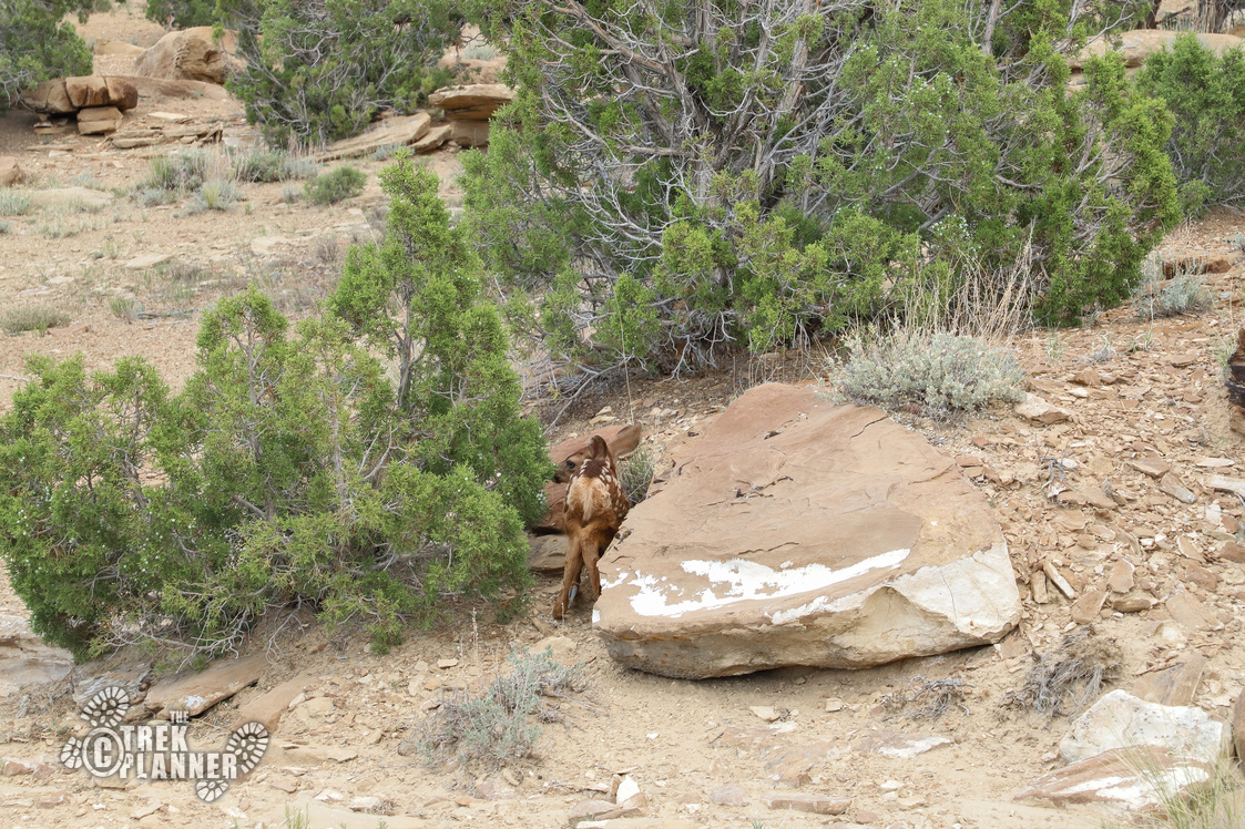
On the way back, I heard some rustling in the bushes and saw some movement. I stopped and got my camera out…
Just then a very small baby deer ran for its life. Then I saw a second baby deer take cover between a rock and a tree. I stood there for a minute, but the deer wouldn’t move. I went around the deer and it still wouldn’t move! So I took a few pictures and when I was far enough it got back up and ran towards its mom who was waiting on a hillside.

Personal Thoughts
If you were in a Jeep or truck, this would be a pretty easy adventure! I was unfortunate, but still had a great time. These pictographs are some of the best ones I have seen besides the ones at Sego Canyon, and Buckhorn Draw road. There are more petroglyphs in this area, so get out there and explore!


