


The Trek in a snapshot

Trek Planner Maps
Trail Map is for Trek Planner Insiders only
This content is locked
(memberships are currently unavailable)
GPS Coordinates are for Trek Planner Insiders only
This content is locked
(memberships are currently unavailable)

Experience. Discover. Explore.
Follow along on our adventure then go out on your own!


All vehicles can access this footprint. The road is dirt but it is graded. Just be mindful if there were lots of recent rain or snow.
You can get to the footprint from Price or from I-70. It just depends on where you’re at.
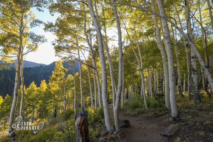
I loved seeing this dinosaur footprint and you will too! It’s a great way to start off your greater Buckhorn Draw adventure. It’s easy. It’s right off the side of the road. It’s worth the short stop!
This is a very easy adventure that takes you to a very clear dinosaur track! On a recent trip through Buckhorn Draw I saw some people up a ways from the road taking pictures of something on the ground. I pulled over and they came back down and I asked them if there was anything up there. They replied there was a really cool dinosaur track! I immediately got out, and hiked the short 350 ft. to the track.
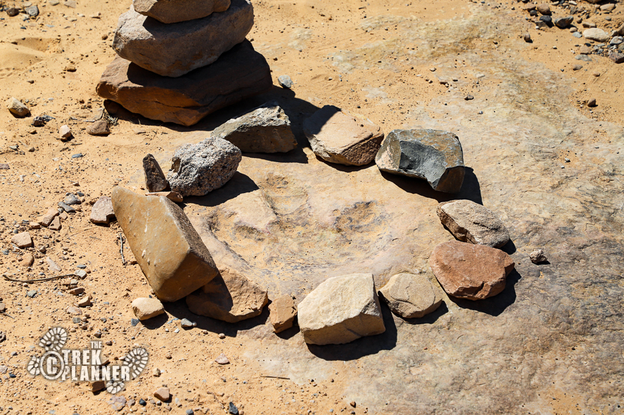
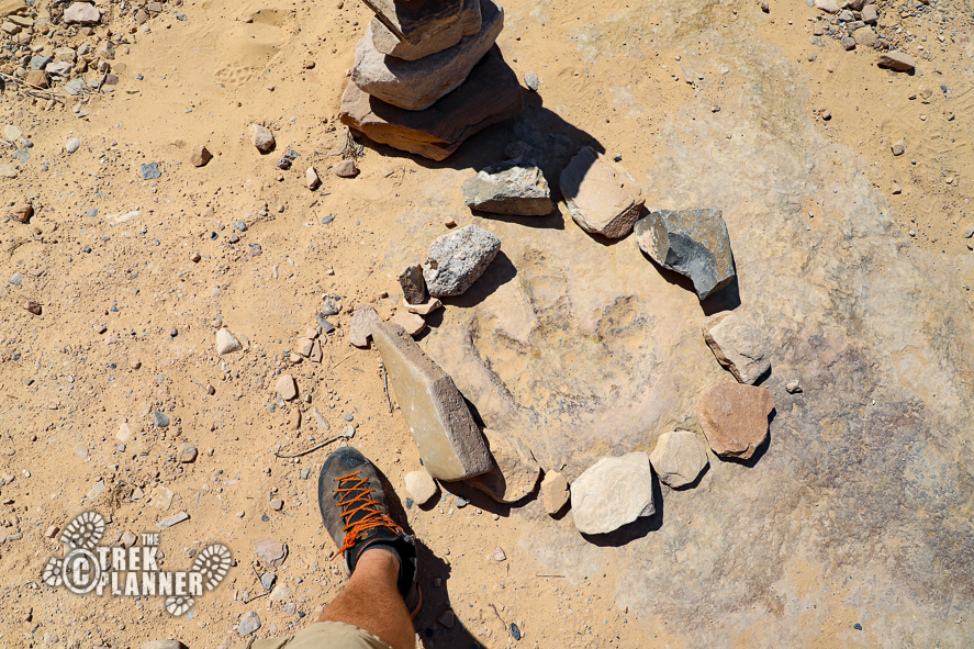
The dinosaur track is large and clear. Some people made a rock circle around the print to protect it and also show you exactly where it is located. The track was made by a theropod dinosaur millions of years ago! It’s crazy to think just how old this dinosaur footprint is!
How can you show your respect for this incredibly old treasure? Do not touch or step on the track. Just take pictures and enjoy it from a distance!


Personal Thoughts
You may be asking yourself “Why has The Trek Planner hidden the GPS coordinates to the footprint when I can just pull this up on Google Maps?” This is my frustration with Google. Many people think that by adding dinosaur prints, ruins, petroglyphs, and other sensitive sites to Google Maps that they are doing other people favors. To the contrary, they are making these sensitive sites easily accessible for people who wish to do damage to them. I have chosen to hide the GPS coordinates and Trail Map to further protect this site from those that type “petroglyphs” in Google Maps and pull up many sacred sites. There are many sites, especially in the Moab area, that have been vandalized recently beyond repair. These sites have been protected for 1,000+ years until someone came by only recently to vandalize them. It’s frustrating to say the least. Please join with The Trek Planner and others to promote good stewardship over our historical, cultural, and geological history. Please do not touch or step on the track. Teach your children about respecting these treasures too!


