
The Trek in a snapshot

Trek Planner Maps
Parking and Overlook: 40.99369, -111.45792
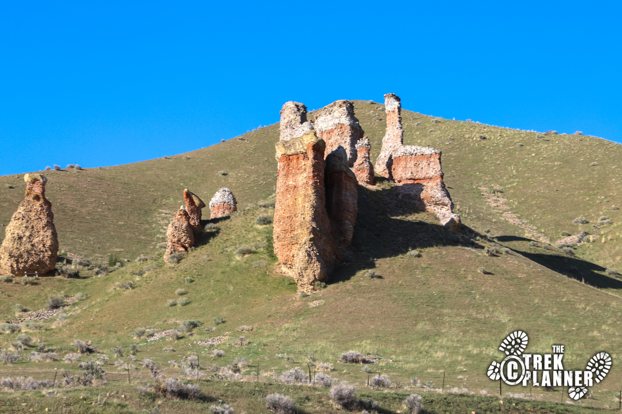
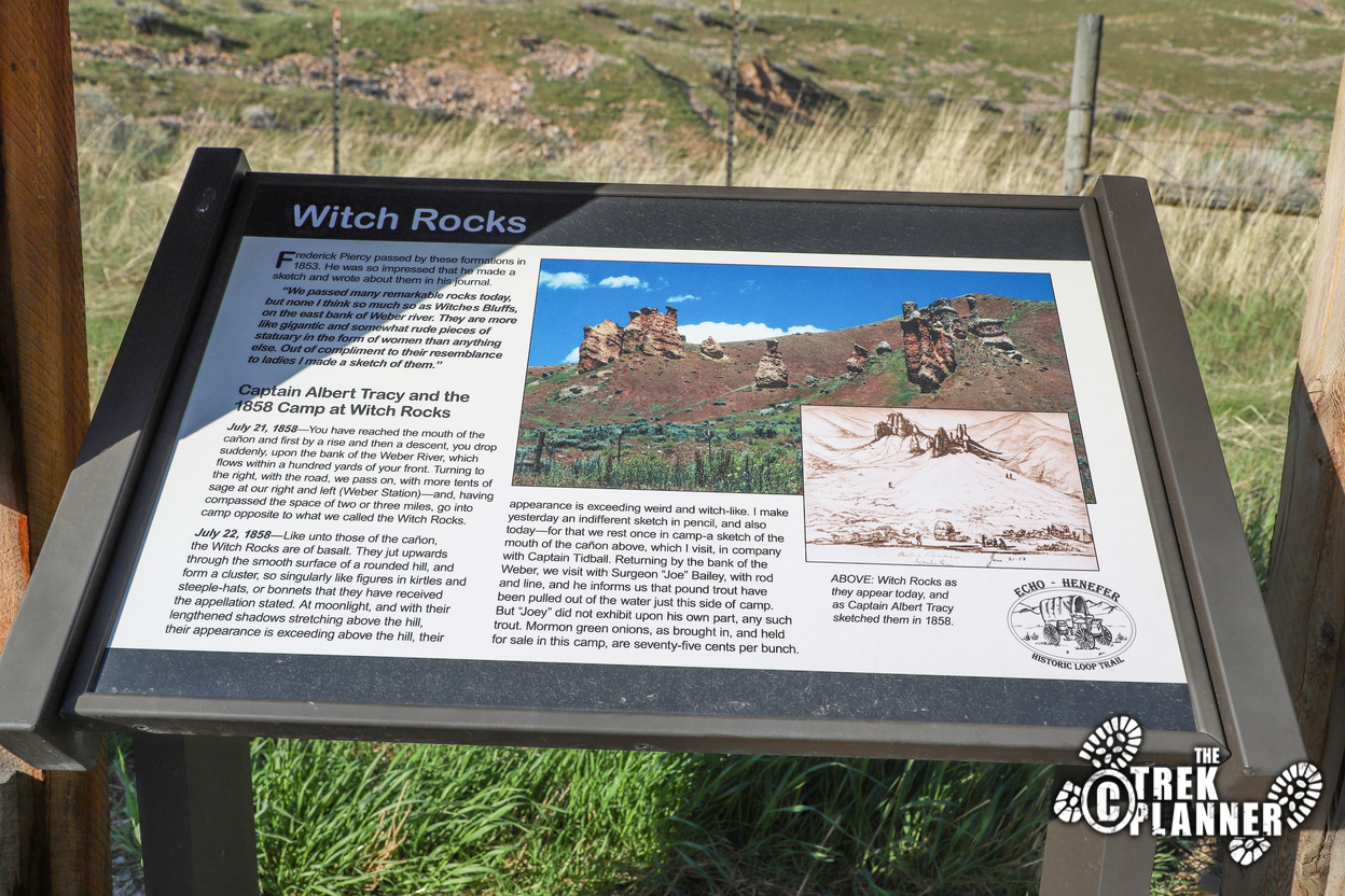
Witch Rocks: 40.99536, -111.45633

Experience. Discover. Explore.
Follow along on our adventure then go out on your own!


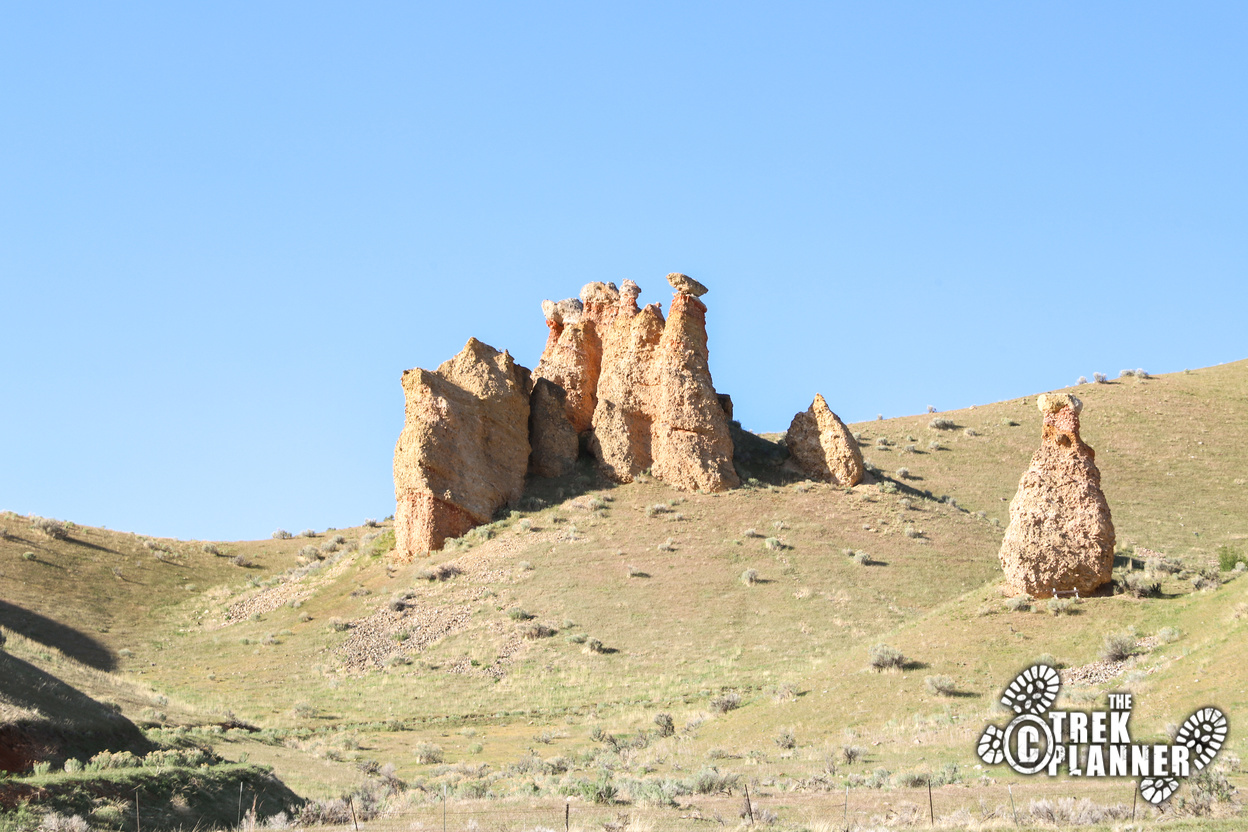
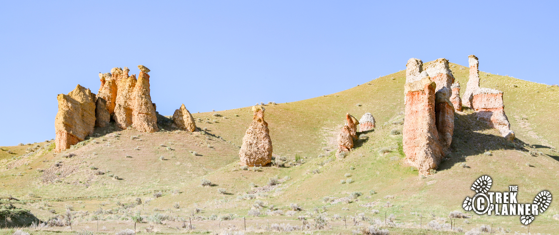
I have always wanted to see these rock spires and just decided to drive here one day and get as close as I could to them. This is a fast adventure, but I was surprised by the amount of history that Witch Rocks hold. You can see the rocks right from I-84 near Echo and Henefer if you don’t want to stop.
Little did I know that the Witch Rocks were a famous landmark for pioneers, settlers, and explorers heading west. In fact, you can read some of the history at the sign where you park at the overlook. The rocks seem out of place and if you are coming through Echo Canyon and making the turn towards Ogden and beyond, these surely would surprise you too!
Witch Rocks are located on private property, but you can still get a great view of them here.
This is what the sign says:
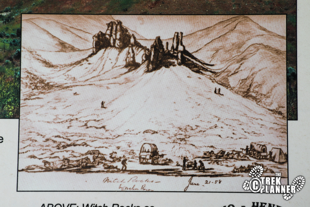
Frederick Piercy passed by these formations in 1853. He was so impressed that he made a sketch and wrote about them in his journal. “We passed many remarkable rocks today, but none I think so much so as Witches Bluffs, on the east bank of Weber river. They are more like gigantic and somewhat rude pieces of statuary in the form of women than anything else. Out of compliment to their resemblance to ladies I made a sketch of them.”
Captain Albert Tracy and the 1858 Camp at Witch Rocks
July 21, 1858 – You have reached the mouth of the canyon and first by a rise and then a descent, you drop suddenly, upon the bank of the Weber River, which flows within a hundred yards of your front. Turning to the right, with the road, we pass on, with more tents of sage at our right and left (Weber Station) – and, having compassed the space of two or three miles, go into camp opposite to what we called the Witch Rocks.
July 22, 1858 – Like unto those of the canyon, the Witch Rocks are of basalt. They jut upwards through the smooth surface of a rounded hill, and form a cluster, so singularly like figures in kirtles and steeple-hats, or bonnets that they have received the appellation stated. At moonlight, and with their lengthened shadows stretching above the hill, their appearance is exceeding above the hill, their appearance is exceeding weird and witch-like. I make yesterday an indifferent sketch in pencil, and also today – for that we rest once in camp-a sketch of the mouth of the canyon above, which I visit, in company with Captain Tidball. Returning by the bank of the Weber, we visit with Surgeon “Joe” Bailey, with rod and line, and he informs us that pound trout have been puled out of the water just this side of camp. But “Joey” did not exhibit upon his own part, any such trout. Mormon green onions, as brought in, and held for sale in this camp, are seventy-five cents per bunch.


Personal Thoughts
This was fun to finally see these up close after 20+ years of driving by them and never stopping.
Keep in mind the rock formations are on private property, please ask permission from the property owner before entering