The Trek in a snapshot
Location
Southeastern Utah
Managing Agency
BLM
Pets
Allowed
Fees
None
Restrooms
None
Camping
Allowed (please pick up after yourself and leave it cleaner that you found it)
Trail Condition
Decent off-road trail. You can pull up near the edge to get a look at the butte
Sights
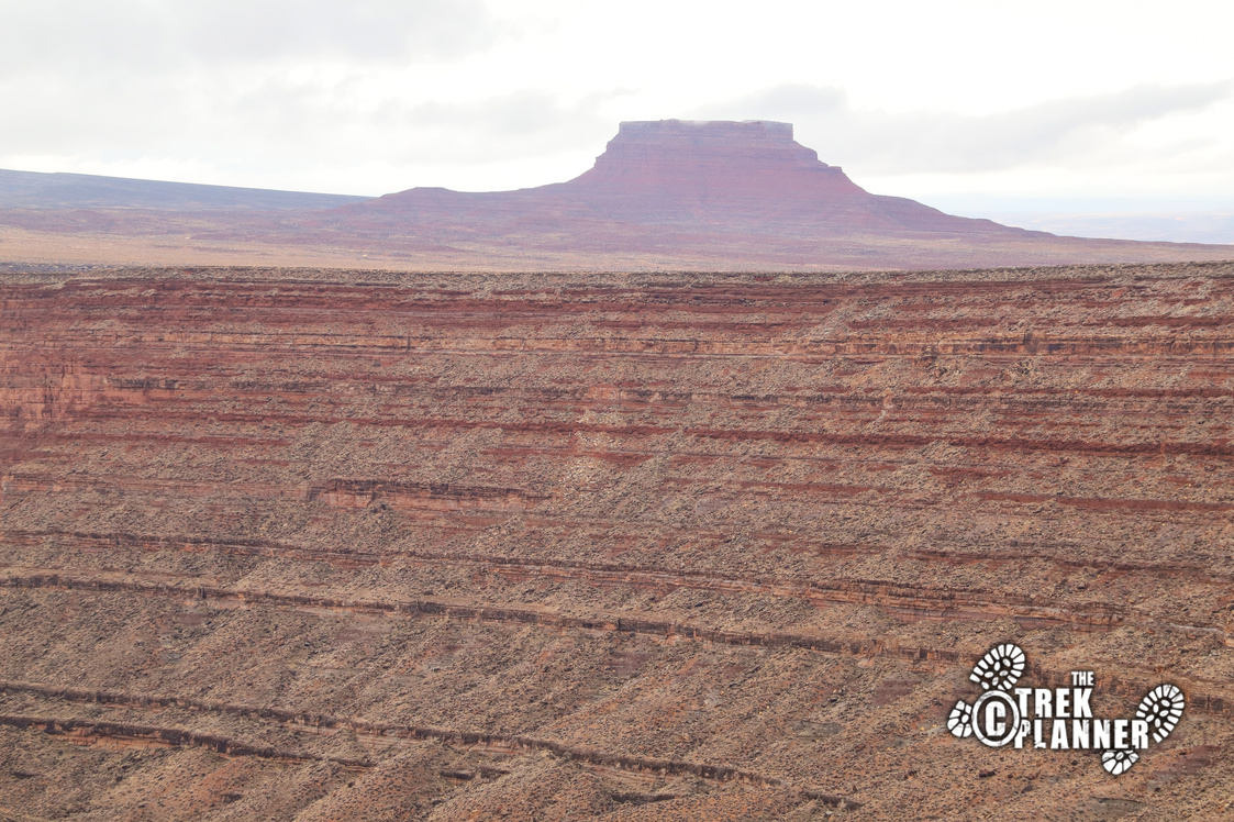
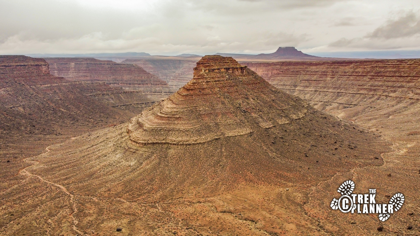
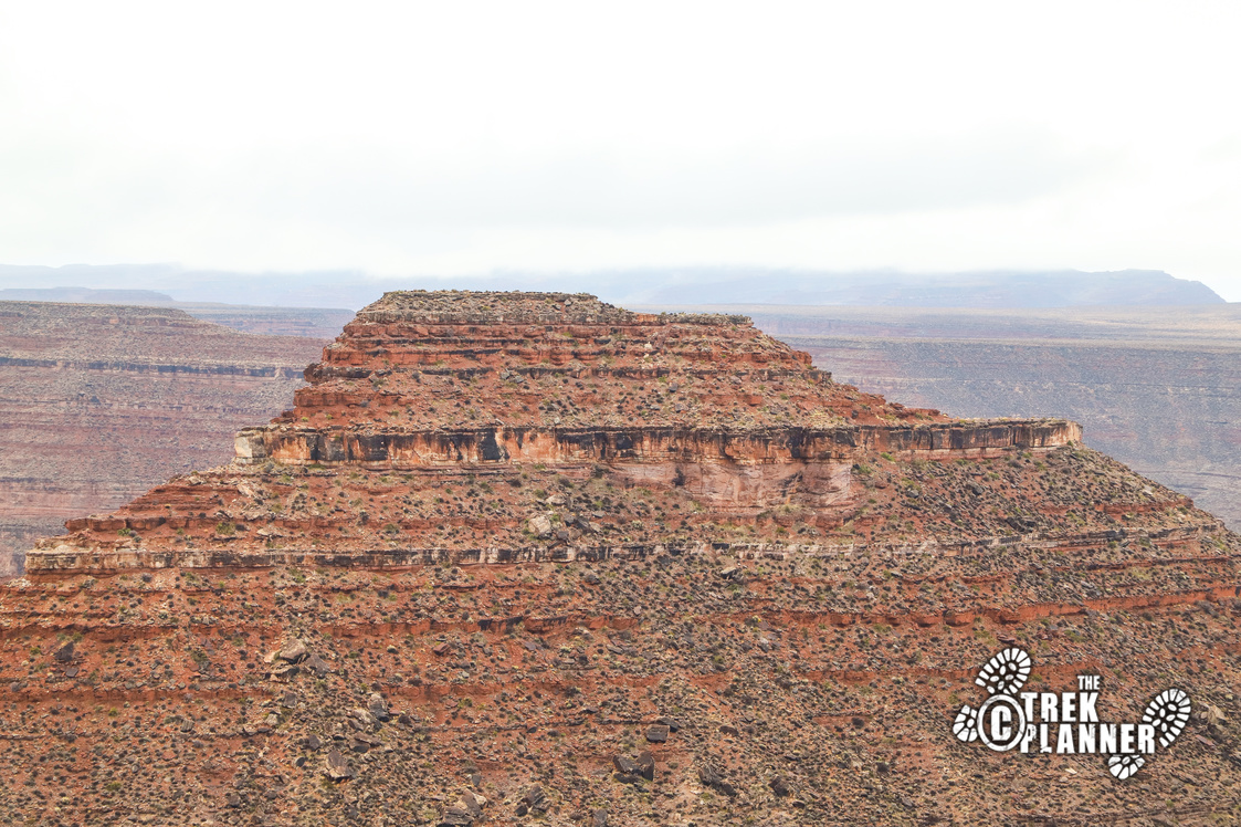
Crater Butte, San Juan River
Water Info
Bring a bottle of water if needed
Best Season
All
Distance
I hiked about 1/10 of a mile
Time Required
15+ minutes
Parking Elevation
5018 ft.
Summit Elevation
Varies slightly
Elevation Difference
Varies slightly

Trek Planner Maps
Parking: 37.22373, -109.73318
Overlook: 37.22304, -109.73362
Crater Butte: 37.218, -109.73925

Experience. Discover. Explore.
Follow along on our adventure then go out on your own!


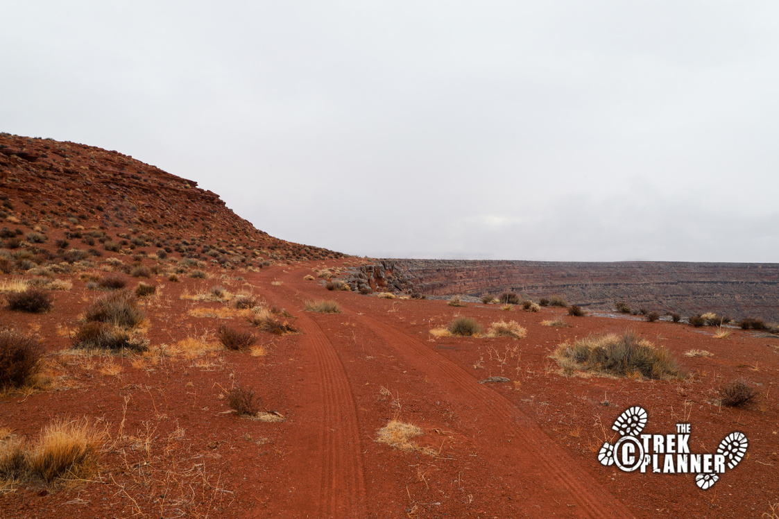
You won’t necessarily need 4-wheel drive, but it doesn’t hurt. I got here without any issue in my low-clearance vehicle. Just make sure you have enough fuel, water, food, and tire changing equipment before you head out. I found a little cell service once I got closer to Crater Butte, but don’t plan on it. This is a remote area!
The dirt road is graded and was pretty smooth. You will pass by a gravel pit when you are about 1/2 mile from the GPS coordinate for the parking.

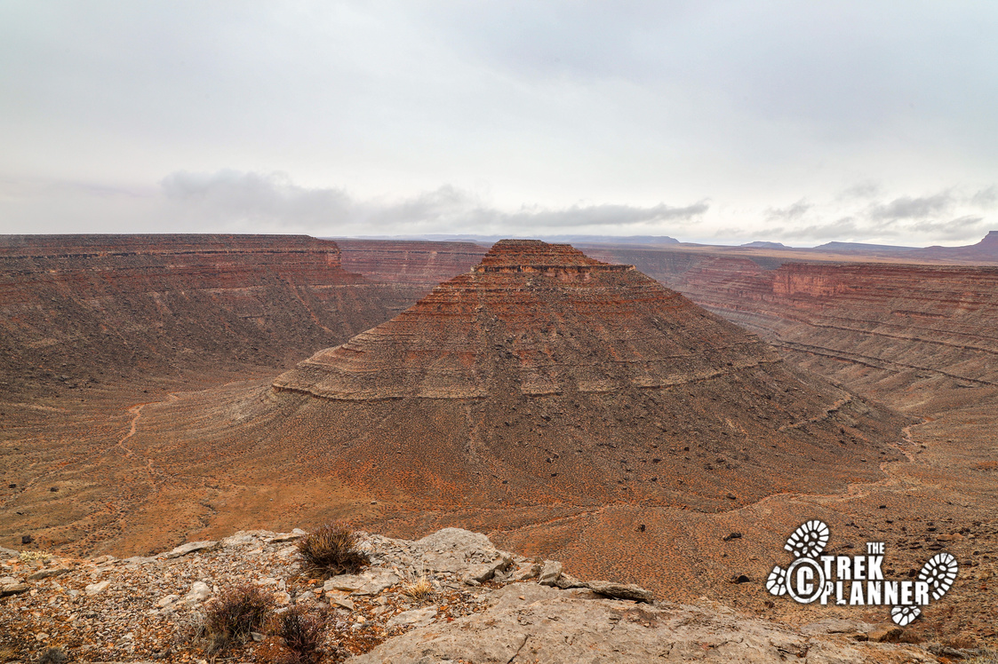
I found Crater Butte while checking out Google maps. I found this large natural bowl next to the San Juan River and wanted to make a visit in person. If it looked this cool from blurry satellite photos, how much cooler would it look in person! So I headed off to check it out.
The drive to Crater Butte was straightforward and easy. You basically travel on the unmarked County Road 2351 for 4 miles until you see it in the distance. I wouldn’t drive close to the edge, which is why I put the parking for this Trek a little ways away.
The butte is not in an actual crater, it just looks like it. The crater was where the San Juan River originally cut through, but has since moved to it’s current path. It’s really amazing to see in person. This doesn’t have a name on any topography maps. I’m sure the locals have their own name for it. I asked Josh what he would call it and he suggested Crater Butte. So, that’s what I’m calling it for this Trek 🙂
The Butte is 5031 ft. The bottom of the “crater” is about 4329 ft. The edge on which I was standing at the overlook is at about 5000 ft. It’s crazy to think that the butte is only about 31 ft. taller than from where I was standing.

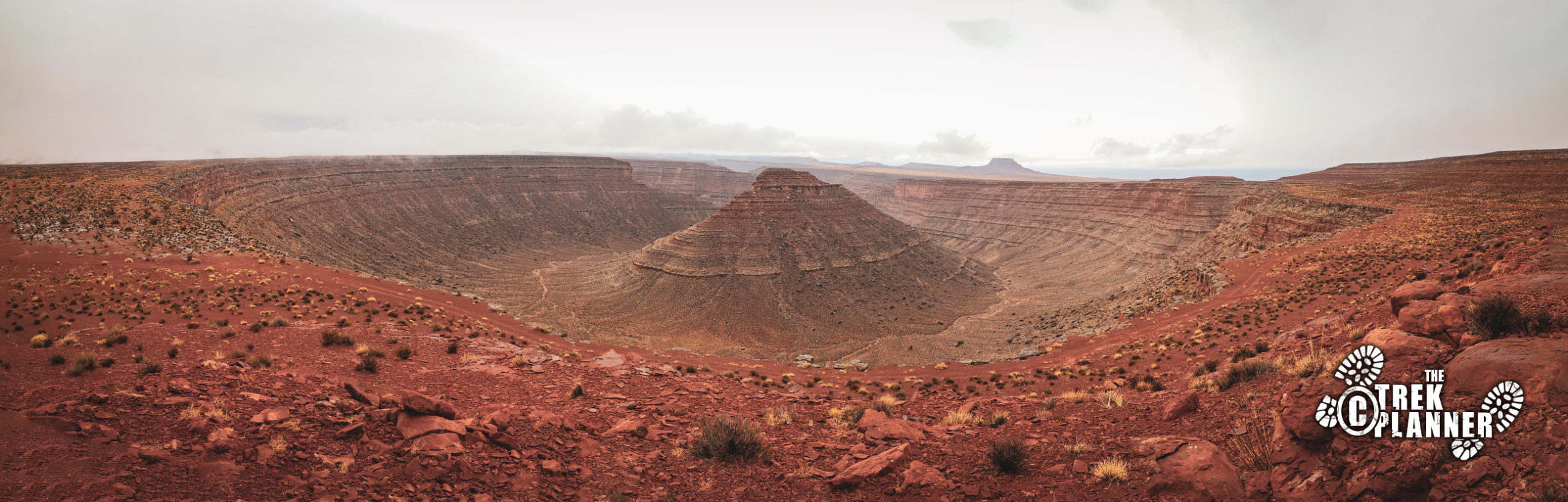

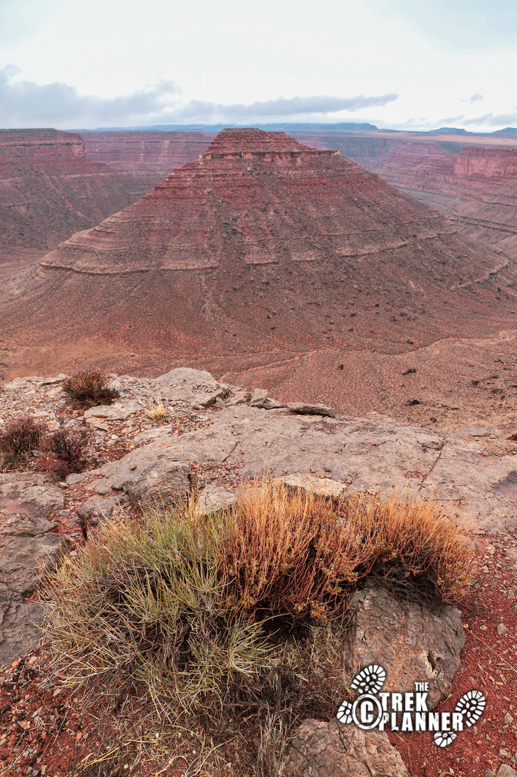
From end to end, it’s exactly 1 mile across with the butte in the center. It’s hard to really take in the entire scene because it’s so immense. On my visit, it was extremely windy and I wanted to use my drone to get better pictures, but drones don’t do so well in 30 MPH wind.
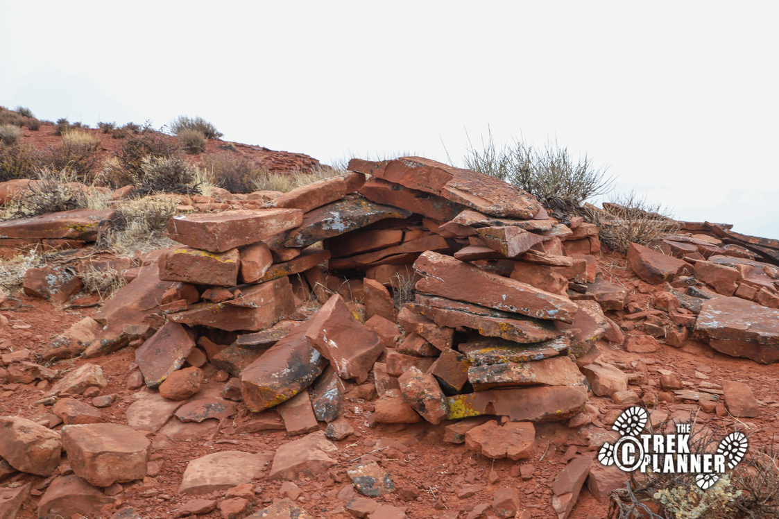
I spent a good amount of time exploring around the rim and found some type of ruin. Not sure when this was made, but it looks kind of old. It looked like it stored something in the center. I’ll post the GPS coordinate for Insider Members.
This content is locked
(memberships are currently unavailable)

Personal Thoughts
Standing on the edge of a 1 mile wide natural bowl is quite humbling. I really couldn't quite grasp just how large it was. Come visit this unique place!