Four Corners Region
Four Corners Region
September 3, 4 & 5
2021


This adventure was A Suprprise Amazing Remote Interesting
The Four Corners encompasses an extremely large and diverse area full of archeological treasures and beautiful landscapes. Many of those same archeological treasures have long since been looted or stolen, but many of the ruins and rock art remain. The Utes, Paiutes, Navajo, the Ancestral Pueblo (Anasazi), and other groups, called this massive region home. Some still call it home to this day. Annie (my girlfriend) and I set out to discover some of these ruins in a very secluded and remote part of the region.
As a reminder, please be respectful of rock art, ruins, and the land in general. Do not touch the rock art or carve your name on the rocks. Enjoy this place by taking photos and admiring the way the ancient peoples created a living in this difficult environment.
Friday night, we got to our campsite just before dark and got everything set up. I made Pad Thai the night before and we reheated it for dinner.
Today we woke up and had eggs, toast, and oatmeal with fruit! We then spent the morning trying and failing to get to where I wanted to start our long journey. Unbeknown to us, there have been recent flash floods all over the region that have changed the landscape.
I was hoping for about a 1 hour drive to our destination, but it took 3 hours. We would go down one way and find the dirt road impassible. We went down another road and found it also washed out from the flooding. This was pretty frustrating since we started the day off very excited to explore.

We eventually found a way that required us to hike 4 miles to where I originally wanted to begin our hike. This still required crossing over a creek which had a decent amount of water in it. The flash flooding destroyed most of this creek and made it more sandy and messy than ever. We had a quick lunch at the car and began our hike.
This 4 mile hike will eventually become an 8 mile roundtrip hike just to get to the trailhead. I was already planning on a 4.5 mile roundtrip hike, but with the washed our roads this would turn into a 12.5 mile roundtrip hike – gross. Annie and I were still pretty cheerful considering the added miles to our already long day. When we got close to where we needed to enter the canyon, we would stop more often for water breaks.
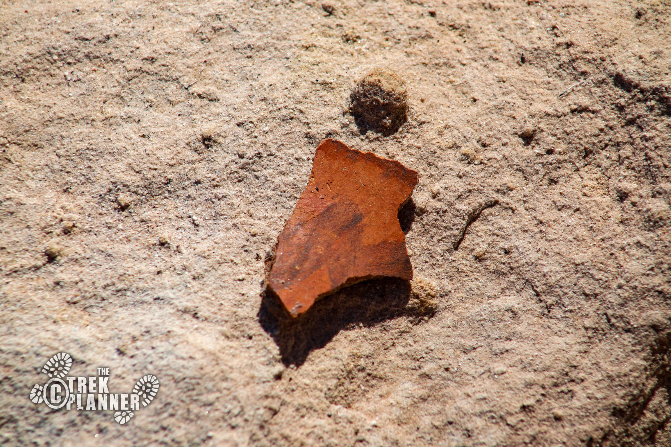
At this point, there wasn’t a trail anymore. We were hiking through dry washes and open areas. We hiked through several dry washes that had broken pottery shards in them. This was very odd to us since we were no where near any ruins or signs of ancient life.
We continued on until we got to the canyon entrance. The canyon was very narrow and had many tall and old cottonwood trees in it. We were grateful for the shade and also the sandstone potholes that had clear water in them. We were very sweaty and our faces were red and dirty from the hiking. It felt good to rest for a minute.

We didn’t really know where to go now. The canyon had some big obstacles and so we chose to go up on the side of the cliffs. When we got up far enough we figured we would scout out a route with the drone. The drone showed us that our current route would eventually dead end and we would need to head back down towards the center of the canyon.
We went down and hiked over and under huge boulders, periodically splashing our faces with water. The canyon eventually widened and the sun was beginning to hide behind the cliffs – we knew we would need to start thinking about heading back soon. Luckily, we had my satellite messenger just-in-case anything happened to us. After all that hiking we looked up and saw it…The ancient cliff village.


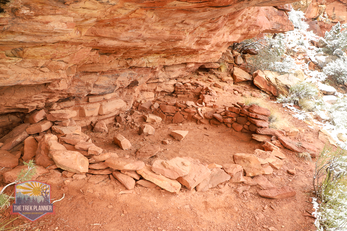
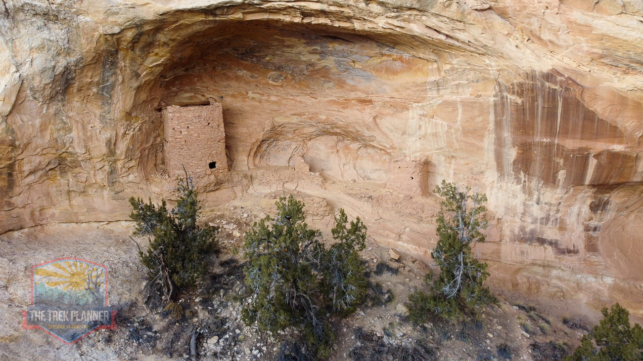
Cliff Village has anywhere between 10-15 dwellings or structures all different in size. There is one ruin that is circular in nature and appears to be a kiva. There are several structures that appear to be granaries that were used to store food, water, and other items. The masonry and construction are beautiful. Other similar structures in the area are dated between 700-1200+ years ago and these are no different.
This little village is located high on the cliffs that are impossible to get to now. The ancient inhabitants here most likely used ropes and possibly some ladders to get to their homes. It was fun to imagine all the dwellings busy with activity. It’s easy to see why the Ancestral Pueblo loved this area. They could easily be protected from all angles, they were close to a creek, had access to trees and other plants, and had access to flat meadowy areas for planting crops.


I found this area a year ago and it took me almost an entire year to get to it. Mostly due to work conflicts. We spent about 45 minutes flying the drone around and taking pictures with my telephoto lens. By this time, we were getting concerned about our water supply. We wanted to explore more, but our water was running low and we decided a return trip would be required.
We walked back to our car where ice cold gatorades were waiting for us! We drove back to our campsite and took hot showers with a water heater we borrowed from my brother – best shower I have ever taken!
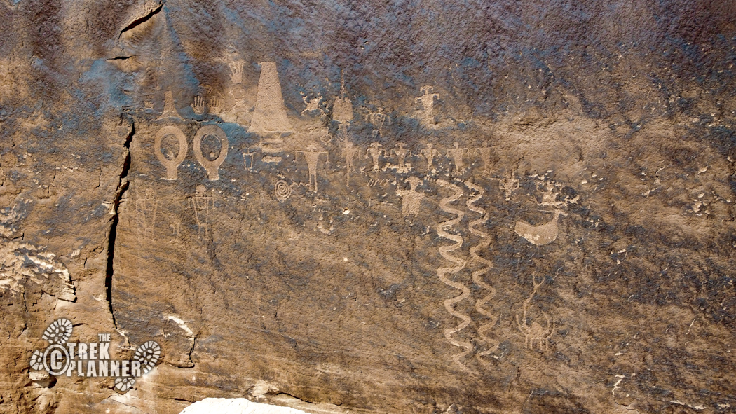
This morning we were pretty dang tired from our 9.5 mile hike yesterday. We ate breakfast, packed up, camp and headed over to Bluff and Comb Ridge to visit some familiar petroglyphs. The Wolfman Petroglyph Panel is easy to get to and one that you need to see if you haven’t! This is a popular hike and we talked with a nice couple from Colorado who said they were exploring all over Comb Ridge. It sounded like they have visited this area many times as they told us about Grand Gulch and sites in the area.


After this, Annie and I tried to explore a place where I thought some Moqui steps would be located, but we truly needed a Jeep or truck in order to get there. My low-clearance vehicle just couldn’t make it. So we instead explored around Bluff and flew the drone around.
We found some petroglyphs near the road and hiked up to them! We then had lunch and Annie left for her home in St. George. Since it was still early in the day, I stayed in the area and just wandered and drove around until I found some more petroglyphs!
I drove down a random dirt road until I came to the end. I followed an old cattle trail which quickly went straight up a sandstone hill. As I was hiking I noticed that someone carved some steps so the cattle could climb it easier. I followed this trail until I saw an arch in the distance. I continued hiking and found a very small, yet scenic arch tucked up in an alcove.


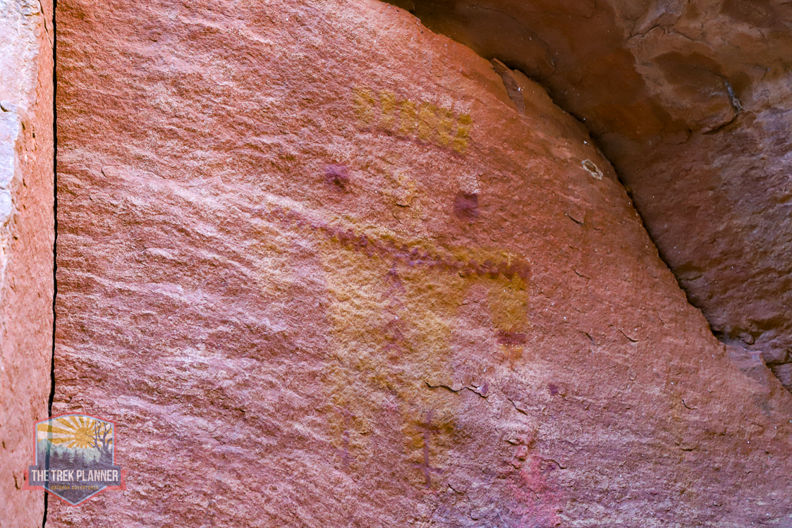
Hiking back down, I found a ruin with tons of vandalism below it. Lots of carved names were made by less intelligent people. I found a few petroglyphs here, but they are very faded. I was about 2pm now and I decided to head to my car and fly the drone one last time to scout for petroglyphs.
I noticed very high that there were some “scratchings” that looked like rock art. I flew in closer and discovered a panel that I named The Spider Petroglyph Panel! This panel is very unique and you can read more about it here.

I found a bunch of pottery shards too. (Remember that taking pottery shards is illegal. Just leave them where they are)


By now it was about 3pm and I decided to head back home!