

Experience. Discover. Explore.
Follow along on our adventure then go out on your own!


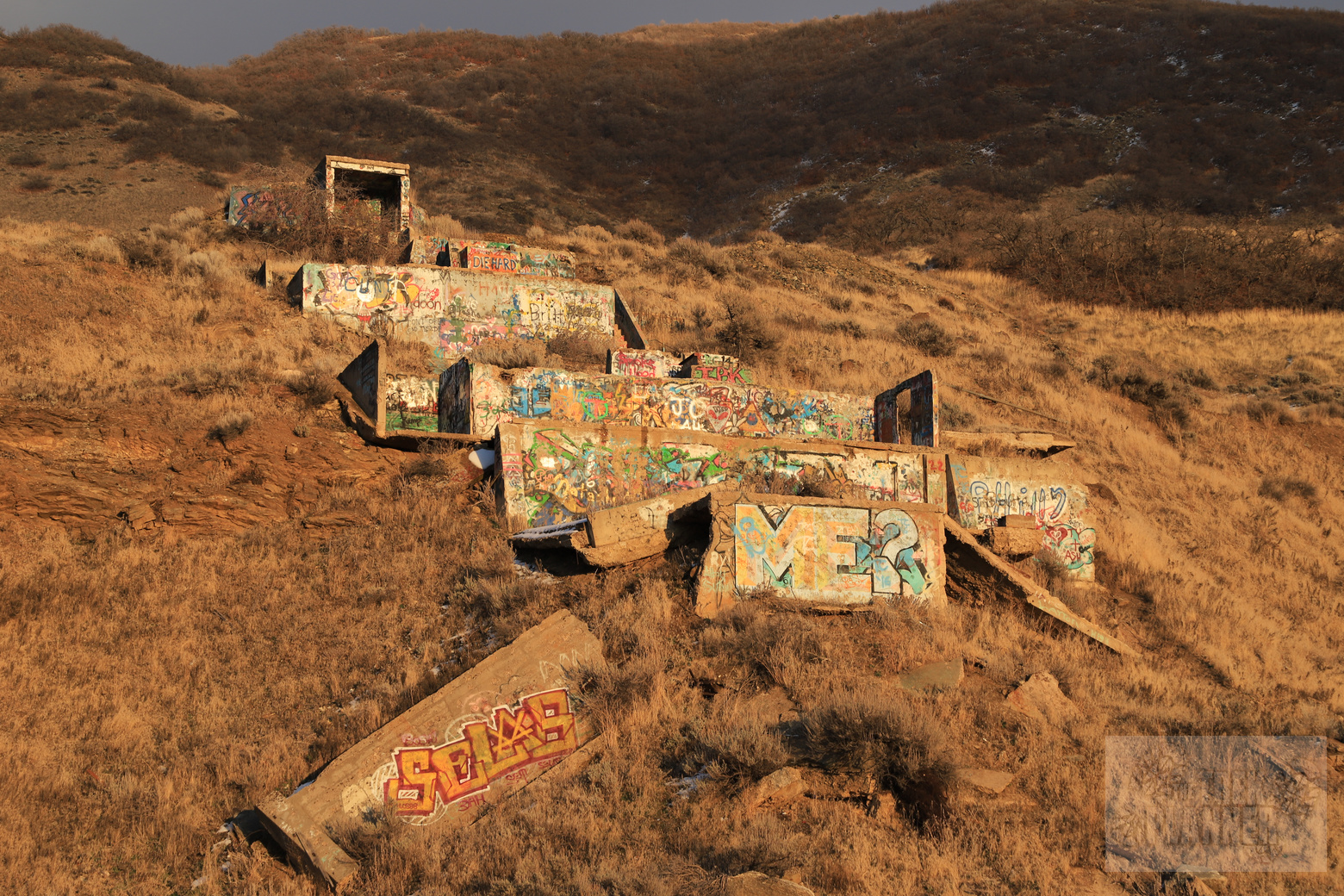
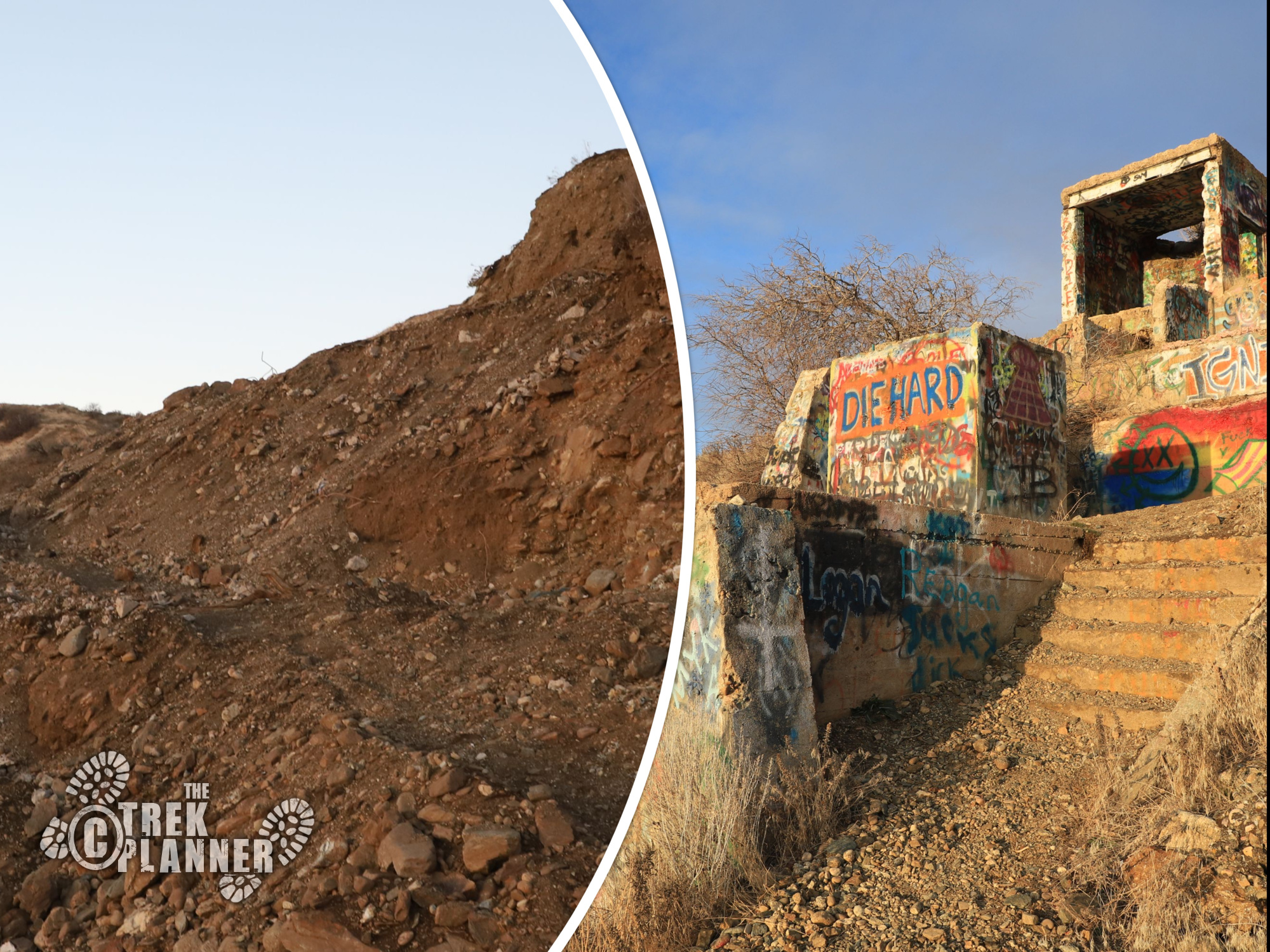
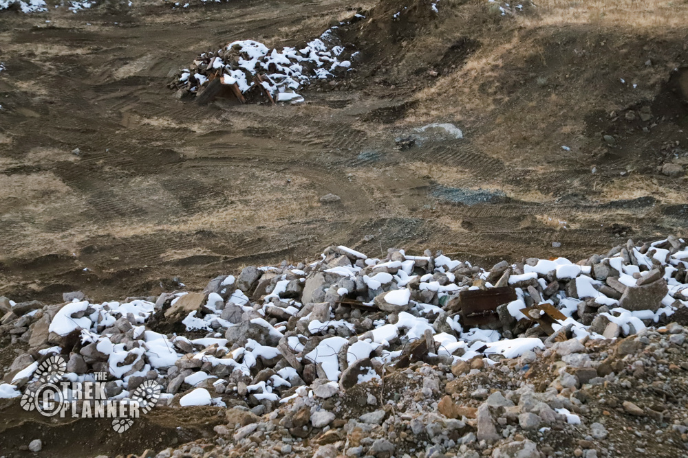
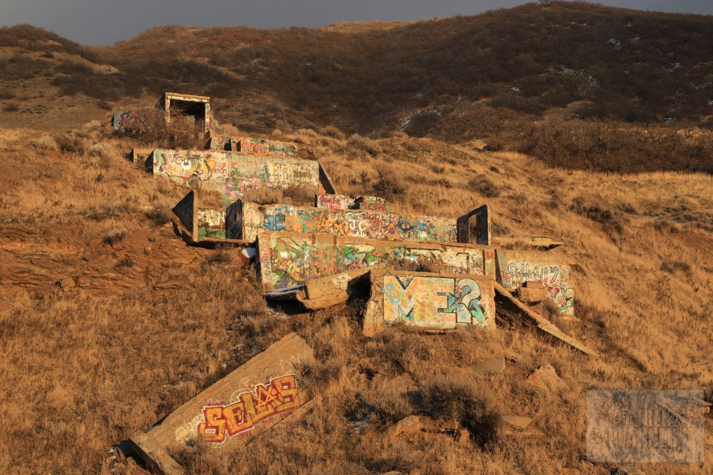
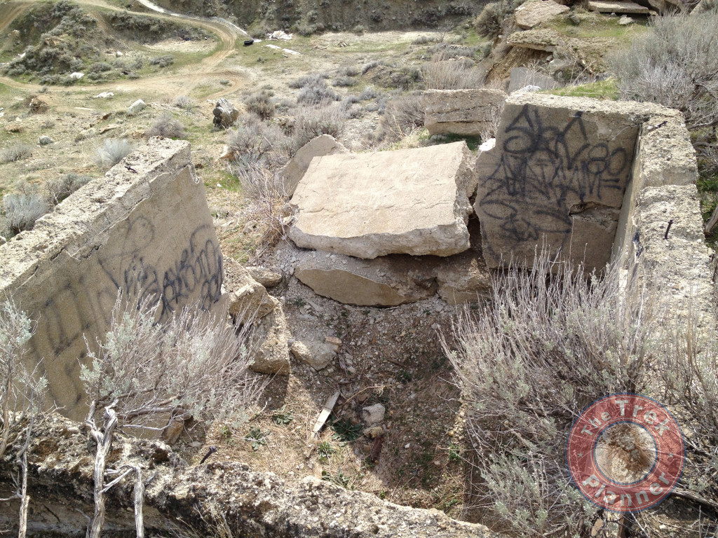
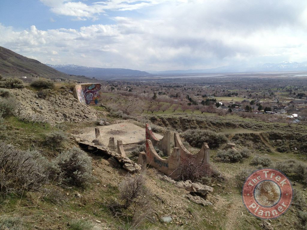
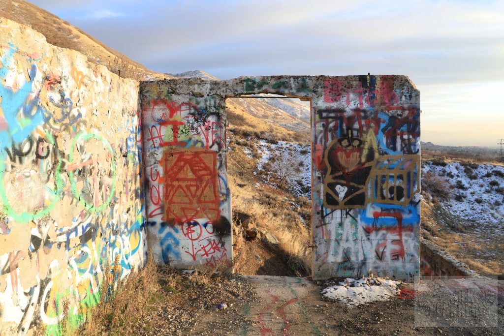
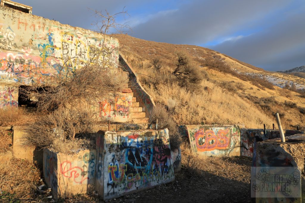
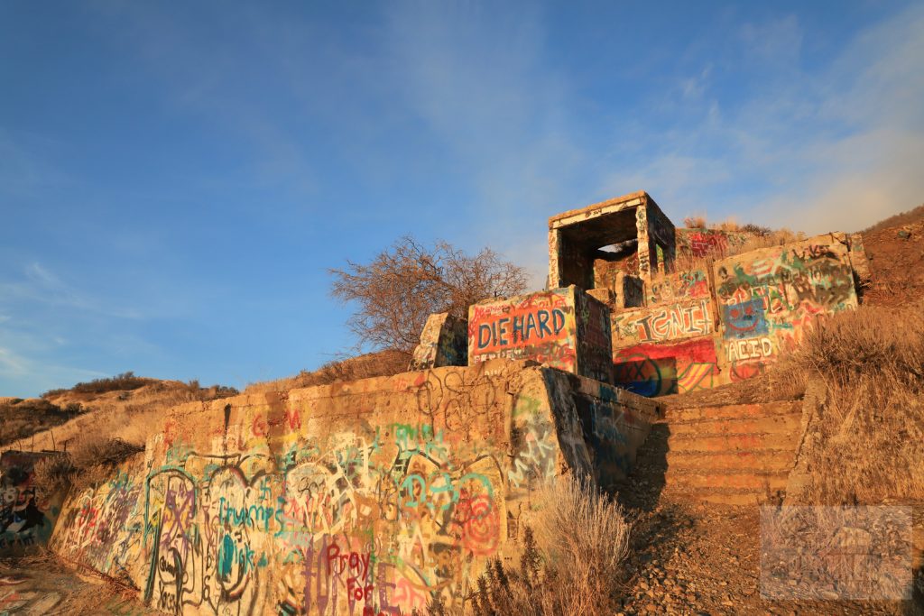
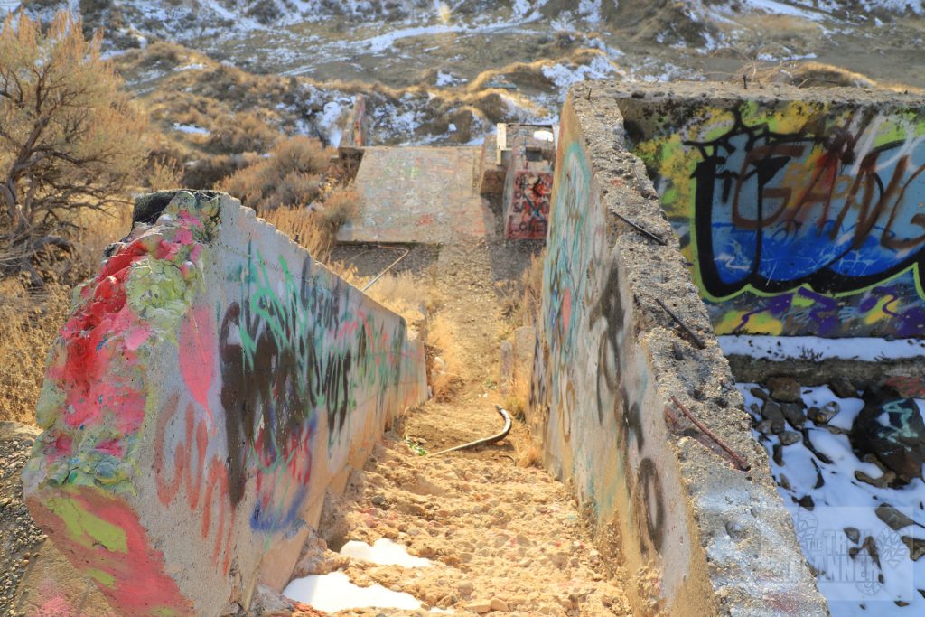
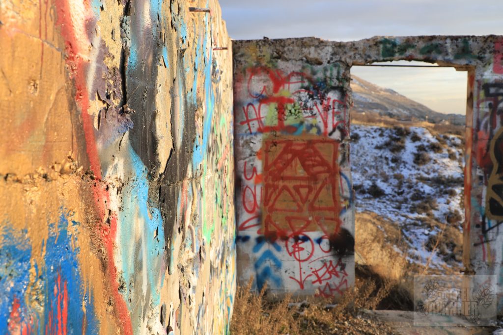
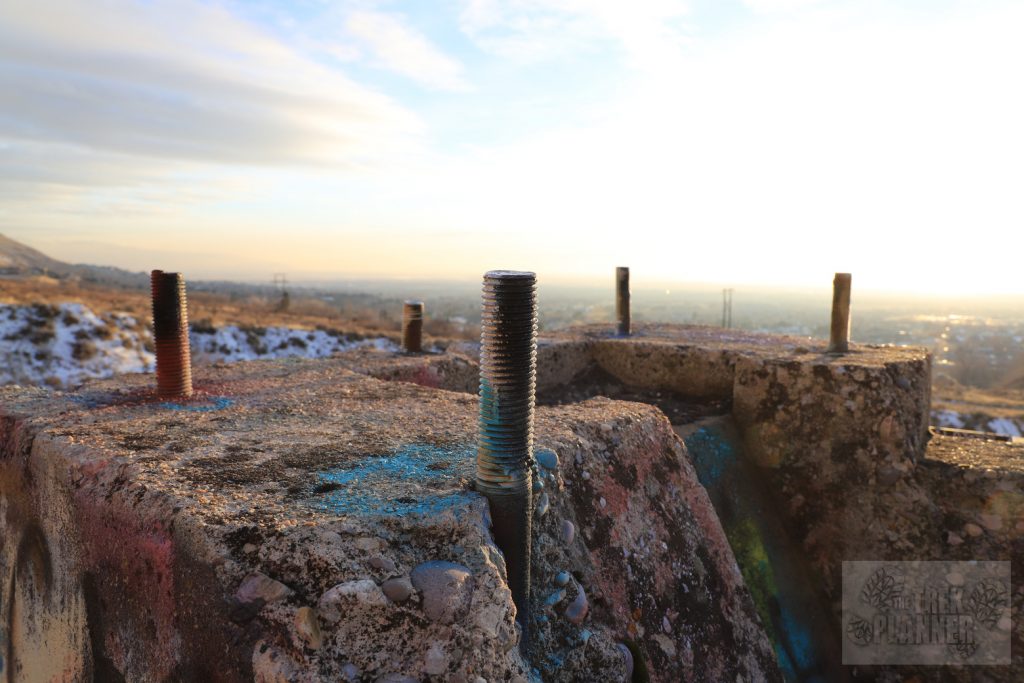
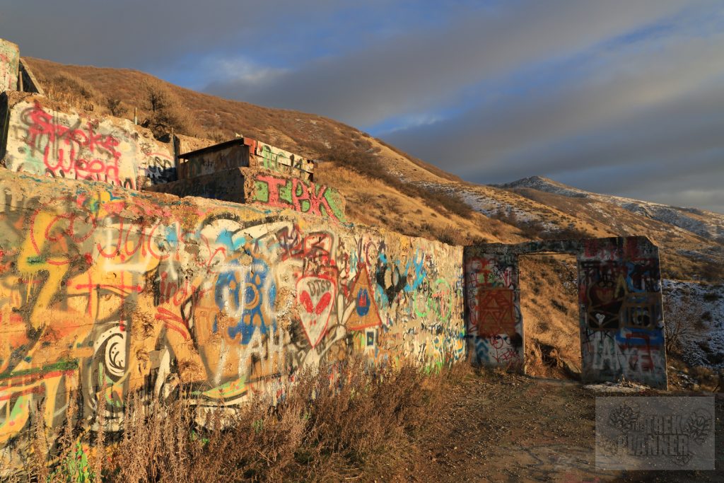
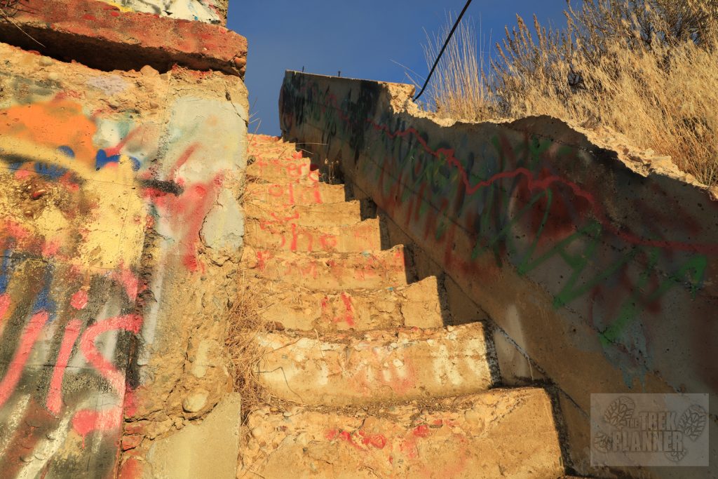
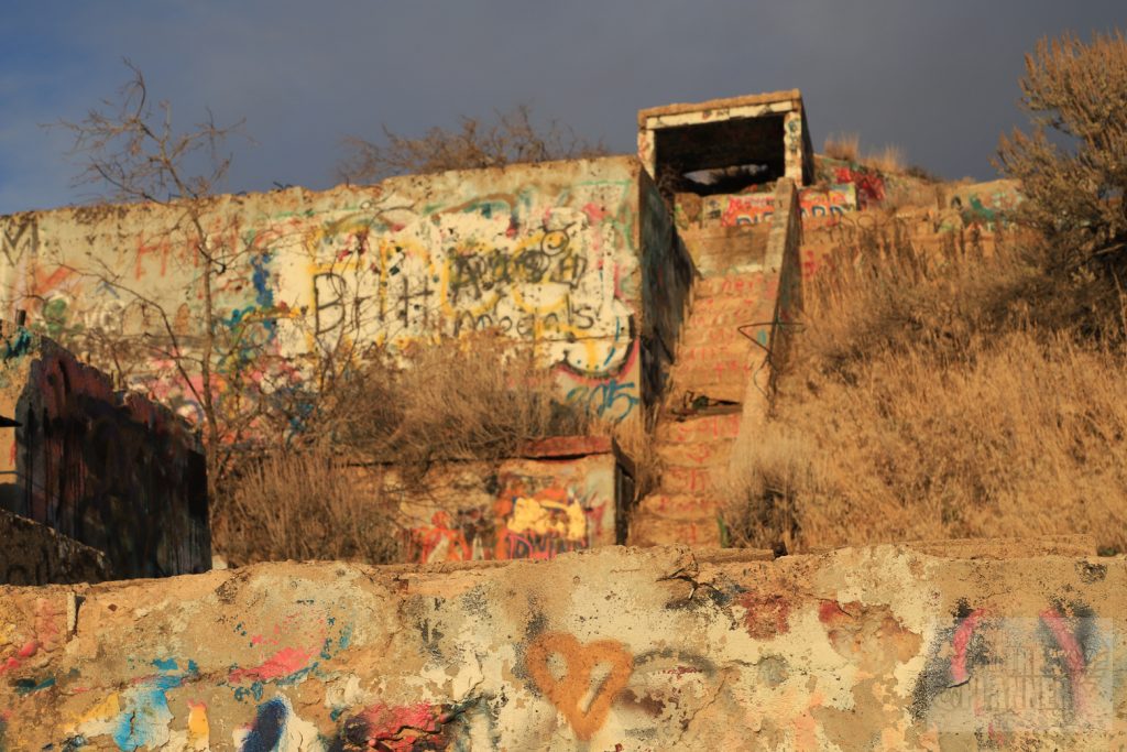
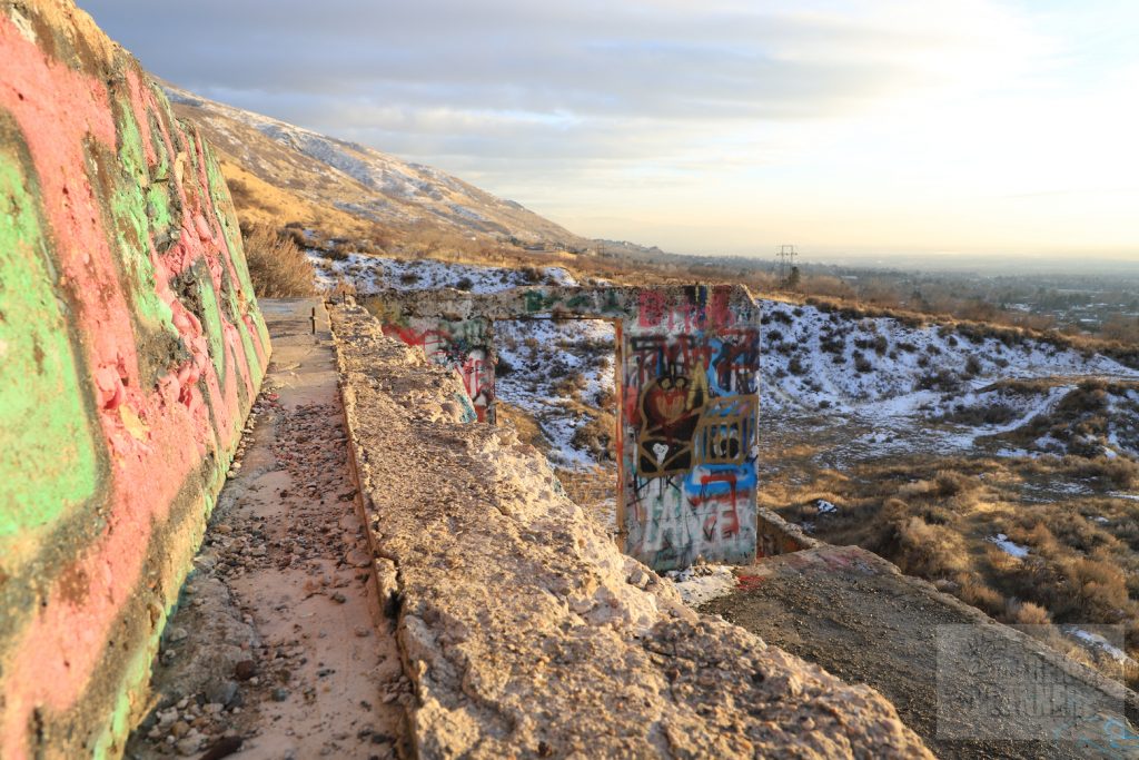
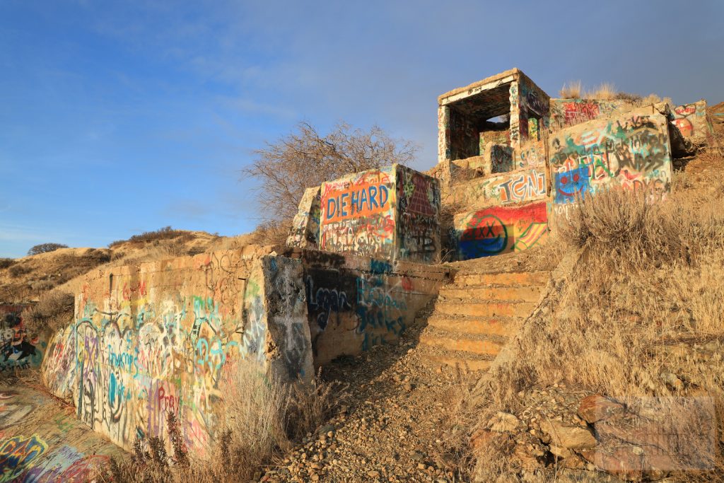
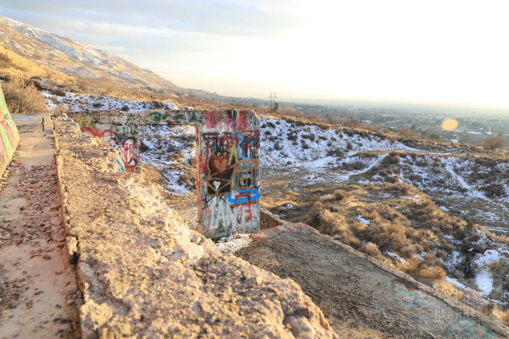
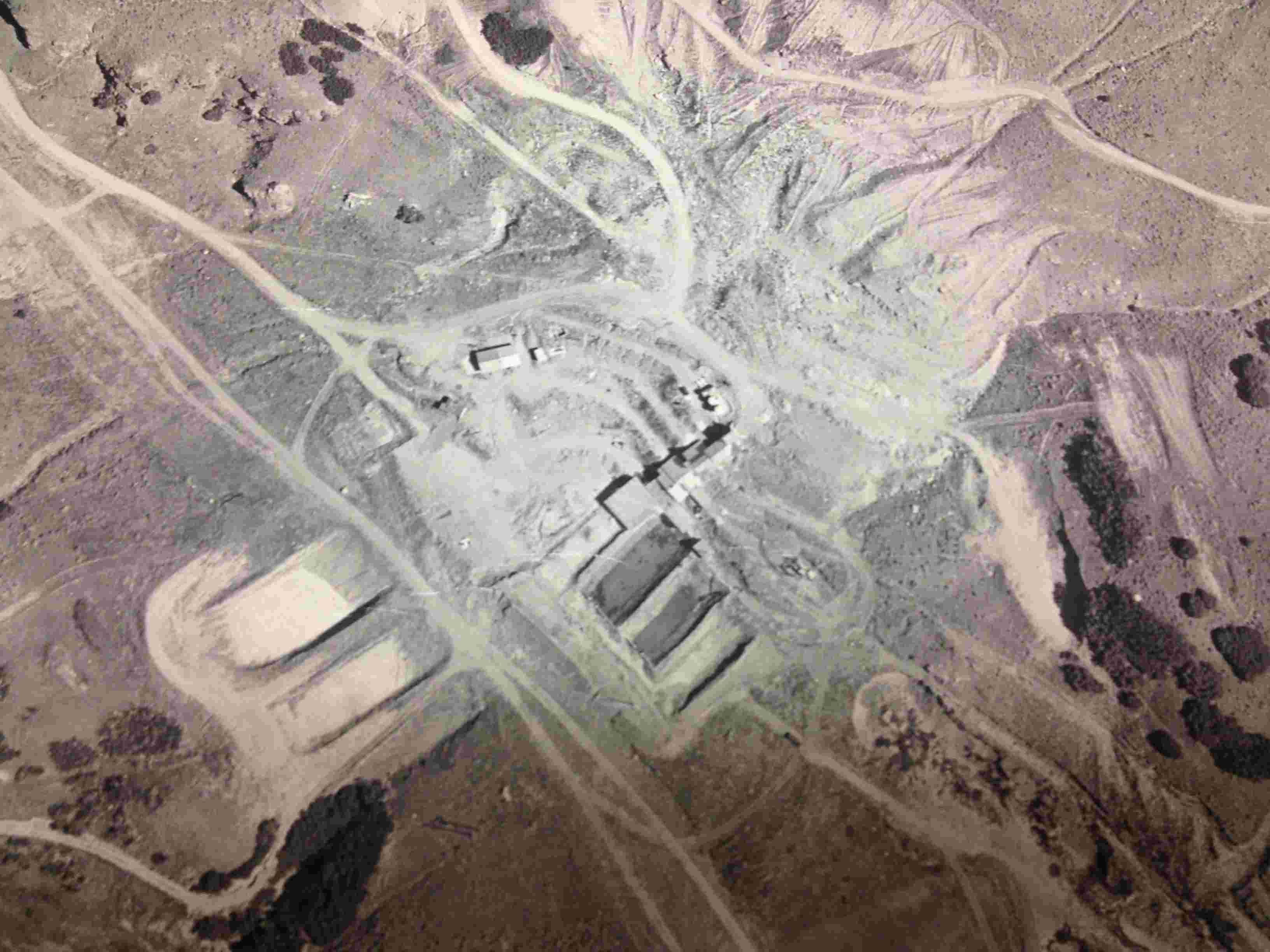
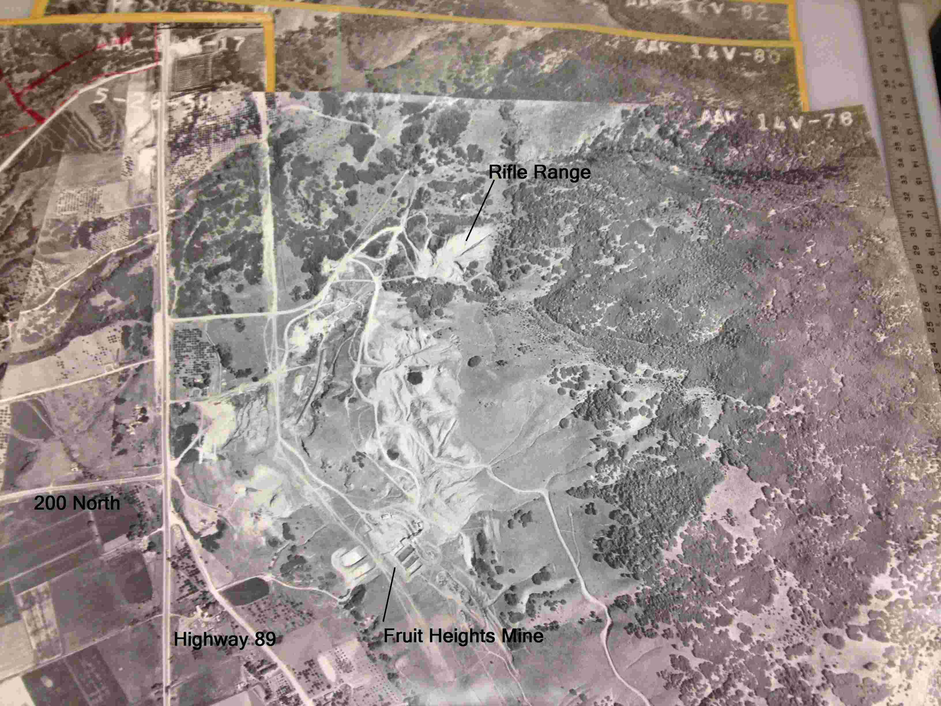
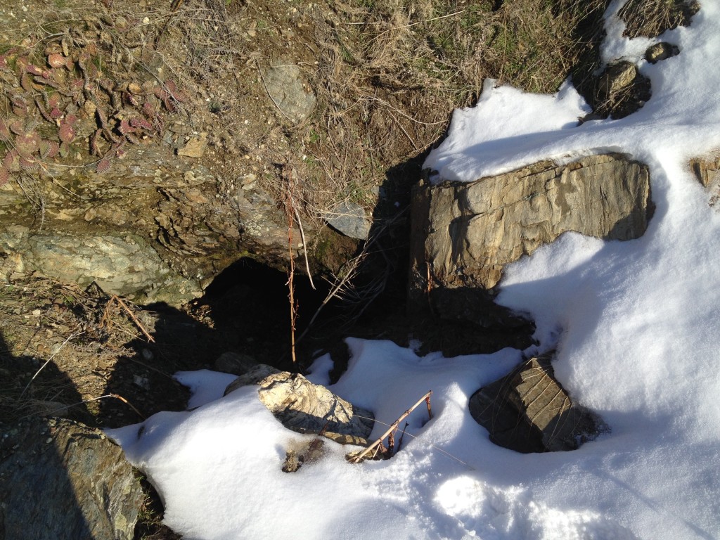
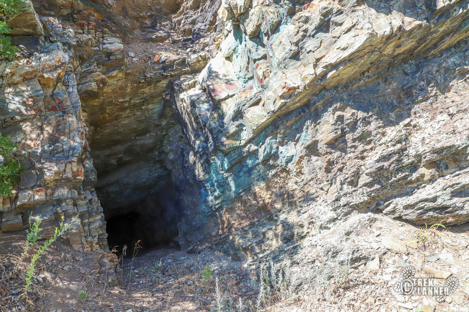
The Fruit Heights Mine has been completely destroyed and is no more. It happened during the first part of November 2020. This Trek will remain up as a reference Trek. I posted some pictures of what is left from the demolition.

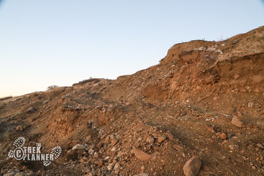
The trail starts off right next to the gun range. Be careful as you travel so you do not hike above or anywhere near the gun range.
You will follow the trail up about 40 feet in elevation and then the trail turns towards the west and slopes downward again before turning around back towards the south.
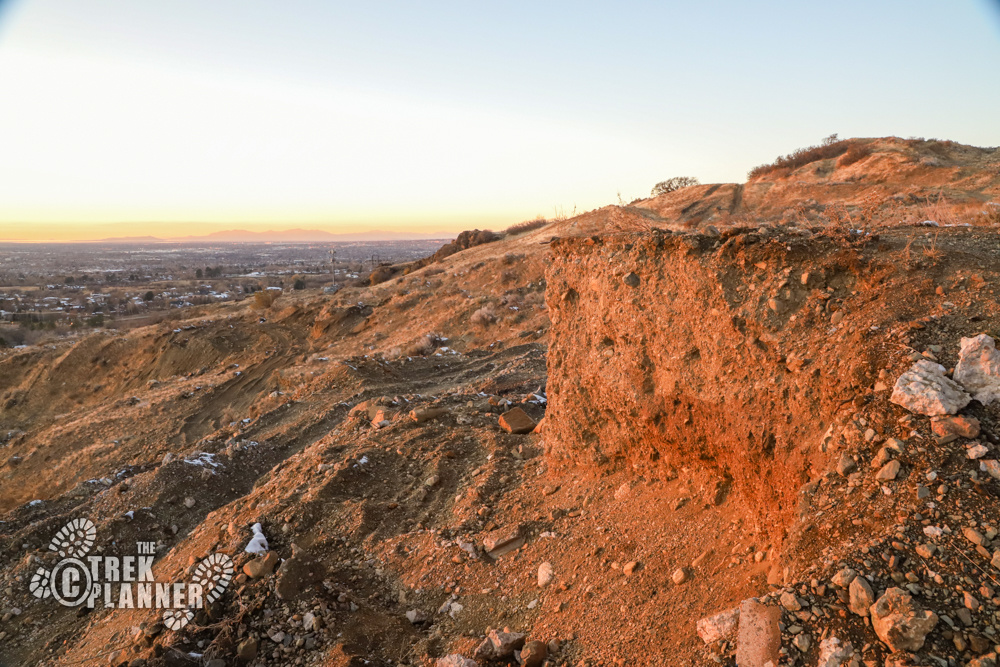
The last time I was up there I did not see any “No trespassing” signs above the mine. But that doesn’t mean that you aren’t trespassing if you go onto this land. It is best to view these from a distance and not mess with the property.
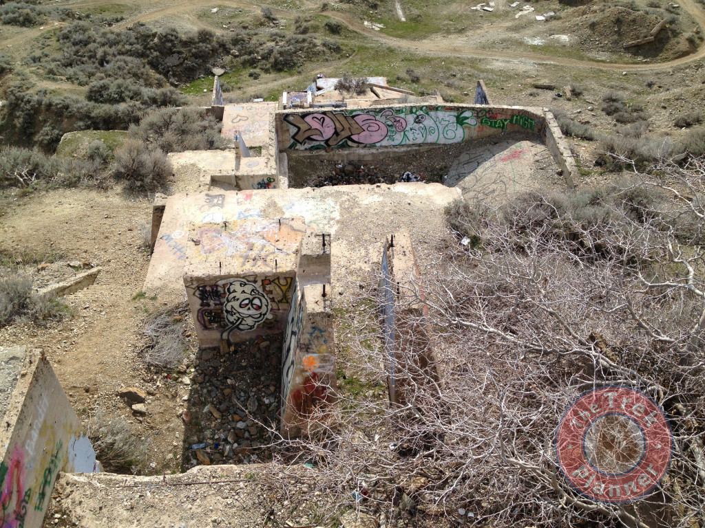
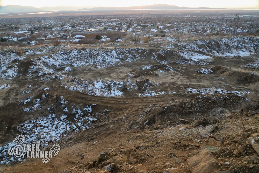
Also a bit of caution. When I was up exploring the area the Sheriff drove up next to me and told me to stay away from the pit at the bottom of the mine (he was referring to the open pit area below the concrete structures) because apparently the animal patrol disposes of rattlesnakes in that pit, or had at one point. I don’t know if it is true but I have seen rattlesnakes in the area along the Bonneville Shoreline Trail just above the mine.
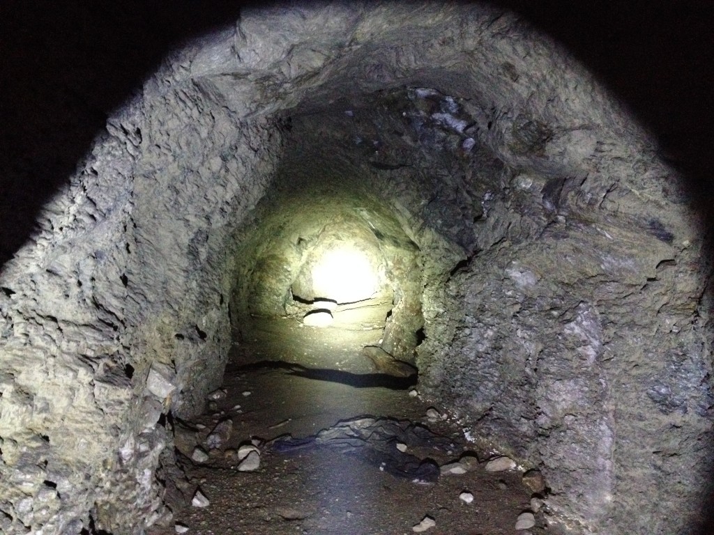
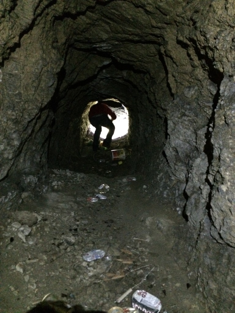
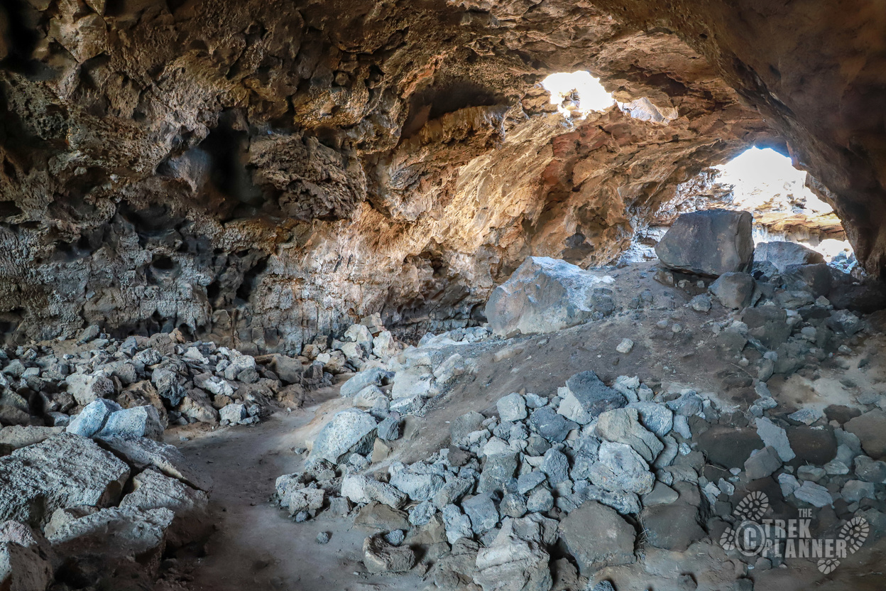
Also, mines are dangerous. Please be careful if you go in or around these areas. This particular mine has been sealed off and the few times I have tried to locate an opening have been in vain.
I’m not exactly sure what was mined here. I heard people mention that it was a uranium mine. I tend to believe that it is a copper mine like the majority of the mines in the Davis County area. Just 50 feet south of the top of the mining structures there is evidence of copper.
If you have any information regarding this mine please post a comment or send me a message.
Update
Well it seems that I was wrong about this being a mine. I am part of a Kaysville Facebook group and posted a few pictures of the structures and asked if anyone had any information. I got dozens of responses and even a gentleman who owned this land back in the 70’s. I will not publish his name but this is what he had to share “in the late 70s I owned it (the land) for 2 weeks in a crazy land trade and I got a call from a guy that was shipping uranium ore by train and he asked me if he could pick up the pile of ore that was up there and finish filling one of the railroad cars. I was not aware of ore still being there but there was a pile that the scammers had salted the mine with. I was glad to see it hauled away. There were no major shafts maybe 20 feet in at one point. The Donner Reed party also came by mountain road on their way to California. I used to take scout groups up their and tell them to watch out for get rich quick scams and short cuts.”
Another person’s comments: “They were so busy building it trucks were going like crazy. Then one day everyone vanished. It was uranium, in that time uranium was the big thing. A lot of locals got scerwed. One big scam. I don’t know if anyone ever got caught.”
Here is another interesting piece: “I also heard it was a fake uranium mine. Back in the 50’s when uranium was in demand for atomic energy & weapons they would “seed” mines to get investors to buy in. The company would run a year than go belly up when there wasn’t any real ore. I think there is a mine adit up the canyon ways that was a hundred feed long. The concrete is what remains of any processing mill equipment.”
Here is the most revealing I’ve found. This is also from the facebook post:
“Don’t confuse the processing plant that the remains of are south of the Dog Pound as the mine itself. It was part of the Scam but the supposed Uranium mine was South and East of the processing plant just inside of Baers Canyon. The supposed mine moved around. It moved from down in the cliffs just inside the canyon, up to the top road scar that runs below the Christmas star and goes into the canyon just below bald peak. It was uranium first, then “rare earth”, then thorium. All designed to part fools with their money. It all occurred in the late ’50s. They went down to Moab and obtained a couple of dump trucks full of real uranium ore and dumped it into the top of the processing plant which was just a large tube made to look like a roller mill covered by a shed.
The ore slid down the tube, into another waiting gravel truck below. it was then hauled laboriously up to that top road around the corner into the canyon just a little way, then hauled back down to the top of the plant and dumped into the top of the plant, thus beginning the cycle again. The same load of ore went around and around for one whole summer. Then it all went bust and the $$$ invested disappeared. Some of the perpetrators of the scam were prosecuted, but not too effectively. That Summer, some of us, being Teenagers went up and watched this all taking place from across the canyon. They had hired a little guy to be their security. He had a pistol that he would wave around at us and shoot in the air while he threatened us. They started stories of Man eating mountain lions and such to try to keep us and anyone else who may see them scamming, away.
There are many glory holes along the front between Farmington Canyon and Weber Canyon. There were two mines on our property in Fruit Heights by the power line and one more just inside Shepard Canyon. In the ’60s, the Corps of Engineers tore down the “uranium mine processing plant” and closed many of the other mine holes that were hazardous. Most of the mines were stock promotions pure and simple. There is some fairly rich copper deposits on our old property. Although it is better ore than Kennecott,there is not enough quantity to make mining economical. Jack Nance was an interesting Man. I remember him walking up and down 100 South and up Green Road. He did a lot of digging. My good friend Dan Nance could enlighten us about his dad. I think he was a committed prospector. One big problem would have been that the Union Pacific Railroad owned all of the subsurface mining rights on these mountains and in the valley in much of Davis County.”
It sounded like the original people who filed the mining claims were only interested in the investment money and keeping it for themselves rather than developing a mining site. It is still very interesting though!
Historical Photographs and Information:
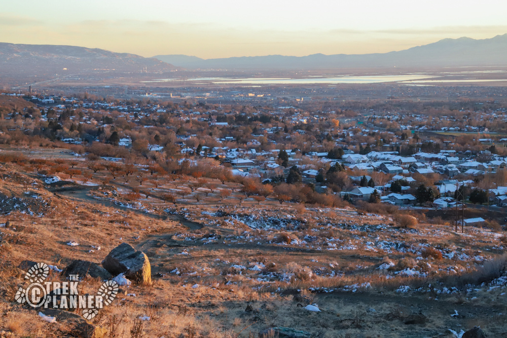
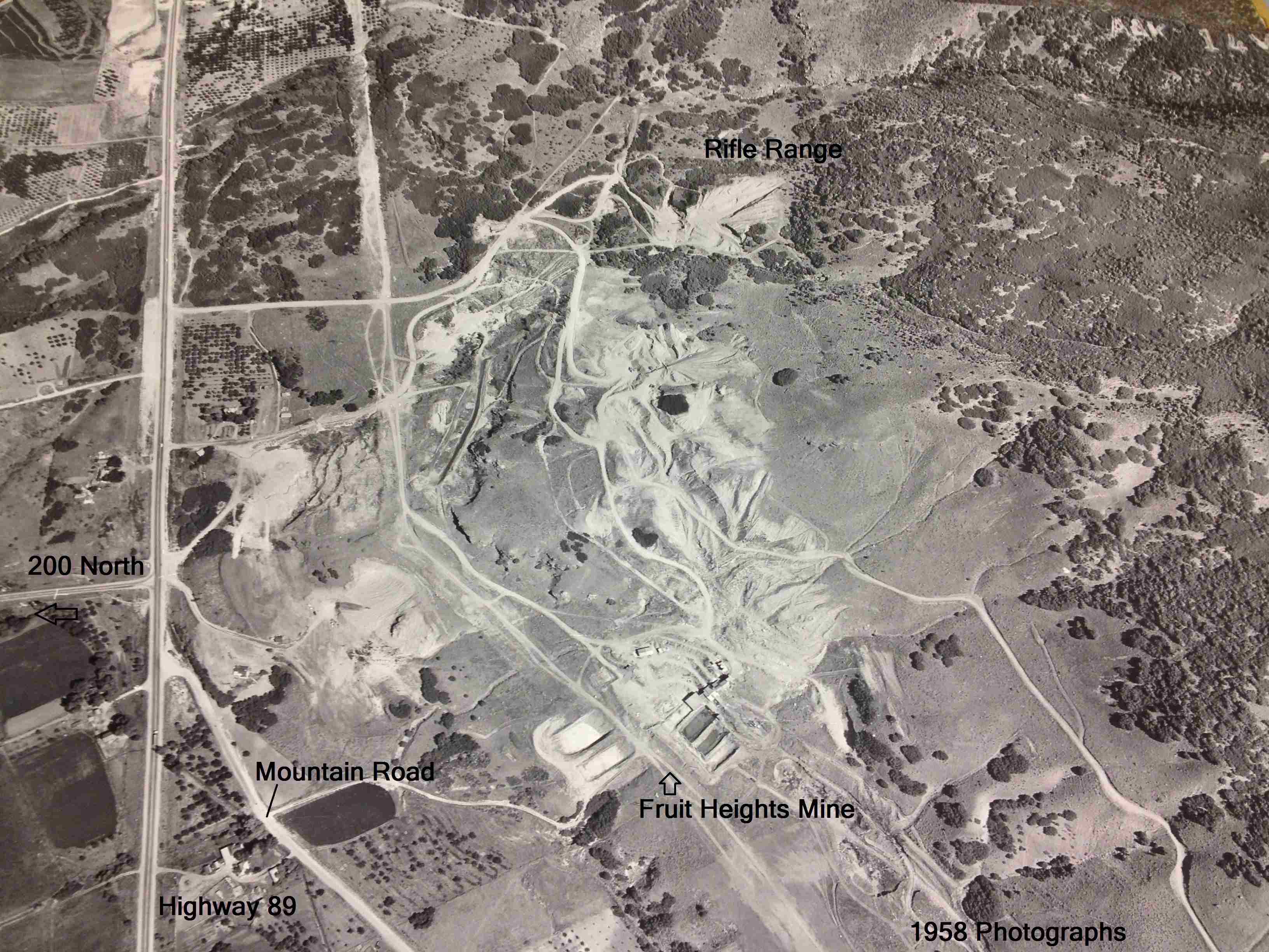
My father worked for the government of Davis County in Utah and one day I came into his work and noticed file cases filled with old 1958 aerial photographs of the Davis County area. We were both curious and decided to find what our hometown (Kaysville) looked like back in 1958. Not surprising, things looked VERY different. We then looked over a few maps of the Fruit Heights Mining area. Back in the day, there seemed to be quite the operation going on here. The broken mining buildings that you see in my pictures are remnants of a major operation that once took place. You can also see in the pictures that the gravel pit to to the north was also a big operation. The rifle range seemed to be in the beginning stages too we noticed.
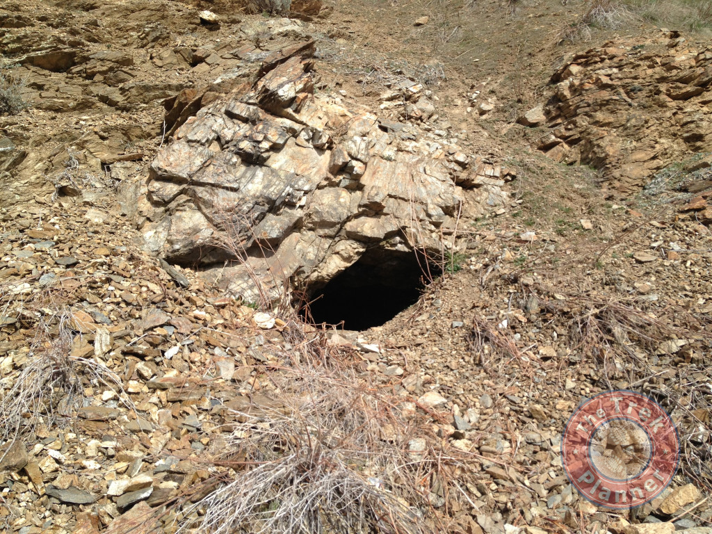
Optional Side Trek: Small Adits
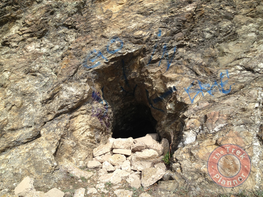
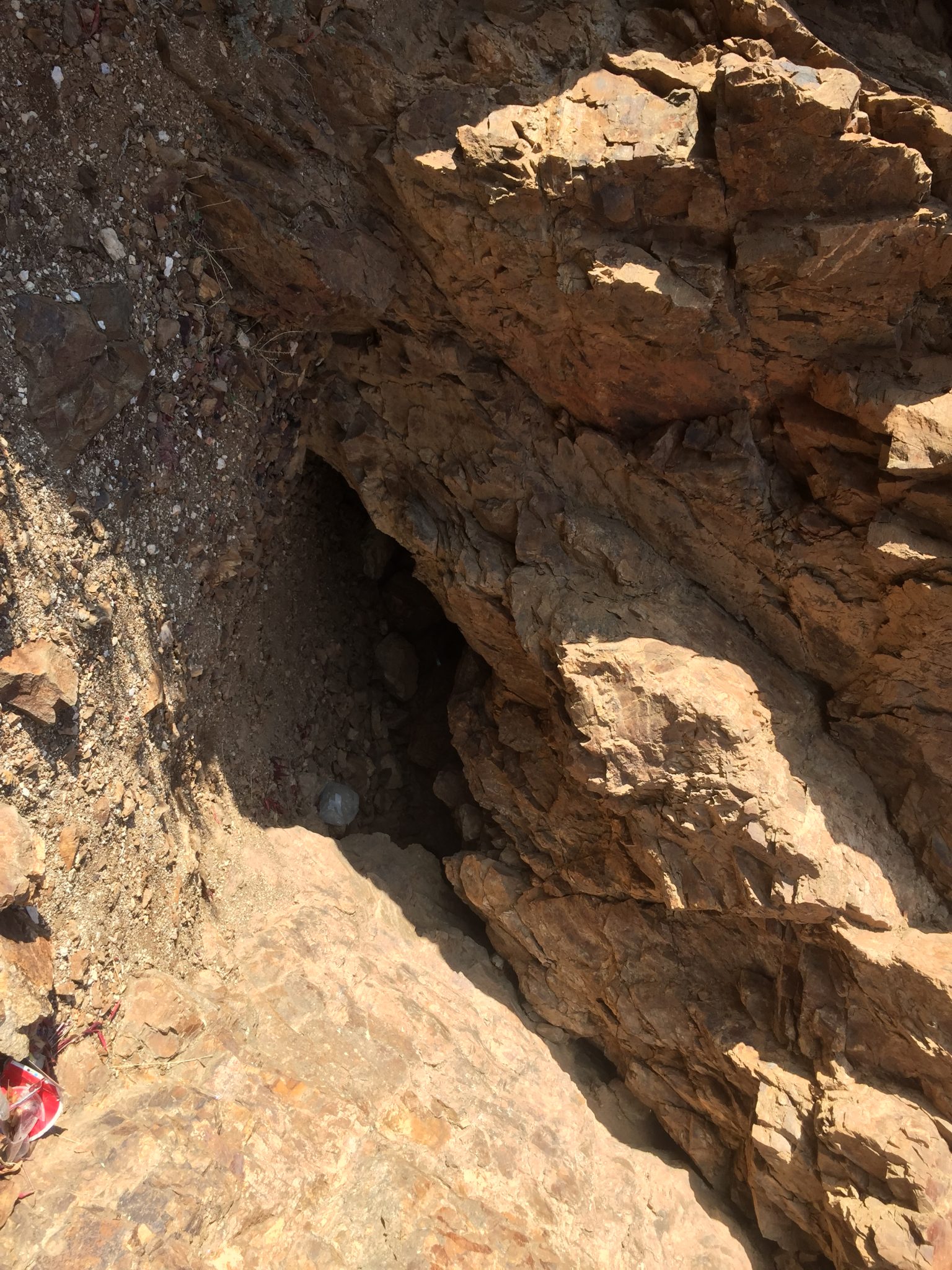
To the north west of the mine you will find a small grassy area. There are two small adits that go in a little ways. They are both right next to each other.
It is directly north east of the first adit.
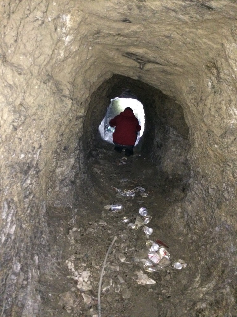
Hawkeye-TP was the one that showed this mine to me. It is very trashed and only goes in about 115+ feet. You will need to crawl to get in through the entrance and for the majority of the mine you will be hunched over.
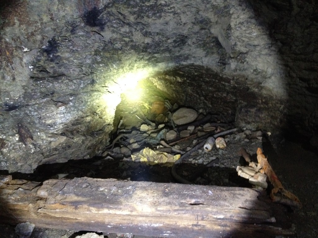
There are two adjacent tunnels but one is completely flooded and most likely stops only a few feet it. The second tunnel is also caved and didn’t go in very far.
[label variation=”label-danger”]Trash Heap Mine:[/label] 41° 2.458’N, 111° 54.197’W
Fruit Heights Mine

Personal Thoughts
This is an interesting area. I have tried numerous times to dig up information about the purpose of the mine and I have come away with more questions. I have heard that the mine had sulfur or even uranium but all these reports are unverified. The structures around the area lead anyone to think that this area was once a bustling mining center but who knows the real story.
Went up here yesterday…. Seems to be an Iron mine and a gravity mill of some sort
Never thought of it being an iron mine before…why do you think it could be an iron mine?
I Found Iron ore in the 2 adit.
Where did you find those photographs? Local library?
The aerial photographs were from the Davis County building in Farmington – my Dad used to work there and we found them one day in his office. All the others are pictures I took.
I found an interesting rock in the area just north of the old mine. I took it to a rock shop in SLC to have it identified. The person at the shop told me that the rock was fowlerite and that the mine in Fruit Heights had been a fowlerite mine. I still haven’t been able to find a lot of information about fowlerite.
Hi Jen, thank you for your comment! I had never heard of fowlerite either – I had to look it up. It looks like a really cool rock! I’ve been up to this mine many times and have yet to find any cool rocks. Good find!
Hi Jeff, I grew up in Kaysville and had been to the mill many times. my question for you is do you know anything about the copper mine about 3 miles up bear canyon? I was there today and I spotted a tag #31H01 at the entrance. I found some specimens in the tailings. As a kid in the 70’s I was told it was shutdown during WWII. That’s about all I know.
Hi Ronald. Thank you for your comment! I made a post about the mines up Bear canyon (http://thetrekplanner.com/baer-canyon/). They were dug by a man with the last name of Hennifer back in the late 1890s to early 1900s. He and a few others dug three mines; one is about 300 feet deep. The other two are short or caved. I have found oxidized copper on some of the tailings too. Hope this helps!
The mine is now being torn down and leveled.. So not much to see now….
I grew up in Layton, the next north of Kaysville and Fruit Heights during the 50’s and 60’s. The mine buildings were very visible from the valley, and I had been up around there a couple of times with scout groups. I don’t know the exact year, but since I was in the Boy Scouts it would have been in the late 50’s. Most of the buildings were still standing, but we never went very close around them. I don’t know anything for sure, but it was always referred to around town as “the uranium mine.” But it was really… Read more »
Hi Robert! Thank you for sharing your bit of history with the uranium mine!