
The Trek in a snapshot
Location
Southeastern, Utah
Managing Agency
Unknown
Pets
Allowed
Fees
None
Restrooms
None
Camping
Not allowed
Trail Condition
Sights
Water Info
Bring a bottle of water if needed
Best Season
All
Distance
Time Required
Parking Elevation
4338 ft.
Summit Elevation
4339 ft.
Elevation Difference
1 ft.

Trek Planner Maps
Trail Map for Trek Planner Insiders Only!
This content is locked
(memberships are currently unavailable)
Parking: 38.64935, -109.59822
Ring Arch: 38.64987, -109.62278

Experience. Discover. Explore.
Follow along on our adventure then go out on your own!


Looking to hike to a very seldom visited arch in Arches National Park? This is a fun adventure that you will enjoy, most likely by yourself and those in your hiking party!
Note: Let me start off by saying that his hike isn’t for everyone. There isn’t a set trail the entire way and it’s easy to follow a path and then magically get off of it then wonder where you are. You will need decent orientation skills and knowledge in order to get to Ring Arch. The trail is pretty easy overall, but the hardest part will be some minor route finding and using those orientation skills of yours to successfully complete this hike.
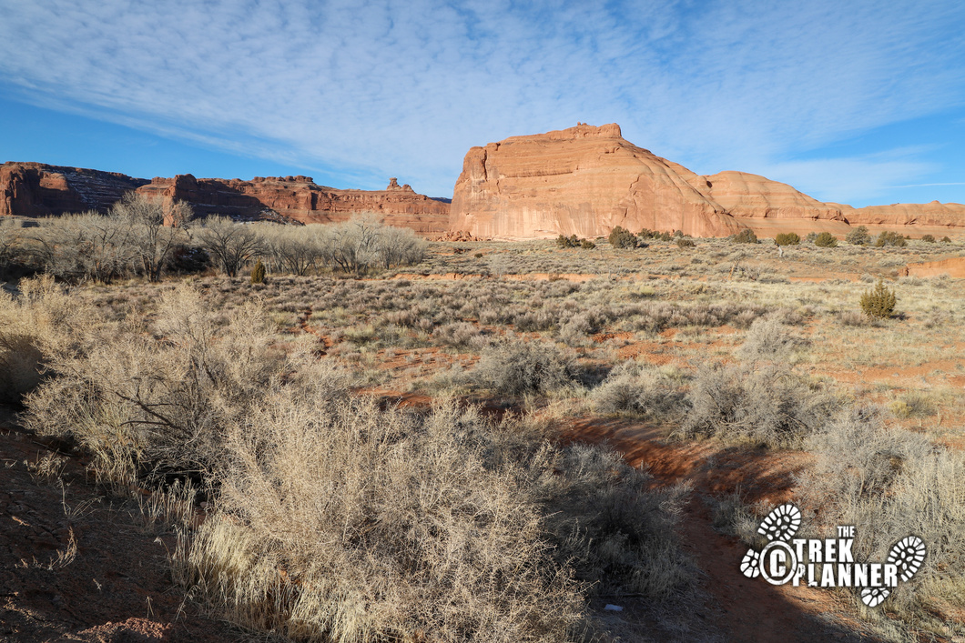
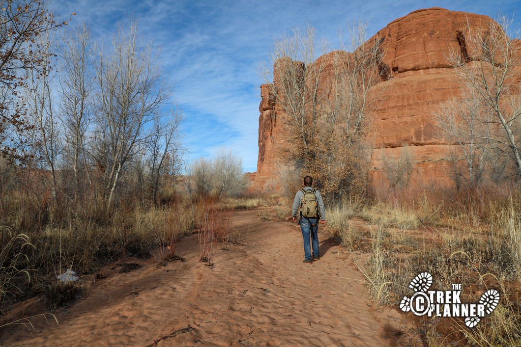
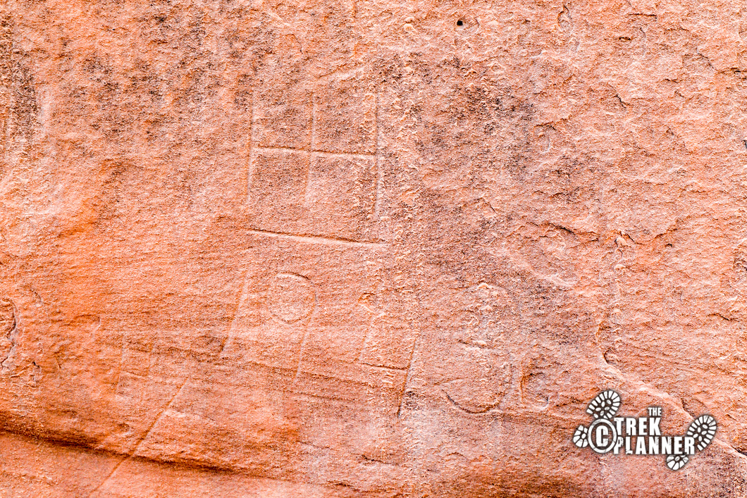
The trail begins at the Courthouse Wash pullout. There is a trail on the north side of the pullout that immediately cuts west towards the wash and all the cottonwood trees. You won’t be hiking in the wash just yet, but you will skirt on the north side (still hiking west) of it until you come to what I call “Cowboy Graffiti”. This Cowboy Graffiti appears to be some ranching symbols and some other historical marks and names carved on the rock. It’s on a boulder and really neat to see!
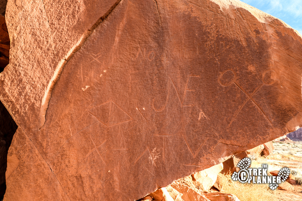
Here is the GPS coordinates for the Cowboy Graffiti:
Trek Planner Insiders Only!
This content is locked
(memberships are currently unavailable)
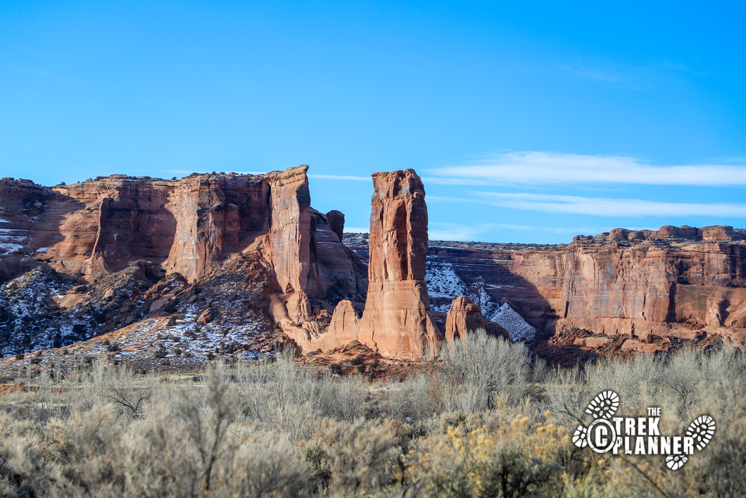
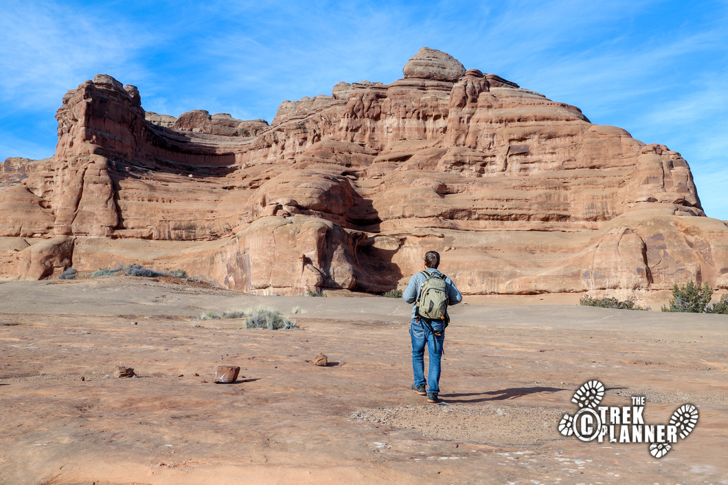
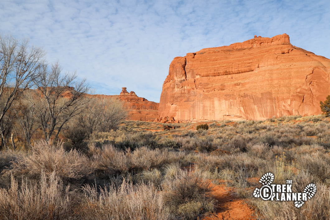
The trail will then go around the tall sandstone tower and go north now. The trail will go inside Courthouse Wash and you will now be enveloped in some thick vegetation. This was the hardest part for me since I would follow what I thought was the trail and then I would end up some place random. Then I would open up my map and find a better trail and then hike on that and then end up at a dead-end in some thick bushes. Thankfully, the main wash was mostly clear and easy to follow. If there was recent rain or snow, this wash can see some good amounts of water in it. Always be careful of flash floods too! I saw some signs of recent flash floods with some thick globs of leaves and dirt about 2 ft off the ground around some tree trunks! You wouldn’t want to be caught here during that time. Just be careful and always pay attention to the weather and where you are hiking.
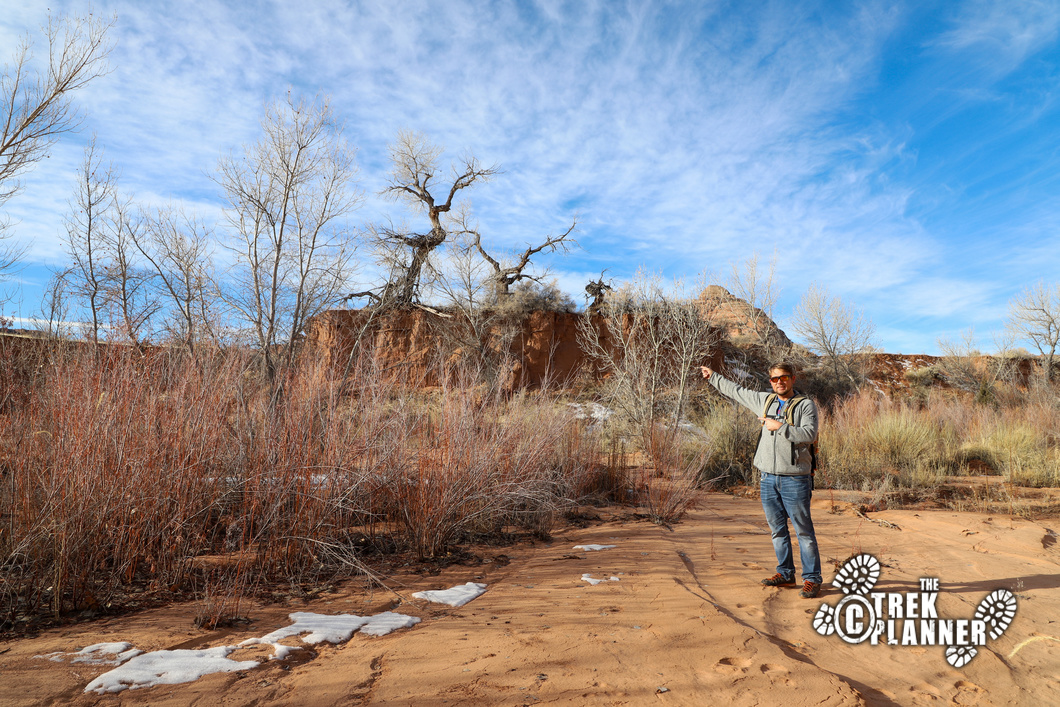
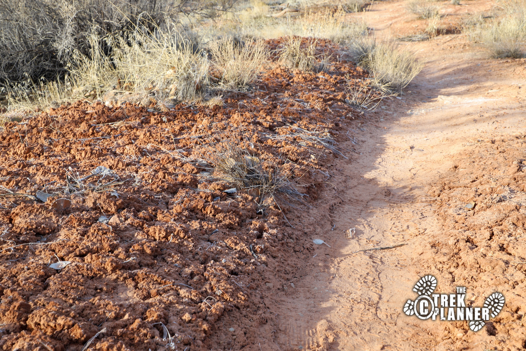
Eventually you will leave Courthouse Wash and you will follow another wash which will be a little easier to hike on since there won’t be trees and bushes in this one. Hike south in this wash for about 1300 ft until you come to some hard sandstone. This is where you will need to turn immediately west and hike on this large sandstone slab for about 650 ft. Be careful of the cryptobiotic soil here! Some hikers before me probably thought this was just mud, but it’s actually living organisms and must be avoided. It can take up to 10 years to grow cryptobiotic soil and one small step can ruin an entire decade of growth! If you want to be a good hiker, avoid stepping on the soil at all costs. Don’t create your own trail, but follow previous hikers steps or follow dry washes.
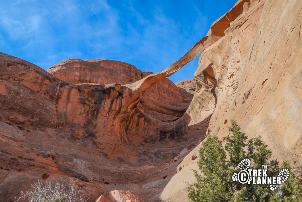
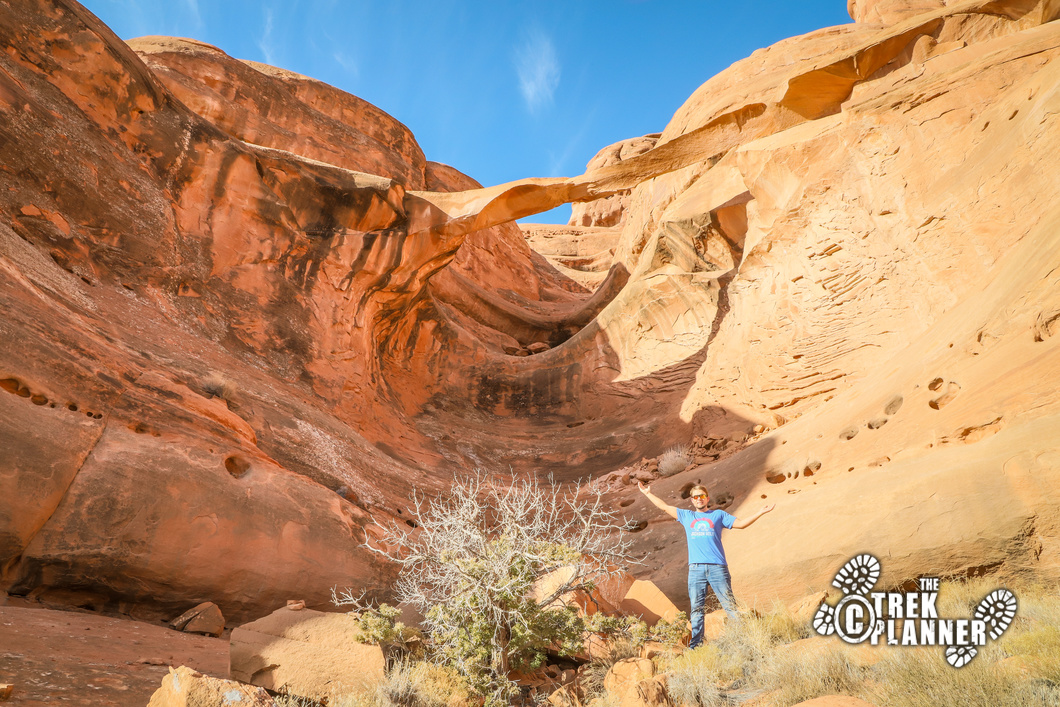
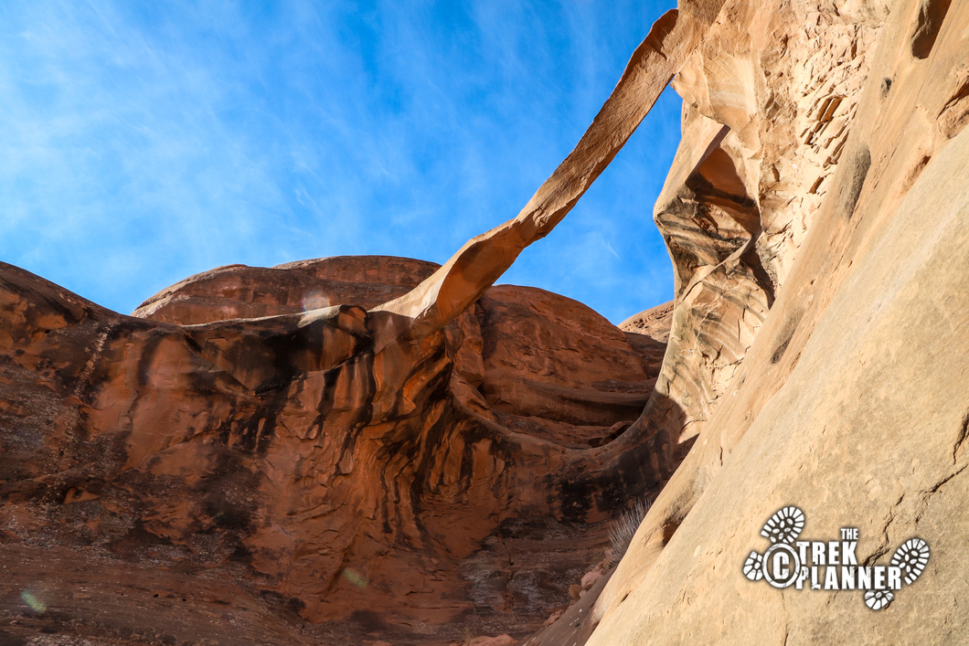
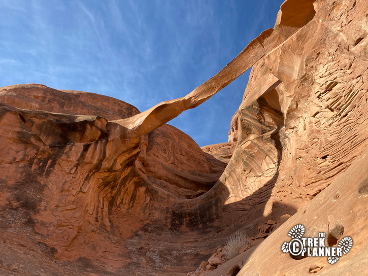
You can see the arch from this sandstone slab you are hiking on so just keep heading towards it!
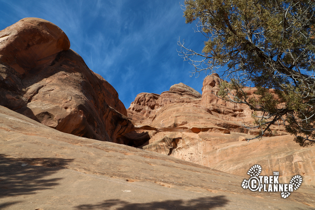
The arch is located in a steep area, but it is possible to get close to it! Ring Arch spans about 46 ft and is only about 2-3 ft thick! It had a partial collapse in 2014 and you can see the broken pieces below it. You can see “Roy H” inscribed on the rock from 1943.
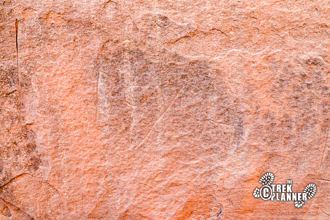
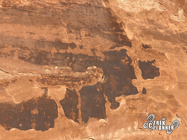
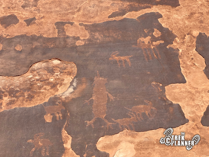
I found these petroglyphs on accident as I spent the next hour exploring the area. These appear to be very old and some are very faint. You can see some big horn sheep, other animals, and a figure with three toes and three fingers on its hands and feet! It’s really cool to see!
Trek Planner Insider Members have access to the GPS coordinate and also extra pictures of the petroglyphs!
GPS Coordinates are for Trek Planner Insiders Only!
This content is locked
(memberships are currently unavailable)

Personal Thoughts
Like I mentioned before, this adventure isn't for everyone. If you have been to Arches a million times and are looking to do something different then this is for you. If you want to skip the crowds and still see an incredible arch, then this is also for you. Either way, you will enjoy this fun adventure!


[…] 9. Ring Arch Hike […]
[…] Ring Arch (has some Insider Information) […]