
The Trek in a snapshot
Location
Brighton, Big Cottonwood Canyon, Utah
Managing Agency
National Forest Service
Pets
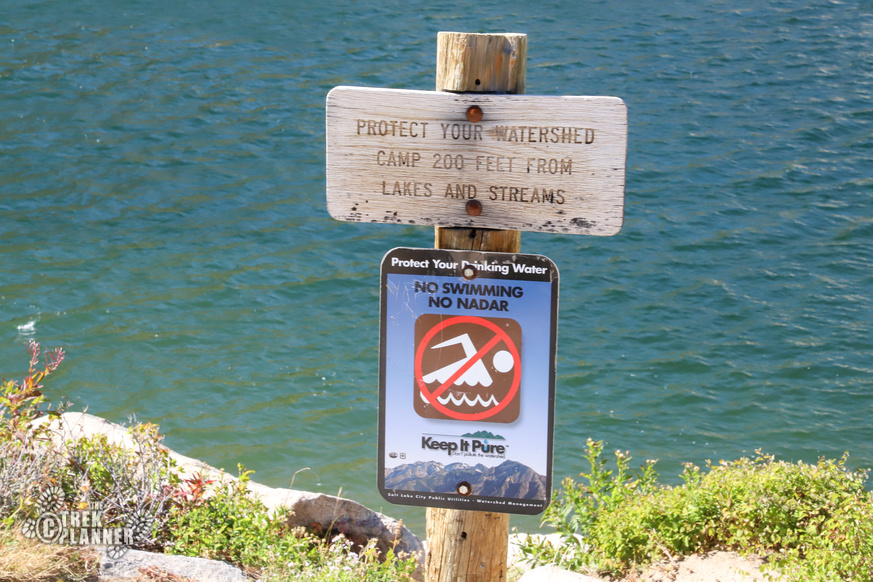
Not allowed Pets are not allowed in Big Cottonwood Canyon for watershed protection purposes
Fees
None
Restrooms
Yes at Silver Lake trailhead or at Brighton Ski Resort if it’s open
Camping
Yes. You are only allowed to camp if you camp 200 ft from any lake, stream, or creek
Trail Condition
Good dirt trail. Gains lots of elevation right at the start
Sights
Water Info
Bring 1-2 liters of water. Swimming is not allowed in any of the lakes.
Best Season
Late spring, summer, fall
Distance
2.2 miles roundtrip
Time Required
1-2 hours
Parking Elevation
8741 ft
Summit Elevation
9519 ft
Elevation Difference
778 ft

Trek Planner Maps
Trailhead: 40.59822, -111.58412
Lake Mary: 40.58929, -111.58839

Experience. Discover. Explore.
Follow along on our adventure then go out on your own!


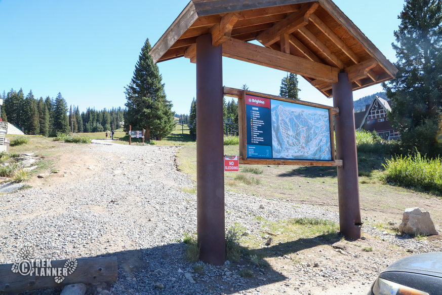
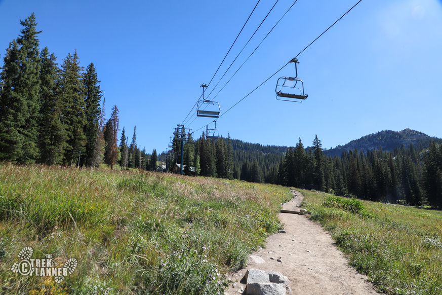
The trail begins at the Brighton Ski Resort. Just park anywhere in the giant parking area and hike up a hundred yards until you see the signs pointing you to Lake Catherine (which is the same trail to Lake Mary).
Lake Mary is the first of three lakes on this beautiful trail in Big Cottonwood Canyon near Salt Lake City. There are two other lakes beyond Lake Mary: Lake Martha and Lake Catherine. If you have time, you should visit these lakes too!
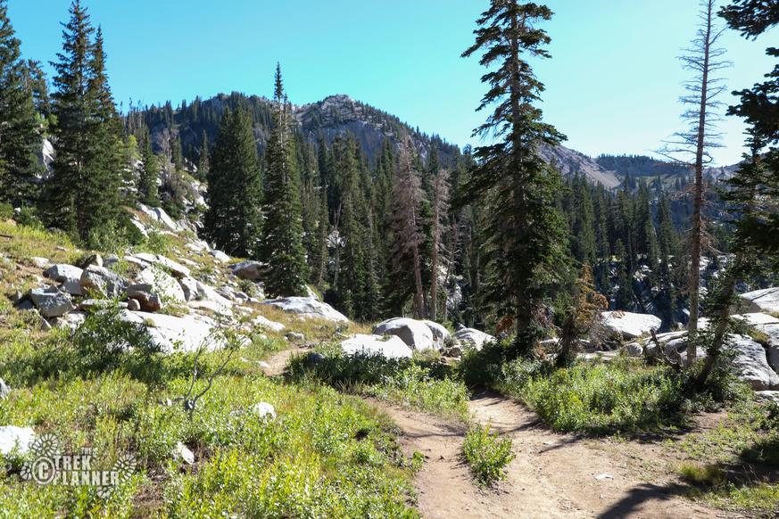
This popular trail travels on the Brighton Ski Resort for about 3/4 mile until it cuts west. There is a good trail to follow as you hike on the mountain meadows and in between patches of pine trees and aspen trees. This part is where you will gain about 700 ft in elevation until you come to Lake Mary.
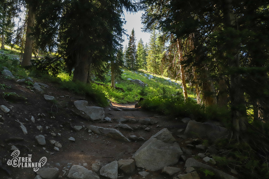
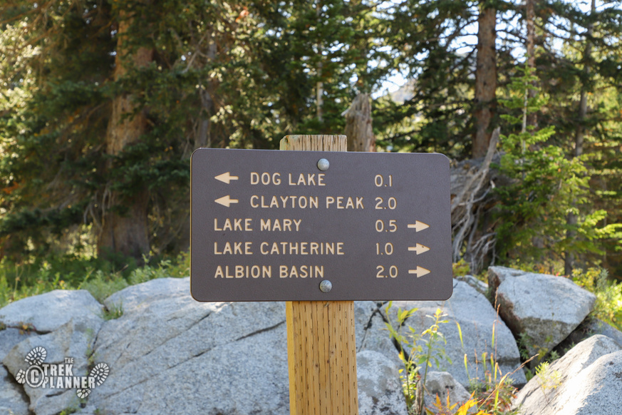
Once you hike the roughly 3/4 mile you will go inside a pine forest and will probably hear a waterfall in the distance. Hike another hundred yards or so and you will come to a junction sign that points you to Dog Lake or to Lake Catherine. Take the right trail to Lake Mary. It’s only about 1/2 mile more.
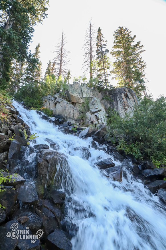
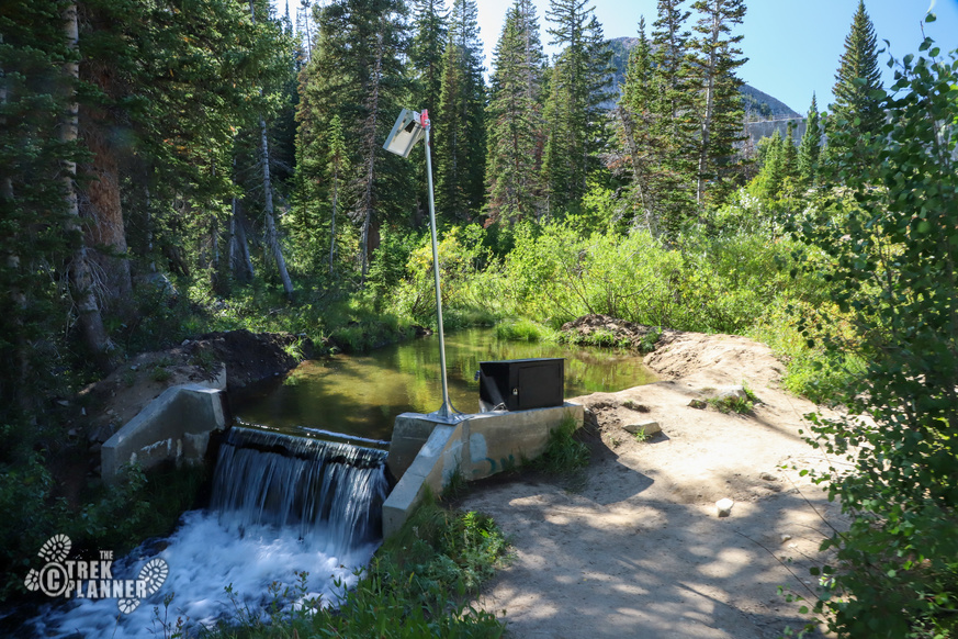
You will cross over a small bridge and if you want to see the top of the waterfall follow the creek down a little ways and you will see it. It’s very steep here so please be careful of the slippery edges.
Go back to the bridge and continue on the trail.
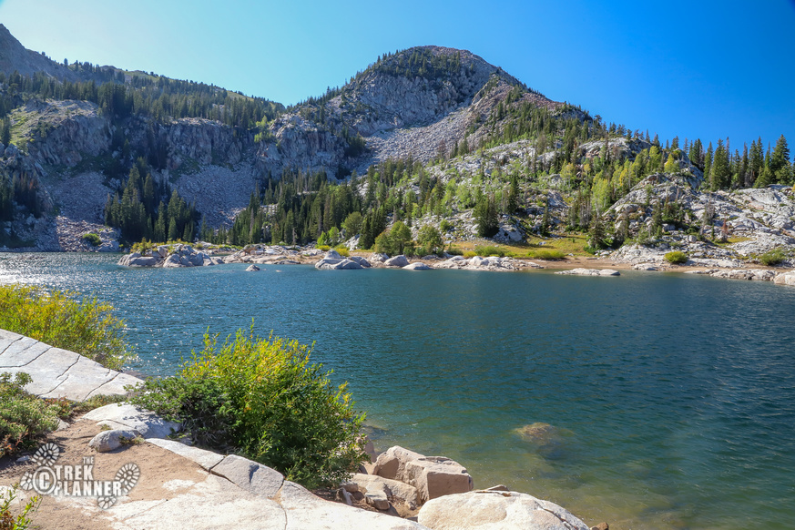
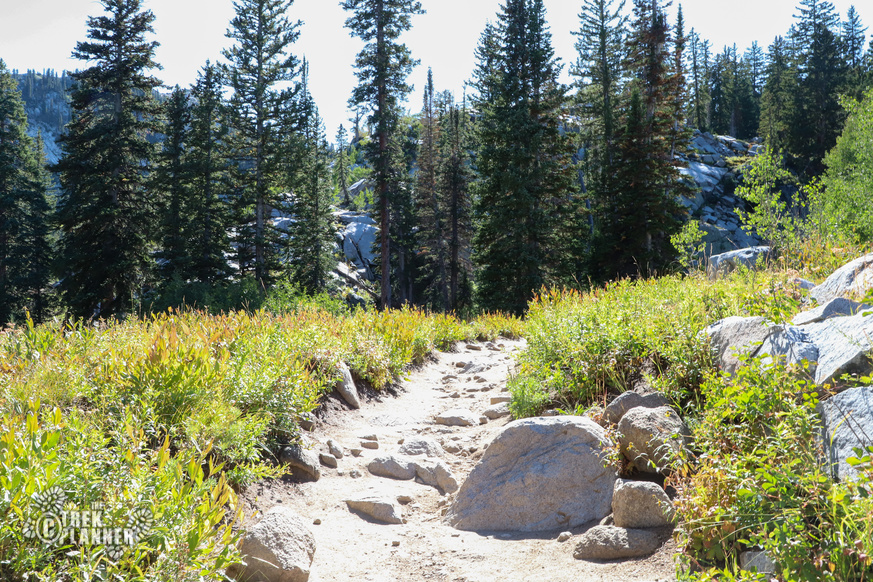
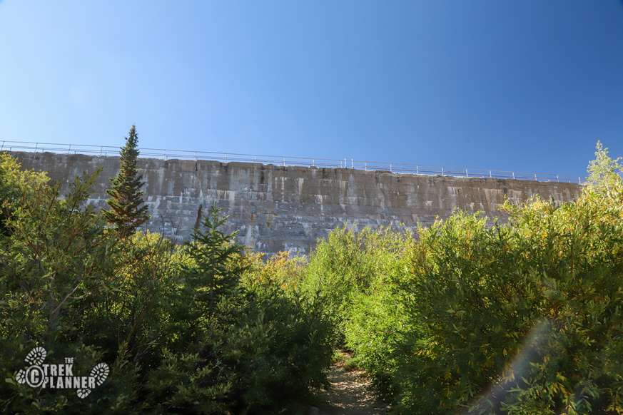
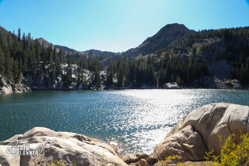
The trail will hug close to the creek and you will eventually see the dam to Lake Mary in the distance. Hike up the south side of the dam until you come to the top of it where Lake Mary will be in view.
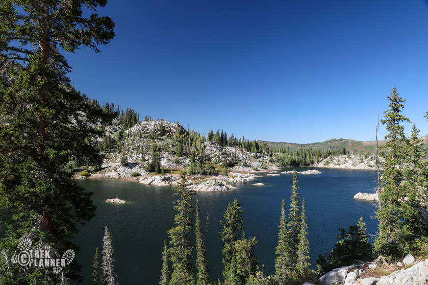
Lake Mary is the largest of the the two lakes on this hike. The lake is surrounded by granite rocks and pine trees! Mt. Millicent is directly the west of Lake Mary. If you look to your south west you will see Mt. Wolverine.
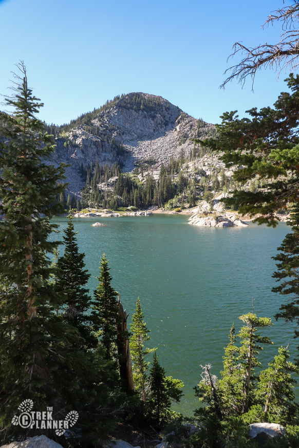
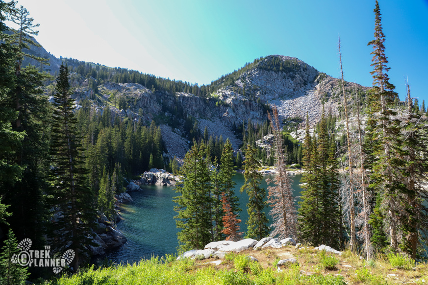
To get some better views of the Lake Mary continue hiking on the trail that goes to the east of the lake.
Lake Mary is a great adventure for the whole family. During my visit I saw a few families and their kids were trying to skip rocks on the lake. I am typically a solo hiker and found lots of other solo hikers too! So even if you just want to visit on your own this is a great hike!

Personal Thoughts
Hiking to Lake Mary is pretty easy and can easily be extended by continuing on the trail to Lake Martha or even Lake Catherine.


[…] get into the pine forest it gets immensely better! There are three other lakes beyond Dog Lake: Lake Mary, Lake Martha and Lake Catherine. If you have time, you should visit these lakes […]