
The Trek in a snapshot
Location
Grand Staircase-Escalante National Monument, Utah
Managing Agency
National Park Service
Pets
Allowed on leash
Fees
None
Restrooms
None
Camping
Allowed by permit only. Obtain through the BLM.
Trail Condition
The trail is easy to follow. It is mostly sand and dirt with several mandatory shallow river crossings.
Sights
Escalante Natural Bridge, Escalante River, wildlife
Water Info
Bring 2-3 liters of water
Best Season
Spring, fall, winter. Summer is ok, but can be very hot
Distance
3.4 miles roundtrip
Time Required
2-3 hours
Parking Elevation
5200 ft
Summit Elevation
5274 ft
Elevation Difference
74 ft

Trek Planner Maps
Parking and Trailhead: 37.77576, -111.41969
First River Crossing: 37.77508, -111.41972
Second River Crossing: 37.77366, -111.43228
Third River Crossing: 37.77295, -111.43737
Fourth River Crossing: 37.77478, -111.43935
Fifth River Crossing: 37.77307, -111.44421
Escalante Natural Bridge: 37.77252, -111.44431

Experience. Discover. Explore.
Follow along on our adventure then go out on your own!


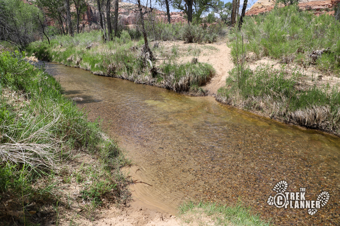
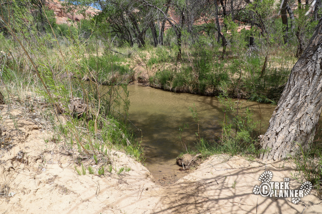
Hiking to the Escalante Natural Bridge requires crossing the shallow and narrow Escalante River 5 times. Make sure you bring shoes that can get wet or shoes you can change each time you cross the river.
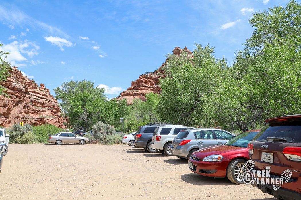
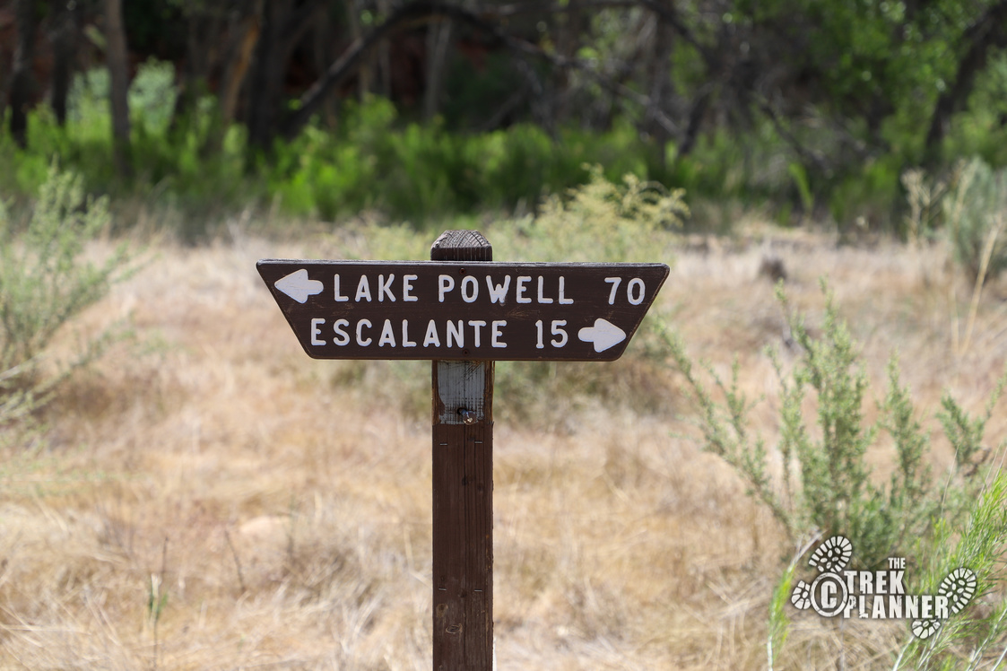
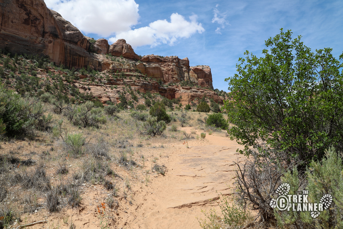
The trail begins at the Escalante River Trailhead. Make sure you lock up your belongings before you head out. Right out of the parking lot you will see a sign that points you left to Lake Powell (70 miles away) or right to the town of Escalante (15 miles away). Head right!
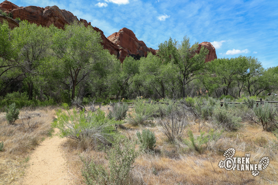
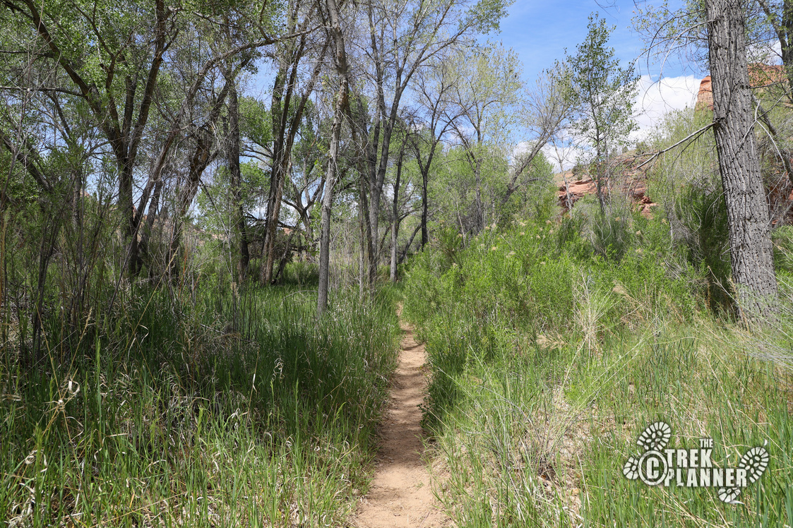
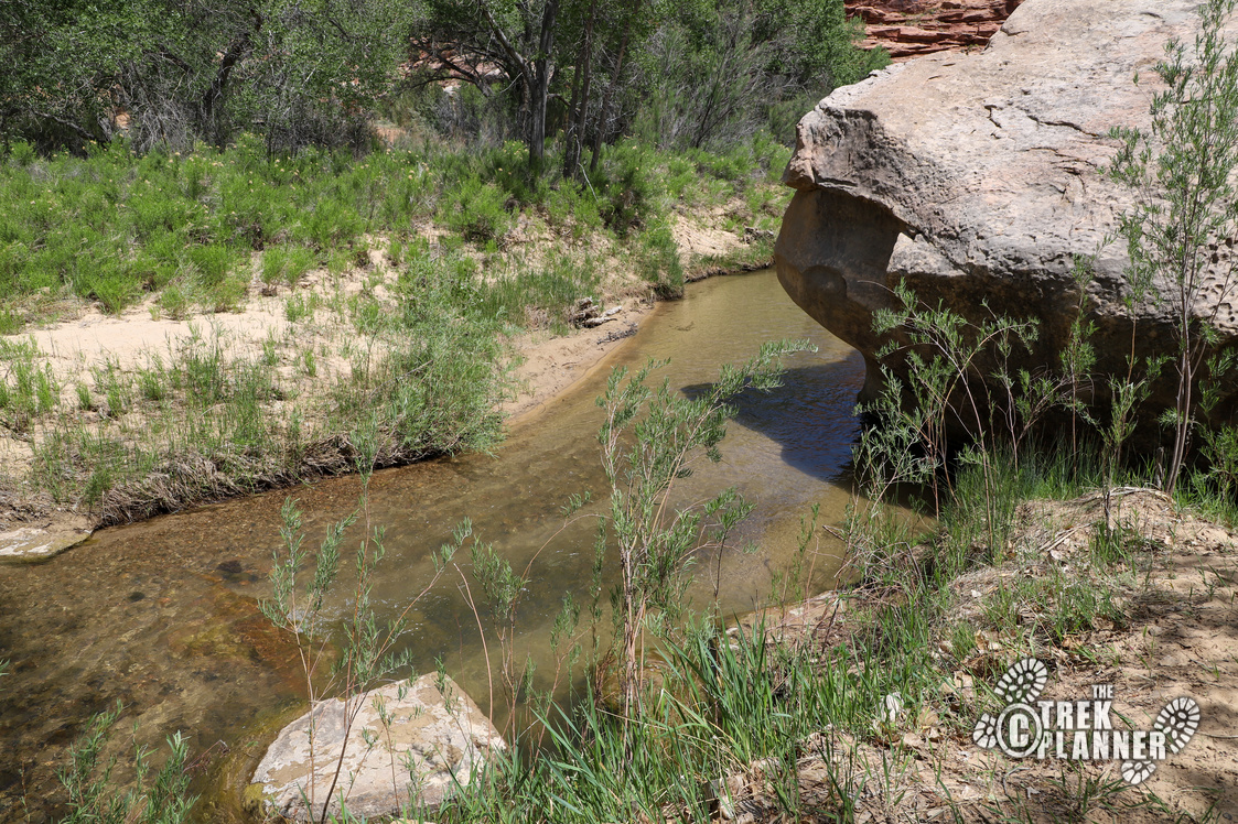
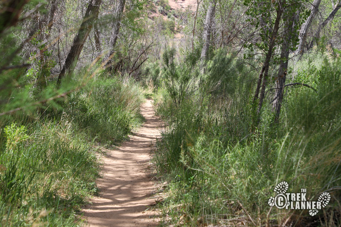
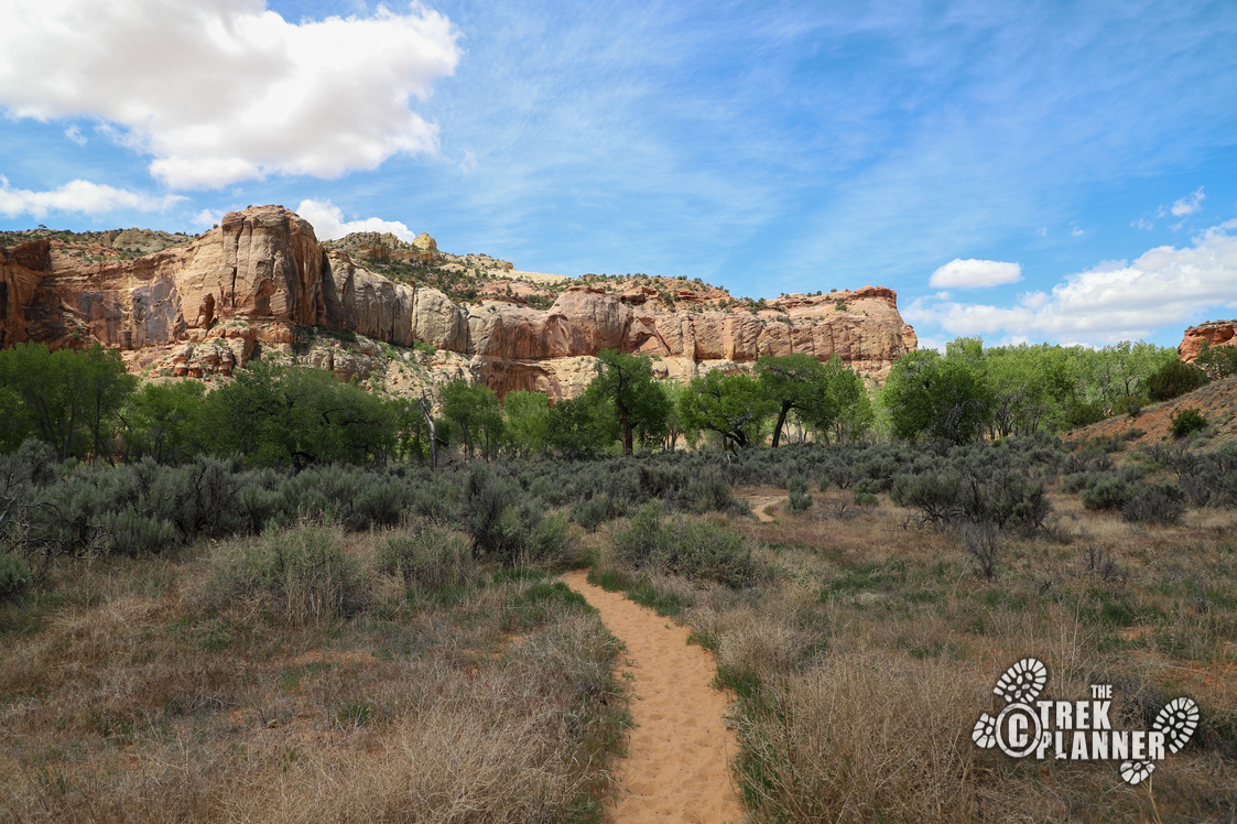
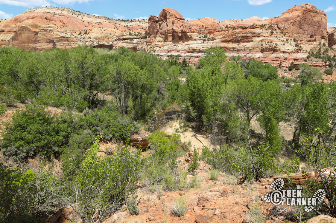
The trail to the natural bridge is relatively flat the entire way. You will be hiking in and out of tall cottonwoods and also open desert areas, but there is plenty of shade on this hike to keep you cool. You will also have plenty of opportunities to take a dip on the river or splash water on your face as you make your way to the bridge. The river isn’t too deep, in fact it was mostly knee deep or shallower in most places. That being said, just make sure to watch for weather conditions because this river does flood from time to time!
The first river crossing is within a few minutes from the trailhead. So if you brought to pairs of shoes to change out of, I would just start in the shoes you will be walking through the river.
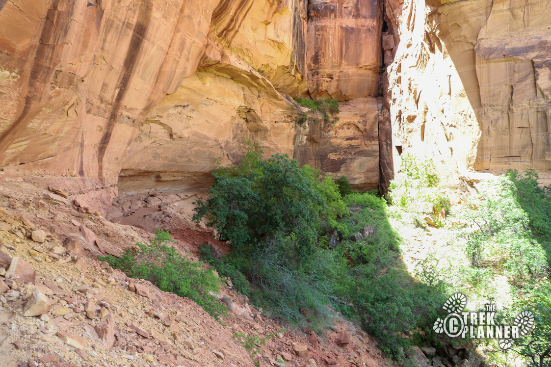
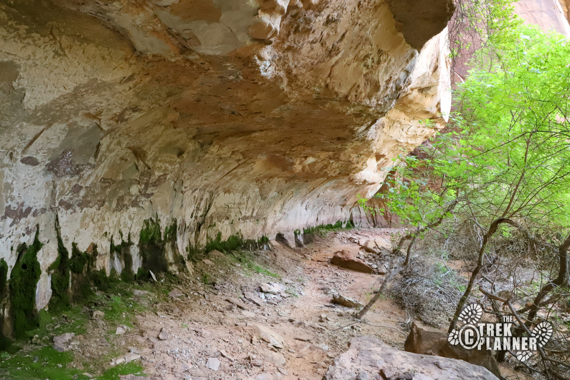
After you cross over the river, you will now be walking among trees and bushes. There is lots of shade on this hike, but there are some areas with just short sage brush that can be scorching hot in summer months.
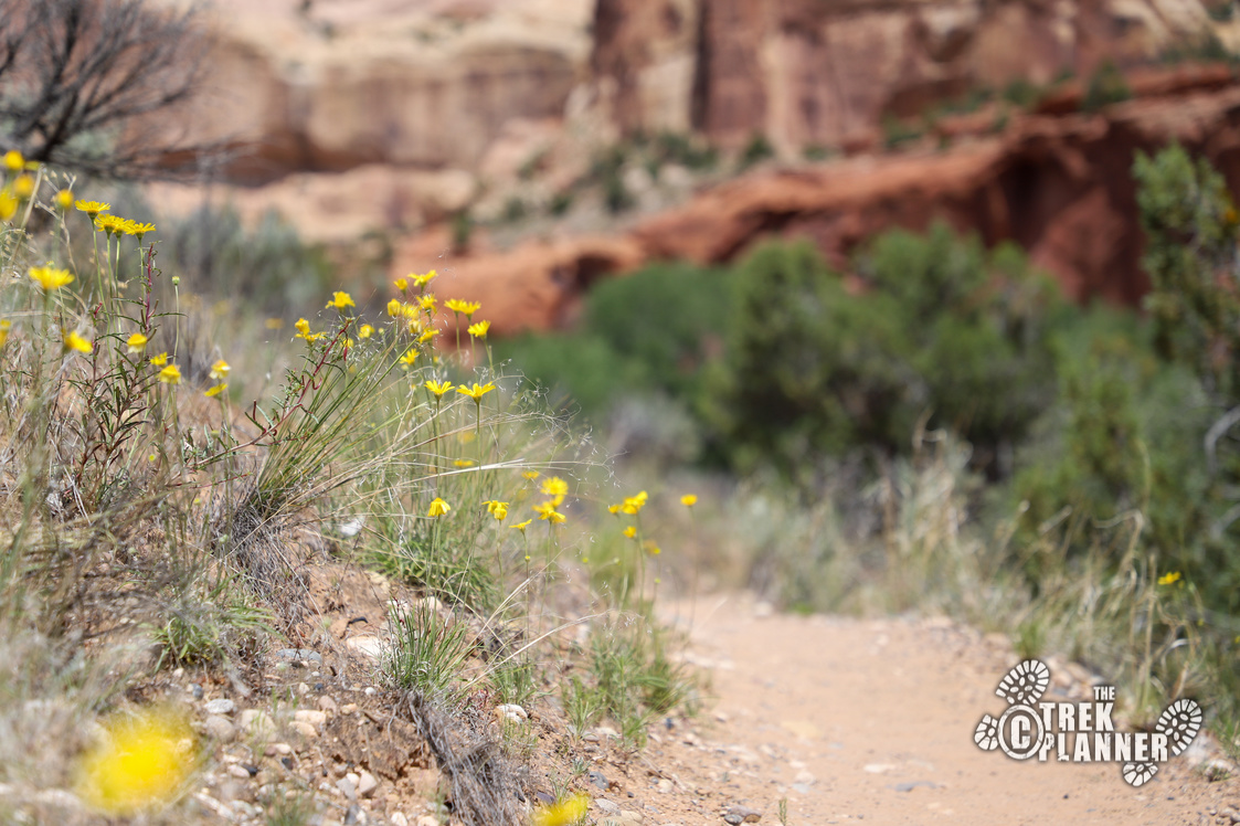
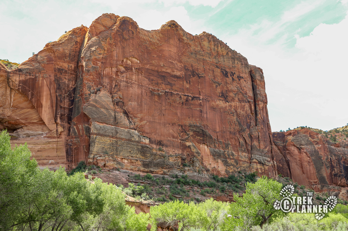
This hike is beautiful and I was constantly scanning the cliffs for granaries or hawk nests or anything!
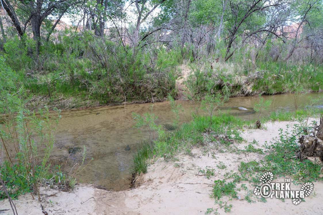
The next river crossing was also a shallow one and I washed my face in it. At most river crossings, I saw a few families with kids playing in the water and trying to see the small fish.
The third river crossing is a few hundred yards from the second crossing and the fourth is even closer! Right after the third river crossing, leave your wet shoes on until you cross over the fourth, then change into your dry shoes if you have them. The cold water felt amazing with the air temperatures in the high 90s!
Third river Crossing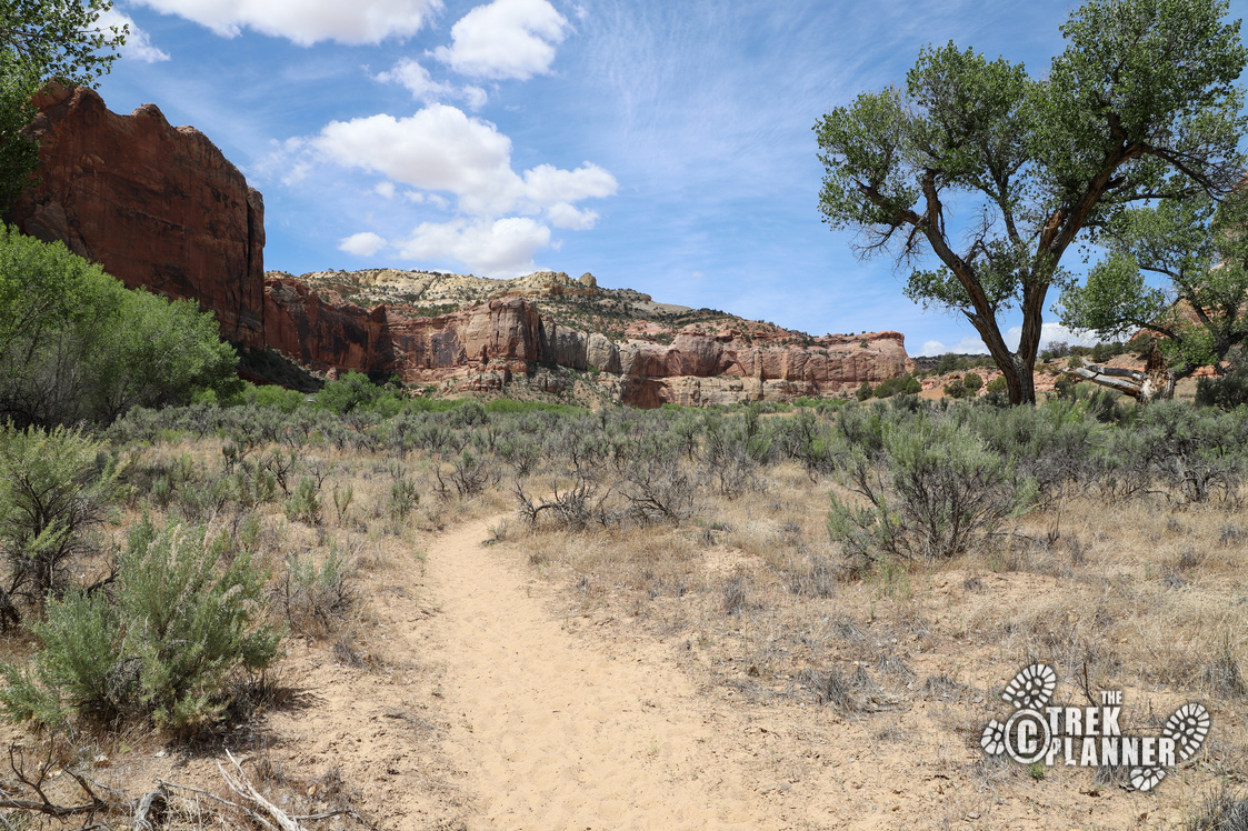
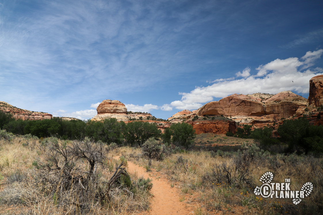
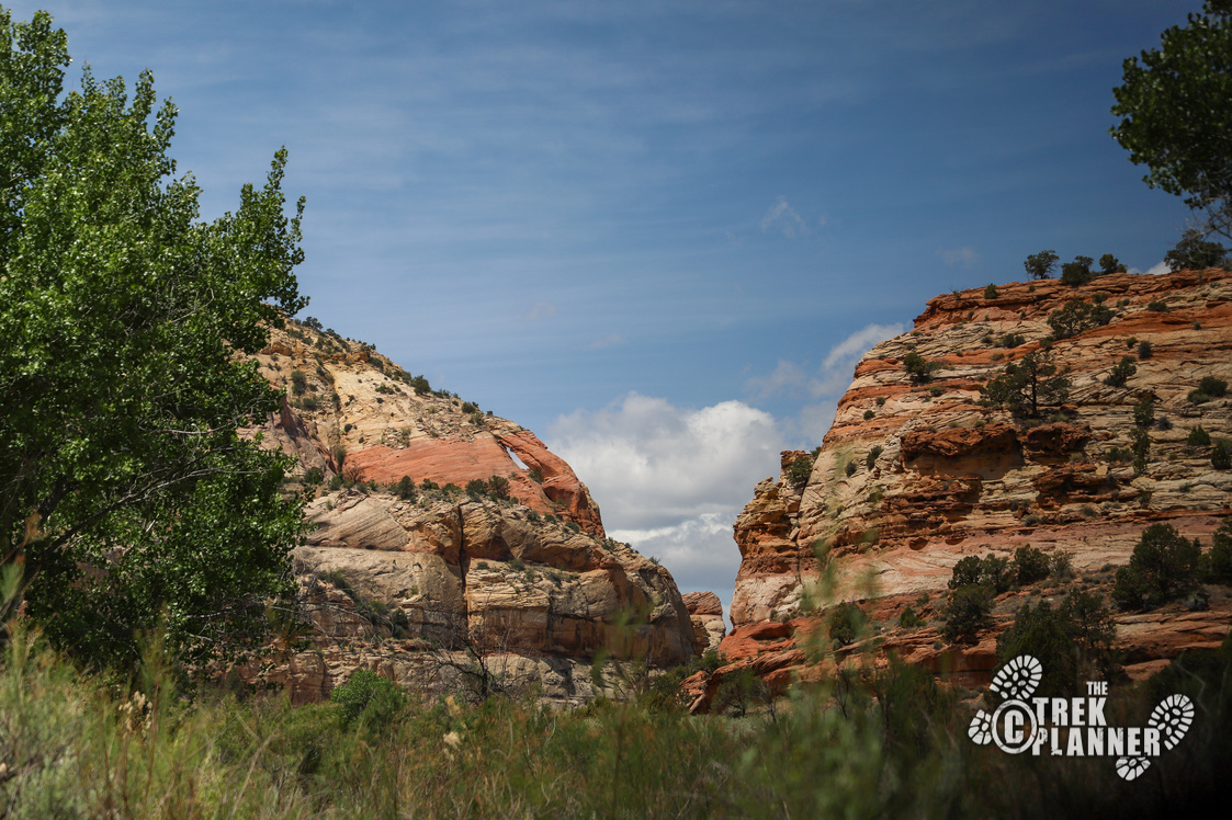
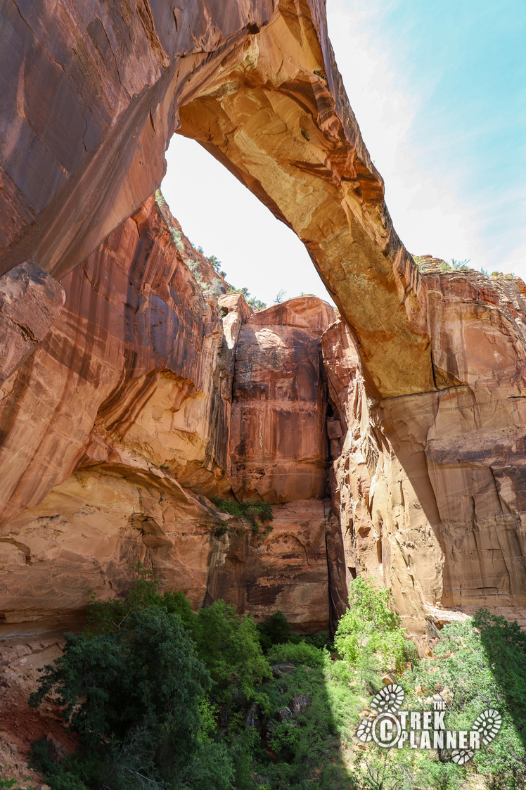
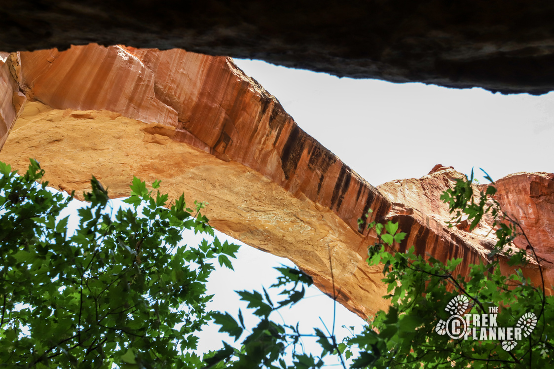
After the fourth crossing and round the corner, take a look to the south along the cliff walls, you may be able to see Escalante Natural Bridge already.
4th river crossing 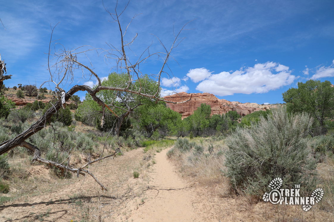
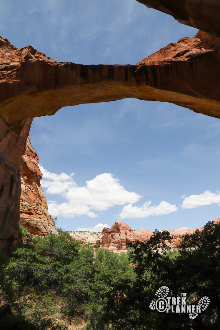
The trail then kind of heads south west until you come to the Escalante River for the 5th time. Before you head to the arch, take a look directly west to see another natural arch. You won’t be going this far though.
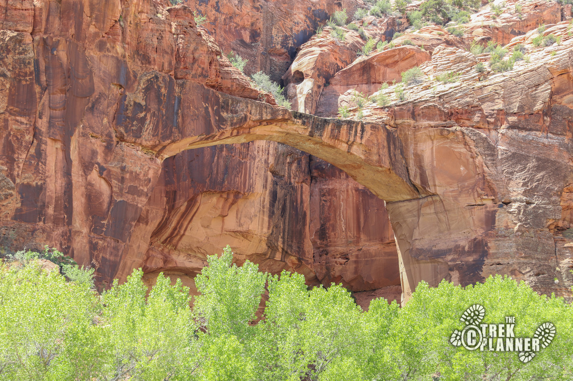
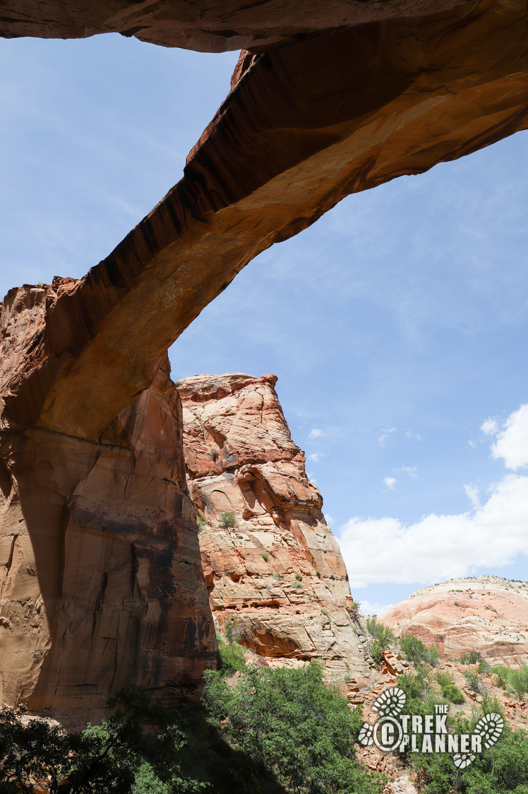
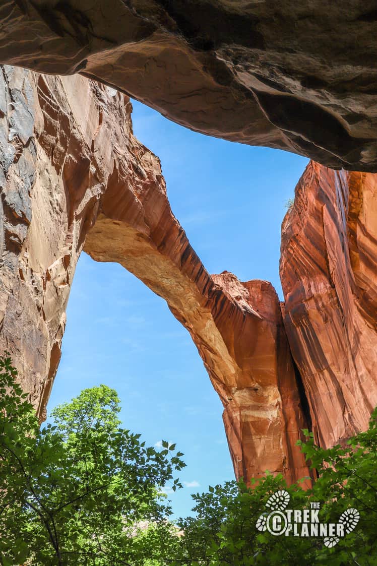
At the last river crossing I saw about five different groups with children taking advantage of the river. Look directly ahead and above to see the bridge. The bridge is about 125 ft. in length and about the same feet in height. I hiked right underneath it to eat my lunch in the shade.
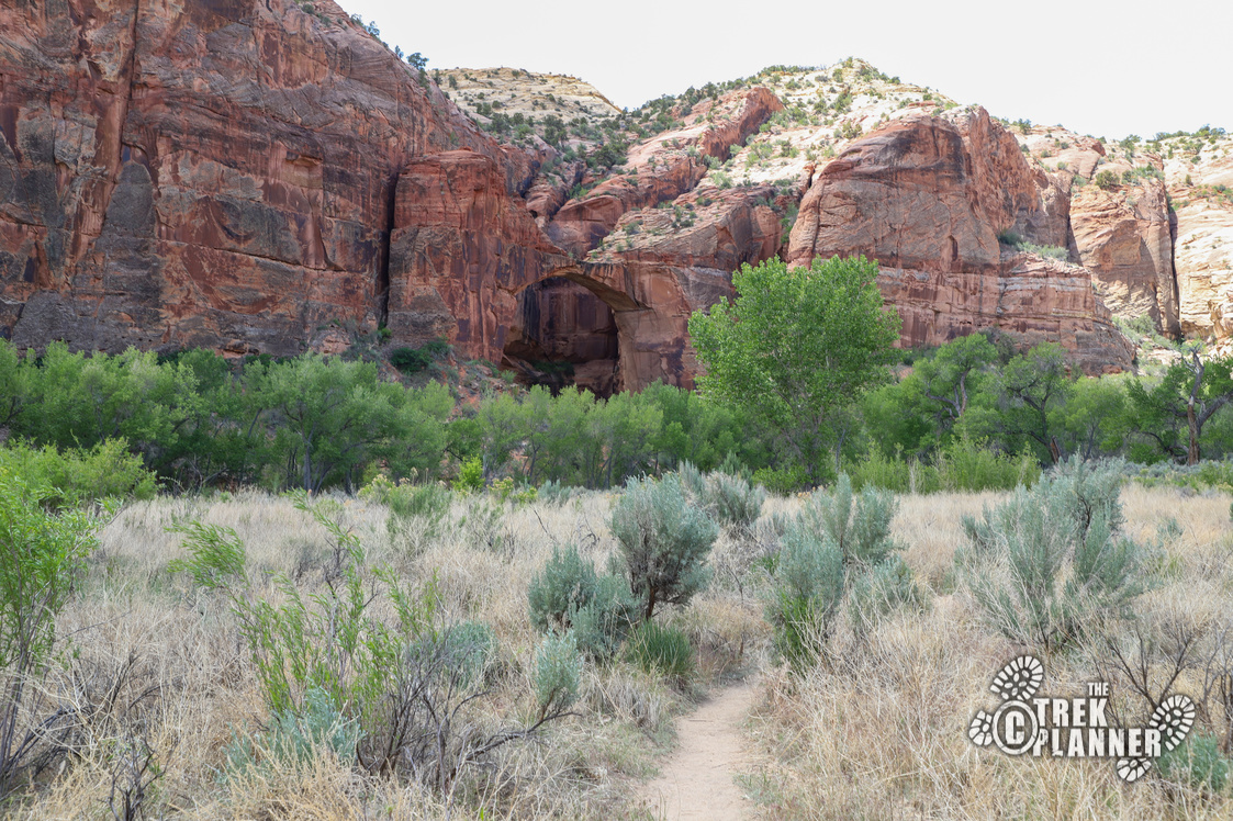
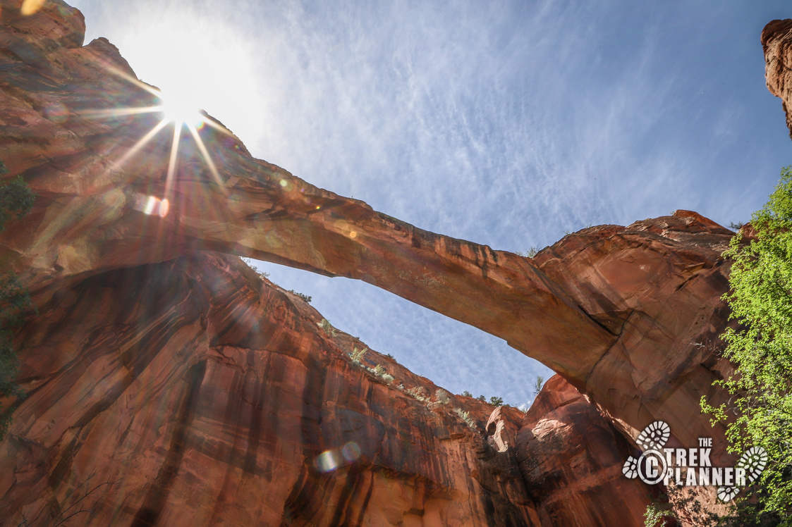
The sandstone bridge was carved by thousands and thousands of years of wind and water erosion.
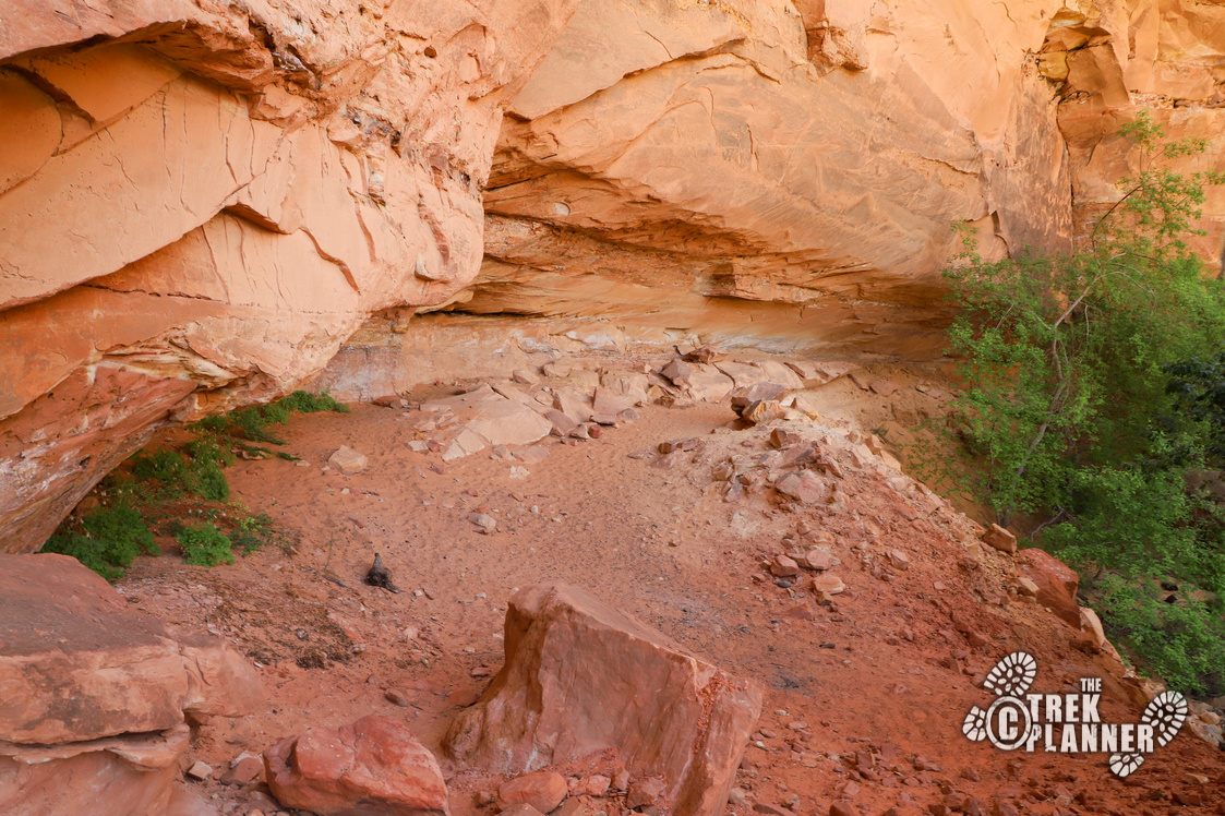
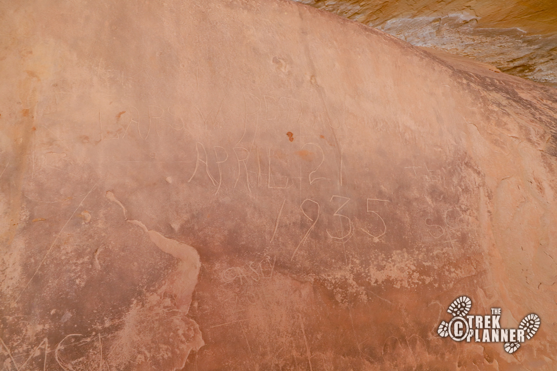
Take a look around and it seems like some ancient peoples may have lived in this area. There wasn’t any evidence of my theory, but there are enough flat areas that make it seem like people could have lived here or built some granaries or storage areas.
Personal Thoughts
Hiking this trail to Escalante Natural Bridge was a highlight for my trip to Grand Staircase-Escalante National Monument! I loved the many river crossings and seeing the massive bridge at the end was very neat to see too. Most people are hiking Lower Calf Creek Falls, so skip the crowds and hike to this natural bridge instead! What some people do is just hike to the river and spend time playing in it and then head out. What I did when I hiked Lower Calf Creek Falls in 2019 was after I finished the hike, I came to the Escalante River and washed off all the dirt and sweat! If you want to extend your visit, get back on the trail and hike west a little ways. There is some rock art at the base of the cliffs. I haven't been there, but I know it's somewhere around there.


