
This content is locked
(memberships are currently unavailable)
Trailhead: 38.53283, -109.60879
This content is locked
(memberships are currently unavailable)
This was a quick stop that showed some amazing historical points of interest! If you have an hour of time and want to see some great things stop here for a visit!


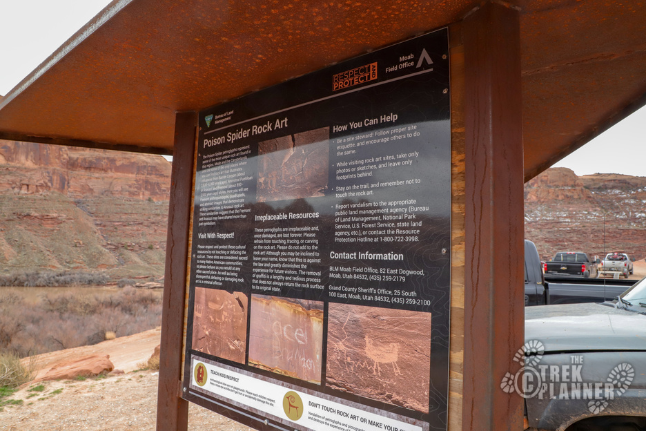
Note: due to the wave of increased petroglyph vandalism, we will keep the Trail Map and GPS Coordinates to the dinosaur tracks and petroglyphs private.
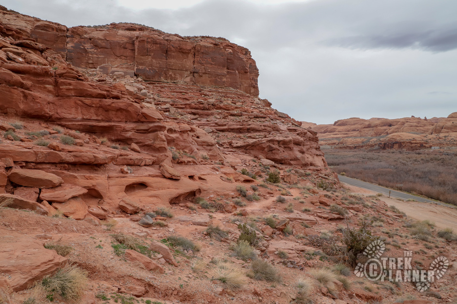
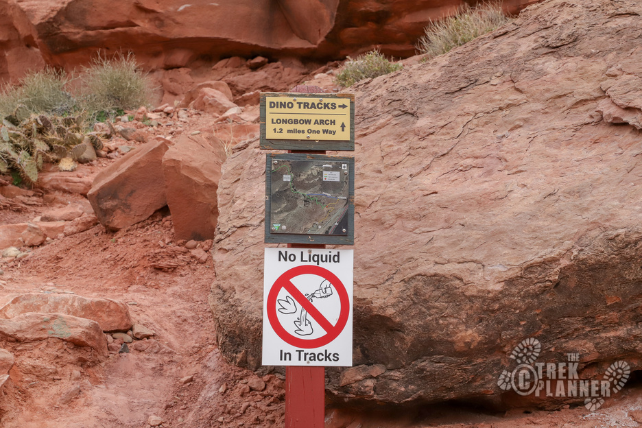
Seeing the dinosaur tracks and petroglyphs won’t take more than a half hour if you are pressed for time. You can actually see the dinosaur tracks from the north side of the Poison Spider Mesa parking lot.
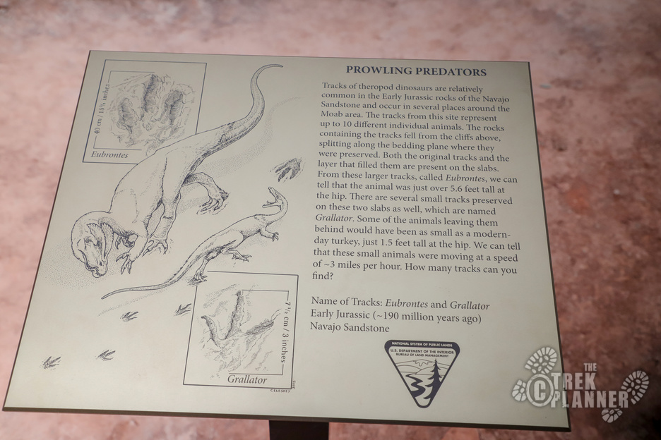
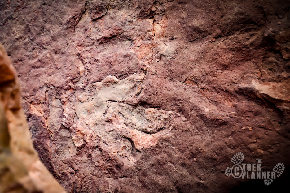
It is clear that people have known about these dinosaur tracks for a long time. They have been scraped and scratched and it seems like plaster was put in them to make molds of the tracks. They really are incredible to see but since these are so accessible they have seen better days.
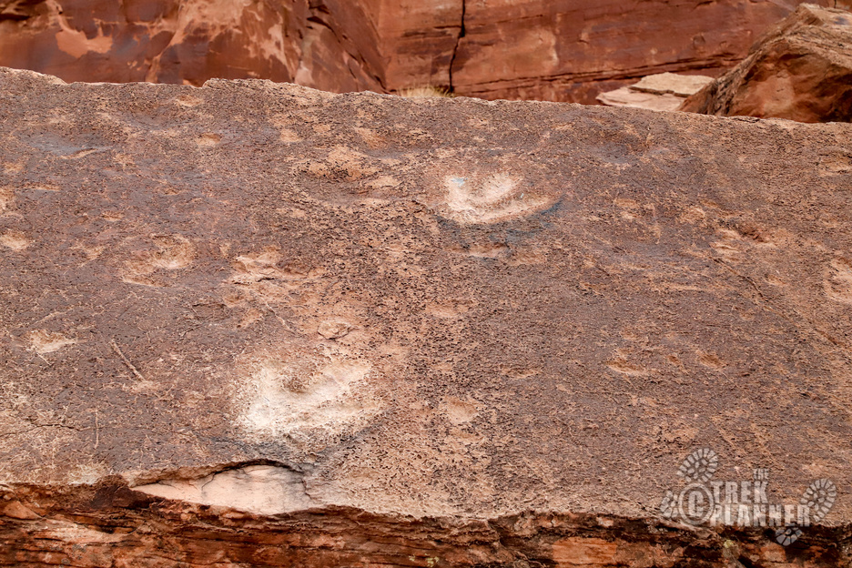
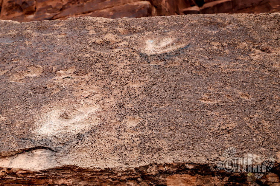
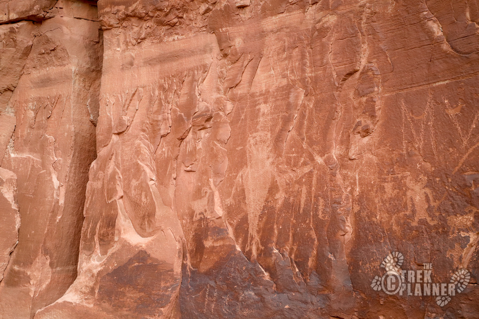
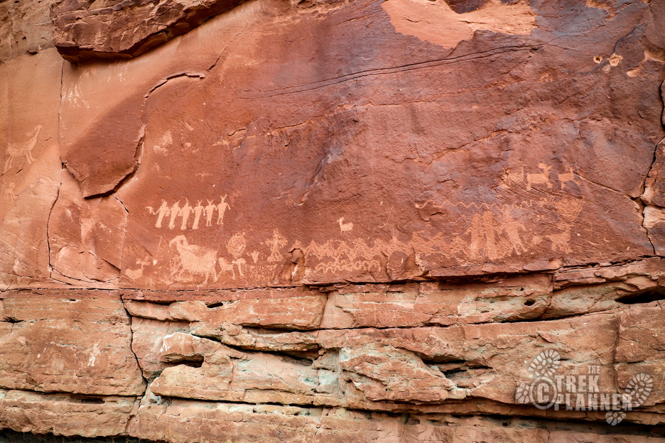
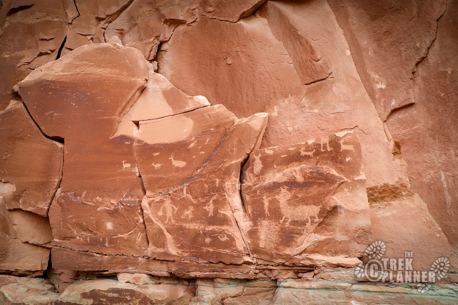
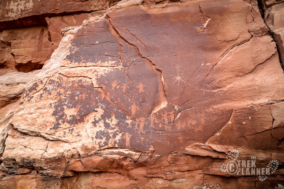
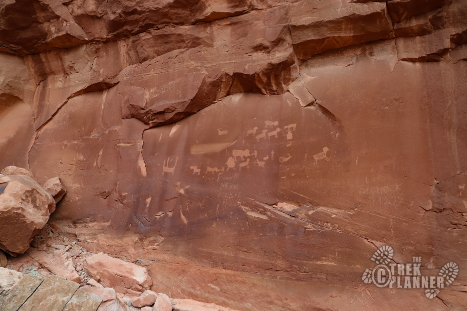
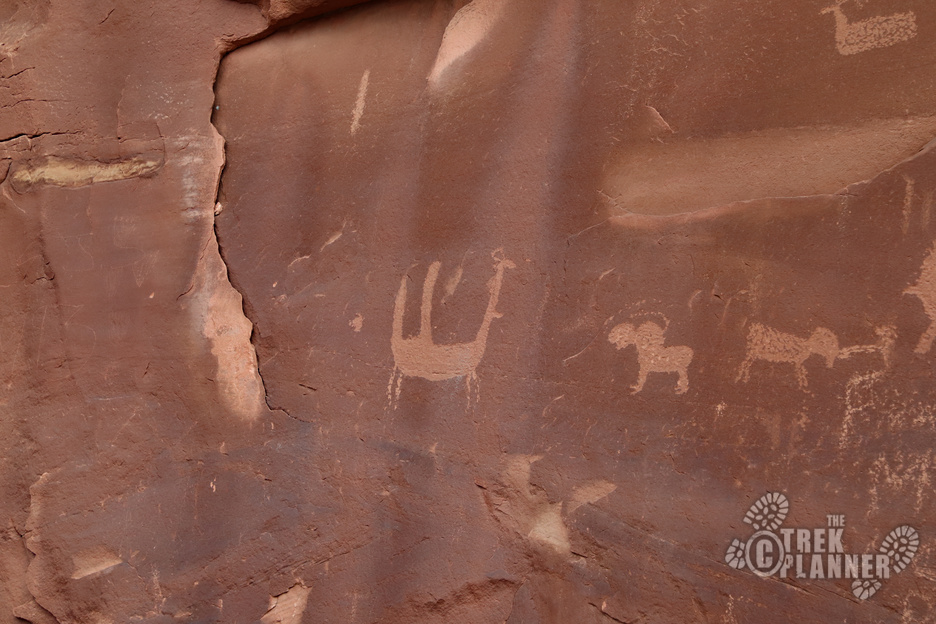
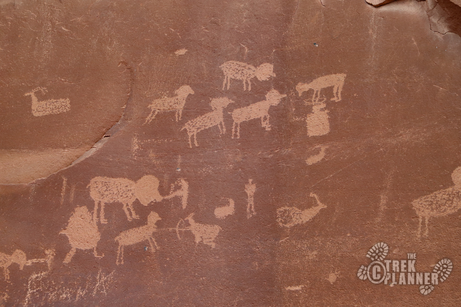
The trail continues up the base of the cliffs where petroglyphs and more dinosaur tracks can be seen.
The petroglyphs are similar in style to many others along the Colorado River near Moab.
The trail loops around back to the trailhead


[…] Full Trek […]