
The Trek in a snapshot

Trek Planner Maps
Turn to Hell’s Backbone (from Boulder, UT): 37.88833, -111.45813
Hell’s Backbone Bridge: 37.97074, -111.59941

Experience. Discover. Explore.
Follow along on our adventure then go out on your own!


Note: This Trek only takes you from the city of Boulder to Hell’s Backbone. You can drive all the way to Escalante on this road. The road may be impassible in winter/snowy months.
You will have no problem getting to Hell’s Backbone in a sedan, truck, or ATV. There were some washboard areas and if it had just recently rained it could make the drive interesting as it’s mostly on a dirt road. That being said, this is a beautiful drive and one you should do if you find yourself in the Grand Staircase-Escalante National Monument area. The communities of Boulder and Escalante are literally in the middle of nowhere and very isolated. I quite like the feel of both of these towns and there are some great places to visit and restaurants to eat at while you’re here.
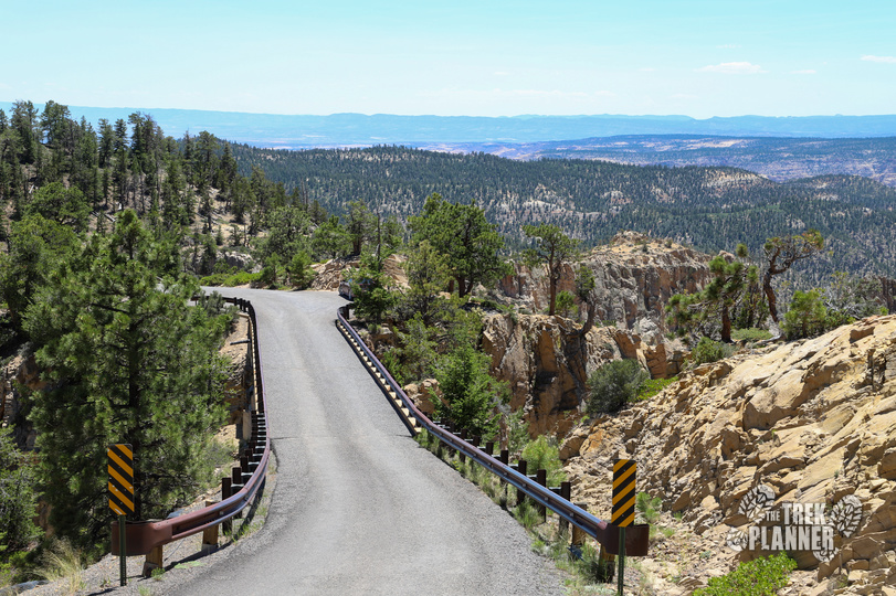
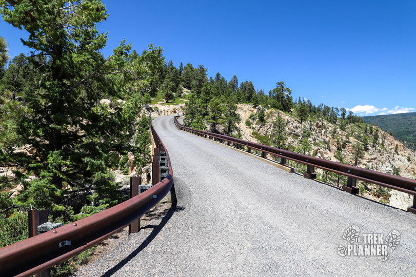
From downtown Boulder it’s just under 18 miles one way to Hell’s Backbone. There are many pull-outs and scenic views along the way, but there are no outhouses, shops, gas stations, or other services on this route. All the services are in Boulder or Escalante so make sure you fuel up and grab some water and snacks before departing. The begins from Boulder, goes over Hell’s Backbone, and then continues on to the the town of Escalante. I did this as a round trip road from Boulder so I can’t say anything about the road continuing on to Escalante for a total of 38 miles.

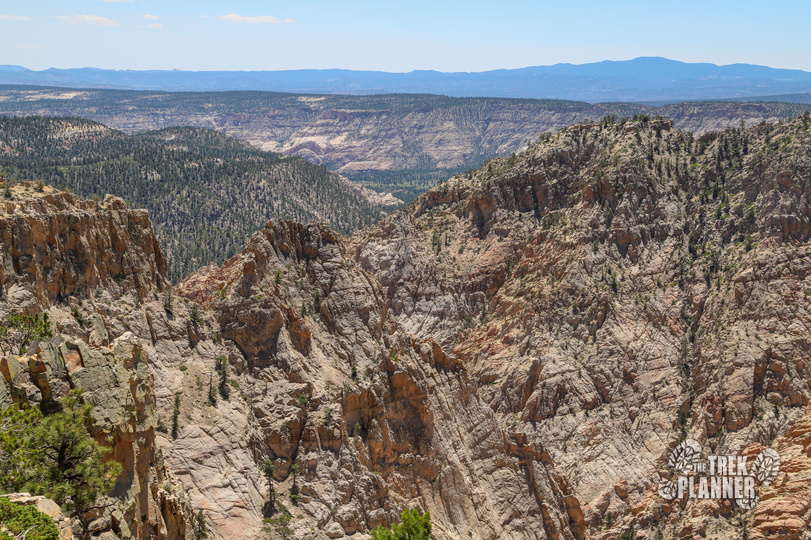
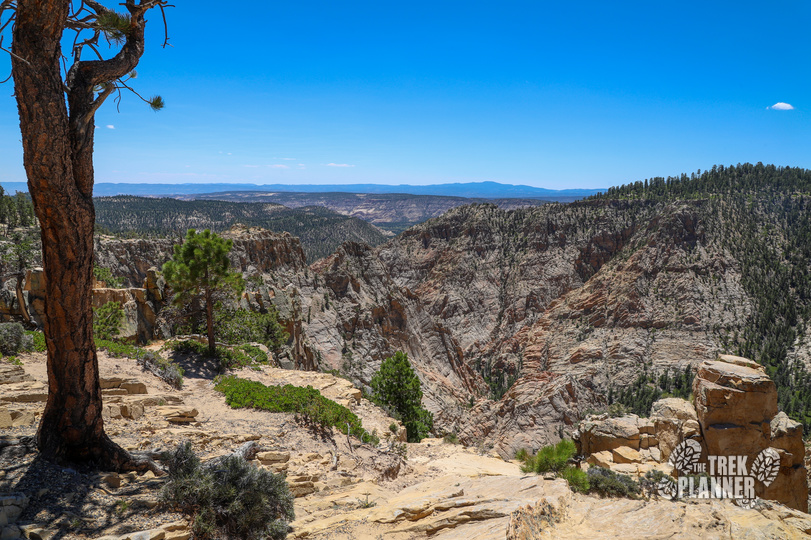
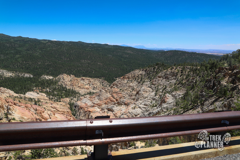
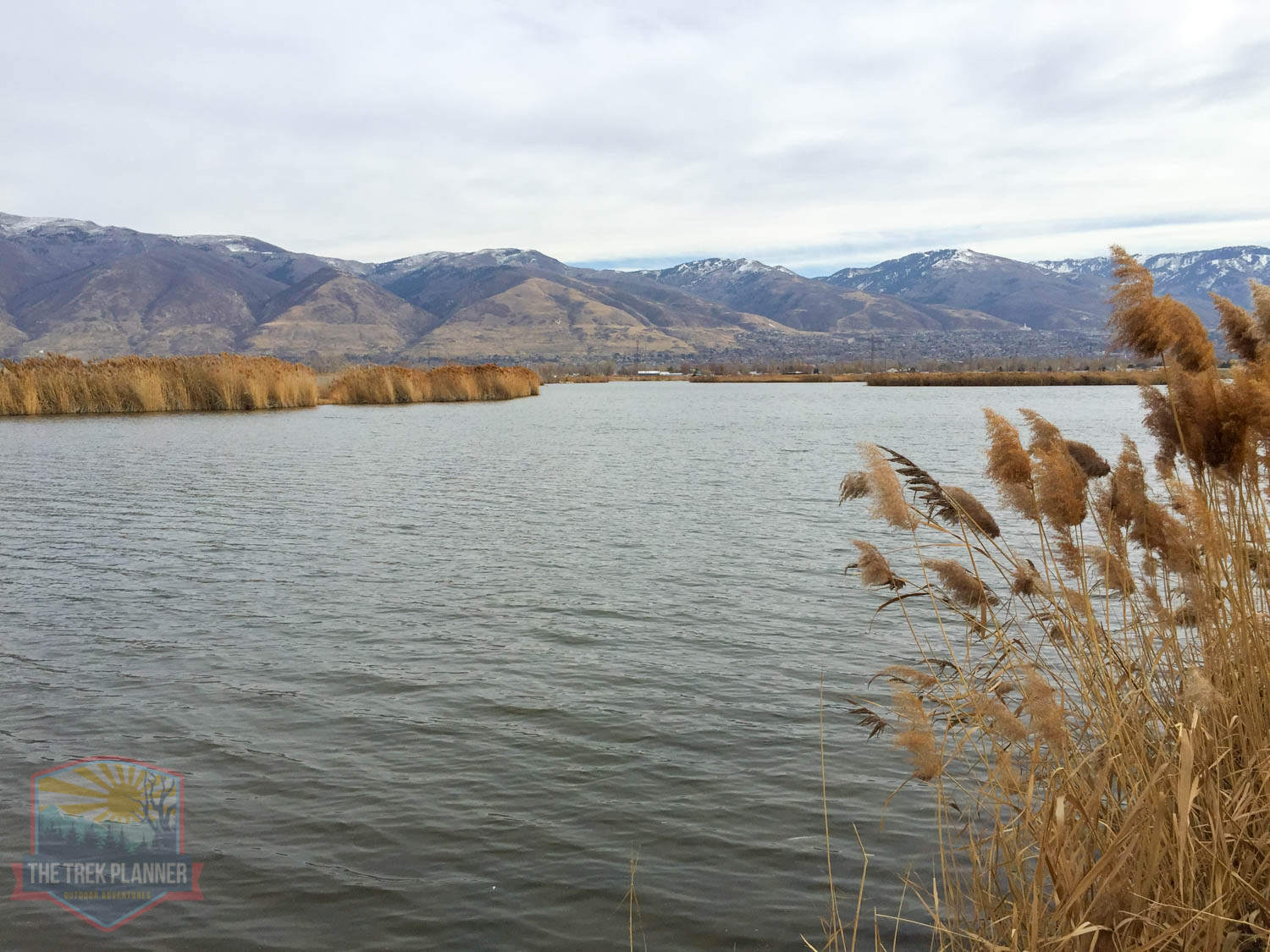
You will pass through sandstone and densely forested areas with pines and aspen trees as you travel through Dixie National Forest. You will cross by a few meadows and creeks that make for great rest stops too!
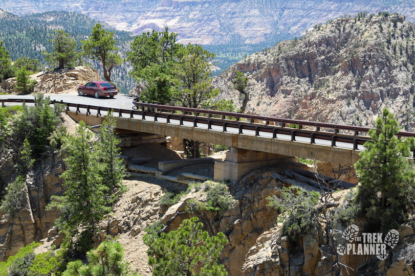
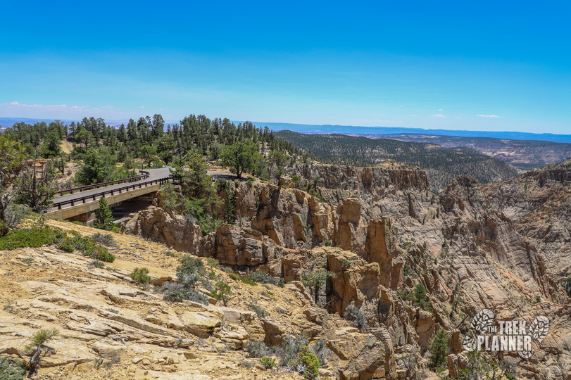
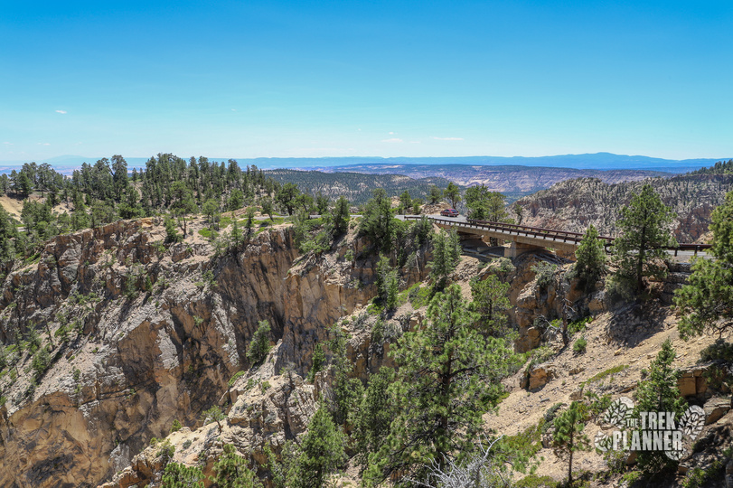
The original road was built by none other than the CCC (Civil Conservation Corps) in the early 1930s. Back then, it was the only road that connected the towns of Boulder and Escalante so it was a very important road – now it’s a scenic route. The road is winding and narrow in at times and will eventually meet up with the bridge. The bridge was also built by the CCC and is about 110 ft long and only 14 ft wide! It’s located on a narrow jagged spine of rock and you can see why this is called Hell’s Backbone! On either side of the bridge is 1500 ft drops into the unforgiving landscape of Box-Death Hollow Wilderness. If you drop your camera or hat it will most likely be eaten up and forgotten forever.

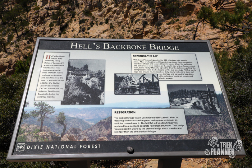
There is a small parking area on the south side of the bridge. The north side has a small parking area but it’s a few hundred yards past the bridge. There is a small information sign at the bridge, here is what is says:
Hell’s Backbone Bridge, aptly named by Henry Backer of Boulder, UT, spans this precarious backbone of rock that separates the head of Death Hollow drainage to the west and Sand Creek to the east. It was built in 1933s by the Civil Conservation Corps (CCC) to shorten the trip between Boulder and Escalante during summer months.
Spanning The Gap
With typical Yankee ingenuity, the CCC felled two tall, straight pines. After leveling them off topside they placed them across this backbone of rock and secured them in place. When the bulldozer and compressor were needed on the south side of the chasm, a local man, Lorrel “Sixty” McInelly, agreed to drive the bulldozer, pulling the compressor across the backbone on the two pine logs. With a safety rope tied around his mid-section, Sixty slowly inched the dozer out onto the logs and across the backbone while onlookers held their breath and silently prayed.
Restoration
The original bridge was in use until the 1960’s, when its decaying timbers started to groan and squeak ominously as vehicles crossed over it. The faithful old wooden bridge was replaced by a steel and concrete-reinforced structure. That bridge was replaced in 2005 by the present bridge which is wider and stronger than the previous bridges.


Personal Thoughts
This is a fun adventure that takes you out into the wilderness to see even more incredible locations in Southern Utah! I highly recommend visiting Hell's Backbone!
[…] off for the Hells Backbone. This is a gravel road to an amazing viewpoint with bridge. I found this website to be interesting on the history of the bridge and details on the drive. We also stopped at Posey […]