
The Trek in a snapshot

Trek Planner Maps
Trailhead: 40° 59.723’N, 111° 53.137’W
Indian Princess Grave: 41° 0.172’N, 111° 53.265’W

Experience. Discover. Explore.
Follow along on our adventure then go out on your own!


The trail starts off in a well used parking lot. There is an asphalt trail on the south side of the parking lot that leads to the Farmington Creek which you must cross – there is a bridge.
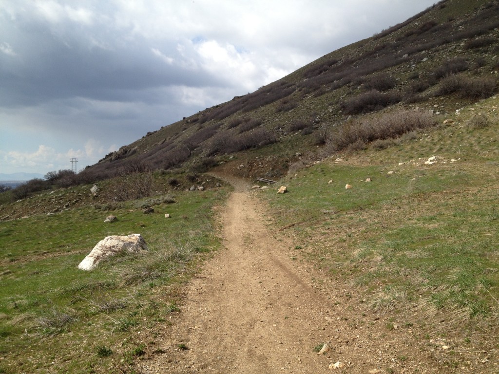
After you cross the bridge look above the hill on the north side and you will see tall electricity polls. This is where you must go.
Even though there are several side trails, make sure you are travelling towards the electricity poles in the north above the ridge. There are posts along the trail that lead you to the Indian Princess Grave, most of the posts will say “Trail” with an arrow pointing you in the right direction.
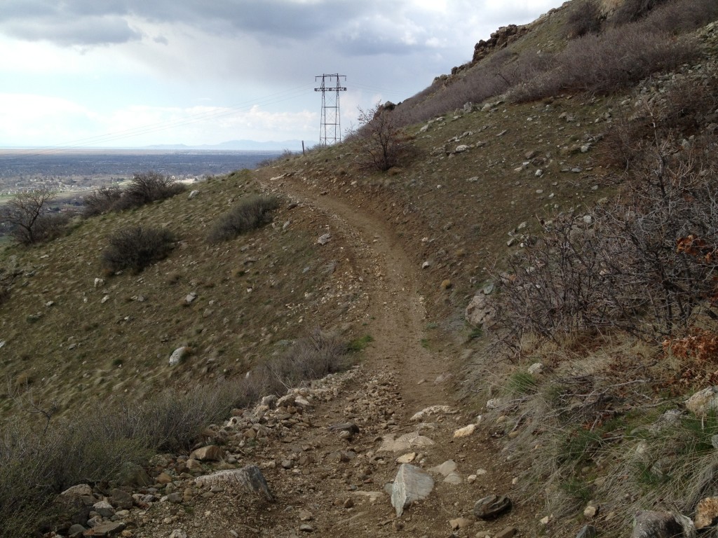
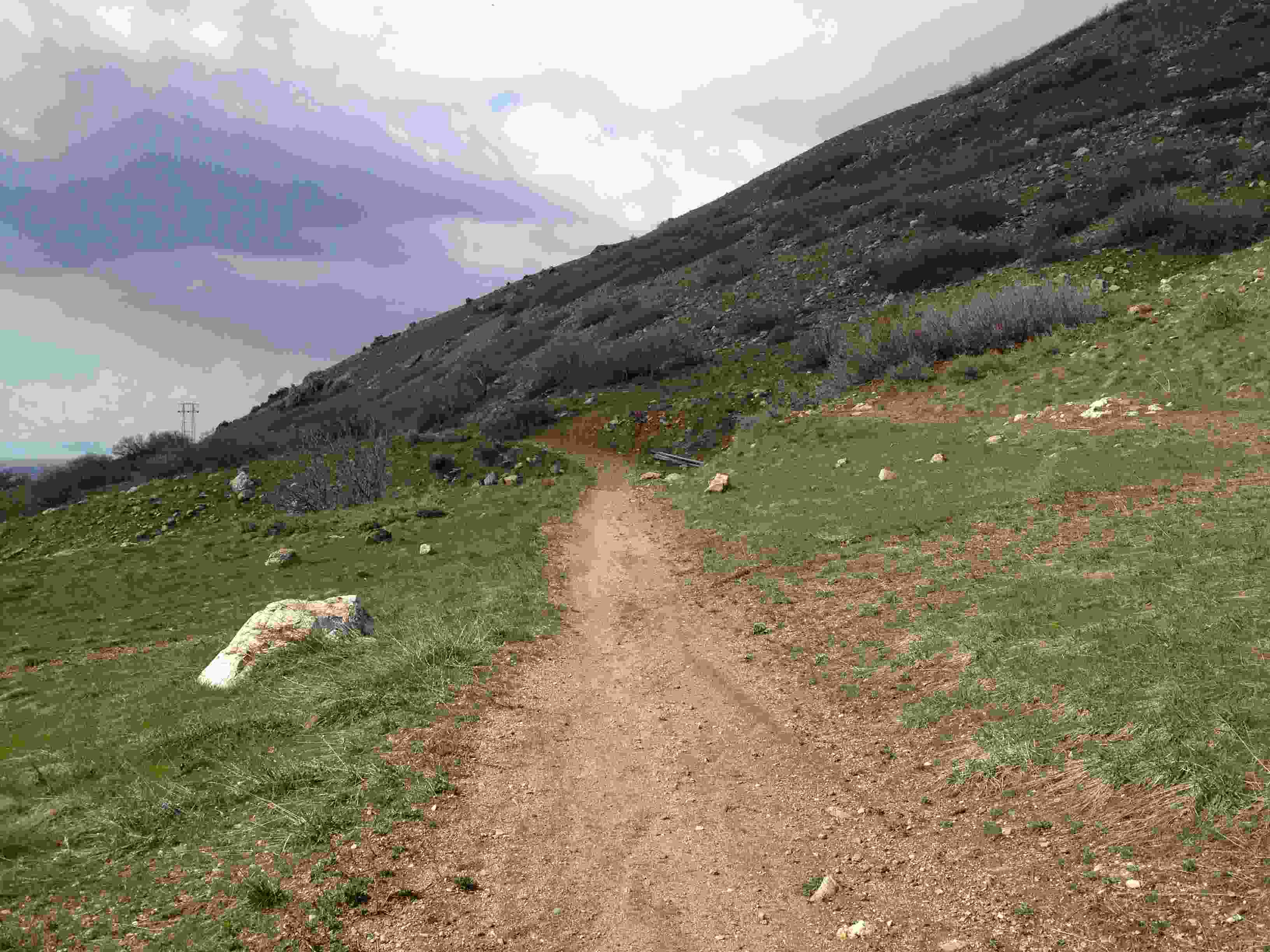
Once you get to the top of the ridge you will see a reservoir. Continue travelling to the east and you will notice the trail begins to climb up. Once you reach the top of this section the trail continues east (the route you do NOT want to take) or it weaves back north. Continue north for a few hundred yards until there is a major intersection.
Once you are at the intersection take the trail to the right that leads up yet another ridge (to the south direction) and you will come to a flat area. Once at the flat area, take the left trail (there is a sign there as well) and it will lead you north.
Travel for about a 1/8 mile until you come to a dip in the road. The dip in the road is about a 25 foot drop and then it comes back up again.
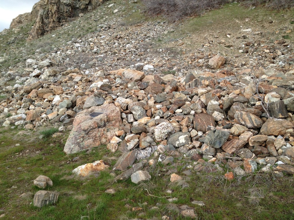
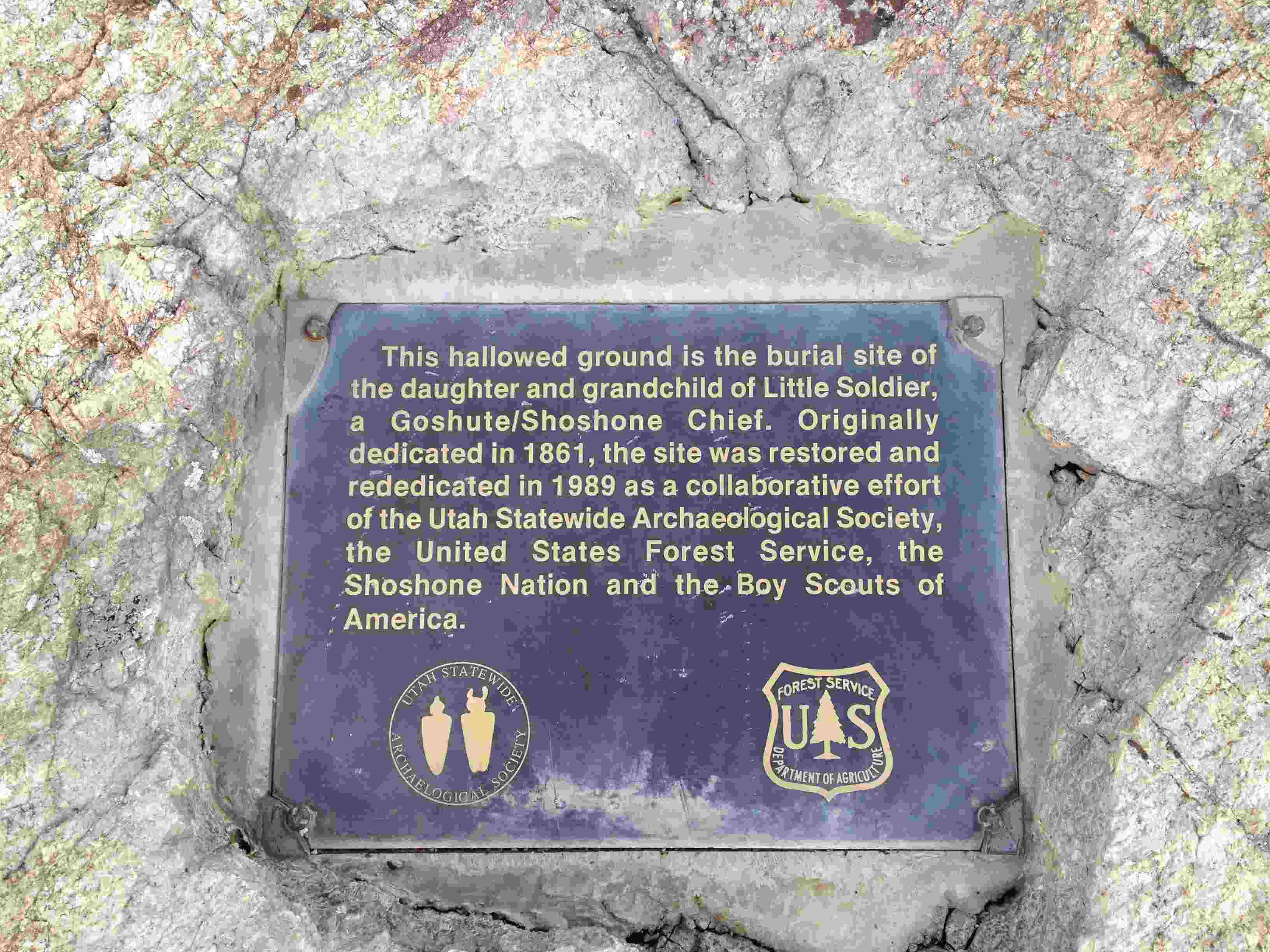
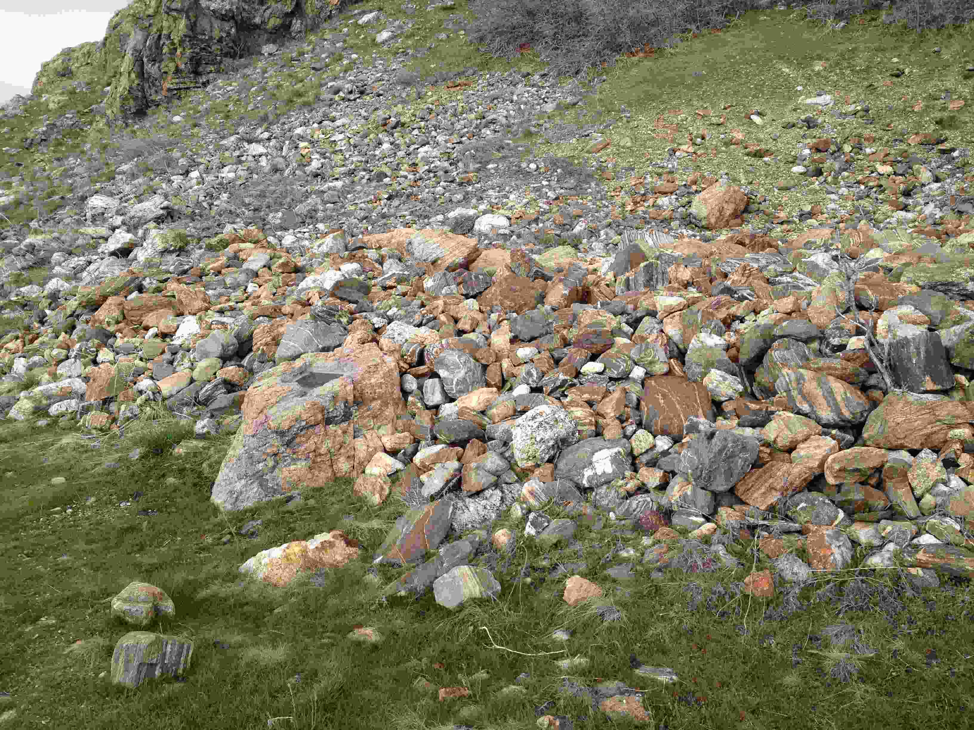
After the dip you will only need to travel another 150 feet or so until you come to an area where there is a large pile of rocks about 25 feet across and 3 feet high. There is a sign that explains that you are standing in front of the grave for the “daughter and grandchild of Little Soldier, a Goshute/Shoshone Chief.”
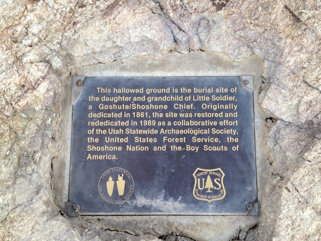
Here is what is written on the plaque…
“This hallowed ground is the burial site of the daughter and grandchild of Little Soldier, a Goshute/Shoshone Chief. Originally dedicated in 1861, the site was restored and rededicated in 1989 as a collaborative effort of the Utah Statewide Archaeological Society, the United States Forest Service, the Shoshone Nation and the Boy Scouts of America.”

Personal Thoughts
The trail is neat going up to the location of the grave as you are on the Bonneville Shoreline Trail. If you have an extra hour and want to do something different then I suggest you come on this trail and check it out.


