


The Trek in a snapshot
Location
Farmington, Utah – Northern Utah
Managing Agency
National Forest Service
Pets
Allowed
Fees
None
Restrooms
None
Camping
Allowed in camping areas
Trail Condition
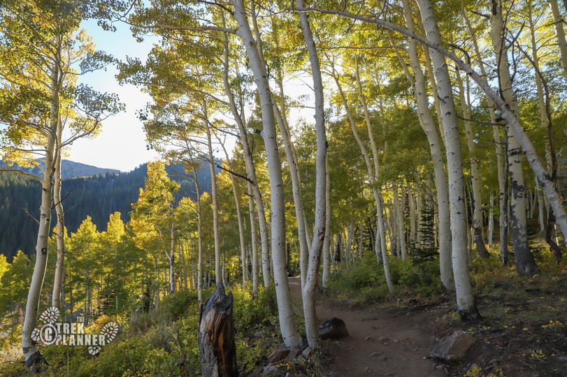
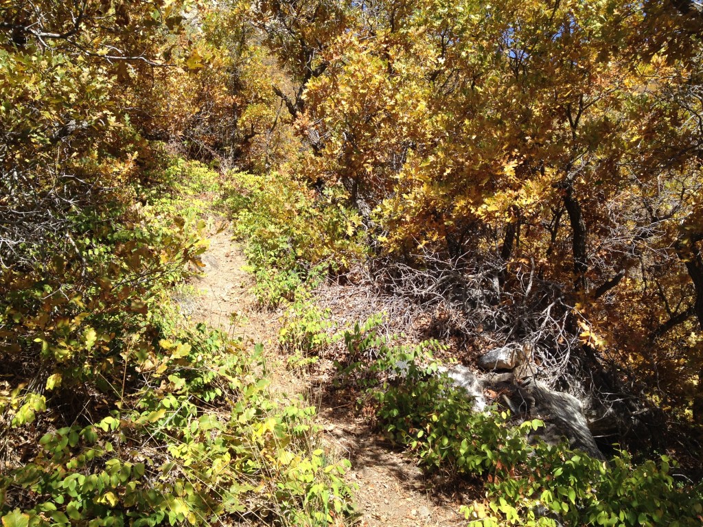
Narrow dirt trail. Steep almost the entire way
Sights
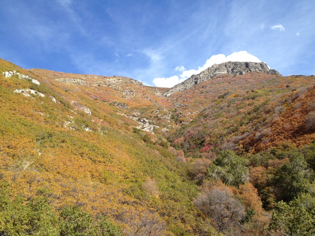
Steed Canyon, Hornet Canyon, Hornet Mines
Water Info
Bring 1-2 liters of water. You will follow Steed Creek for the first little bit then you will be near Hornet Creek for portions of this hike
Best Season
Spring, fall – summer is very hot
Distance
About 3 miles roundtrip
Time Required
1-2+ hours. You could easily just hike as far as you’d like then turn around
Parking Elevation
4805 ft
Summit Elevation
5795 ft
Elevation Difference
990 ft

Trek Planner Maps
Trailhead: 40° 58.017’N, 111° 52.398’W
Farmington Trailhead: 40° 58.443’N, 111° 52.345’W
Mezzanine Rock: 40° 58.730’N, 111° 51.779’W
GPS Coordinates for Hornet Mines
GPS coordinates are for Trek Planner Insider only
This content is locked
(memberships are currently unavailable)

Experience. Discover. Explore.
Follow along on our adventure then go out on your own!


Hornet Canyon and Hornet Mine are most easily accessed through hiking in from the South entrance (see map above) – It is about a .61 miles to the actual trail head of Steed/Hornet Canyons and the trail that you use to get there is the Bonneville Shoreline Trail.
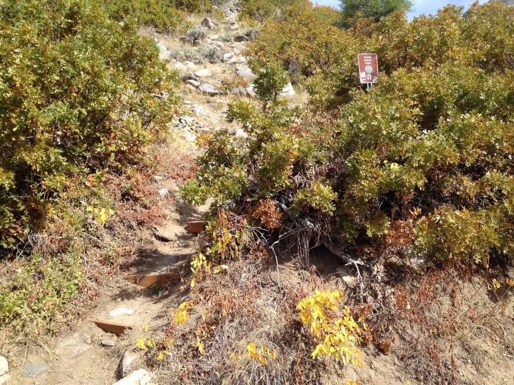
Follow the trail all the way past where there is a dam in the creek – you will hear running water but not see it. Past this point, walk for another 50 or so feet until you see this sign (see below picture) which says “Steed Creek Trail”.
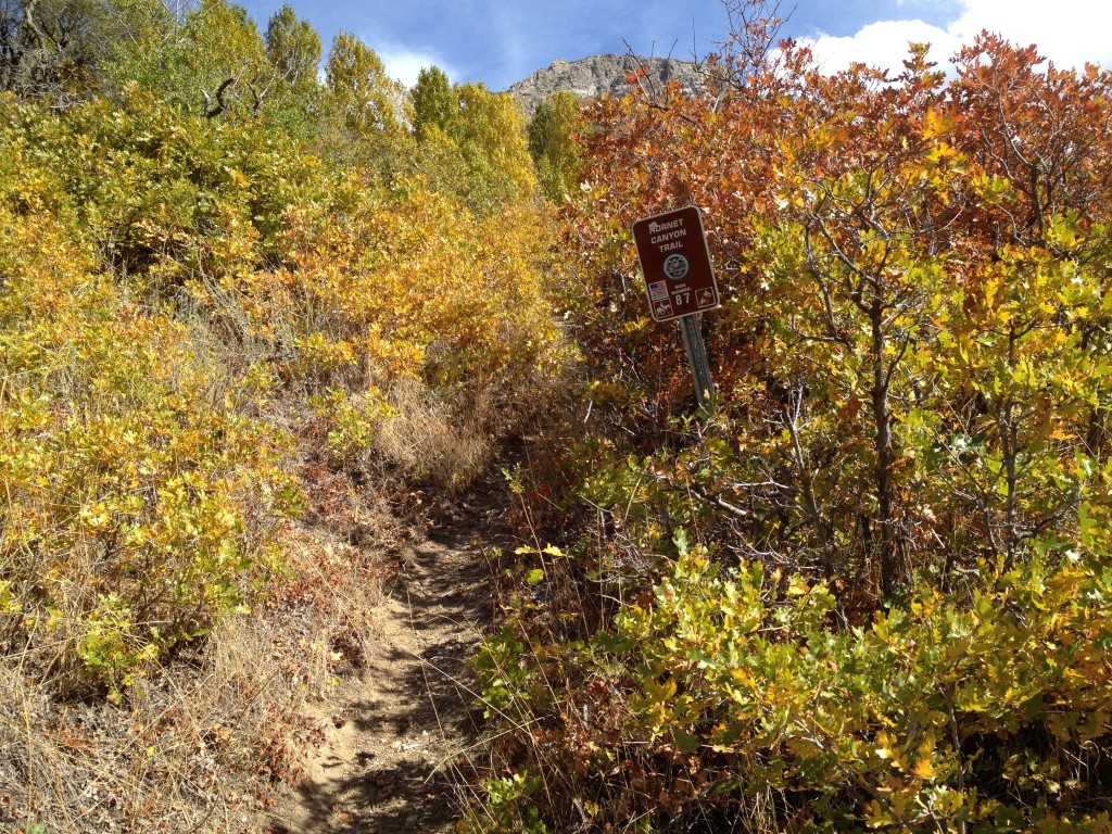
The trail is often steep and narrow but clear and visible. You will see a number of man made retainers to keep rocks from sliding down to the creek below. Keep going until you see another sign which says “Hornet Canyon Trail and the trail then splits to the left.
The right trail continues up Steed Canyon.
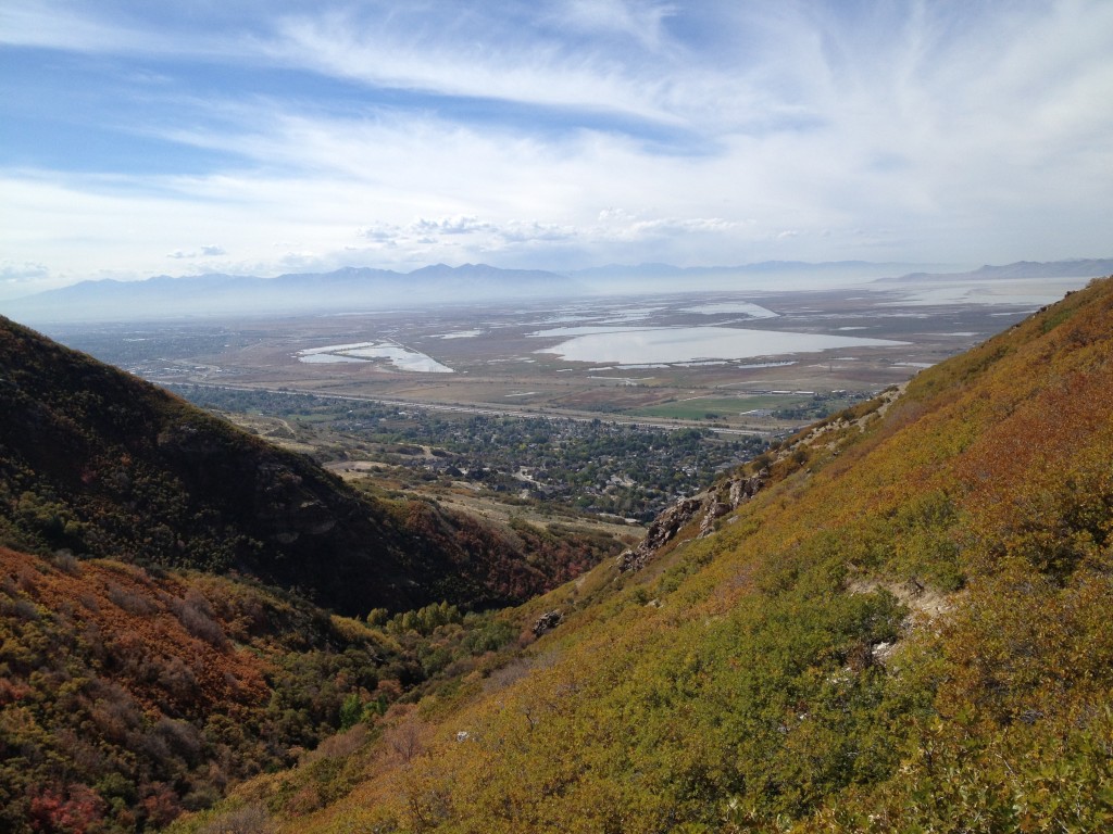
The trail will eventually fork again and you must stay to the right. The left trail leads to a small camping area and a neat overlook of Farmington and Antelope Island.
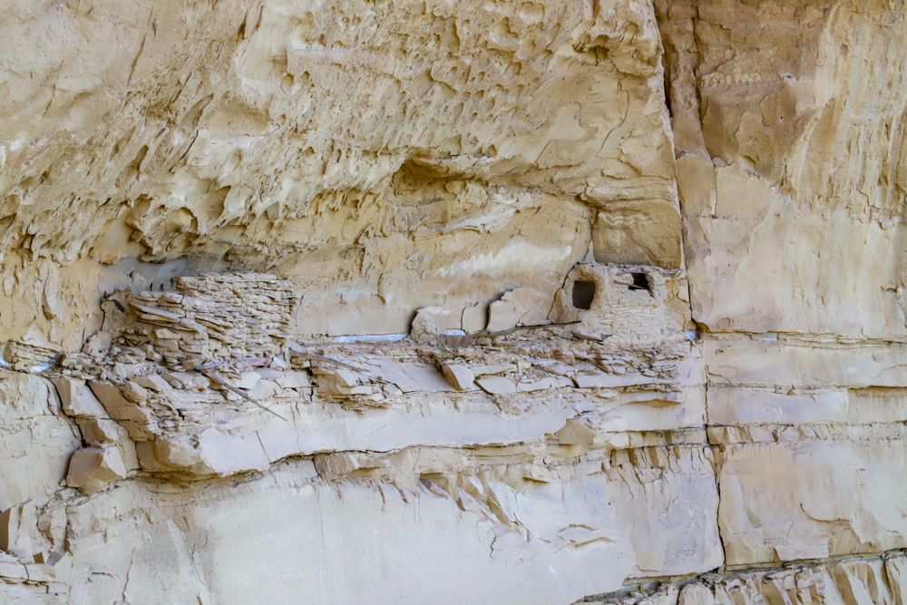
The right side continues on for another 75 yards or so until you will come to Mezzanine Rock.
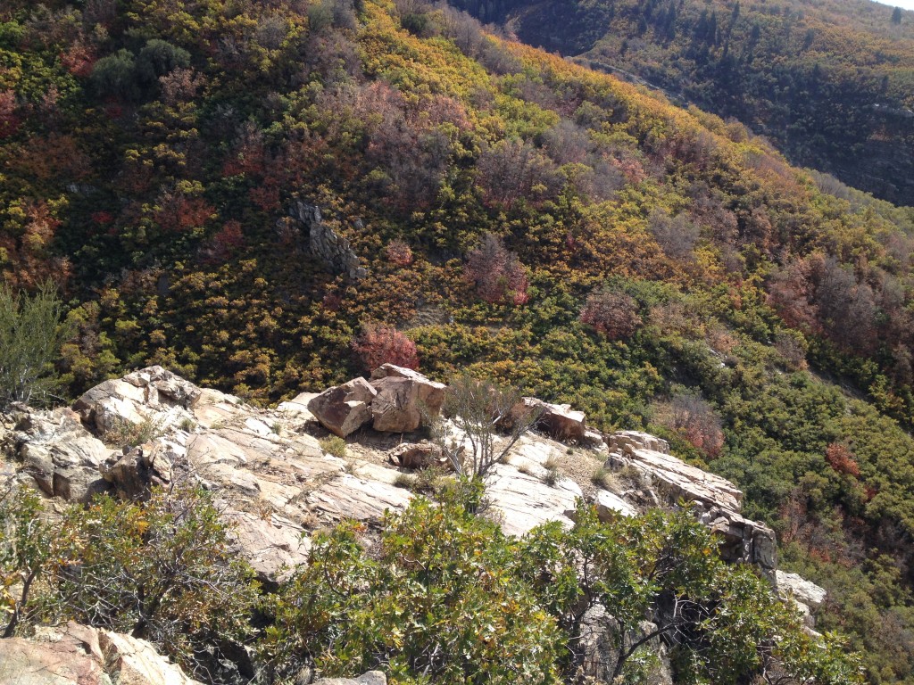
Here is Mezzanine Rock, which features a great overlook of Hornet and Steed Canyons.
About 50 feet up from Mezzanine Rock the trail splits again. The left side leads to the open Hornet Mine and the right side continues up Hornet Canyon.
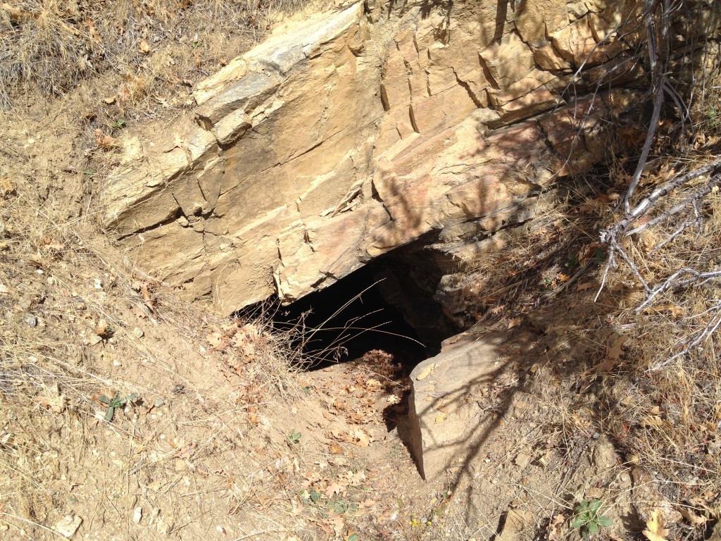
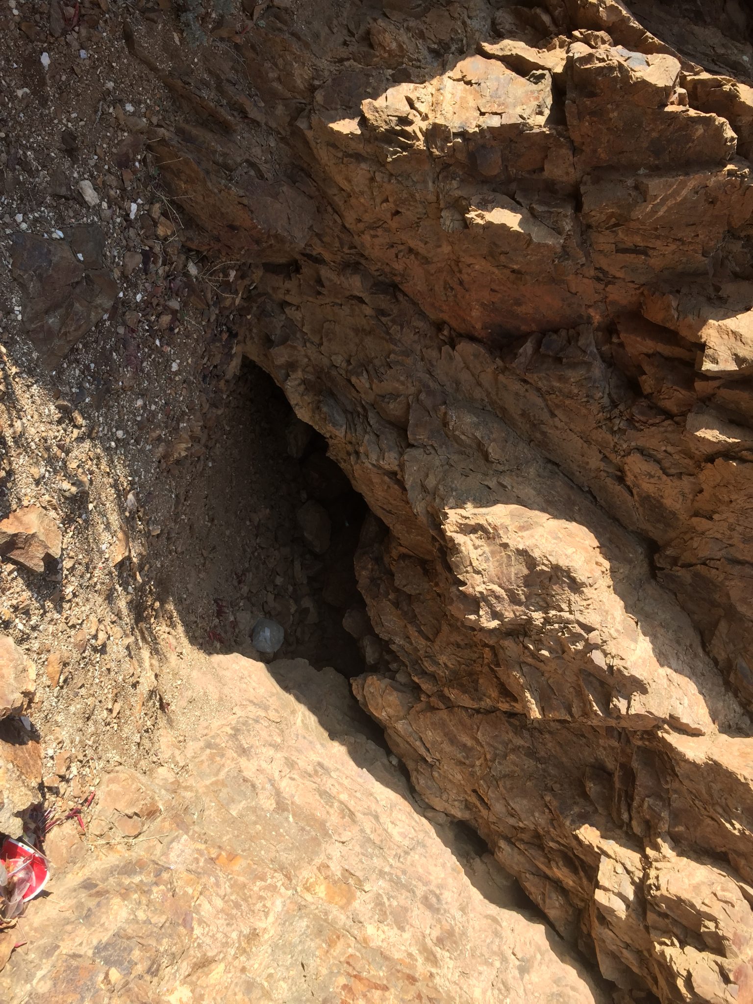
Stay left and you will see a tailings pile and the open Hornet Mine just a little bit above that.
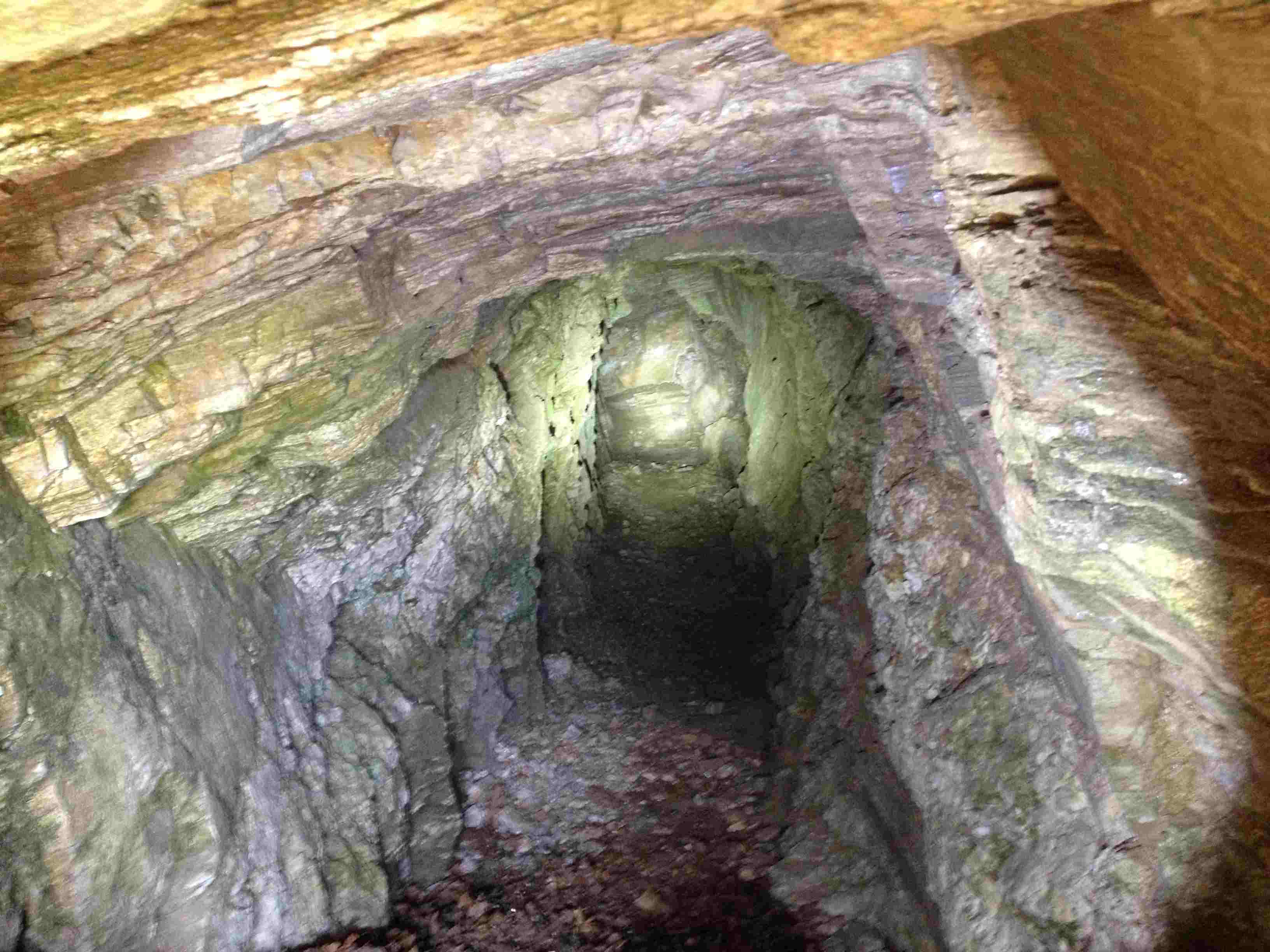
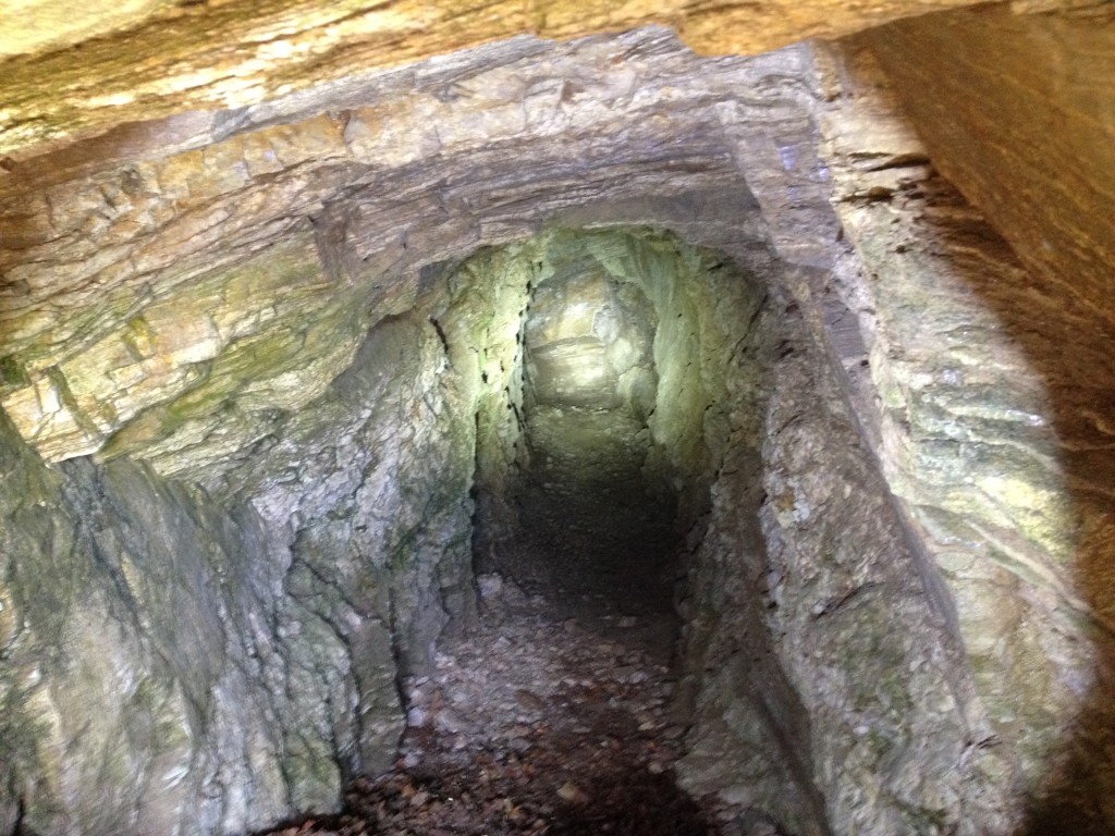
The mine itself is just a simple prospect that goes in for about 35 ft or so. The opening is small so you will have to crawl or slide inside.
Hornet Mines 2 and 3
There are two other mines in the area but both are now caved in. Directly to the west of the open mine you will see a small tailings pile and evidence of the caved in mine is directly to the top of the tailings.
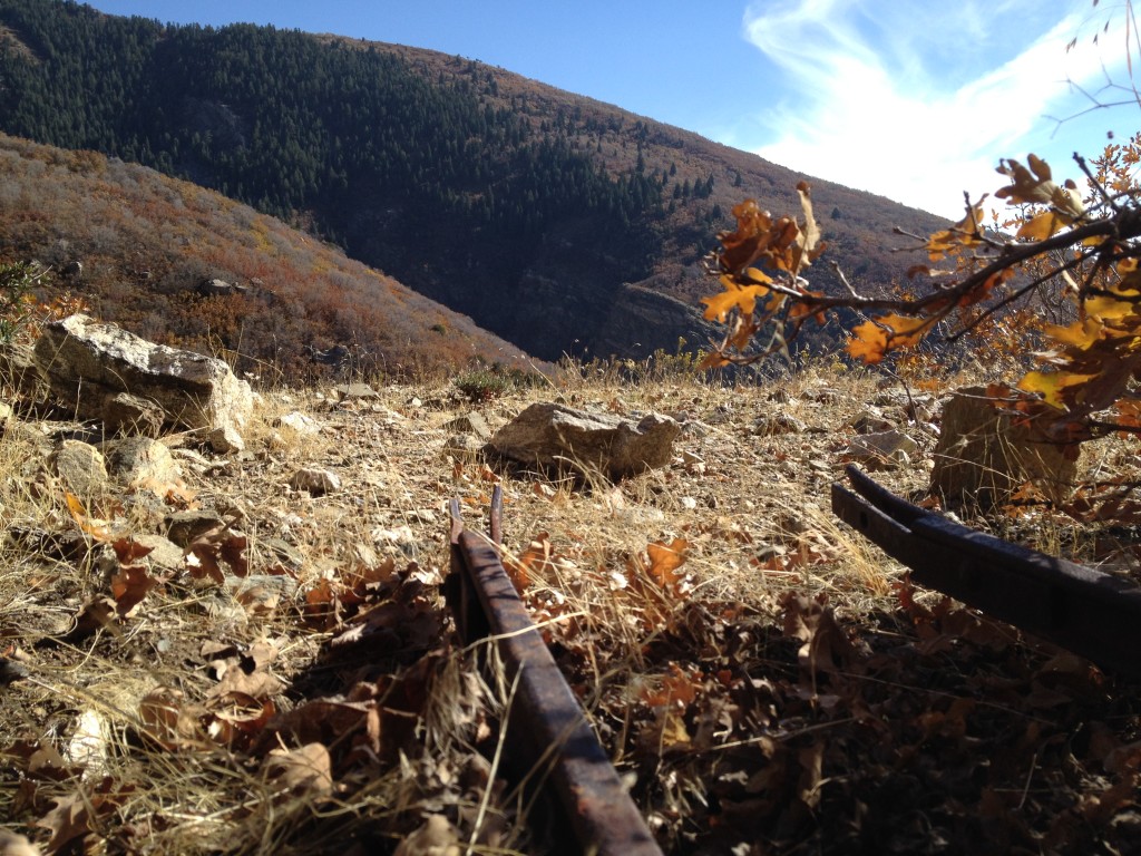
The other mine is probably more substantial than the other two but it is sadly also closed off. The reason why this mine is worth a mention is because it still has ore cart tracks leading out of the mine. The opening is only covered with dirt but rocks scatter the area that are colored in greens (oxidized copper) and reds.
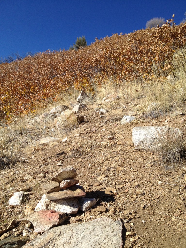
To access this mine, go up the trail from Mezzanine Rock until you come to a small pile of rocks to the left of the trail which I created during my last visit. This rock pile points you in a north west direction and you will see a lone Juniper bush (see the top of the picture to the right) below some Cottonwood trees. You will need to bushwhack through this area.
There is no evidence of a trail so I assume people usually skip by this or do not even know it exists.
Once you come past the scrub oak bushes you will see the tailings pile. Climb to the top of this and you will see the caved in mine and the ore cart tracks.
The mine is completely closed off and probably under more than 15 feet of dirt and rock.
Historical Information:
Here is some information about these mines.
In the book by Glen Leonard, A History of Davis County to 1890, he makes mention in the book about two brothers who may have mined in Hornet Here is the quote from his book:
The Abbot brothers, L.E. and Jed, had mines in at least two places. Some were on the north side of Steed Canyon canyon, near the head of Hornet Creek. They had other prospects near the top of the mountains in the vicinity of the Farmington “Little Lake.”
Now even though the book isn’t explicit in the location this is the only information I have found that has actually attached names of people to the mines in Steed and Hornet Canyons. It would make sense that the Hornet Canyon Mines are the same mines that the Abbot brothers were at. The mines are located very high elevation at almost the “head” of Hornet Creek.
Also here is some more information about a first hand account that I personally had with a local Farmington resident:
One day while hiking up Steed Canyon, I had the chance of meeting an older gentleman who said he lived at the bottom of Steed Creek. I asked him a few questions about the canyons and the mines. He knew about the three mines up Hornet Canyon. He said two of them only go in about 30 feet or so but the one with the ore tracks goes in several hundred feet.
Ore Cart Tracks in Hornet Canyon Mine
Hiking up Hornet Canyon

Personal Thoughts
I have never heard of Hornet Mine until I was looking on the internet and found a Farmington City map which showed it listed. After not finding any other information about it, and no pictures too, I decided to climb up Hornet Canyon to see what I could find. The hike is more enjoyable than the mine prospects themselves so keep your expectations low for the mine and just enjoy the hike.

There’s a fourth mine in that group. It is also collapsed. It is below the three about 100 to 200 yards southwest, just about twenty feet west of a rock outcropping that is below the Hornet Canyon trail. It has a tailing pile that would indicate a tunnel of 80′ to 100′. Here’s a photo of that particular mine with the miner from the State Historical Society. The location they give is wrong. It’s not in Farmington Canyon–this is Hornet Canyon. Find it and compare to the photo. No structures are left, obviously. http://content.lib.utah.edu/cdm/singleitem/collection/USHS_Shipler/id/4887. Here’s another photo of the same… Read more »
Thanks for the comment Matt. Those are some sweet pictures and great historical info! I’ll have to go up and take another look around and try and find the tailings!