
The Trek in a snapshot
Location
Grand Staircase-Escalante National Monument, Utah
Managing Agency
Grand Staircase-Escalante National Monument
Pets
Allowed on leash
Fees
None
Restrooms
None
Camping
Not allowed
Trail Condition
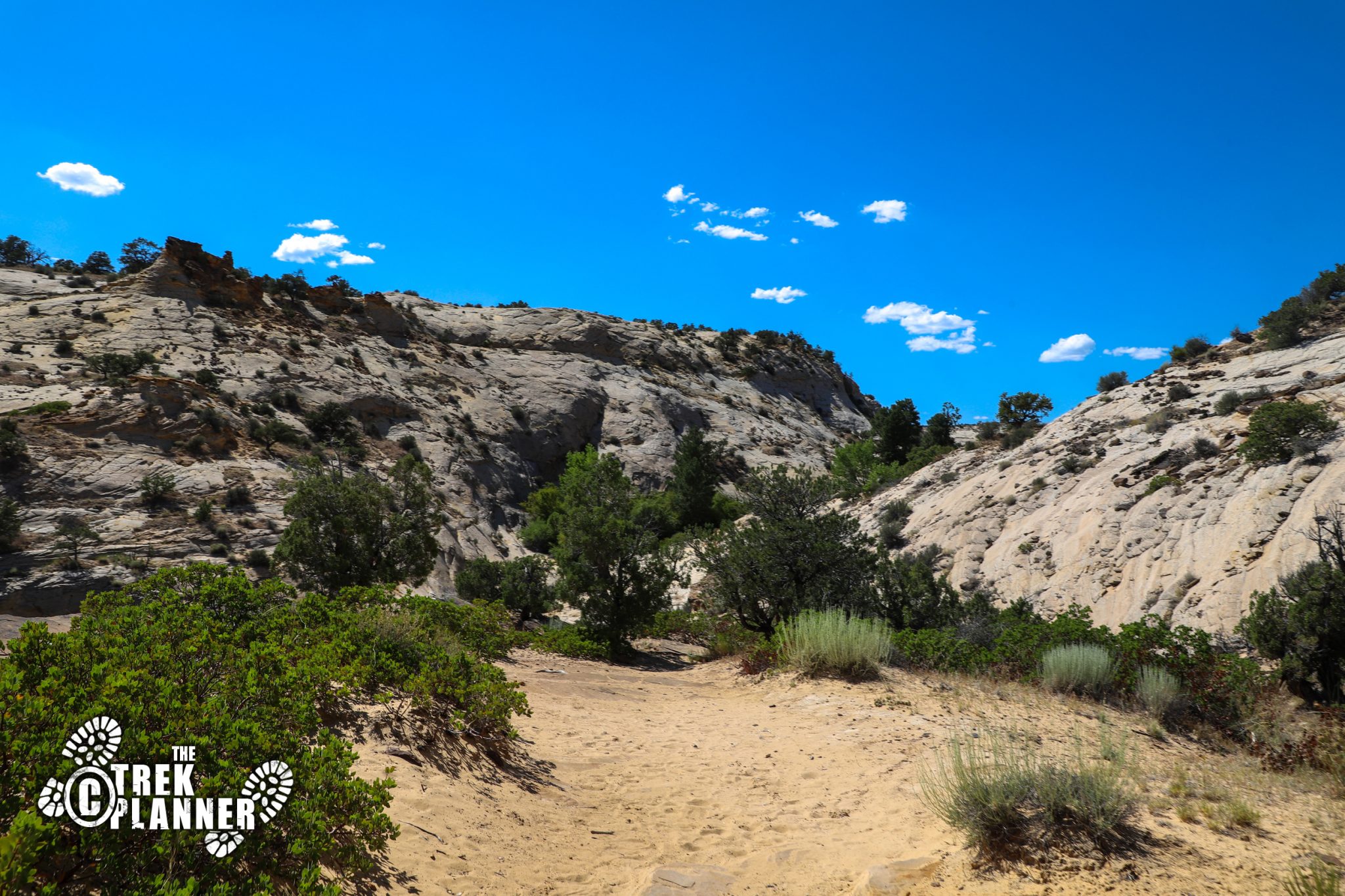
You will be hiking on sandstone, sand, and dirt. There are cairns to guide you. Steep trail at the beginning
Sights
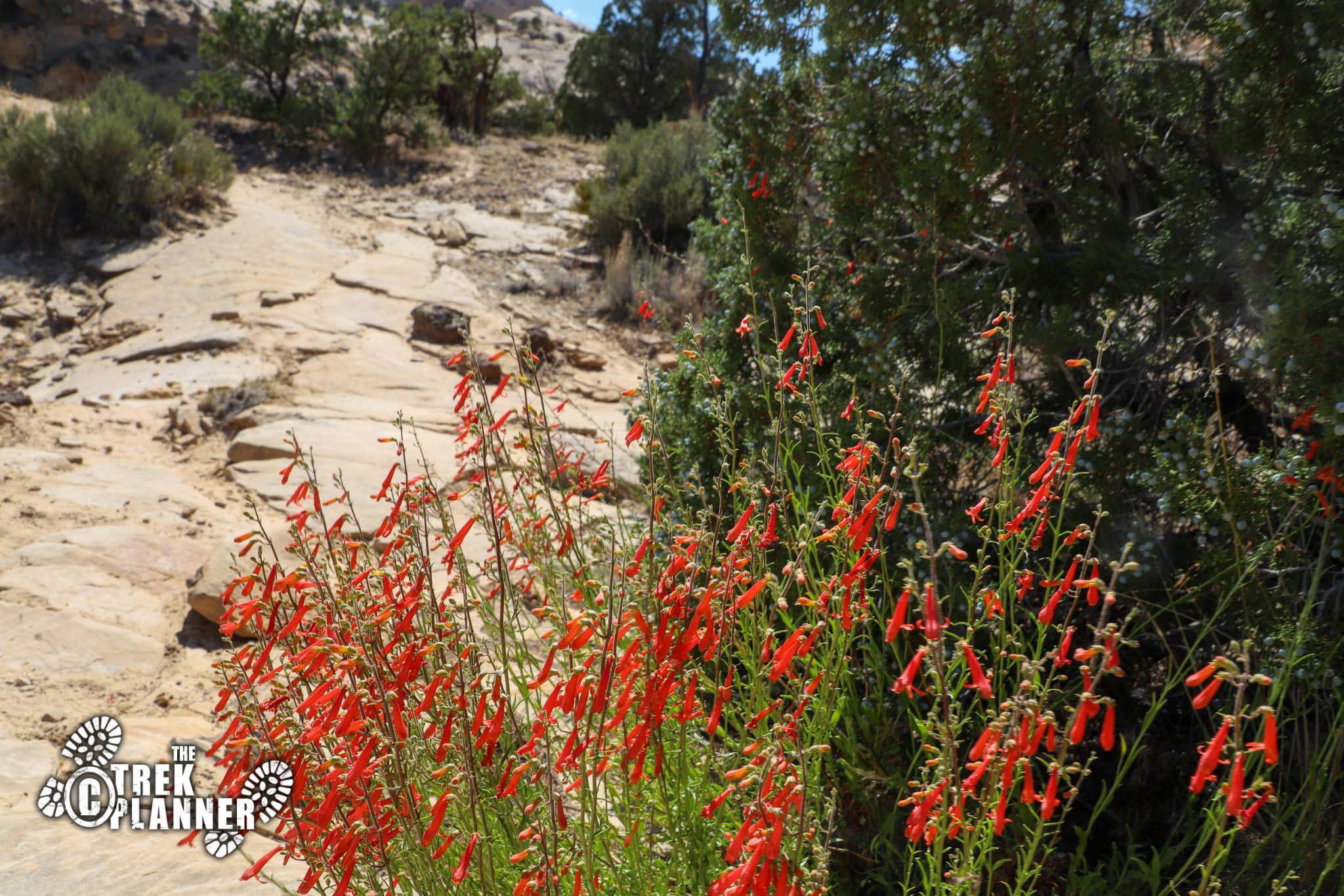
Upper Calf Creek Falls, Sandstone cliffs and desert terrain
Water Info
Bring 2-3 liters of water depending on if you are hiking in the hot months. I brought a water filter just in case
Best Season
All
Distance
Time Required
Parking Elevation
6529 ft
Summit Elevation
5934 ft
Elevation Difference
595 ft

Trek Planner Maps
Trailhead: 37.85927, -111.43771
Upper Calf Creek Falls: 37.8548, -111.45171
Middle Pool: 37.85521, -111.45215
Upper Pool: 37.85576, -111.45258

Experience. Discover. Explore.
Follow along on our adventure then go out on your own!


 The hike to Upper Calf Creek falls is a decent leg burner, but it’s nice and short! It took me just over 30 minutes to get to the falls and I wasn’t even hiking that fast. This could be a quick adventure if you want to find an amazing desert oasis! You start at the top of the canyon and immediately hike down a pretty steep trail until it levels-out somewhat. It isn’t so steep to cause alarm, but it’s enough to make you go really slow on the way back. This trail doesn’t see nearly the popularity such as Lower Calf Creek Falls (see our Trek for Lower Calf Creek!), because the Upper Calf Creek Falls aren’t quite as spectacular and rewarding, but you will still have a fun adventure if you don’t have the same high expectations.
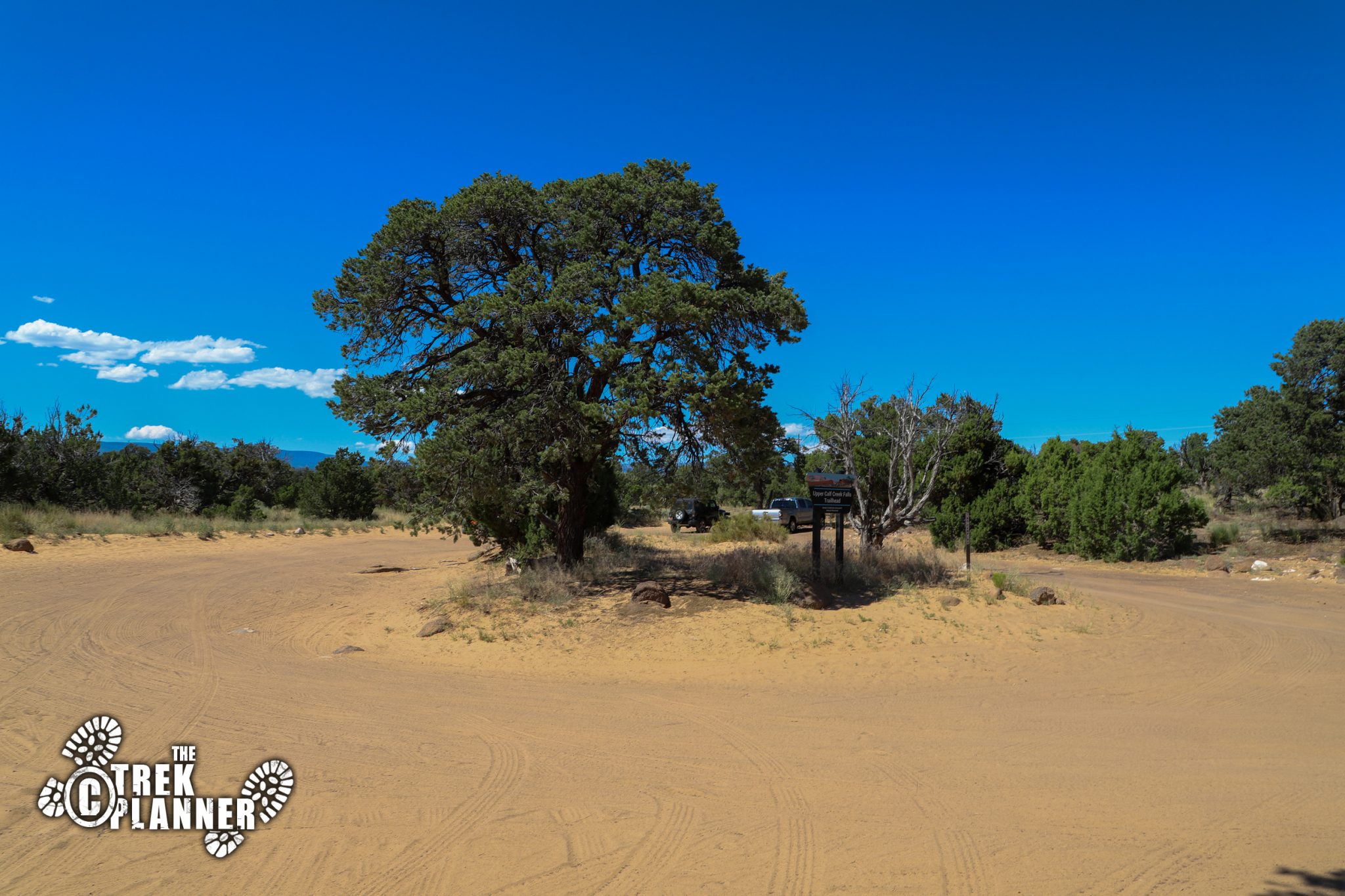
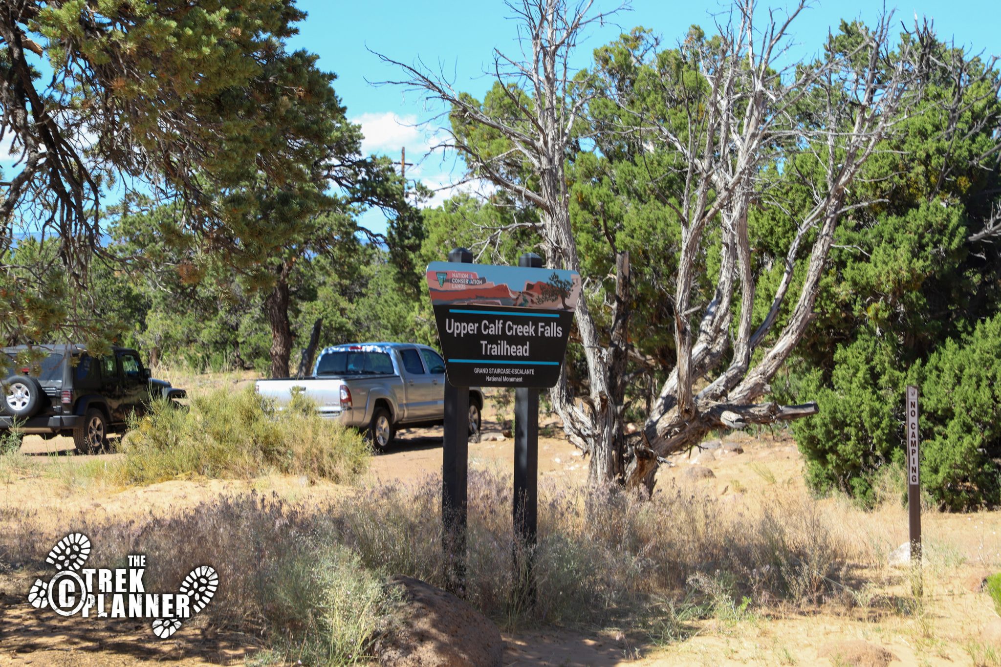
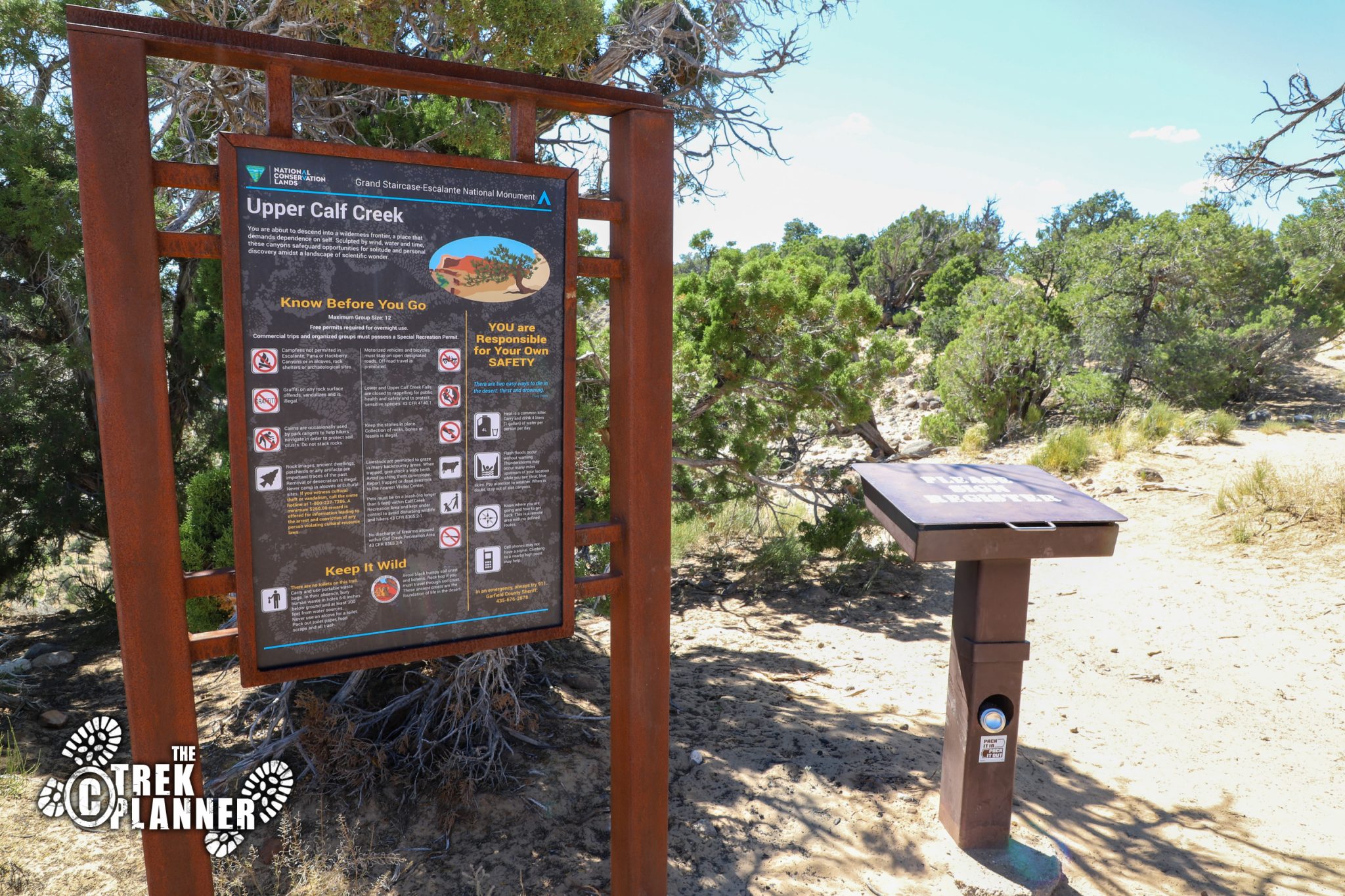
The parking lot has some good sized trees so make sure you park underneath one of them so your car doesn’t melt while you’re gone. I hiked this in the middle of the summer and the temperature was already over 100 degrees Fahrenheit (37.7 Celsius). I found a nice shady spot for my car, grabbed my backpack, and went over to the trailhead. Just make sure you register before heading out.
You will want to bring extra water for this hike if you are silly enough like me to hike this in the hottest time of the year. I was prepared with a water filter, hat, sunglasses, and plenty of extra food too.
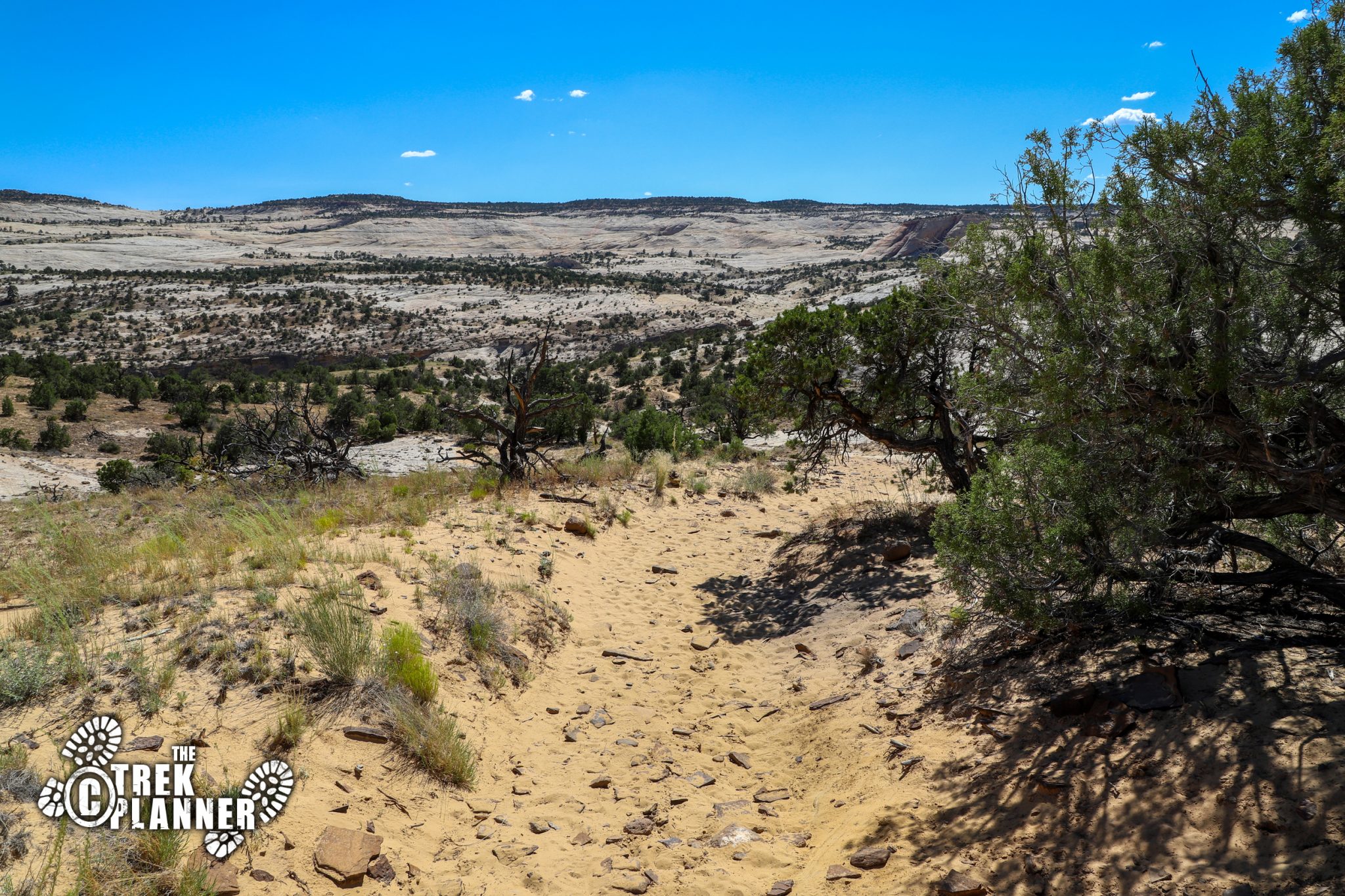
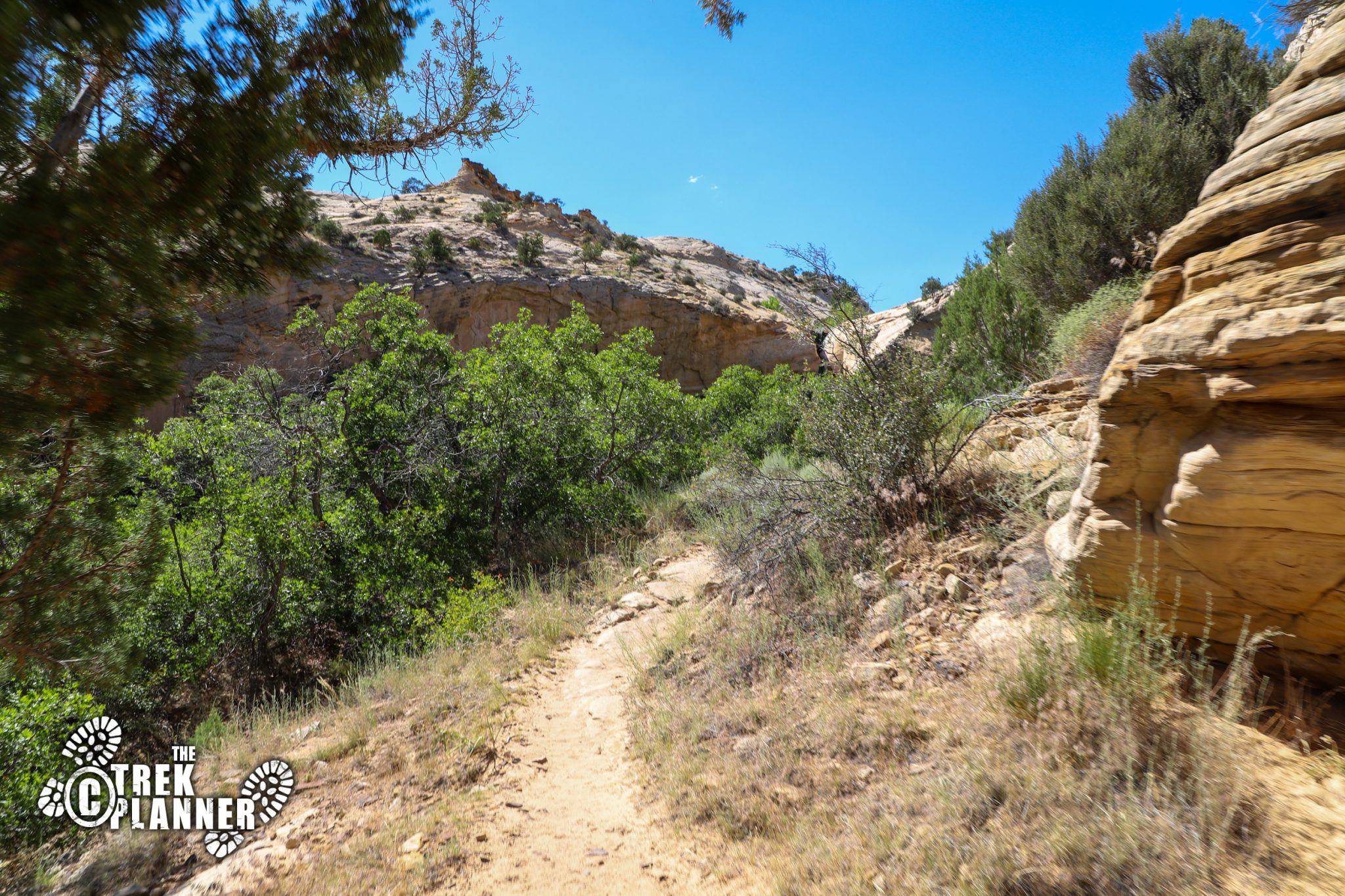
The trail will immediately take you down a steep slope on top of sandstone. You can see a well worn path of previous hikers, but there are plenty of cairns to guide you just in case you get off trail, which I found was the case for me a few times. I like to stop and take lots of pictures and sometimes I get off trail a little bit. Luckily, I always track my trails, so if I get way off the trail, I can always look up my GPS tracker and get on the trail again.
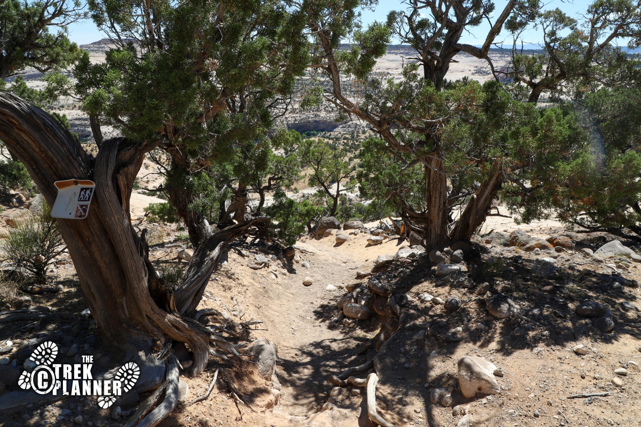
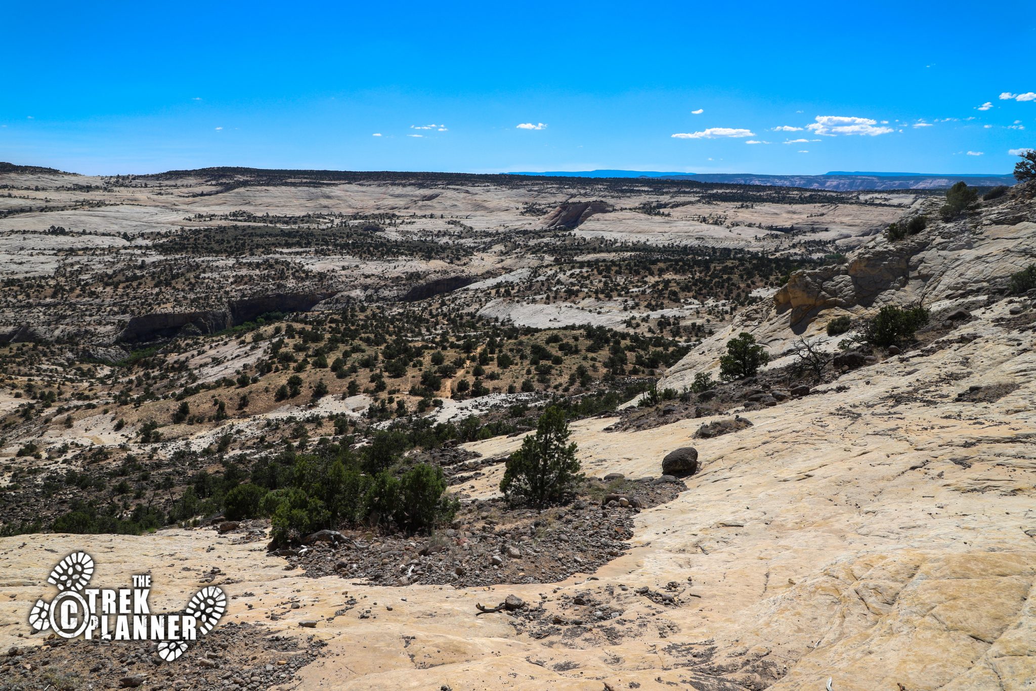
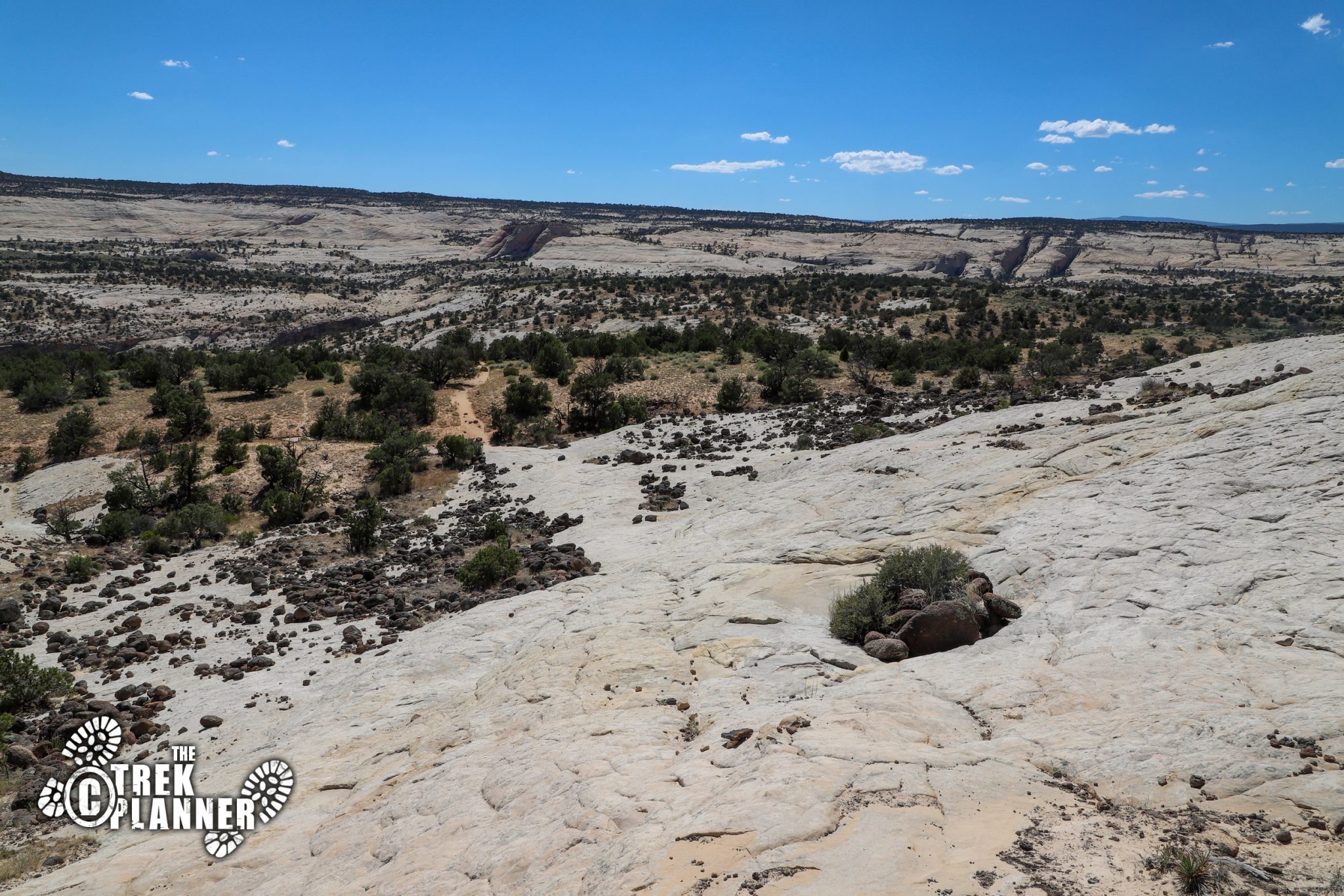
You will hike on a mix of sandstone, sand, and dirt on this trail. The sandstone was great because it provides a good grippy surface. The sand part was the most annoying, not only was it incredibly hot, but I don’t like how you waste so much energy walking on it. Luckily, the sand parts in the trail were spread out.
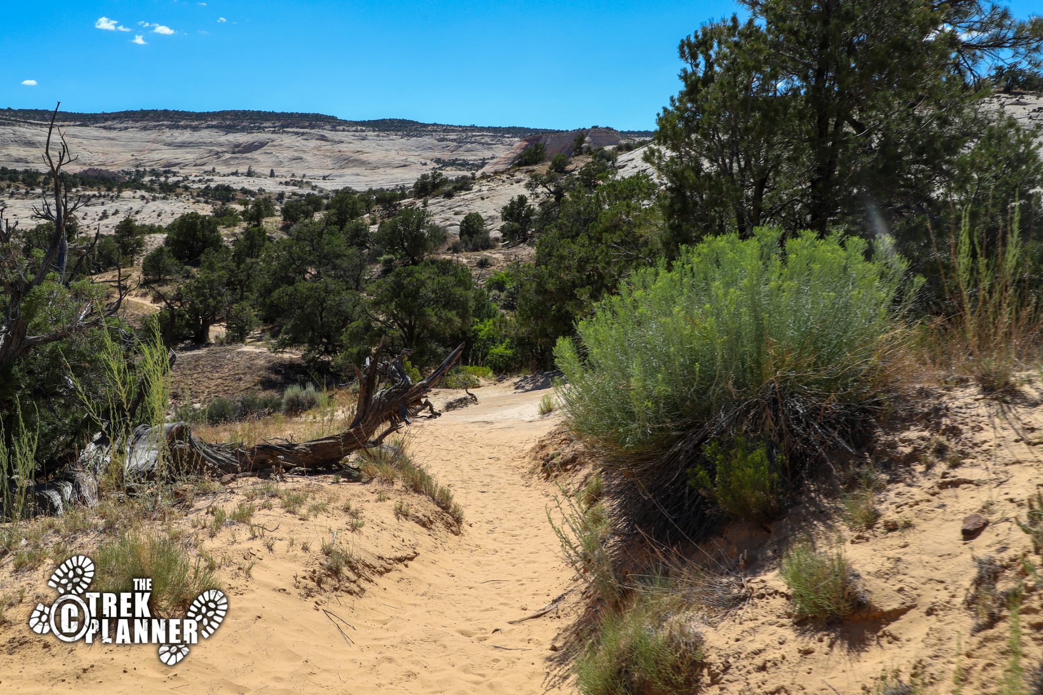
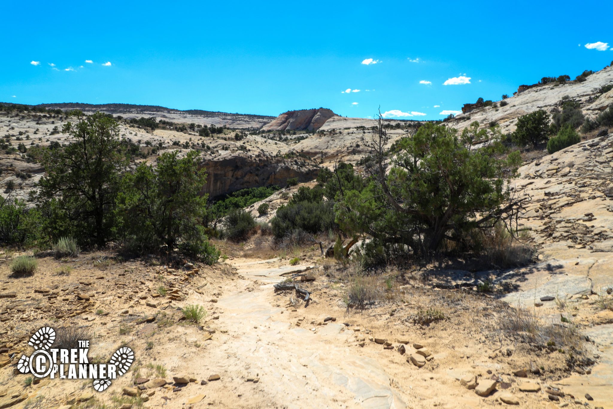
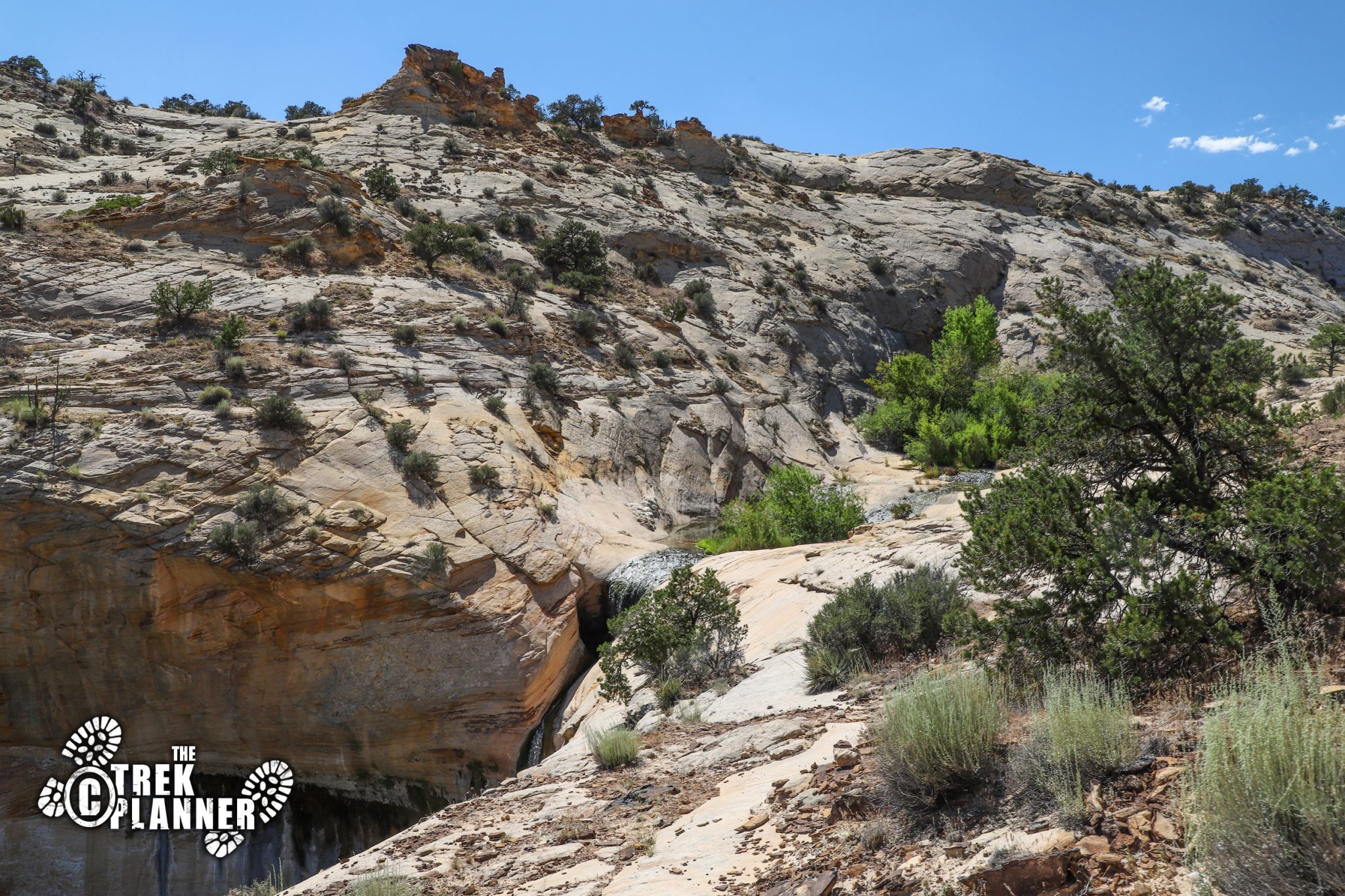
Once you lose most of the elevation on this trail, you will be getting close to the canyon bottom. Eventually, you will come to a fork in the trail: the left trail goes down to the Upper Calf Creek Falls pools which is at the lowest part of this canyon you’re in. The right trail goes to the Middle Pool and then the Upper Pool. Most people hike to the Upper Pool, swim around, and then hike back to the parking lot. I only hiked to the middle and lower part, although, all of the pools are really close to each other.
The middle and upper pools are usually full of algae. The upper pool is pretty deep and people sometimes jump off the rocks (do so at your own risk). The lower pool is also pretty deep. Be careful around this upper area because the edges are steep and you could easily slip and fall down.
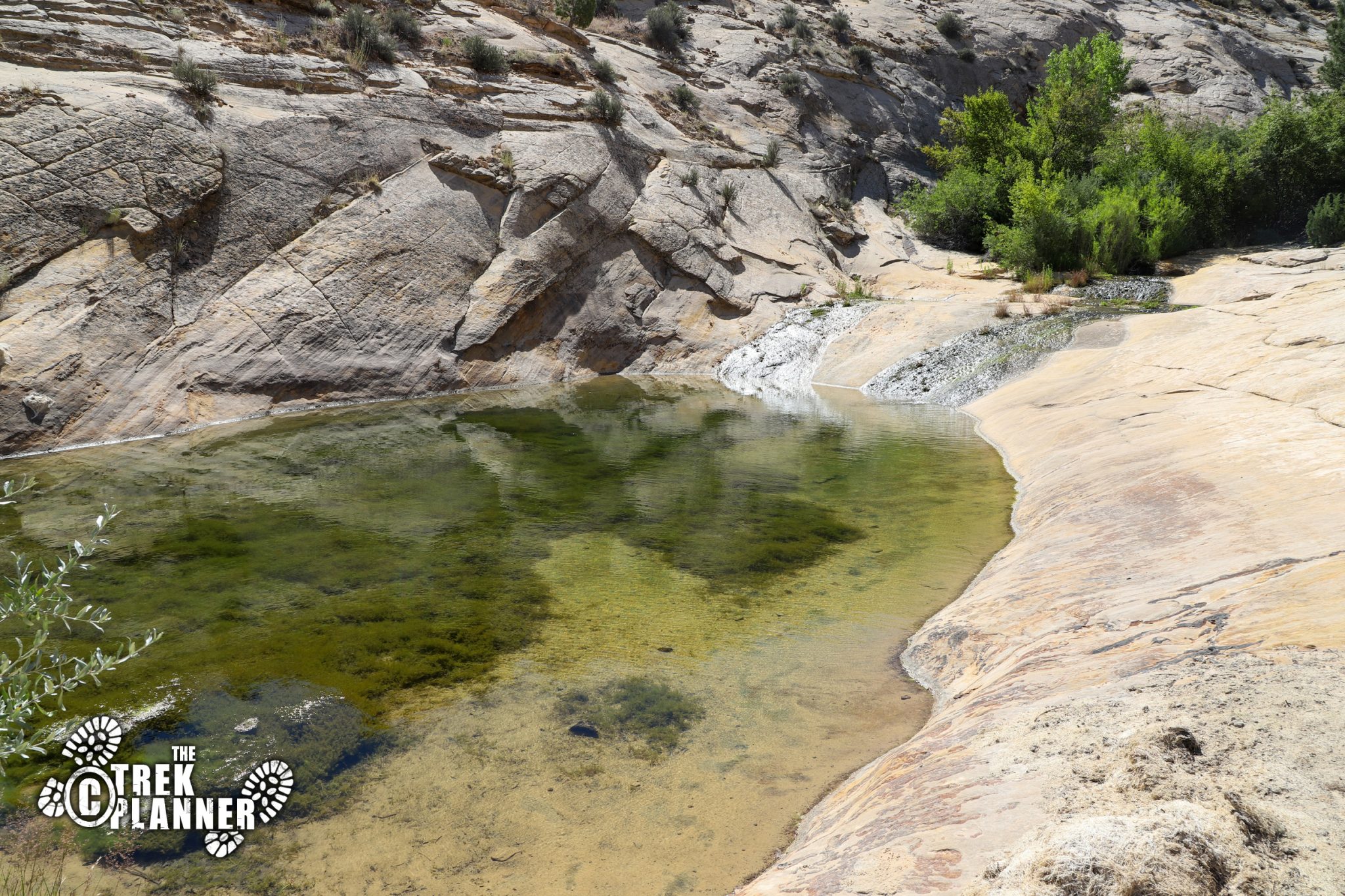
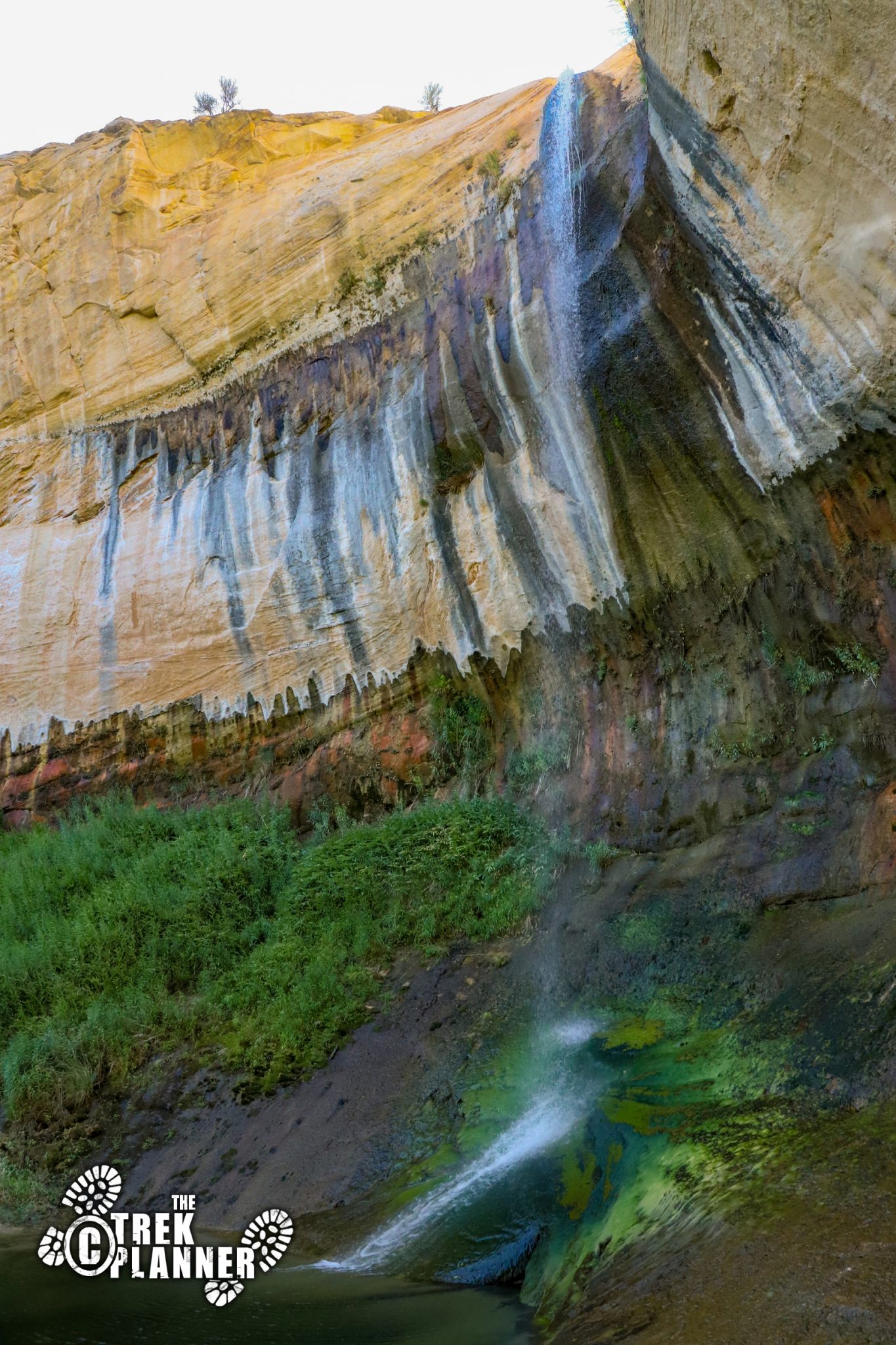
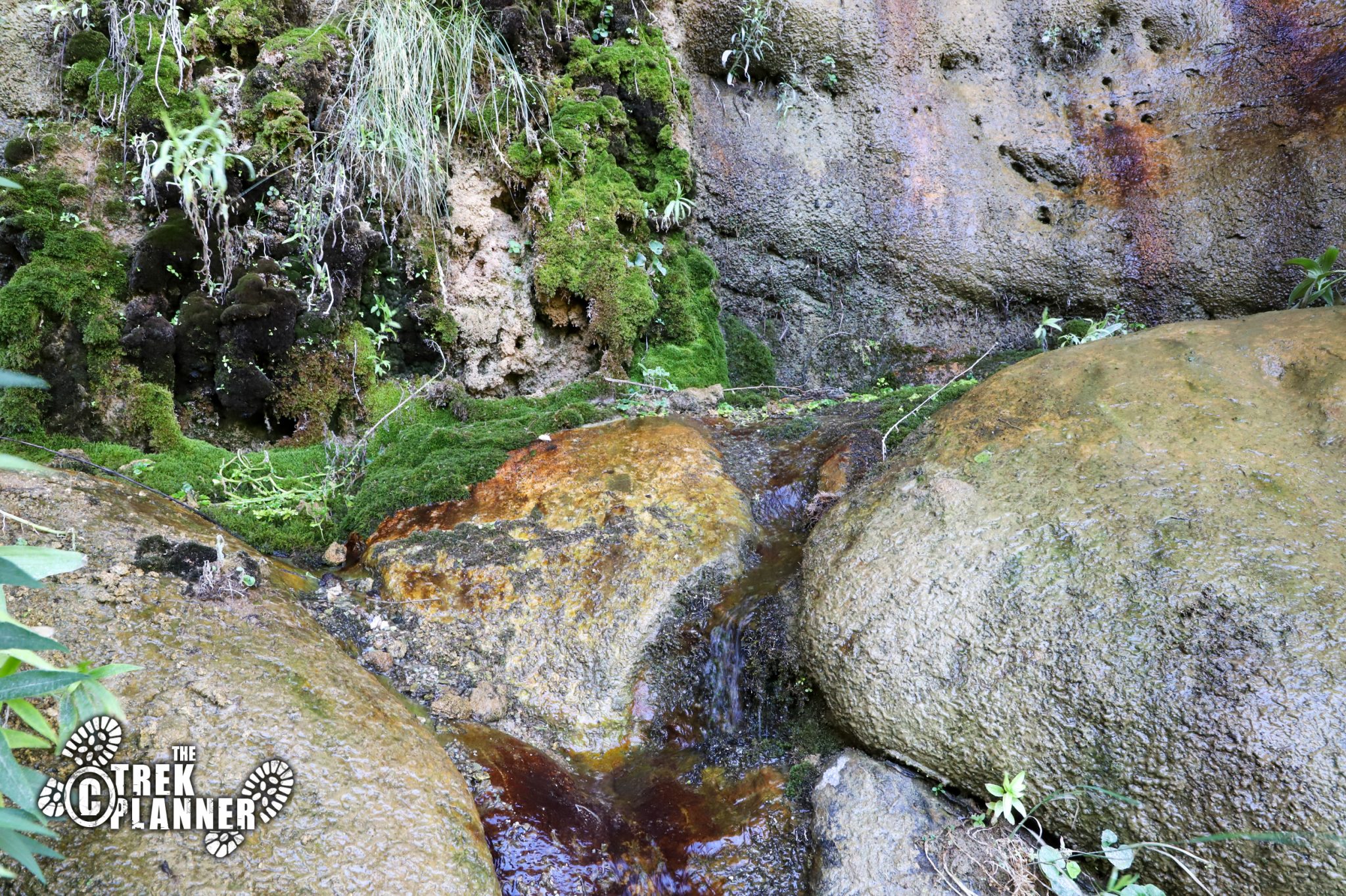
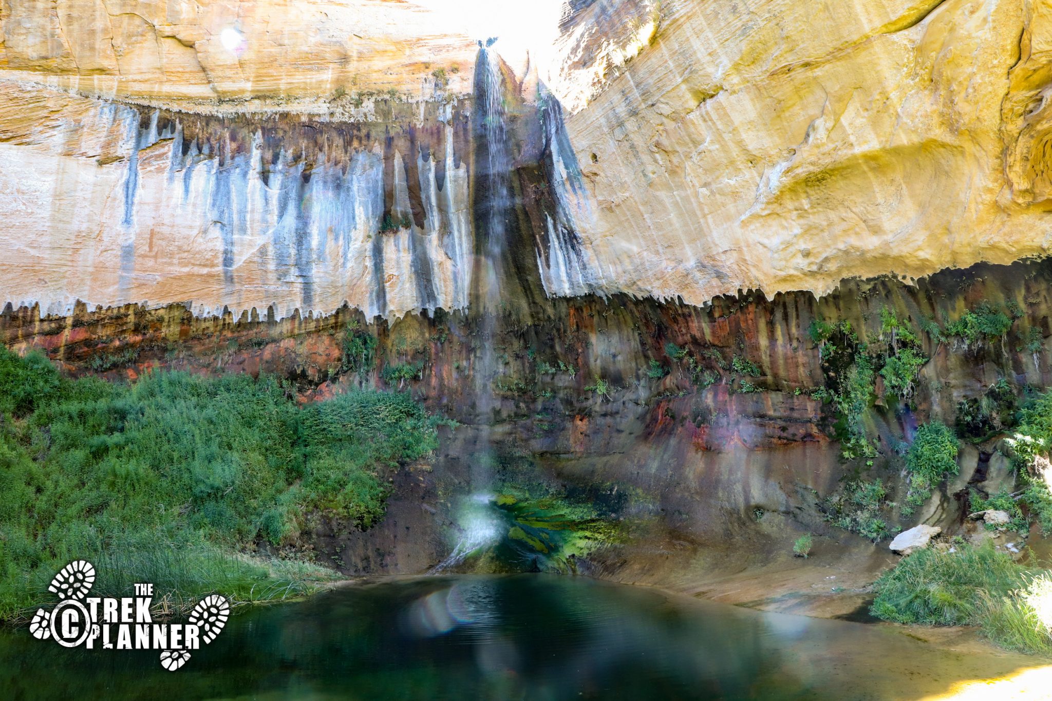
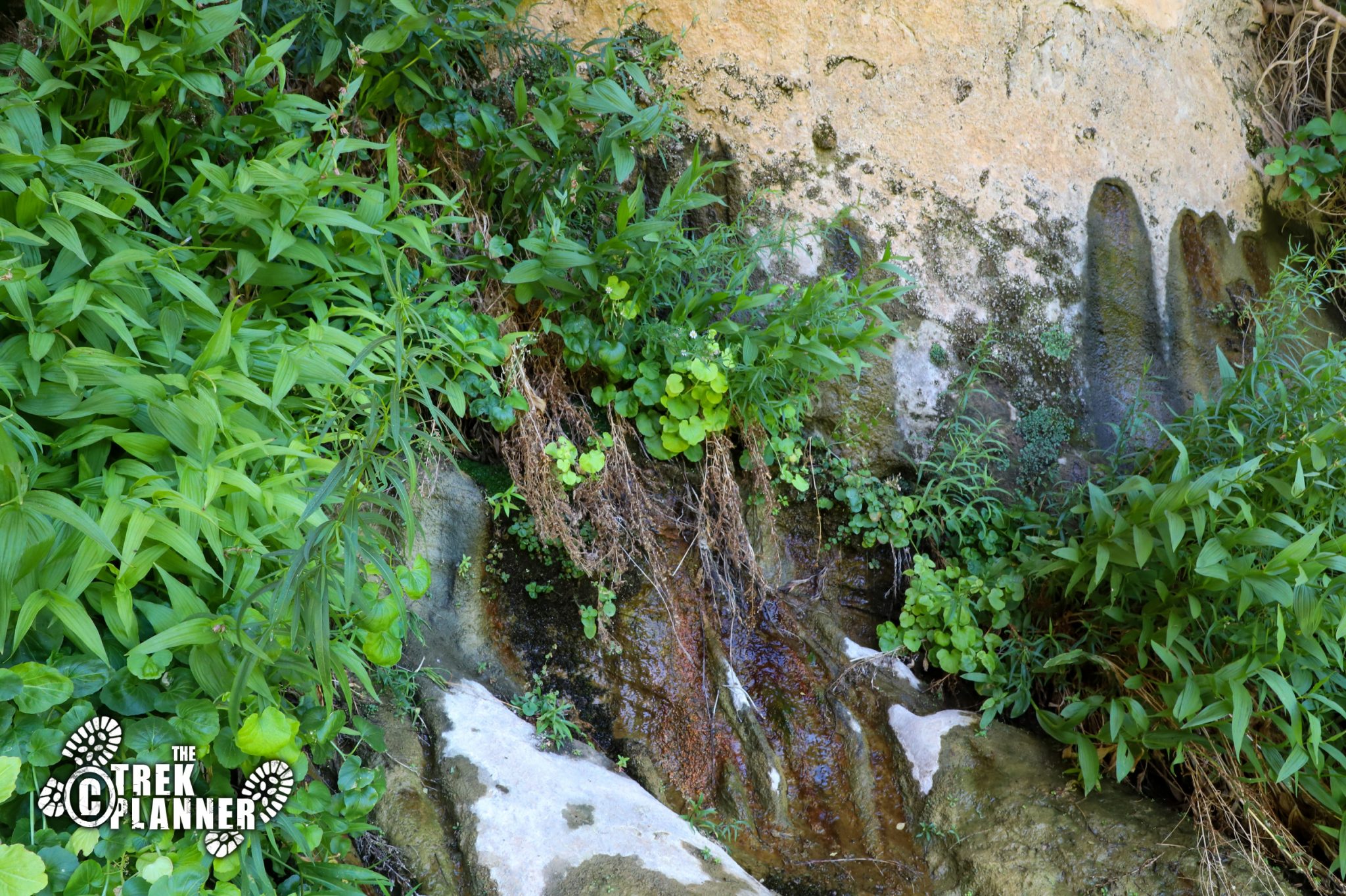
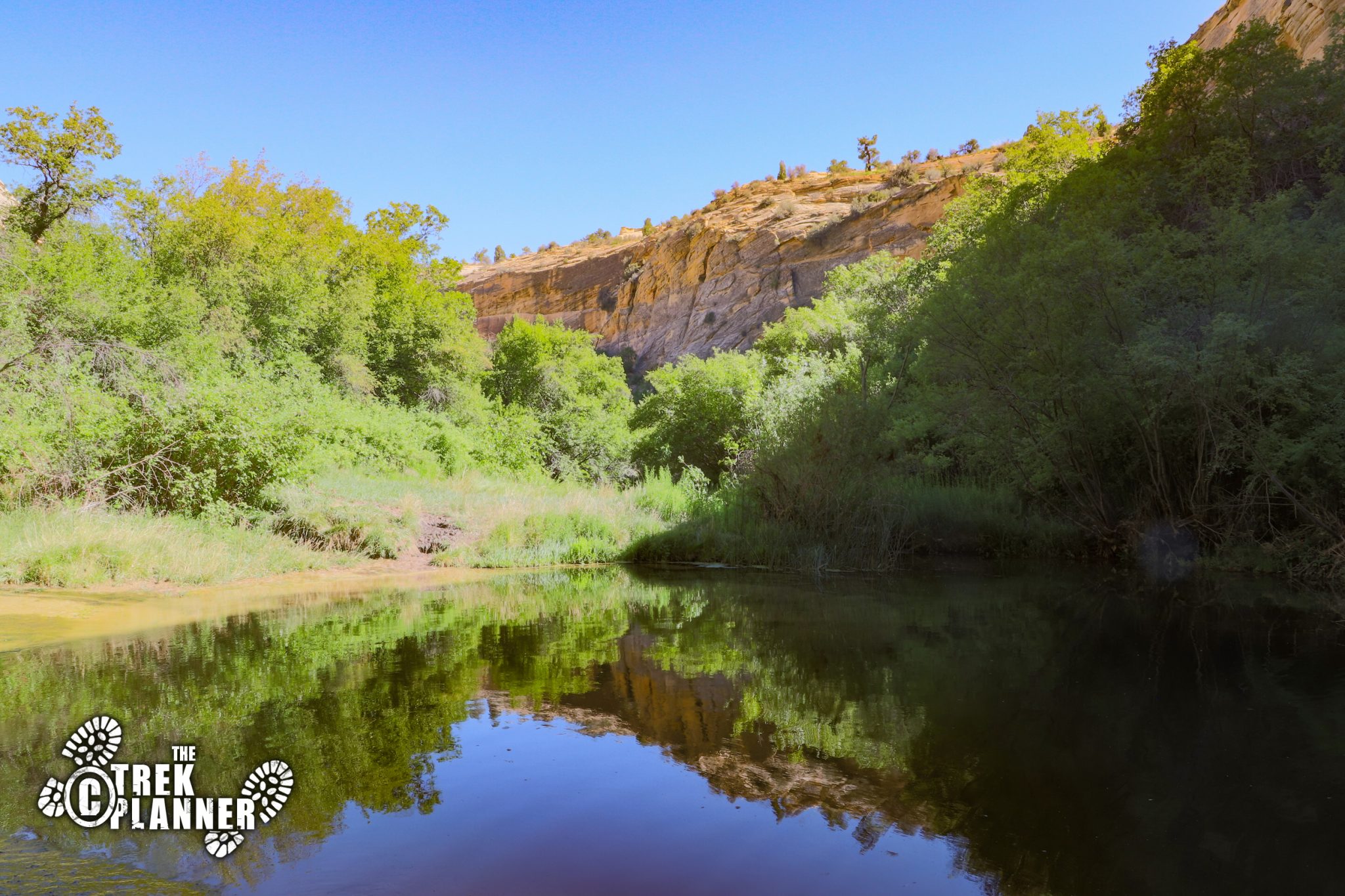
After checking out the middle pool, I went back to the fork in the trail and hiked down below. This is where you will find lush green grasses and trees getting as much of that clear precious water as they can! I saw many hanging gardens with even some of the creek water seeping right out of the walls. I love seeing flowing water in the hot desert! This was a great place to relax!
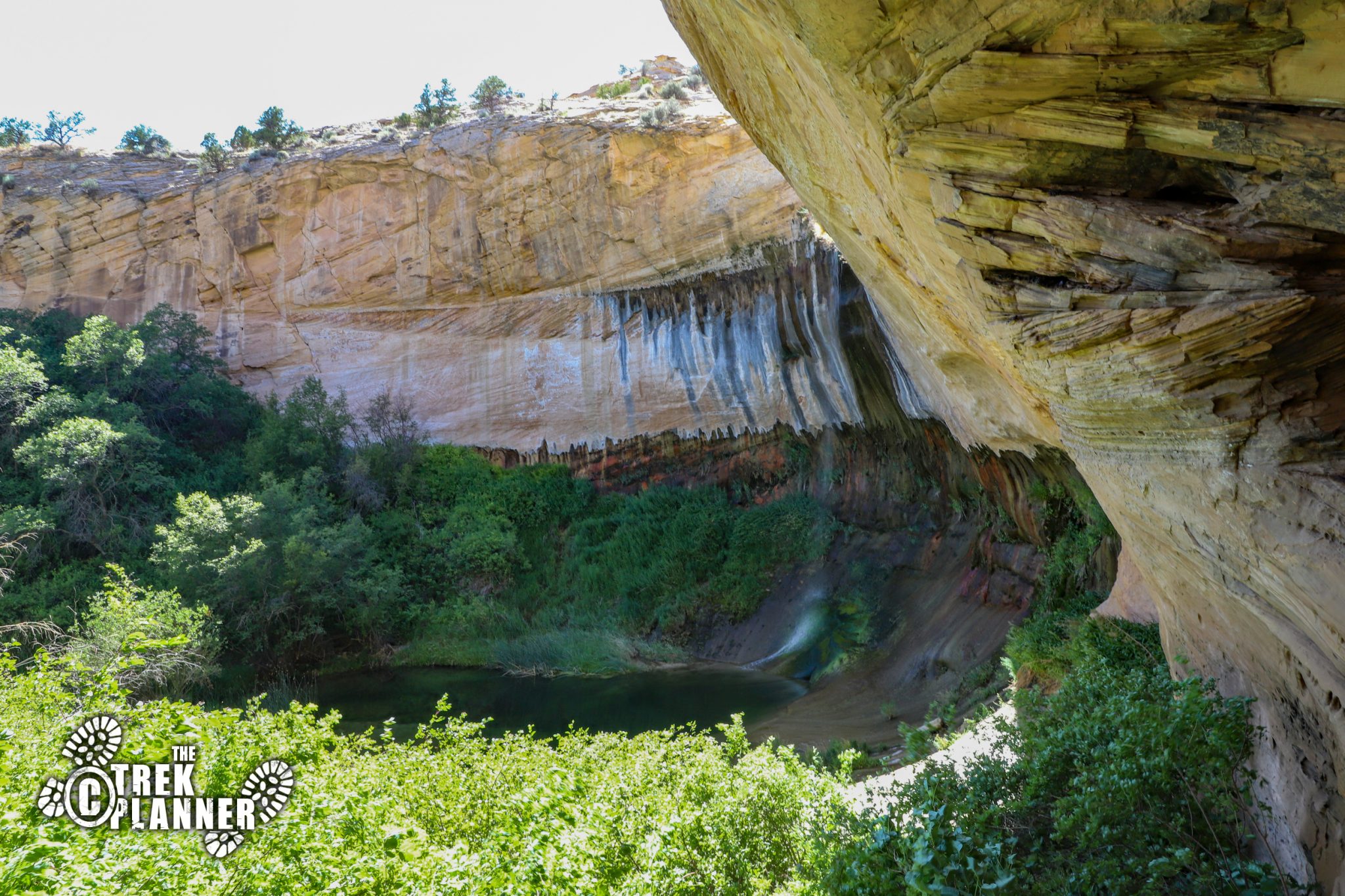

As I got closer to the waterfall, I quickly realized that there weren’t many places to sit or even lay down. And, this is one of the reasons why this hike isn’t as popular as Lower Calf Creek Falls. The Upper Falls only have a few small areas to sit down and then the rest of the area is muddy or full of thorny bushes and even some poison ivy. It’s not so bad, and the falls are still beautiful to see! The pool has steep edges so it’s somewhat difficult to wade or even put your feet in. I found on the right side of the falls was probably one of the better spots to enjoy it. If I had to estimate, I would say that the upper falls are just over 85 ft. high.


Personal Thoughts
If you are looking for a quick adventure to a waterfall that you can swim in, this is your trip! It's only a short 1.20 miles to the falls and it's worth checking out!


