


The Trek in a snapshot

Trek Planner Maps
Map is for Trek Planner Insiders only
This content is locked
(memberships are currently unavailable)

Trailhead: 41° 0.131’N, 111° 50.433’W
GPS Coordinates to the mines:
This content is locked
(memberships are currently unavailable)

Experience. Discover. Explore.
Follow along on our adventure then go out on your own!


This mine was closed by the Utah Department of Natural Resources. This Trek is now listed as a reference Trek.
You will have to hike down to Farmington Creek from Sunset Campground, cross over then bushwhack a short ways to the mine.
You will find evidence of three mines in the area. One (upper west mine) is completely blown making it impossible to enter. The other mine (upper east mine) has roof collapses making it impossible to move 50 feet. The lower mine is the largest “historic” mine in Davis county with nearly 600 feet of tunnel.
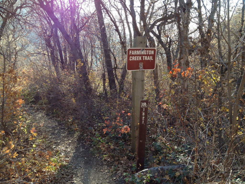
The easiest way to visit the Morris Creek Mining Complex is by starting up at Sunset Campground.
Hike several hundred yards to the farthest southern point at Sunset Campground and you will see the “Farmington Creek Trail” sign.
This trail will lead you all the way to the creek which is about .30 miles down.
The trail is easy to follow and a good steady down climb until you come to the creek.
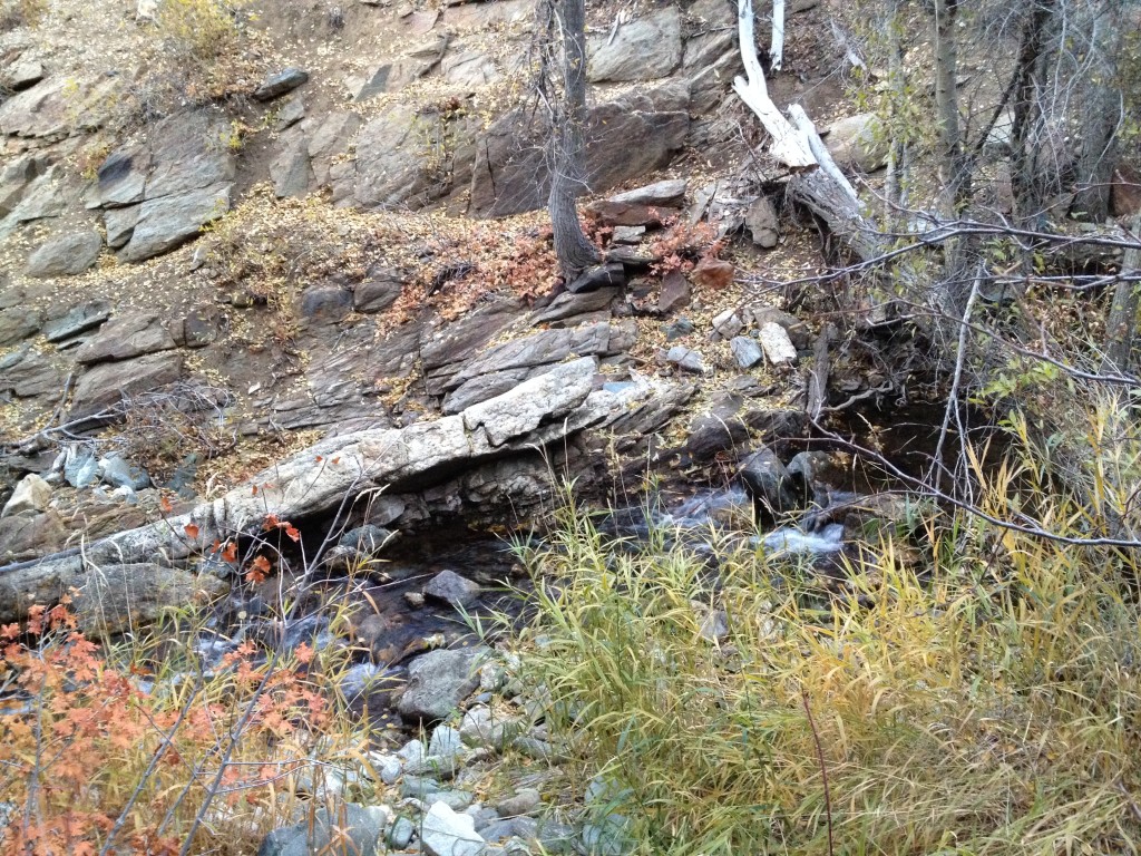
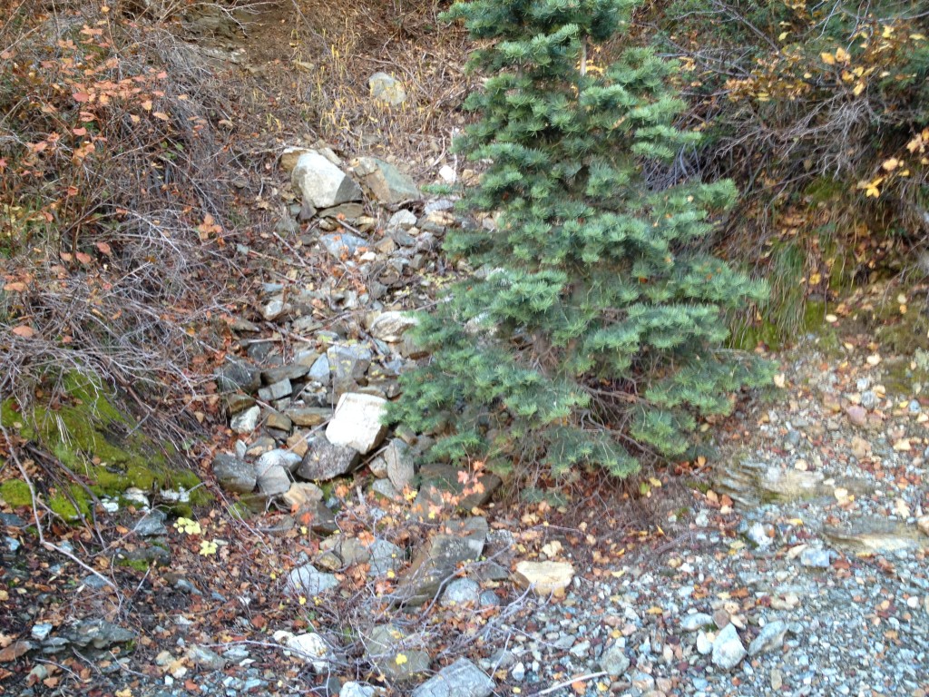
Once you are at the bottom of the trail you will notice that the trail continues down the canyon to the west or up the canyon to the east. You will want to take the east trail, closely following the creek for about another 90 yards or so then choose a good location and cross to the other side.
You will see that the trail splits again (after about 35 yards) but continue to stay on the trail that stays right next to the creek.
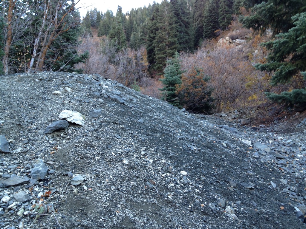
The picture to your right is the typical spot I use to cross the creek (this is looking north).
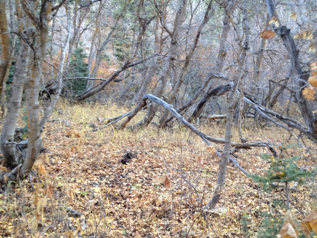
Once you cross the creek you will need to bushwhack slightly even though you may see hints of a trail. Keep hiking for about 45 yards towards a south-west direction travelling under trees and you will eventually come to a large metal boiler.
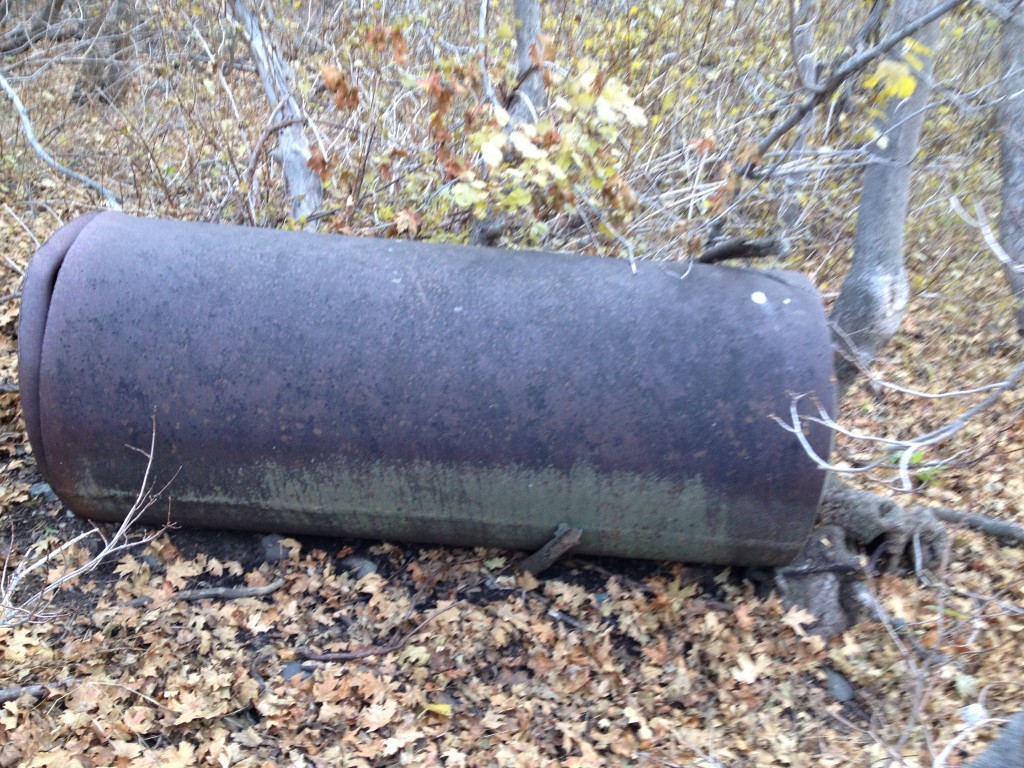
Water Container? Gas container? Hot water heater? Most likely a boiler.
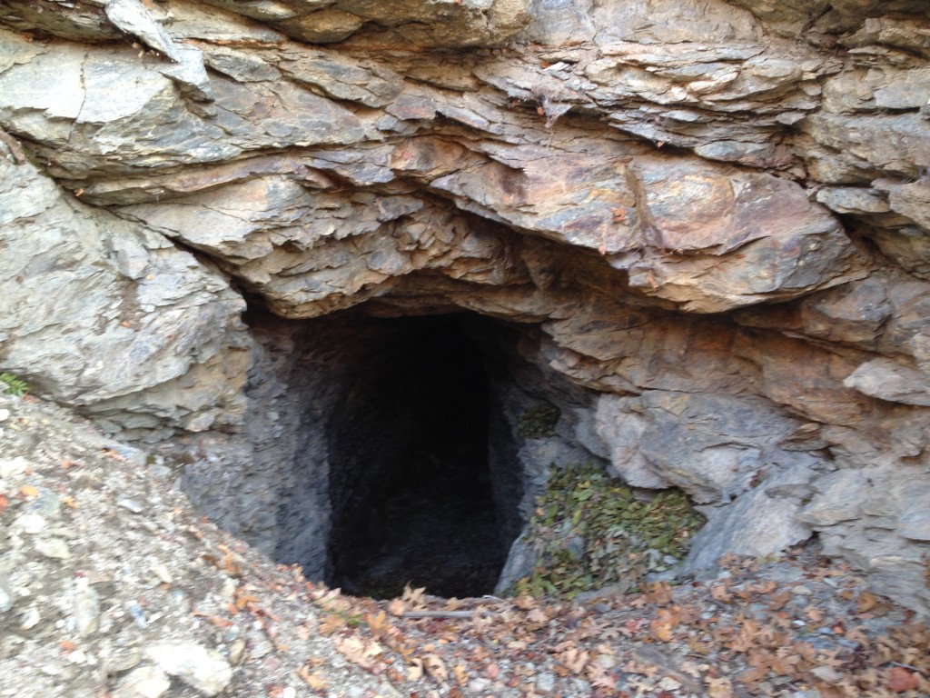
Anyway, if you see this mining relic you are just below the tailings pile for the lower mine.
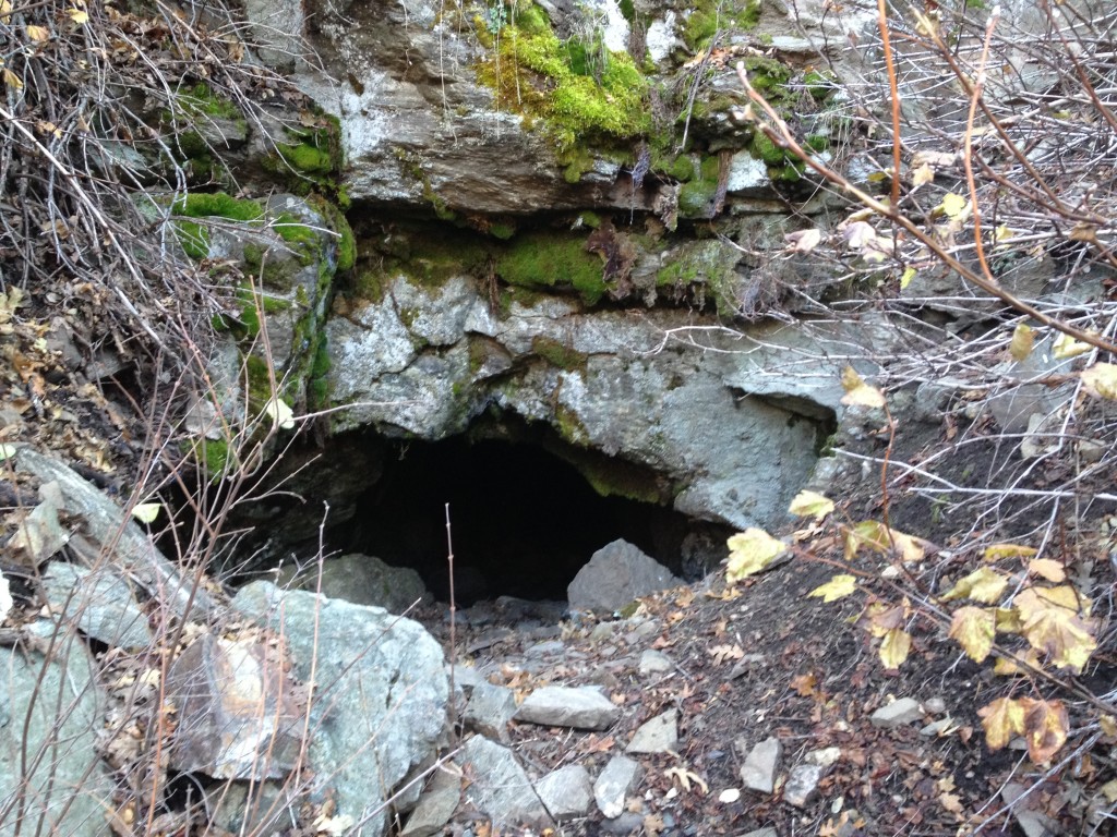
You will see three very large tailings piles lined up next to each other. Follow the middle tailings pile up and directly to the rock face and you will see the lower mine entrance.
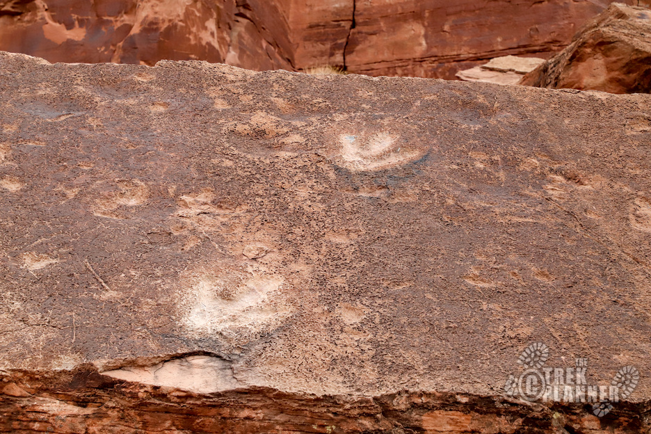
After research I have found that these mines contained good amounts of copper. If you look closely in the Upper East mine you will see colorful oxidized copper that covers a few areas on the walls and ceilings. Also, the tailings piles feature small amounts of copper.
According to us-mining.com, the Morris Creek mines are registered as copper mines.
PLEASE USE CAUTION WHENEVER ENTERING THE MINE!
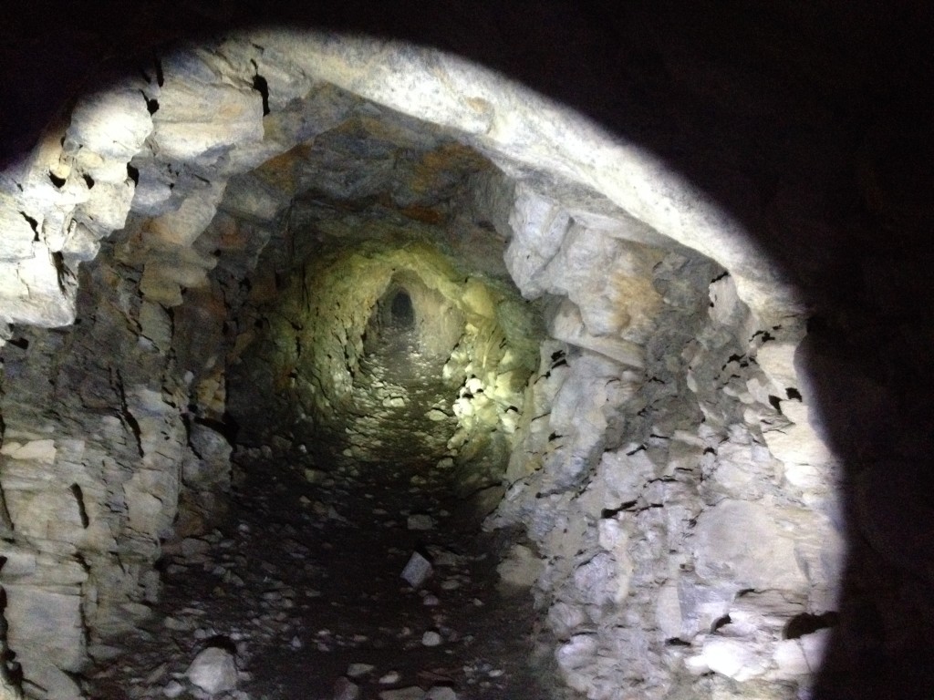
This mine is about 600 feet deep with a collapsed roof at the end. It is likely that it goes in farther but with the cave in it is impossible to go beyond it.
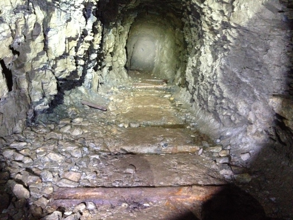
Once inside the mine you will travel straight for about 300 feet in a southward direction then the mine cuts left (southeast direction) for about another 300 feet or so until you come to the collapse. Halfway between this point there is a small roof collapse which you can easily hop over and you will also see clear water coming from the ceiling.
You can still see evidence of a mine track throughout much of the mine.
The mine is pretty muddy passed this point so please bring appropriate footwear.
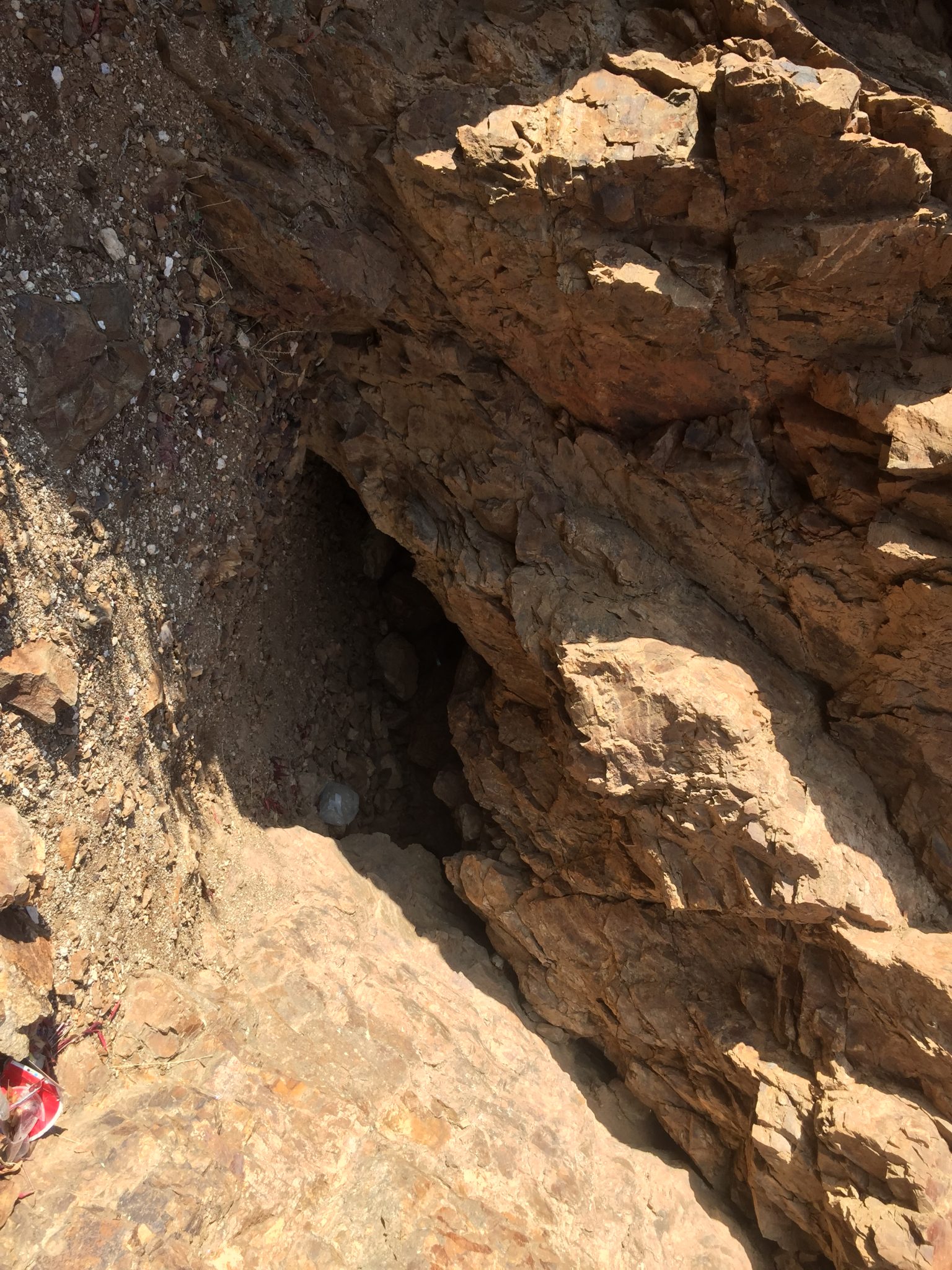
The upper mines aren’t that great to see but if you want to see them continue your hike from the lower mine and hike north until you come to a small narrow ravine that heads straight up the mountain about 100 yards in a southward direction.
This ravine was carved out by the local miners and goes directly beneath the Morris Mine Upper East and West.
Remember that the West mine is blown so you will not be able to enter it but the East one (now closed) had an unstable roof It goes in for about 20 feet or so then immediately turns west and you will need to crawl your way through some spots if you want to reach the end of the 50+ or so feet of tunnels.
The Upper West mine is located directly to the west of the Upper East mine at about the same elevation. You will see a small trail and a tailings pile once you arrive.
Here is a picture of the caved mine.
Historical Information:
While I was reading the book History of Davis County from 1890 by Glen Leonard I found an interesting part about the mining activities in Farmington Canyon. I have reason to believe that the Morris Creek Mine Complex and several others in the Farmington Canyon area were mined by Henry Southworth and his son. Here is the excerpt from the book:
The pioneer and most persistent follower of mining in our vicinity was Henry Southworth. His son, Edward, worked some with him.
They had at least two mines on the north side of the canyon, near Halfway Creek. They owned several others in the canyon near Whipple Creek. Henry, doubtless, had prospects in a number of other places.
I believe Henry and his son Edward dug the Morris Creek Mines because the book referenced Whipple Creek. Whipple Creek just so happens to be only 100+ yards away from the Morris Mines.
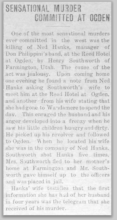
After doing more research about who Henry and Edward are, I found out that they are both buried in the Farmington Cemetery. Henry was an interesting man and had an interesting family. His son (who is also named Henry) even killed someone in Ogden Utah. Here is the story:
Henry was suspicious of his wife and thought she may be cheating on him. Henry came home from work one day to find his wife gone and the children hungry. He eventually found out that his wife was with another man in Ogden and Henry went to Ogden and shot the man 5 times, killing him. There are numerous newspaper articles about this man and his murder trial. Eventually he was acquitted and returned home and tried to reconcile with his wife but she later divorced him.
If you want to read more here are more links to the interesting murder trial. Southworth Murder Trial
The below newspaper clipping is from the Emery County Progress for August, 19th, 1911 – Source
Why Southworth shot “Ned” Hanks
Southworth Returns to His Home
Exploring Morris Creek Mine

Personal Thoughts
This is a great place to explore and even spend a night at the Sunset Campground. I have been here several times and am still amazed at all the mining structures and tunnels in the Farmington Canyon Complex.

Unfortunately, the Department of Natural Resources closed the lower Morris Creek mine. I don’t know if they closed the upper mine while they were at it (I didn’t bother checking it out after finding the lower mine sealed). The upper mine was in a lot worse condition safety-wise than the lower mine, so I imagine it’s sealed as well. Living close by in Centerville, I loved visiting these mines whenever I got the chance. I’m sad most of the mines in Farmington Canyon are now closed.
Thanks for letting us know, Kevin. I guess that doesn’t surprise me that the DNR also closed the Morris mine because they already closed the Grist Mill and Farmington Canyon mines so it would make sense that they would also close this mine.
I totally agree with you. The Farmington Canyon mines are where my love for exploring mines started and it’s sad to see them closed up out of fear. It’s only a matter of time, I think, until Patsy’s Mine is closed too…
I’ve been in both of of these mines also several years ago,.Hate to see them closed.
I was sad to see the Morris Creek one closed too. It was a great one to explore