
The Trek in a snapshot

Trek Planner Maps
Trail Map is for Trek Planner Insider Members Only
This content is locked
(memberships are currently unavailable)
GPS Coordinates are for Trek Planner Insider Members Only
This content is locked
(memberships are currently unavailable)

Experience. Discover. Explore.
Follow along on our adventure then go out on your own!


Driving Directions
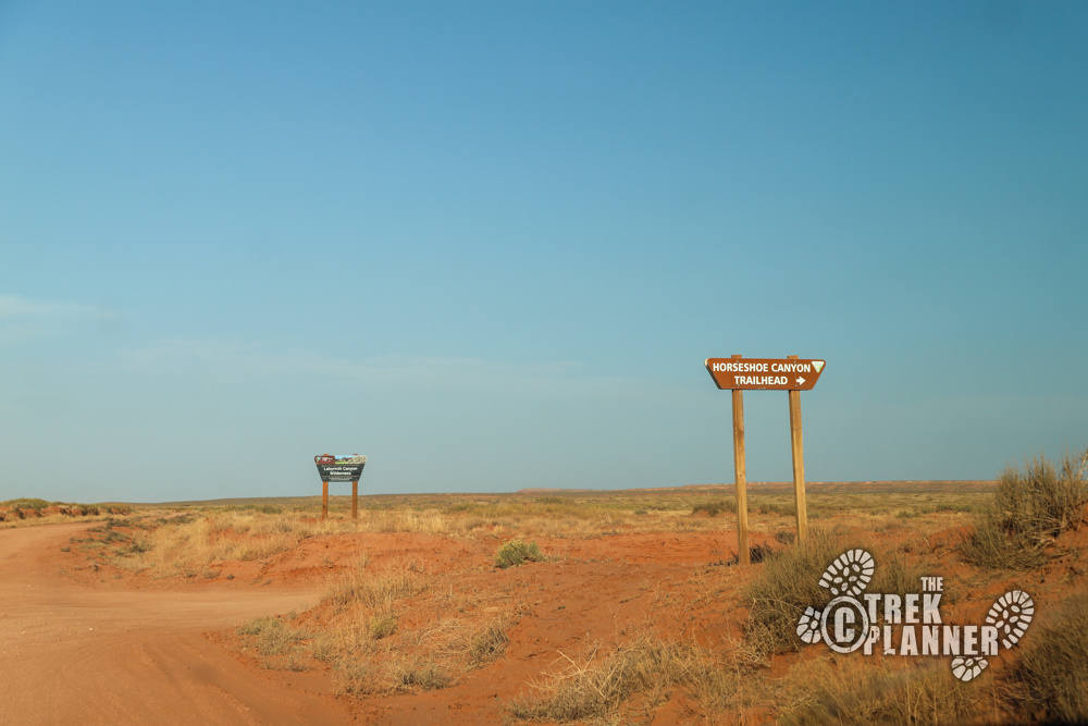
A high-clearance vehicle with 4-wheel drive is preferred. I drove here just fine in my low-clearance 2-wheel drive vehicle, but if there were recent rain or snow I would have gotten stuck or had a very tricky time getting to the trailhead. You will be travelling 31 miles on a dirt road that was mostly in OK condition, except there were many ruts, bumps, small pot-holes, and short stretches of sand dunes to drive on.
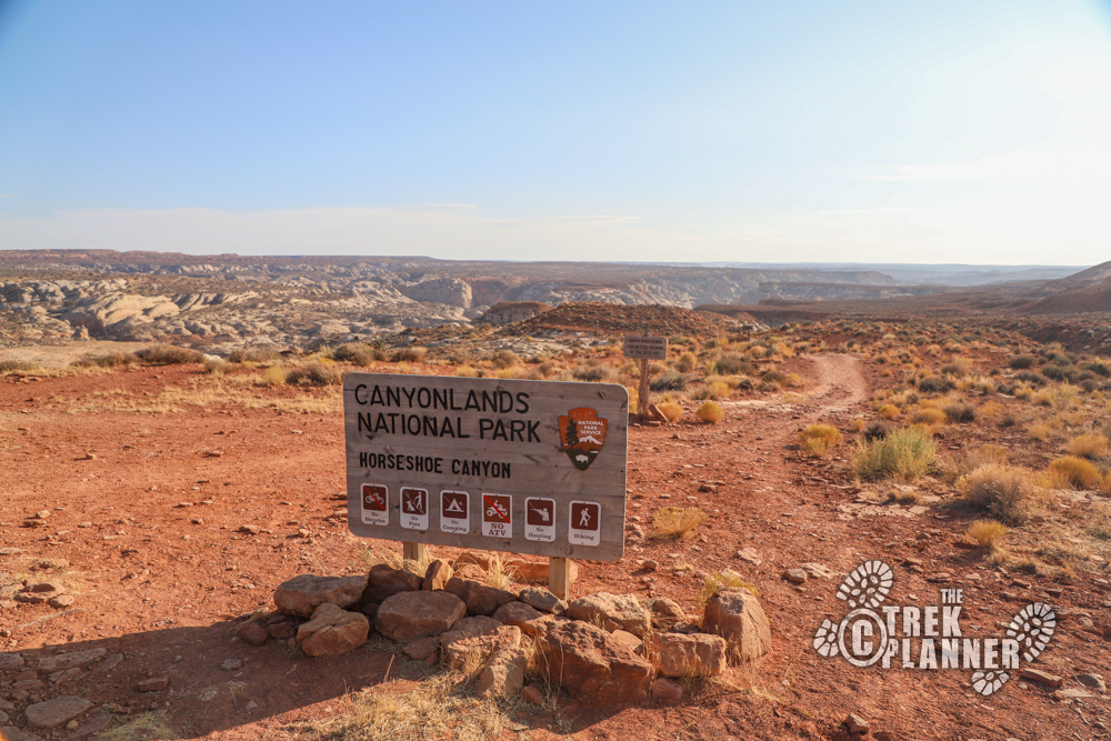
The road is graded, but can deteriorate over time until it’s graded again. There is one sign pointing you to Horseshoe Canyon and that is nearly at the end of the 29.3 miles of driving. Use my GPS coordinates to aid you in getting to the trailhead if needed or print out directions before you leave. When you get to the trailhead you will probably have GPS signal, but it works intermittently. Plug in the GPS coordinates BEFORE you leave good cell phone coverage, just so you have everything marked before you get there.
Check with the Park Service for current road conditions before heading out. Make sure you have extra fuel, food, water, a full-size spare tire, tire changing equipment, and a shovel. For current road conditions check The Maze: Highway 24 to Horseshoe Canyon: https://www.nps.gov/cany/planyourvisit/road-conditions.htm
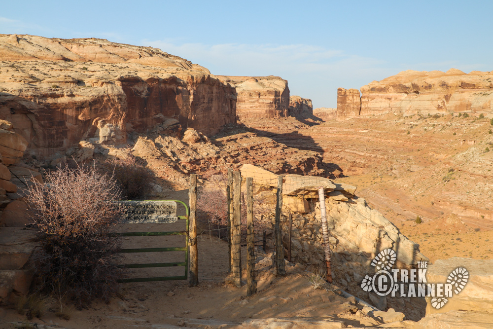
Please do not touch the rock art
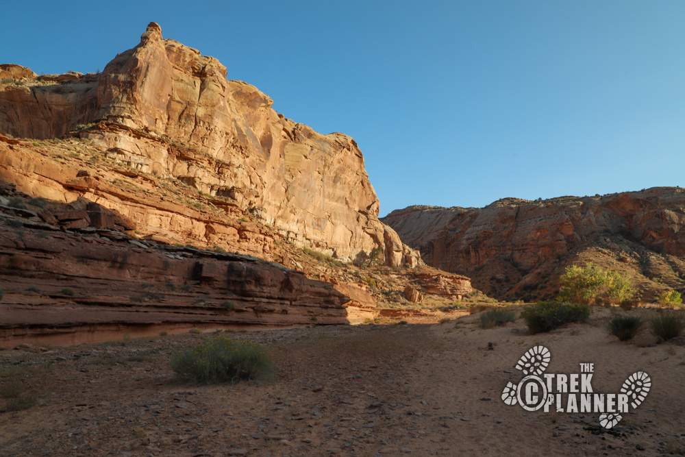
The hike to the Great Gallery is a grand adventure that won’t disappoint you. You will see some of North America’s finest rock art inside Horseshoe Canyon. In fact, a certain type of rock art called Barrier Canyon style, was created in this canyon. (Horseshoe Canyon was originally named Barrier Canyon). You begin on the far western edge of Canyonlands National Park. Horseshoe Canyon was added to Canyonlands in 1971.
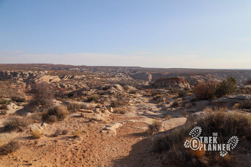
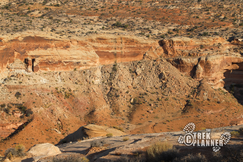
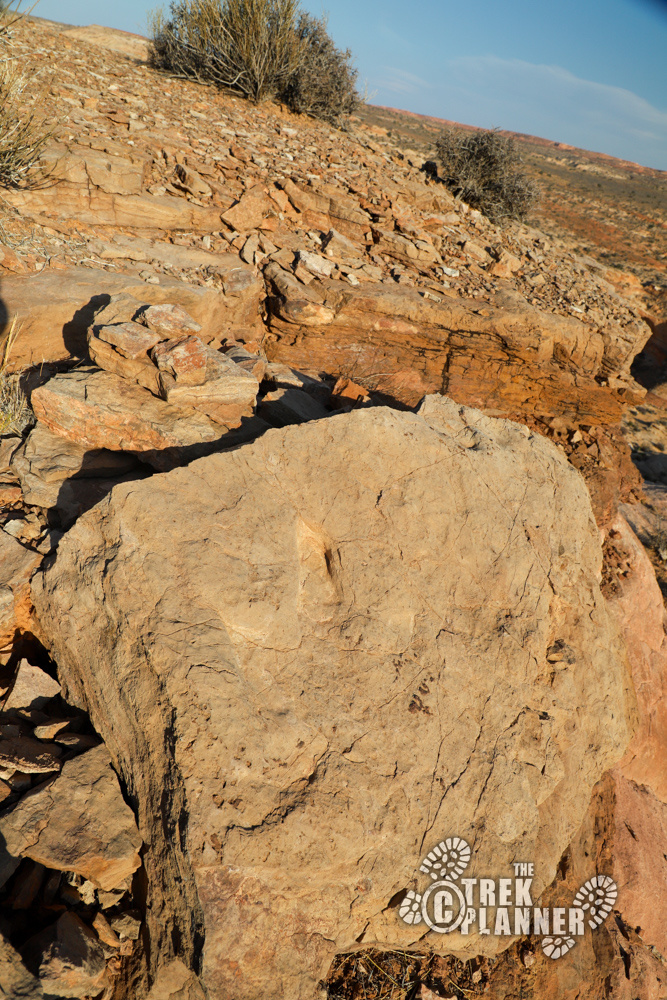
The hike begins on a gradual descent into Horseshoe Canyon. It’s pretty straightforward at this point as you can see where an original road was cut by (possibly) ranchers and prospectors. The first landmark you come to are some dinosaur tracks. I will post the GPS coordinates for Insider Members and Plus Members. There are three right next to each other.
Dinosaur Track GPS Coordinates:
This content is locked
(memberships are currently unavailable)

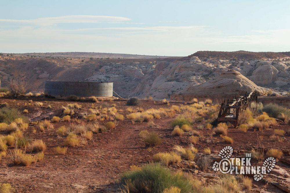
The next thing you will see down the trail at about 0.60 mile is the historical water storage container and trough. These are located on the edge of a cliff. The pipes go a ways down to the canyon floor where water was pumped to fill up the circular container.
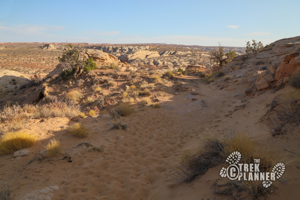
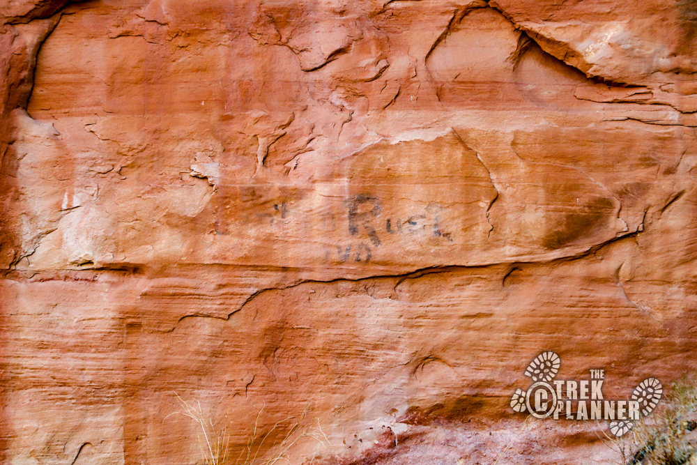
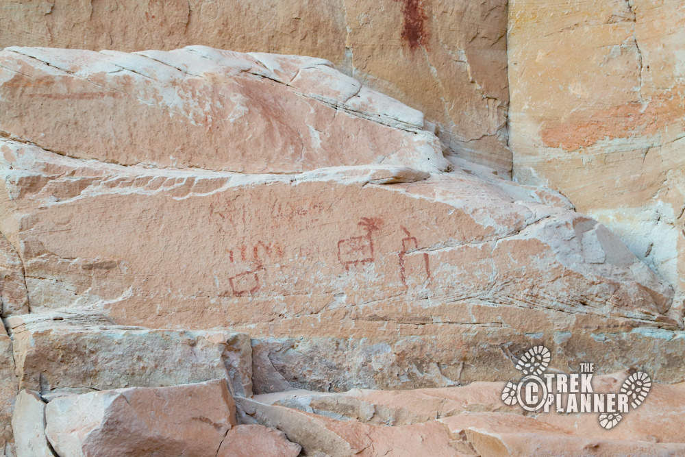
The trail then circles around for a bit until it comes to a metal gate. This is to keep vehicles and livestock from entering the canyon floor. The gate is located about 1.08 miles into the hike. You can still get through the gate, you just have to go through the little turn-around spot on the right side. From here the trail goes down a sandy ramp until the canyon floor. You will reach the canyon floor at about 1.38 miles. Just below the gate I saw some writing on a rock wall. What do you think it says? I couldn’t make it out.


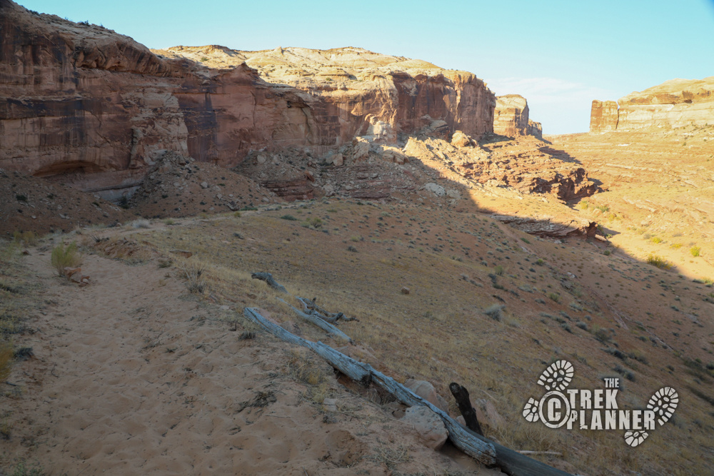
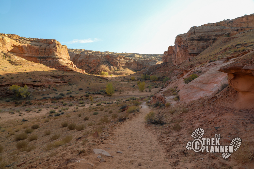
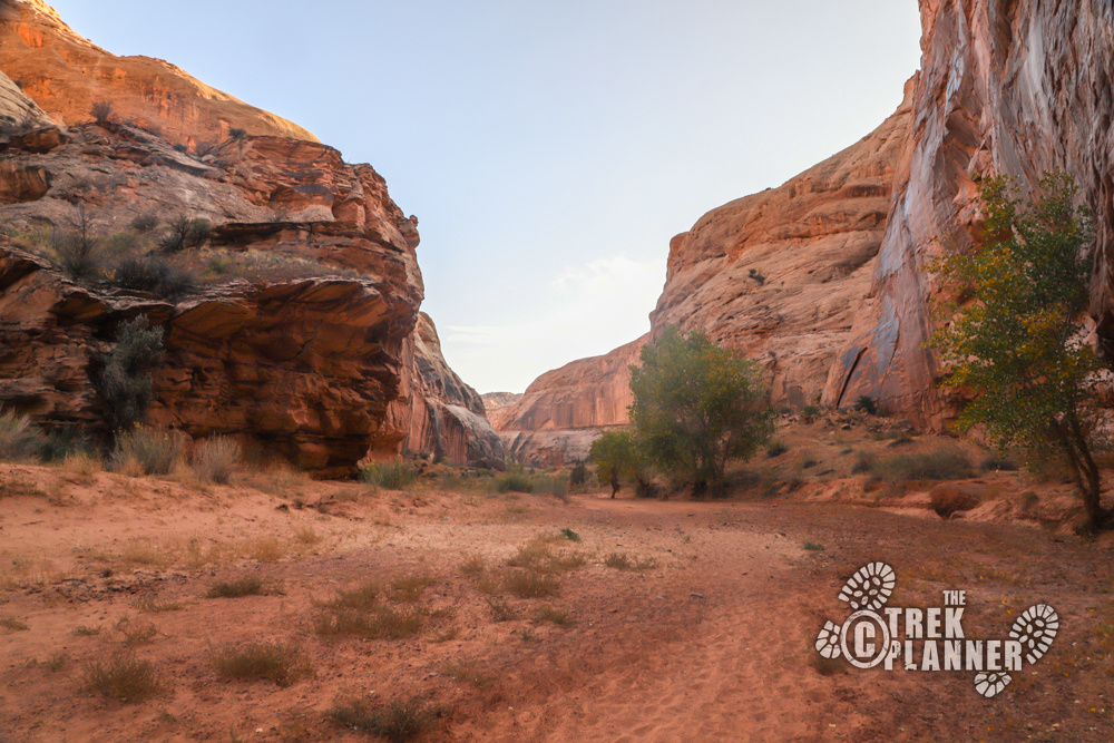
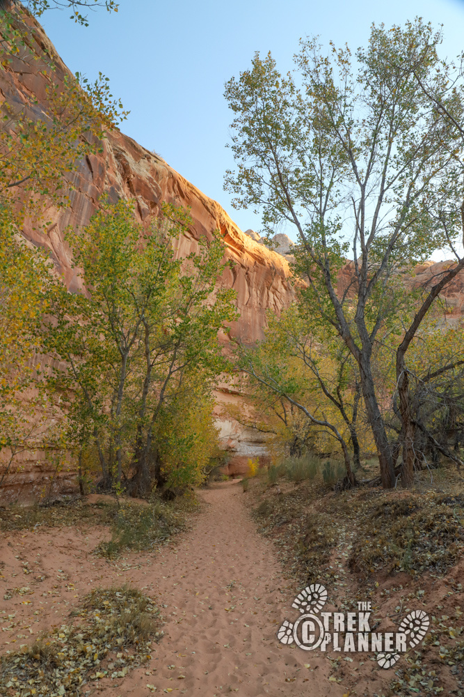
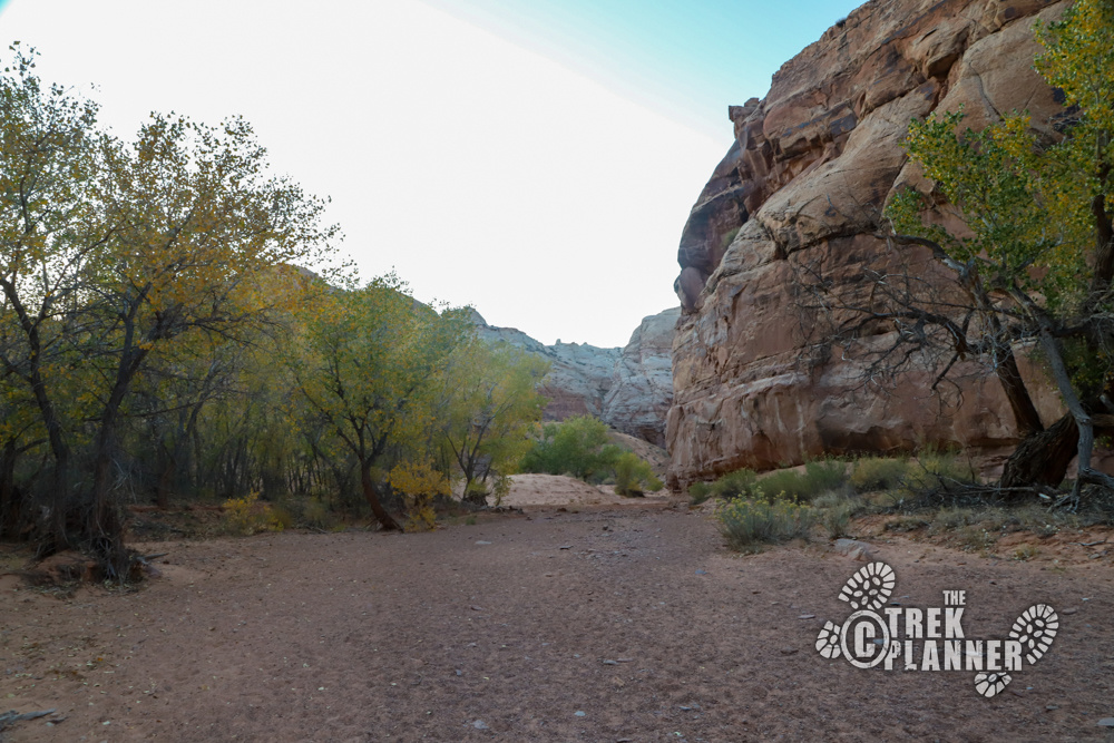
From here you will be hiking on the sand in the center of Horseshoe Canyon until you come to the Great Gallery pictographs. There are moments where the trail goes on solid dirt, but be prepared to hike on sand the rest of the way.
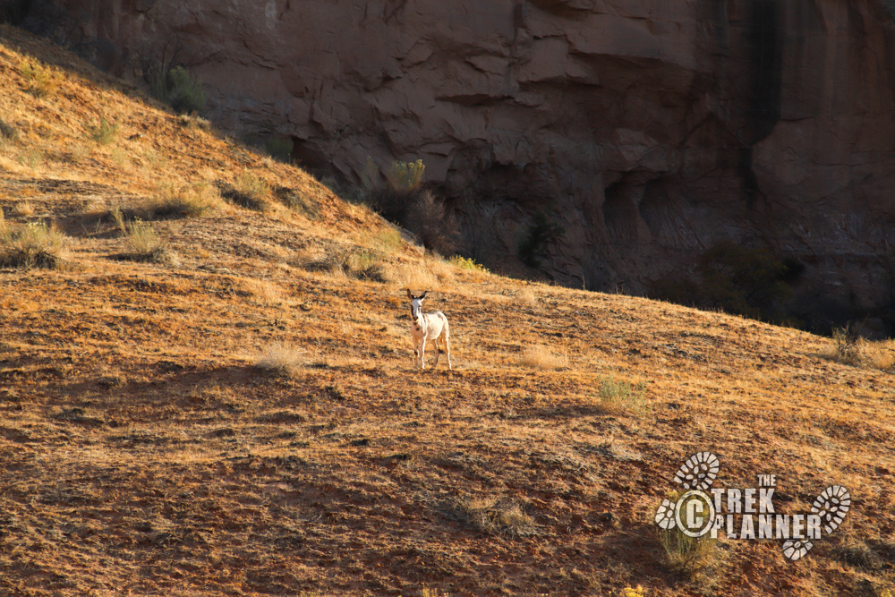
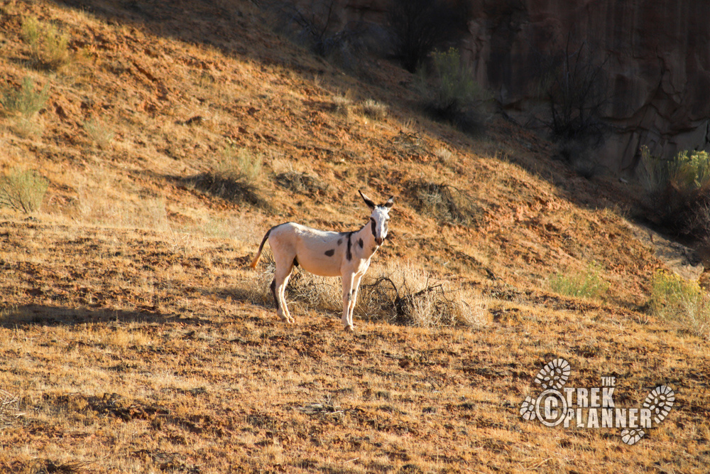
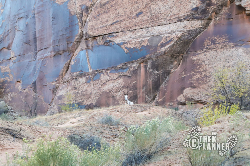
It was around here that I passed some hikers who told me they had seen a white wild “horse” in the canyon. They didn’t say if it was aggressive, but I planned on treating it like it was and would stay my distance if I did encounter it. Well, I did encounter it pretty quickly (it’s actually a wild burro) and it was always watching me and even “escorted” me around the canyon. I would hike up the canyon and it would run ahead of me a little ways. I always stayed my distance and tried to avoid it as much as possible. (When I finished the hike I saw a sign at the trailhead that I missed that stated there was a wild burro that was territorial. The sign warned to stay away and not provoke or go near it.)
The burro that I saw had a black colored splotch on its right eye so if you see the same one leave a message in the comments below!
High Gallery
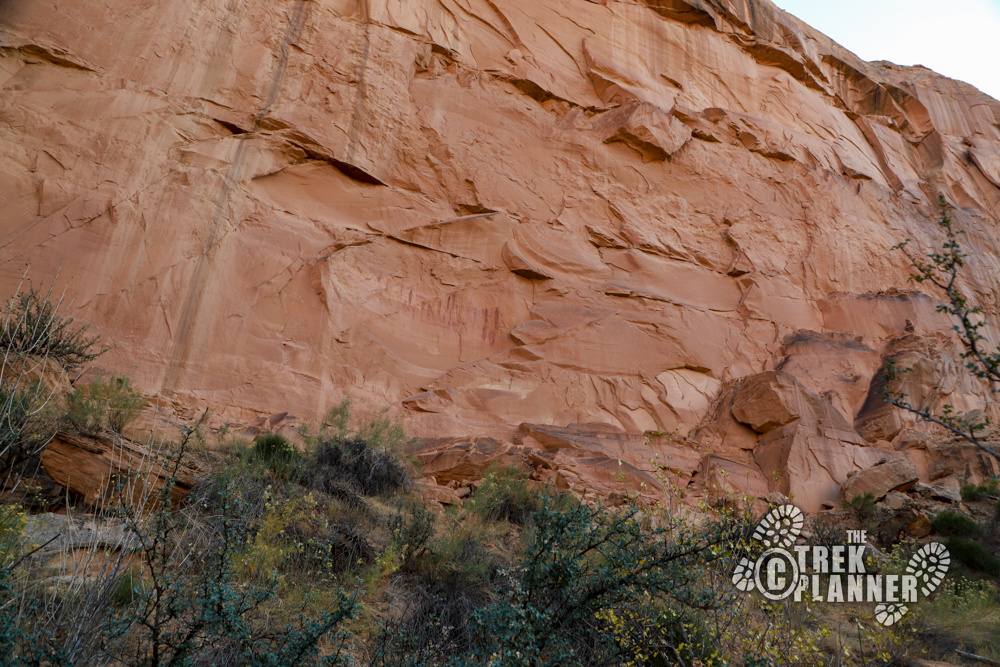
After hiking about 1.75 miles I noticed a rock cairn and trail leading to the left (east) side of the canyon. I followed it and saw the first pictograph panel called High Gallery. The High Gallery is located at about 1.83 miles into the hike.
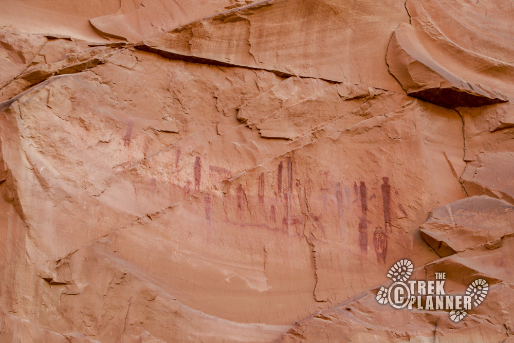
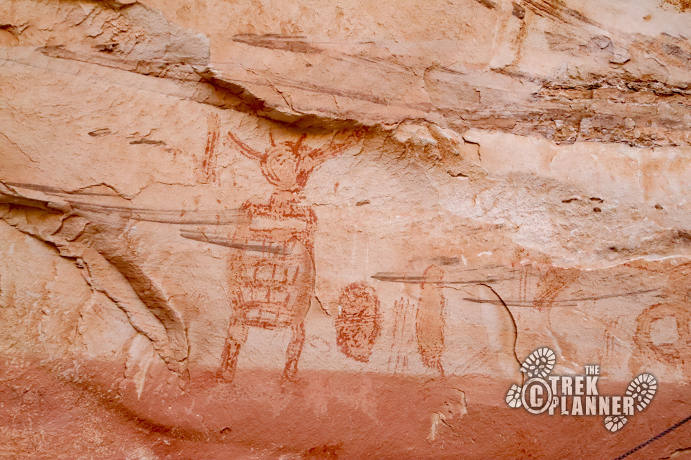
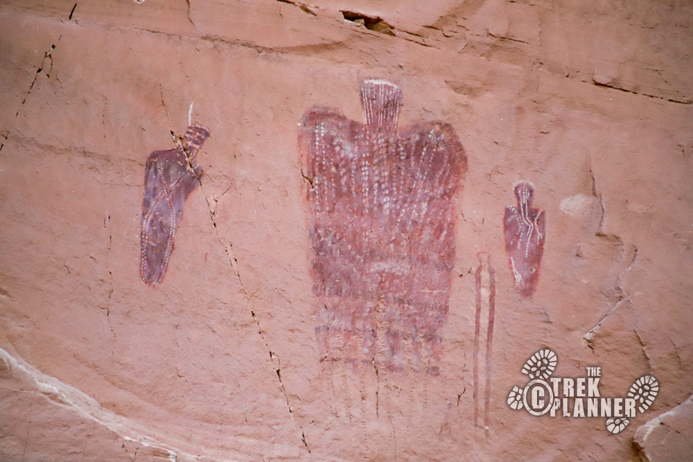
This is a fantastic panel that is high up on the cliffs. The original authors must have used some type of scaffolding or ladder to climb up this high! Binoculars are recommended to view these ones. There is a winged figure that is very similar to the figures located in Buckhorn Draw which is north west of Horseshoe Canyon in the San Rafael Swell.
Most of these figures don’t have arms.
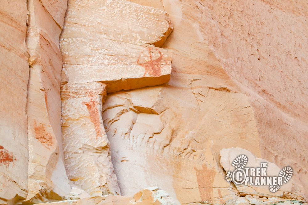
Horseshoe Gallery
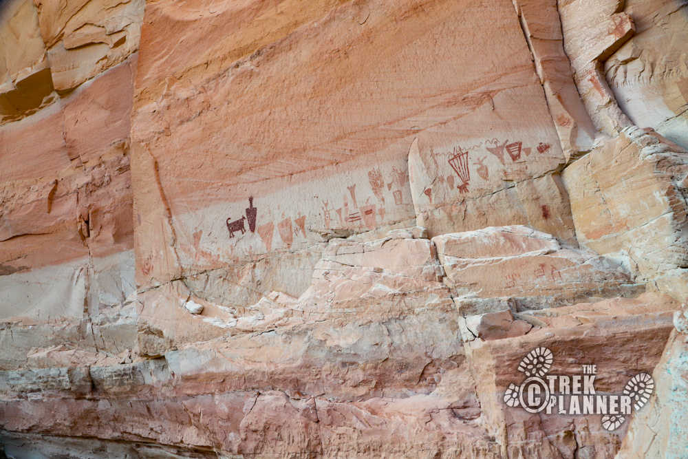
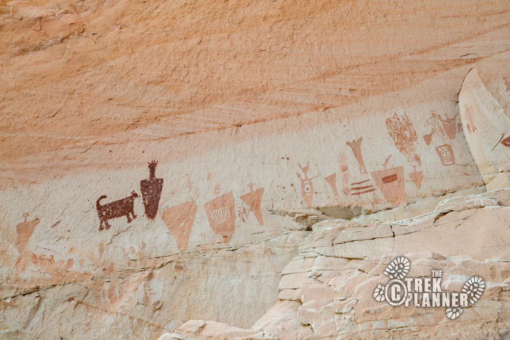
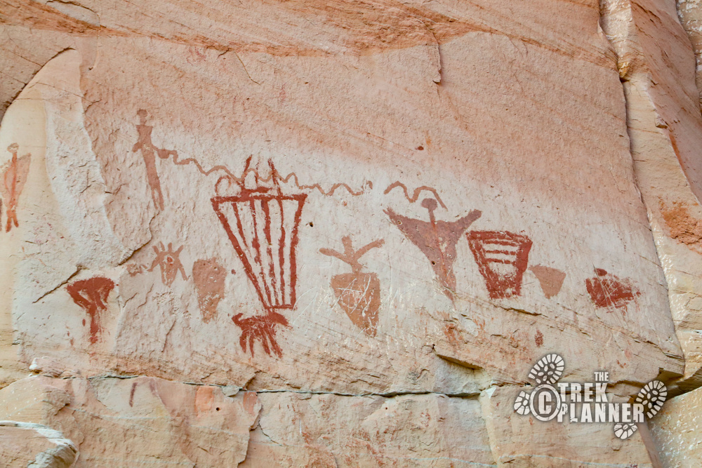
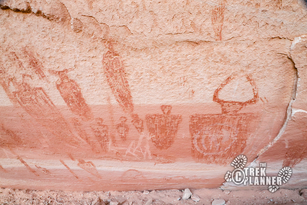
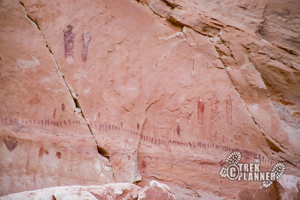
Horseshoe Gallery is located directly west of the High Gallery at about the 2 mile marker into the hike. These pictographs are located closer to the ground, but still about 18-20 ft high.
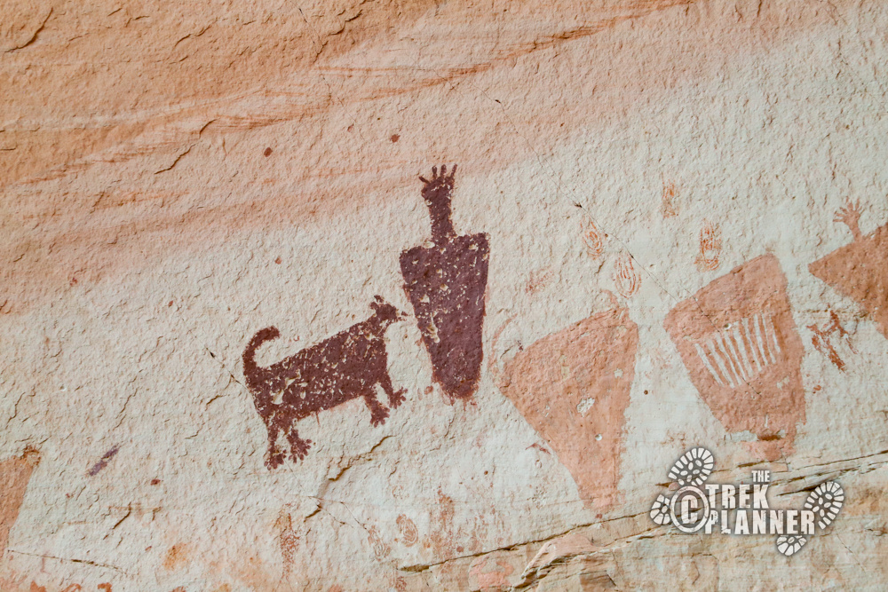
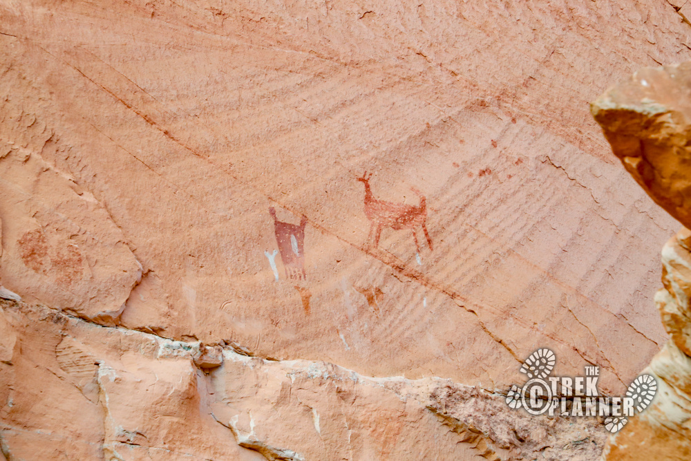
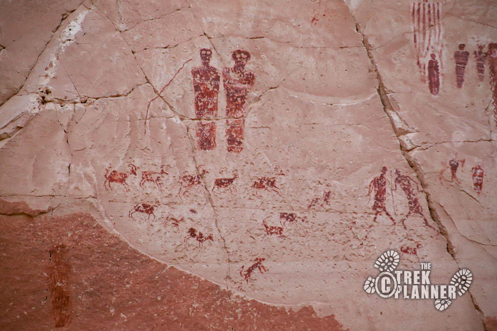
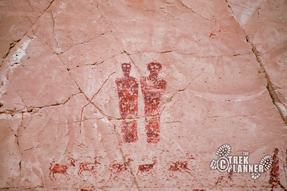
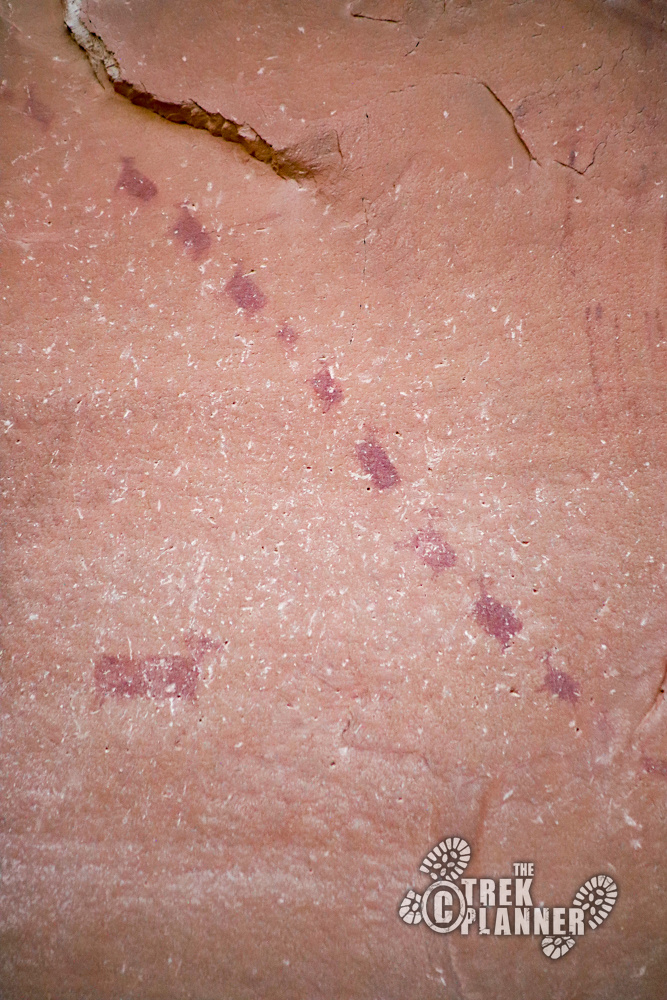
Most of these are lighter color, but there are a few pictographs that are dark red including a figure with a dog! Most of these don’t have arms or legs either and have points or antennae or horns on their heads.
There are depictions of big horn sheep, coyotes or dogs, and maybe deer or elk too.
From here you will be hiking another 0.65 mile until you come to the Alcove Gallery.
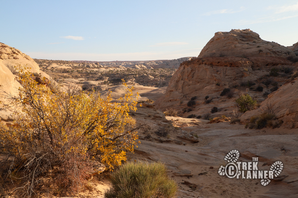
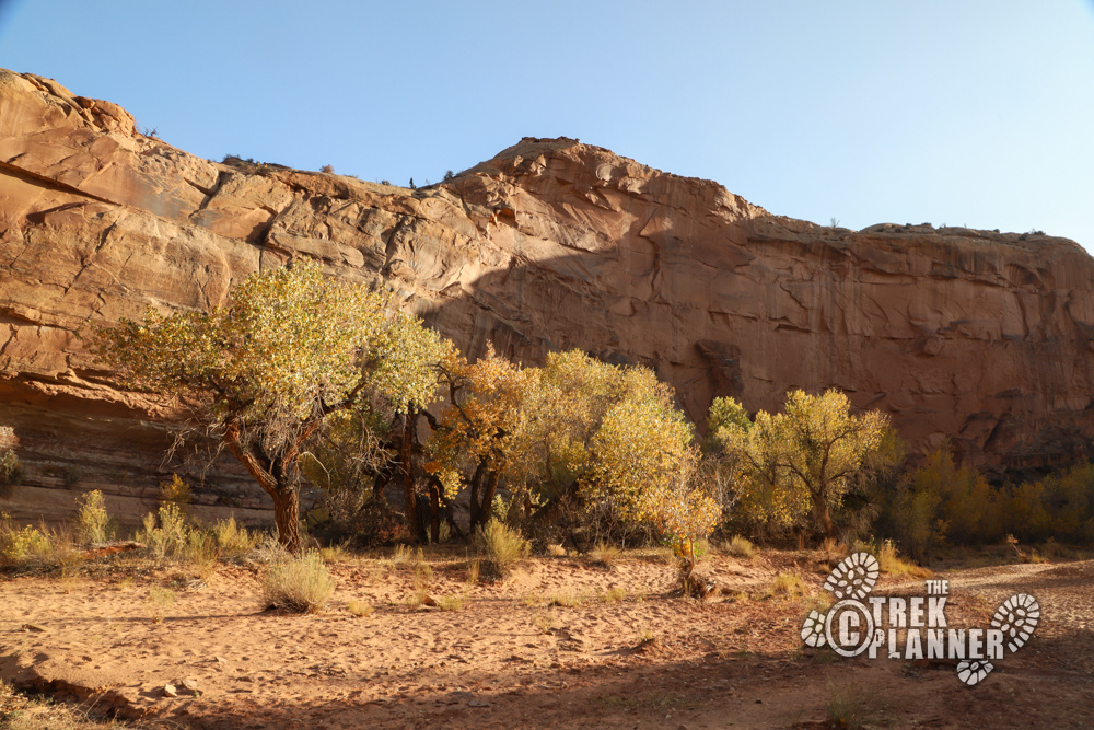
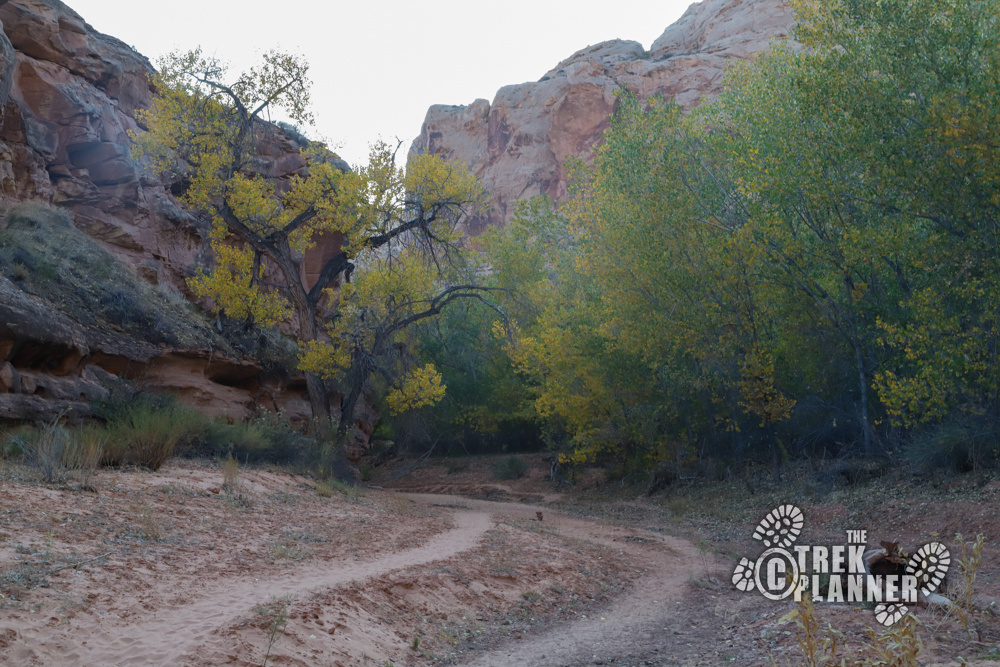
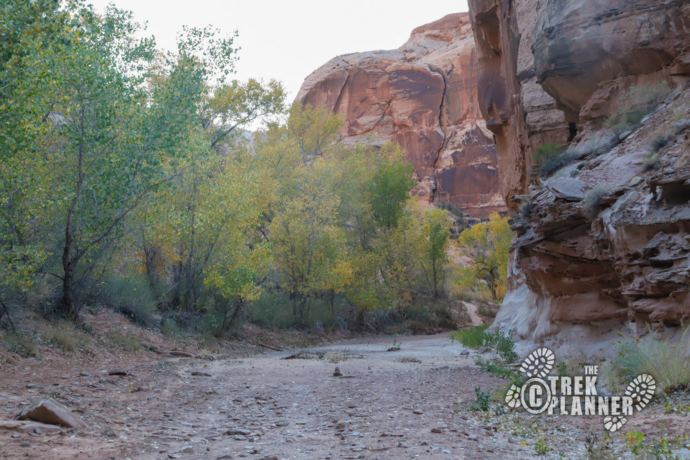
The trail is beautiful and has many old cottonwood trees. Fall is the perfect time to visit since the temperature was in the upper 60s and the leaves on the cottonwood trees were turning yellow.
You may be wondering: if there are water-loving cottonwood trees here, where is all the water coming from. There are some small natural springs up the canyon, but this canyon does see flash floods as evident by the many broken branches pushed up against some of the living trees.
Be careful if you are hiking in rain as there could very well be a flash flood higher up the canyon.
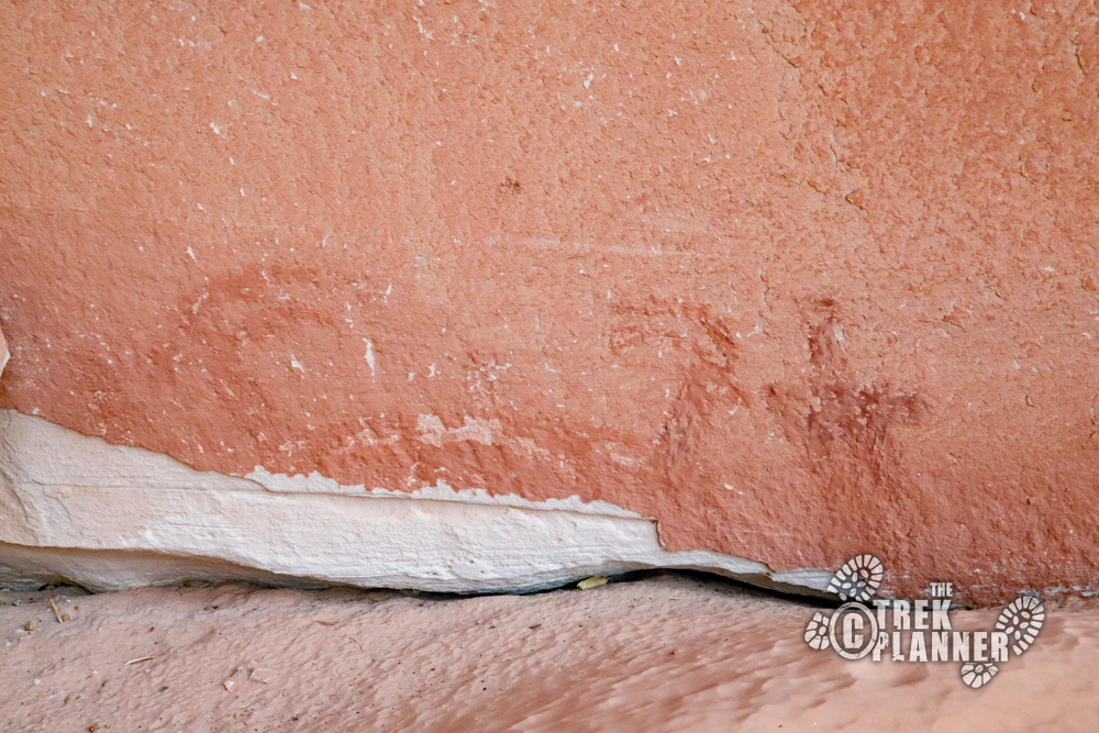
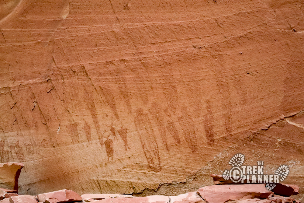
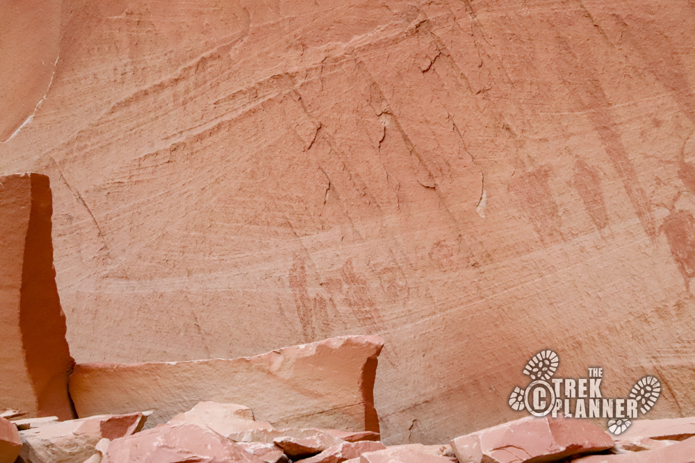
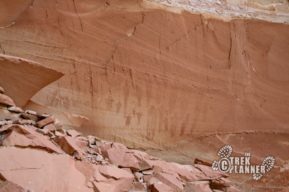
Alcove Gallery
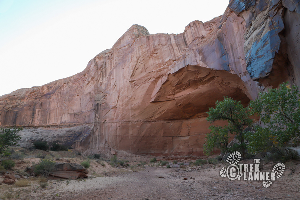
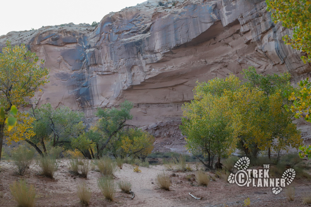
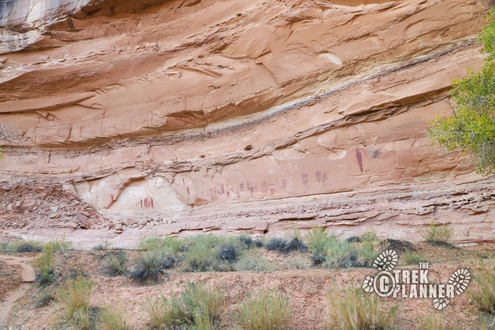
At around mile 2.65 you will come across a giant alcove on the west side of the canyon.
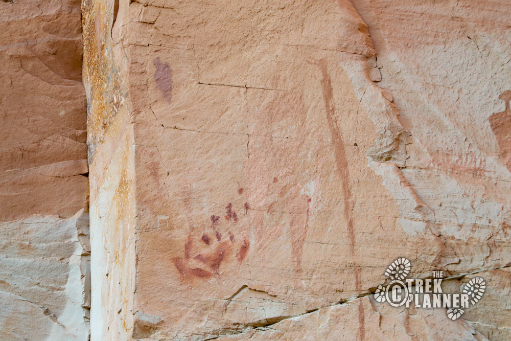
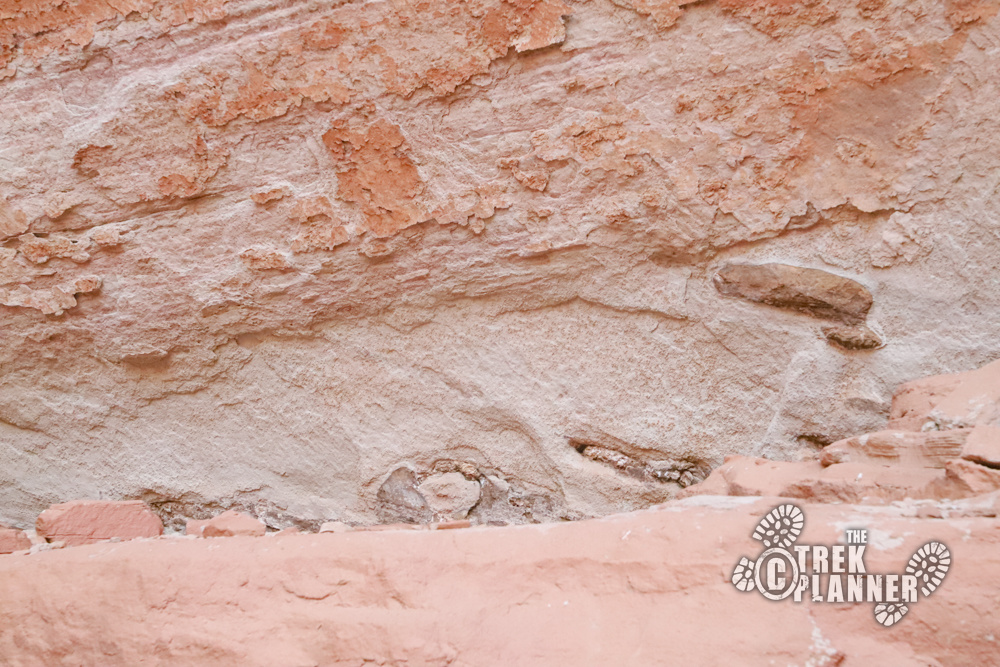
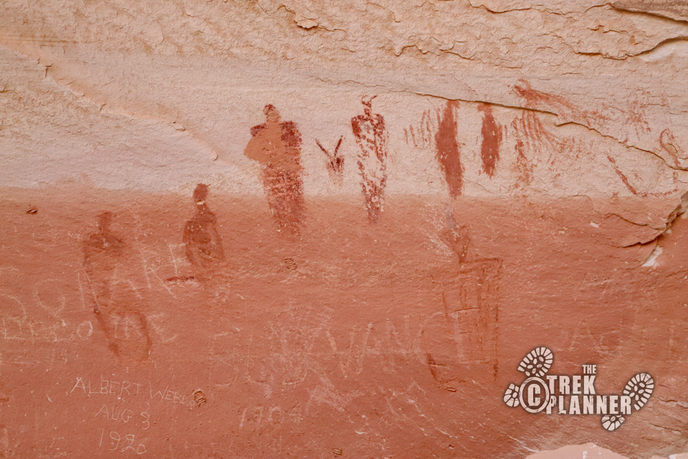
The Alcove Gallery is located inside a very large and wide alcove on the west side of the canyon. There are pictographs and some petroglyphs beginning on the north side of the alcove all the way to the west side. Take note of the layer between the sandstone walls that has some petrified wood in it.
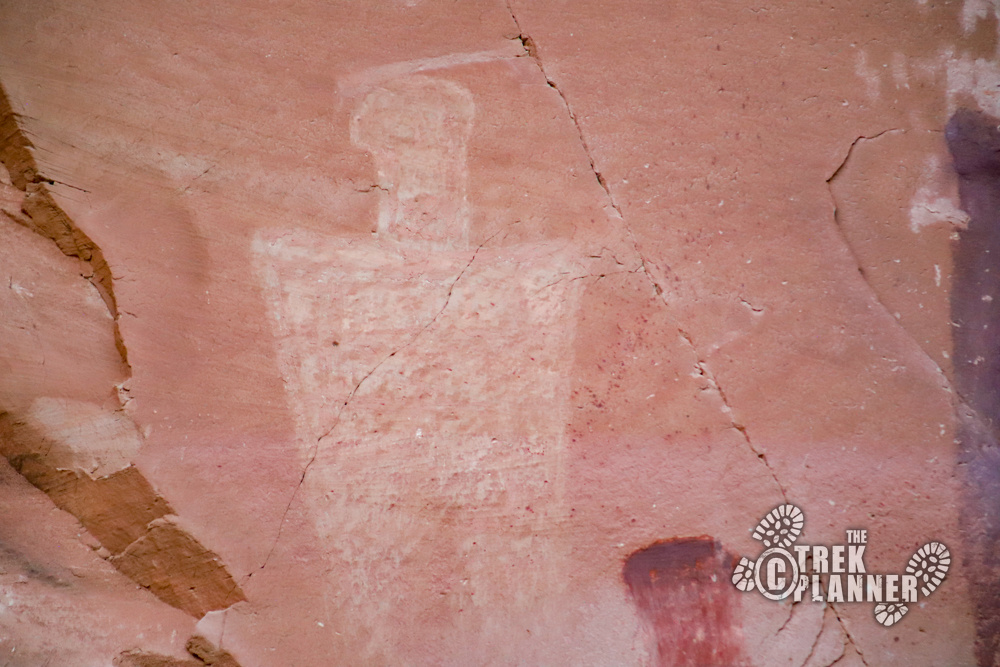
These pictographs are faded, but are in the similar style as the others galleries. The pictographs on the west side of the alcove appear to be made more of mud than of paint. There are some very interesting anthropomorphs (human-like figures) in this canyon and some of them are found in the Alcove Gallery. You will also see some historical names from the early 1900s.
From the Alcove Gallery, it’s another 1.05 miles until the Great Gallery. You will be hiking on lots more sand with some hard sandstone surfaces sprinkled along the way.
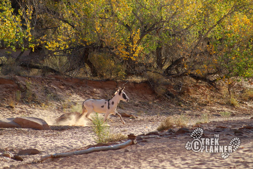
I took this time to just enjoy the canyon and the changing leaves on the trees. The wild burro ran far ahead of me and was spying on me in some bushes as I hiked by. It wasn’t aggressive to me, but it seemed more curious. Still, I didn’t get close or try to get in its way.
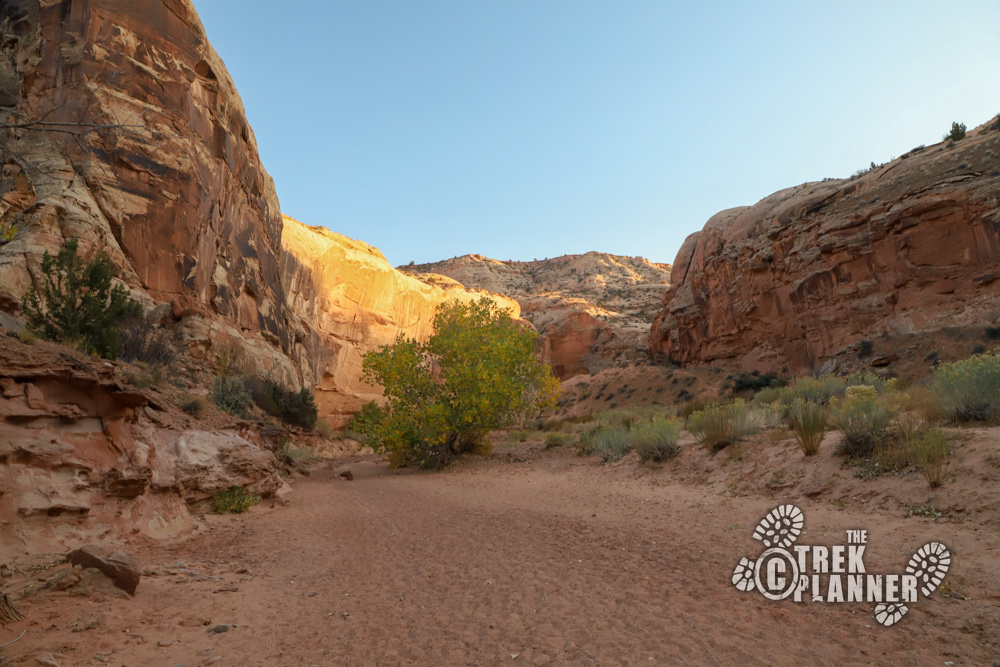
I encountered very few people on this hike and the people that I saw just looked tired. I could tell that all this hiking through the sand was wearing them down. It was beginning to annoy me a lot too, so I tried to go out of my way to walk on rocks or harder surfaces.
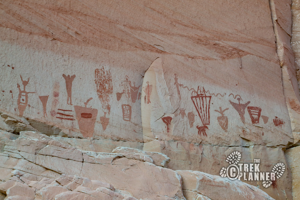
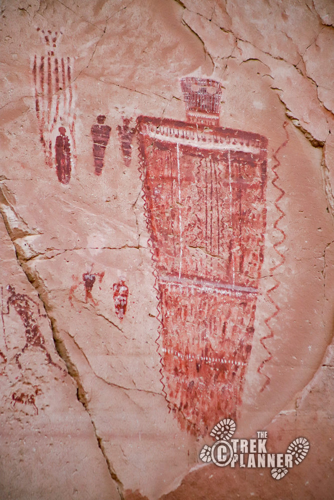
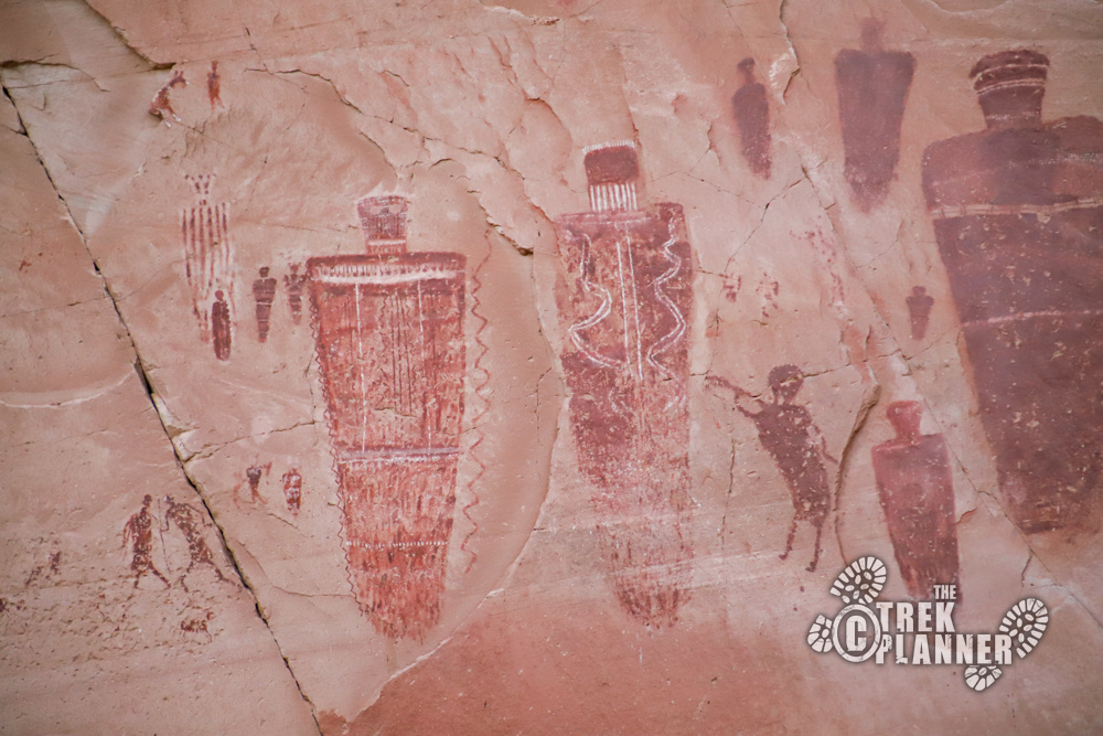
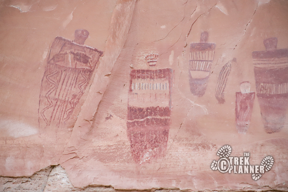
The Great Gallery
I finally turned the last bend and saw some rock art in the distance under a smaller alcove and just knew that this was the Great Gallery. Woohoo! I was getting tired by this point and looking for a great place to eat my sandwich and take a long break.
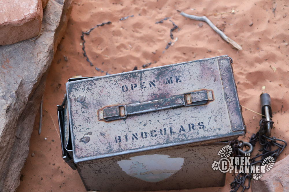
There is a trail that gets close to the pictographs, but you should stay behind the fencing. As you come up from the dry wash to the pictographs you will see a bench and two ammo cans: one is for hiking registration and the other has binoculars in it! Use the binoculars, but be sure to return them to the ammo can.
The entire pictograph panel is over 100 ft long.
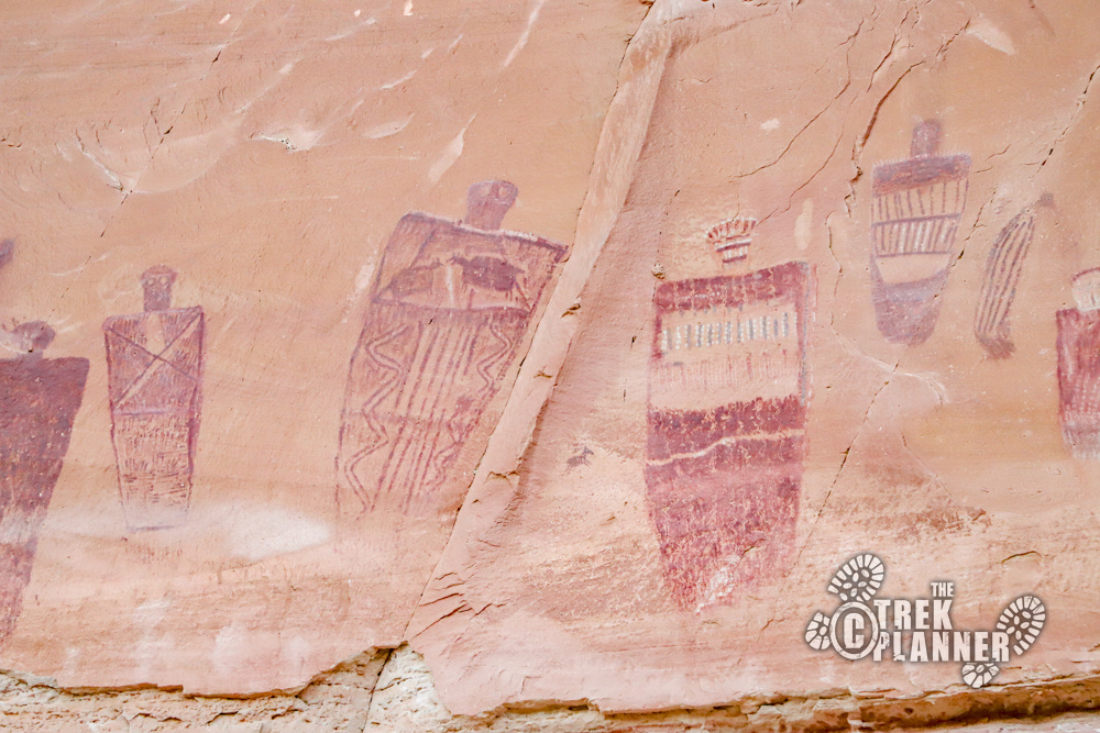
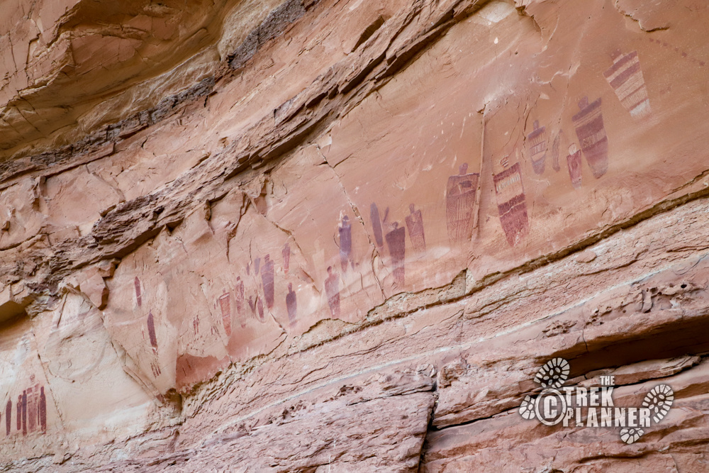
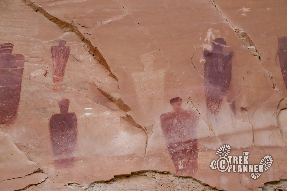
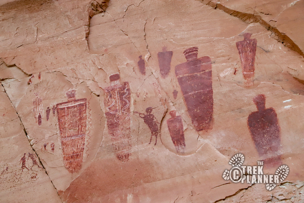
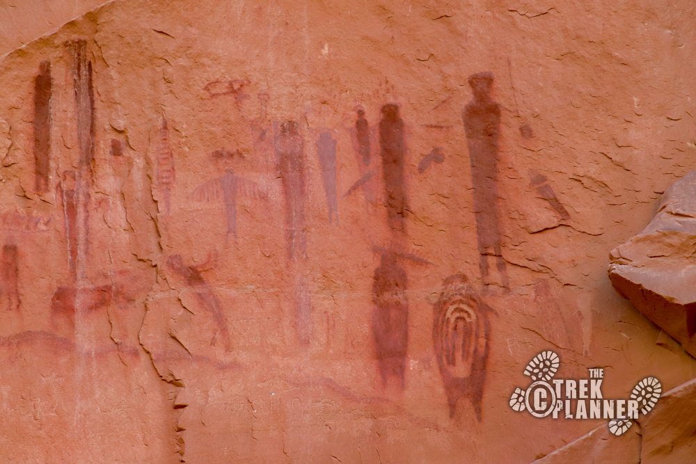
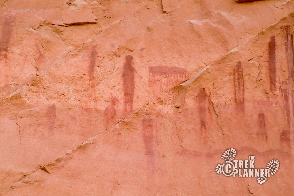
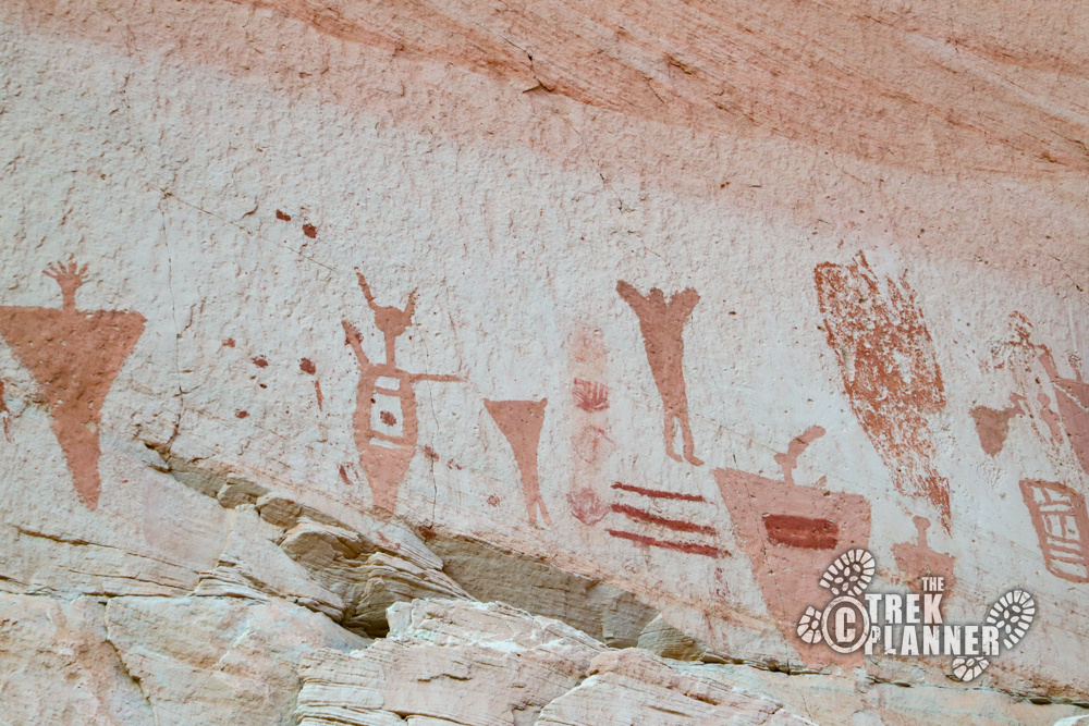
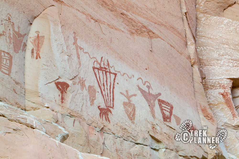
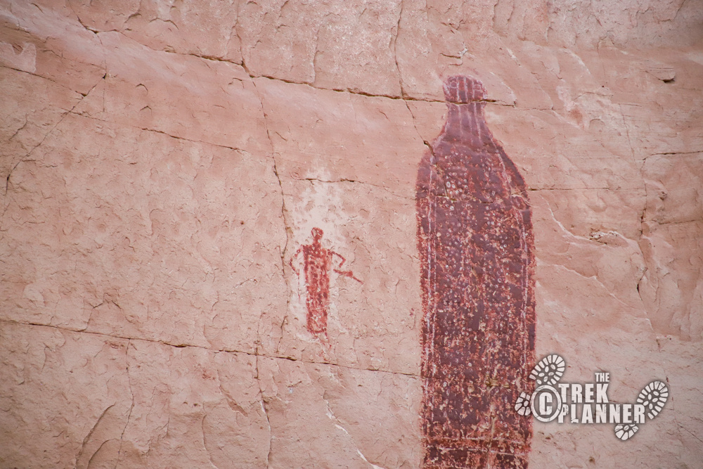
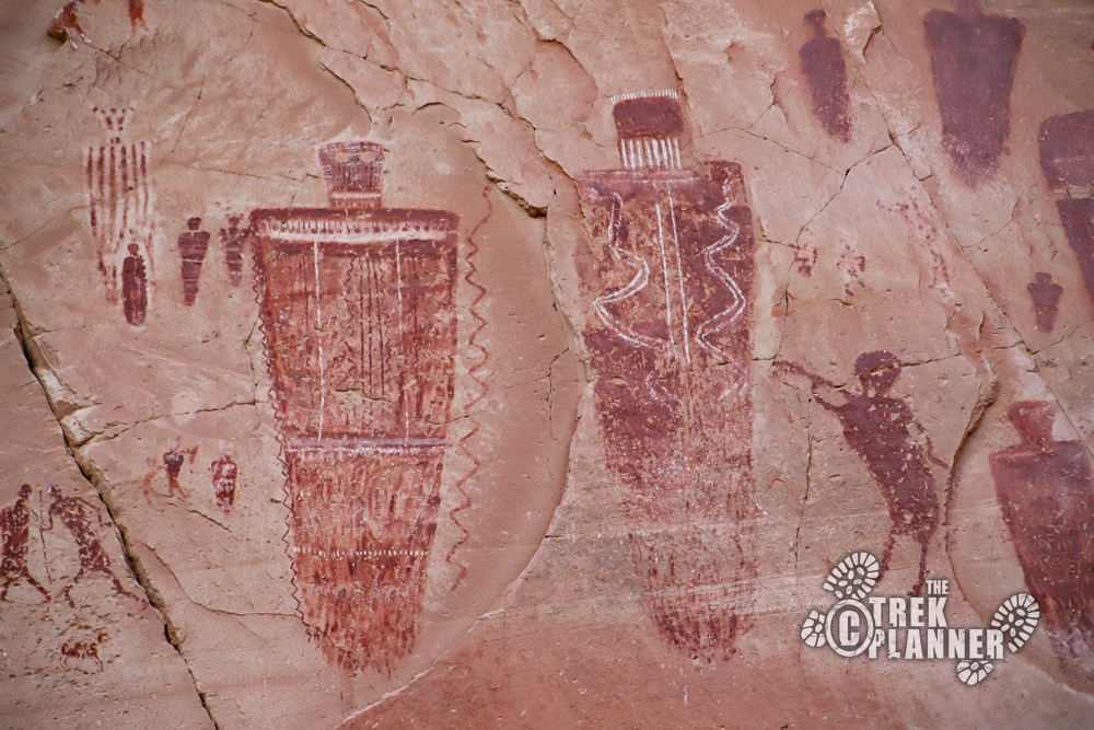
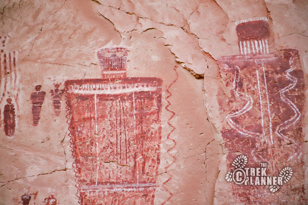
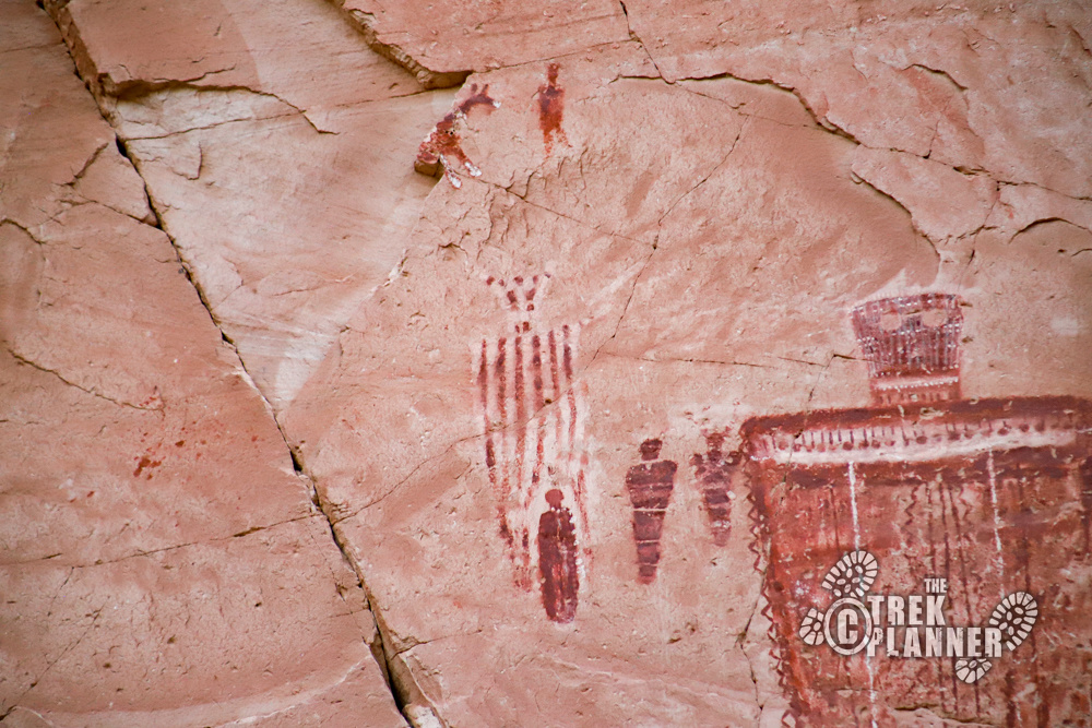
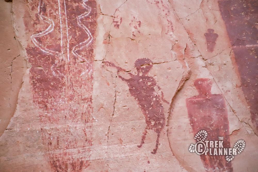
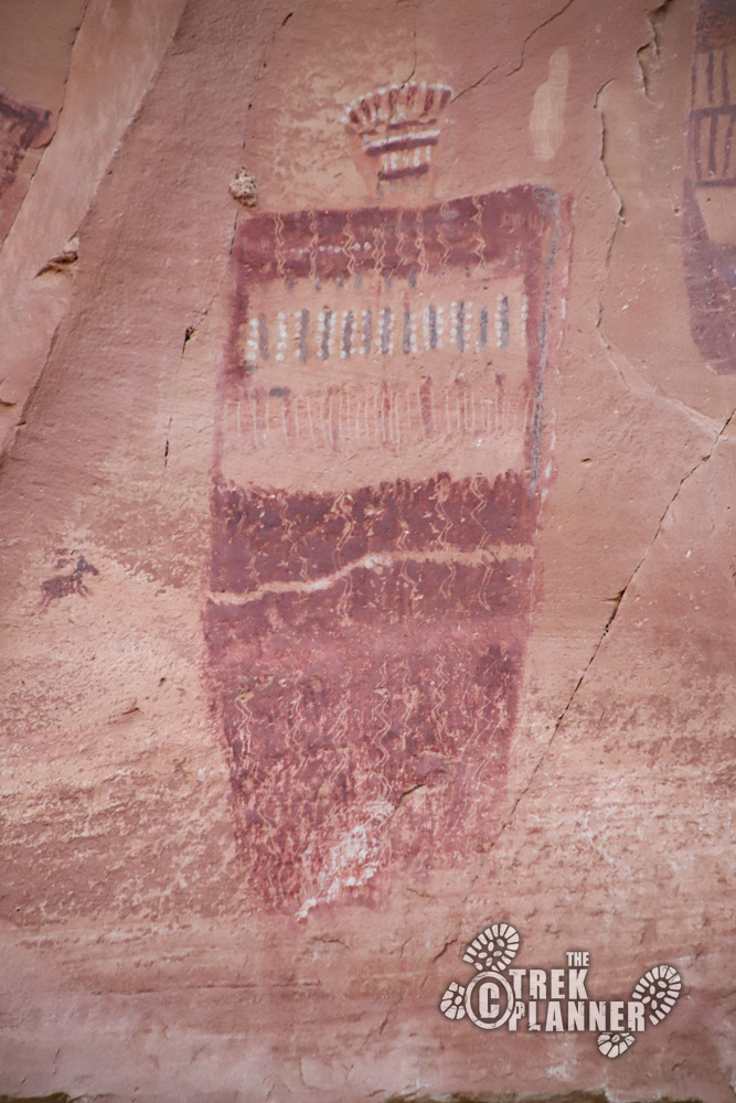
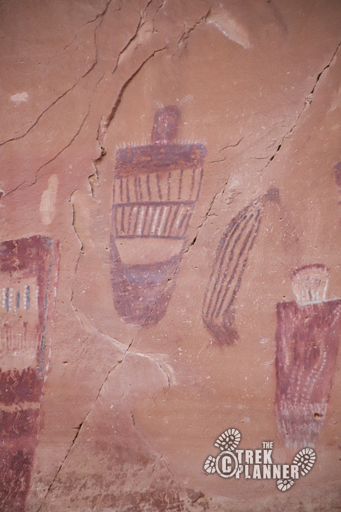
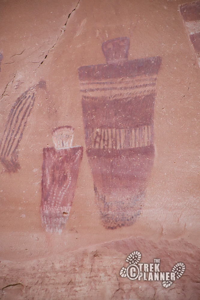
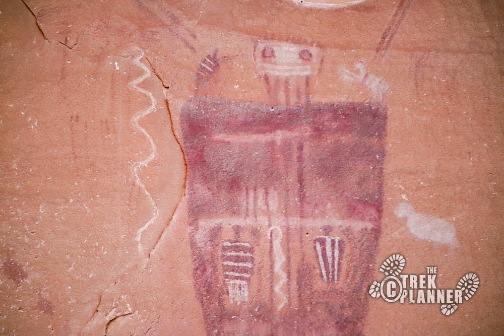
These pictographs are absolutely incredible and worth the 3.70 miles of hiking to get here. You will see many depictions of anthropomorphs with some being over 6ft tall! The amount of detail that the original authors made in their creations is simply amazing. I had my 300 mm camera lens and got to be able to see all the details up-close.
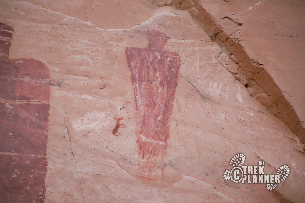
There are many different types of colors including browns, reds, oranges, whites, and even some greens. You will see figures with animals or people inside of them.
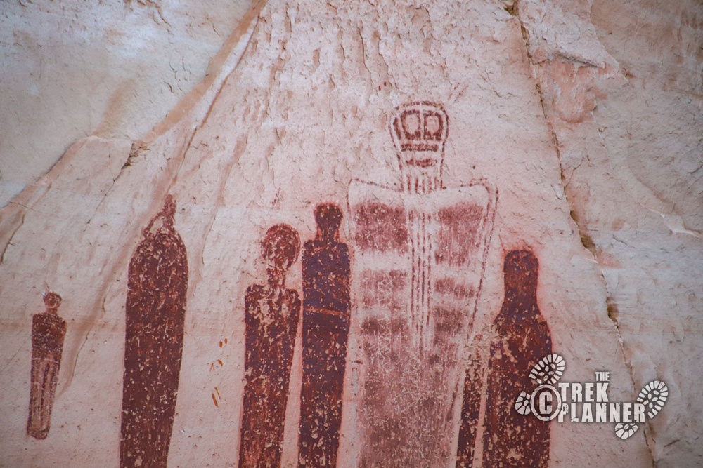
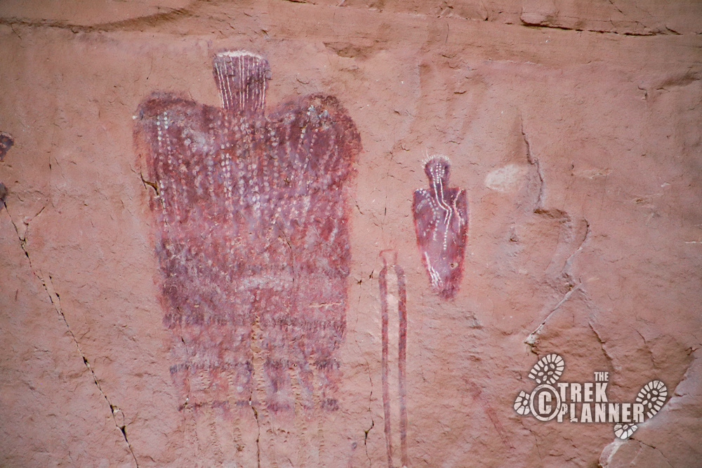
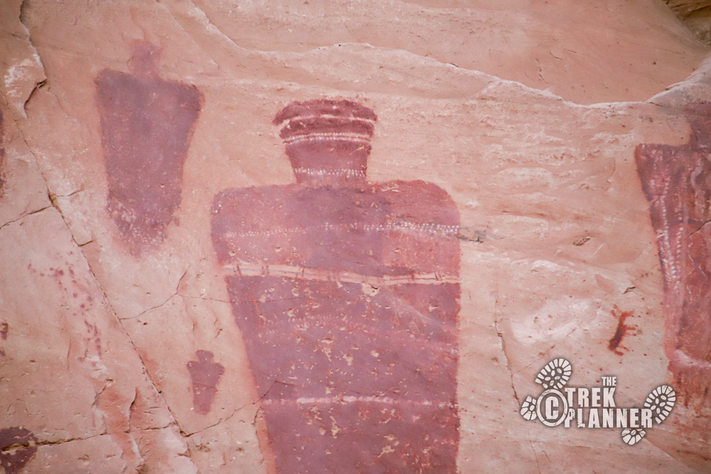
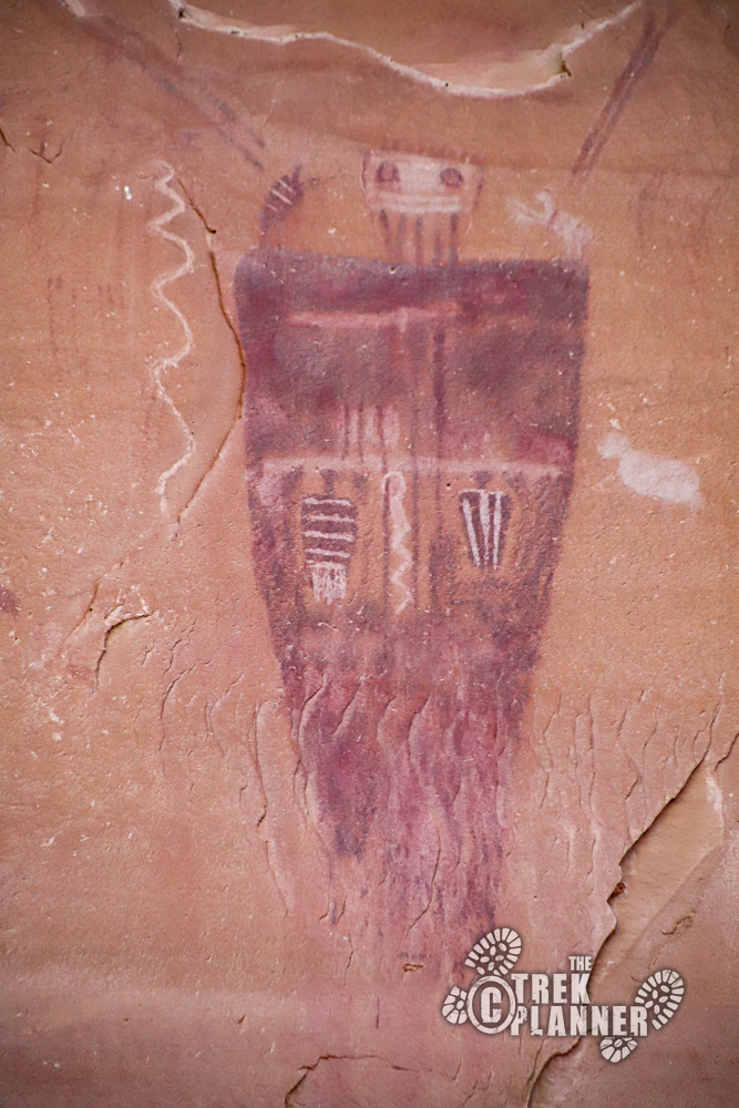
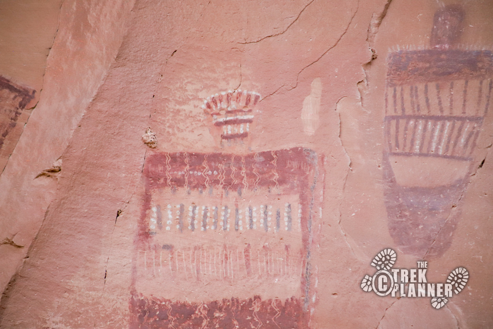
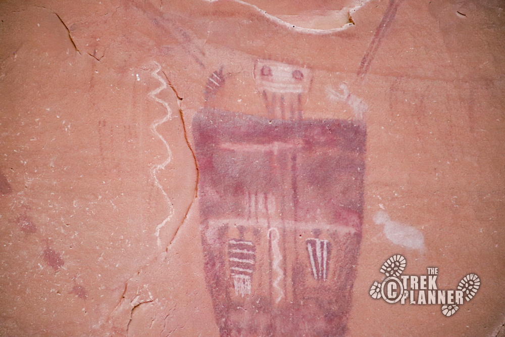
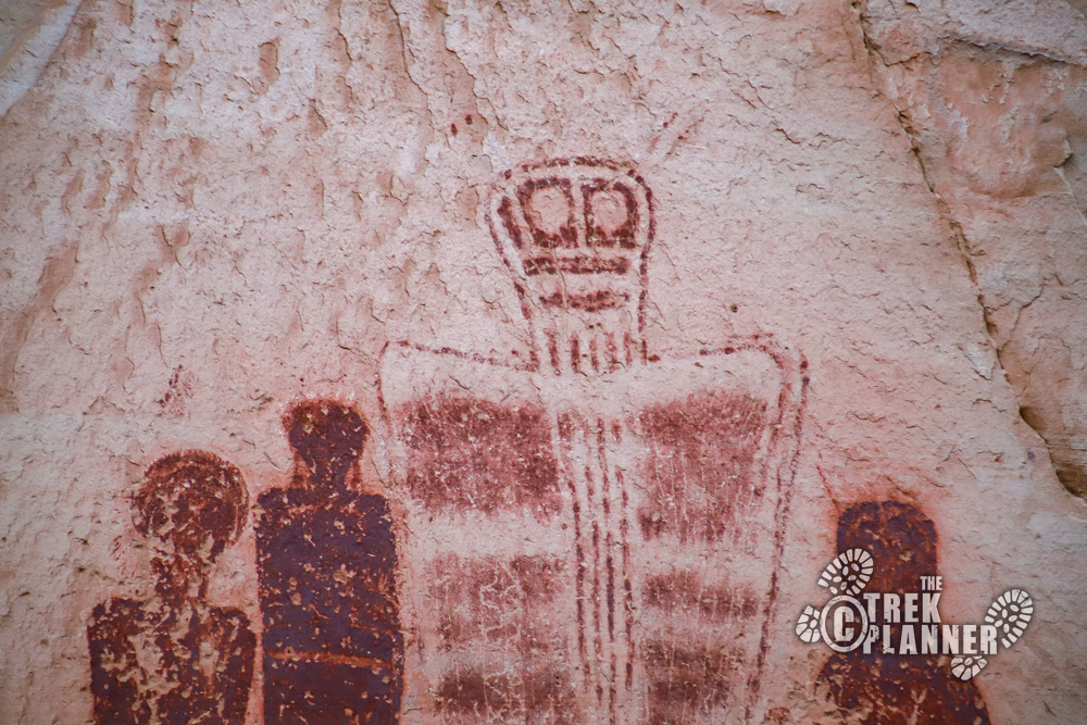
Take note of the pictograph style: large long limbless bodies with hollow eyes and some horns or antennae on their heads. What were the ancient authors trying to convey here? Were these religious figures, real figures, ideas, or something else? We don’t know the meaning of these so your guess is as good as any.
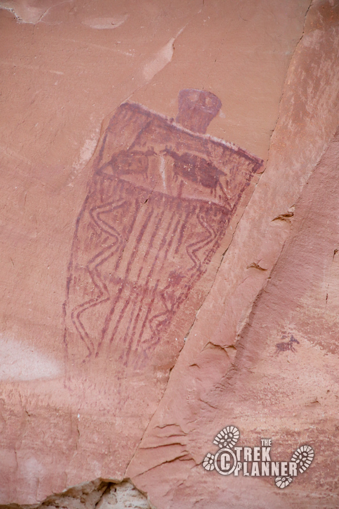
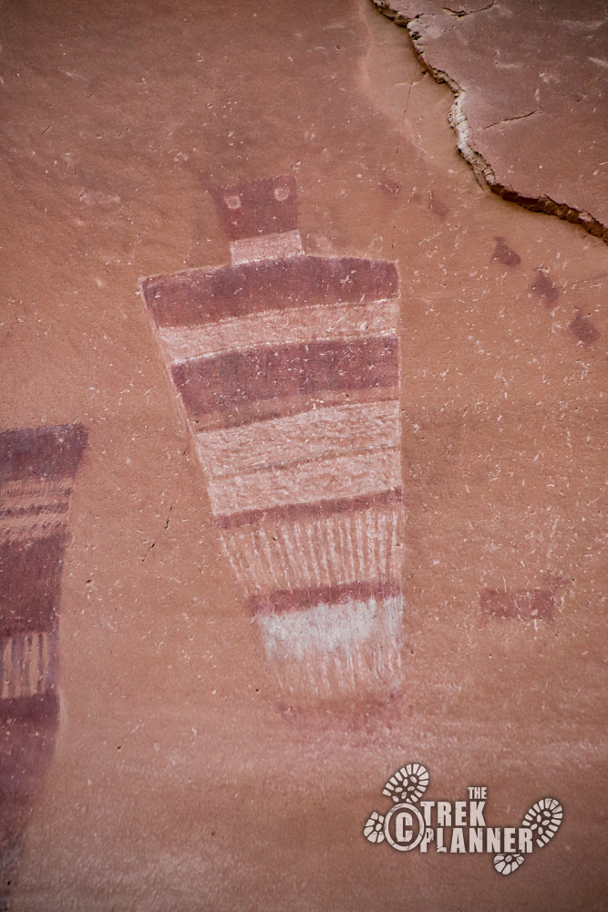
I highly recommend putting down your cameras and phones and just absorb everything. The authors of this panel stood in the exact same place you did and had the same exact view of the canyon that you do. Just enjoy this incredible place and try to take it all in without any distractions. The feeling I got is that the Great Gallery was/is a very special place.
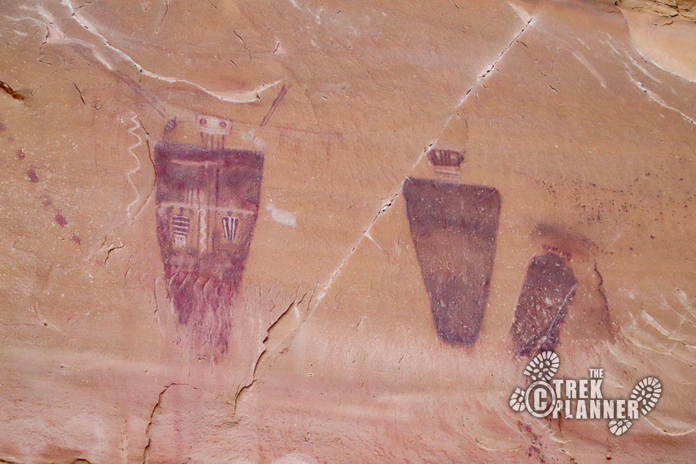
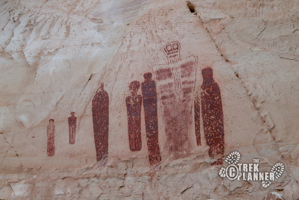
One pictograph panel in particular seems to be the most special. It’s located under a small outcropping and is sometimes called the “Holy Ghost Panel” or “The Holy One” panel. Again, we don’t have the meaning, but this panel was especially eerie to me. Every time I looked at it, I felt like it was looking back at me. I can’t really explain it!


Personal Thoughts
This is a must-do adventure for those who are wanting to see some of Utah's and North America's best rock art. I recommend coming in fall when it's cooler and your hike will be much more enjoyable. Bring a camera and binoculars! I rated this hike a little bit higher only because of the miles of sand hiking. If there wasn't so much sand, then I would probably rate this about a 4.3 or so. After seeing many other places that already have the Barrier Canyon style of drawing, I was completely floored by how much I loved seeing these pictographs - the place where this style of rock art originated.


[…] Hiking Now Reading Temple Mountain Wash Pictograph Panel – San Rafael Reef, Utah NextPrev […]
[…] it’s generally believed that this style of drawing/painting is of the Barrier Canyon Style. Barrier Canyon (currently named Horseshoe Canyon) is on the western edge of Canyonlands National Park. Long limbless bodies with hollow eyes and […]
[…] This is a beautiful part of Robbers Roost. While you are in the area you should check out Horseshoe Canyon. […]
[…] were already some rock art in the area to the west at Temple Mountain and also to the east of me in Horseshoe Canyon, so it was possible that rock art could be found in these other nearby canyons and […]