
The Trek in a snapshot
Location
Central Utah, near Wellington, Utah
Managing Agency
Multiple agencies including the University of Utah
Pets
Allowed but must be controlled by owners
Fees
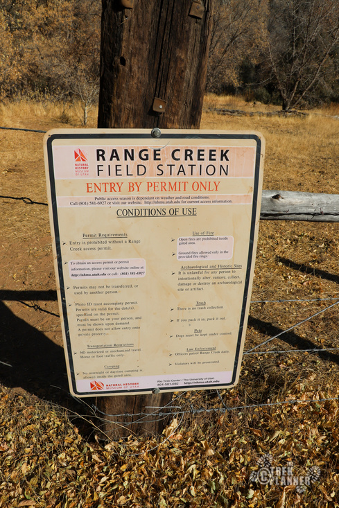
There is a fee to enter Range Creek. You pay online and then print out your permit and bring it with you. Permits are $1 per person and must be purchased in advance. 28 permits are available each day https://nhmu.utah.edu/range-creek/visitor-permits You can book a tour through a private company but those tours range from either $300-700 per person.
Restrooms
There are outhouses at the camping area and a few portapotties located throughout the canyon
Camping
Camping is only allowed outside of the gate into the actual canyon. The campground is located right at the north entrance gate.
Trail Condition
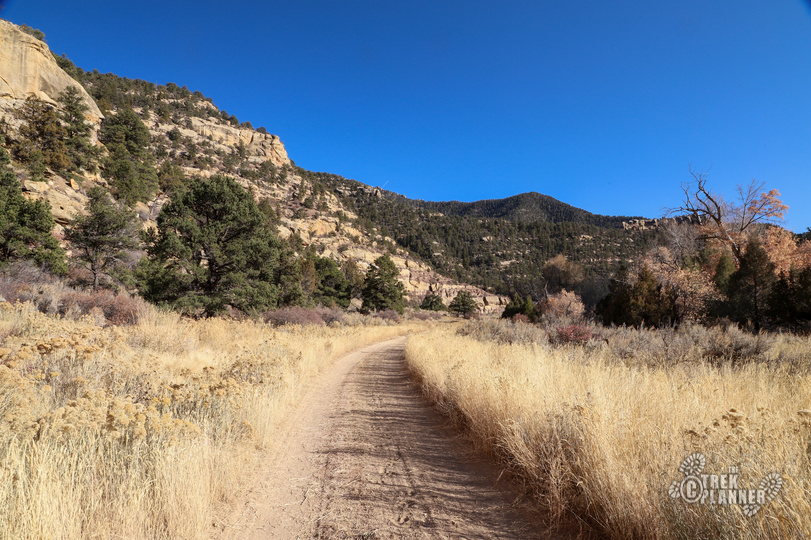
Graded dirt road. A high-clearance vehicle is highly recommended to get to the canyon entrance. I would highly suggest bringing mountain bikes to explore
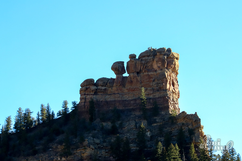
Sights
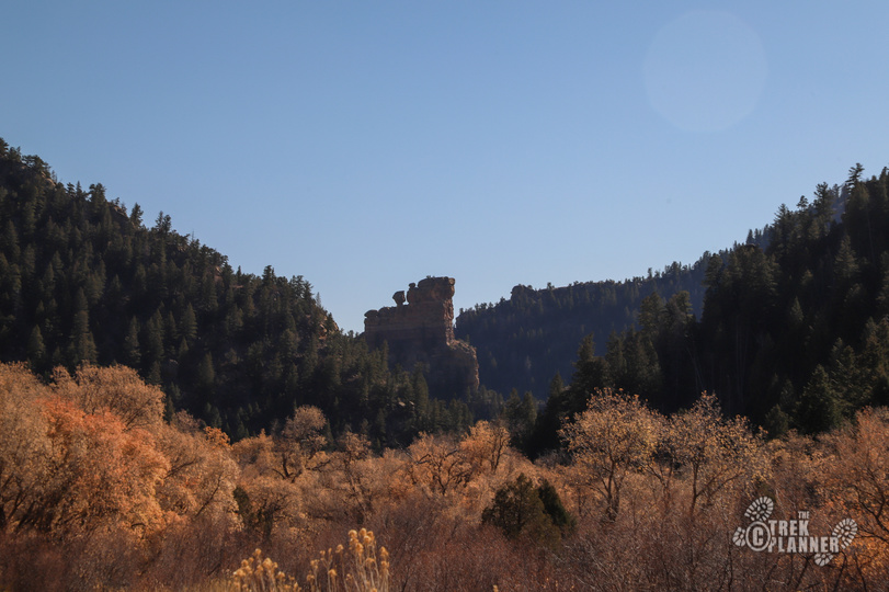
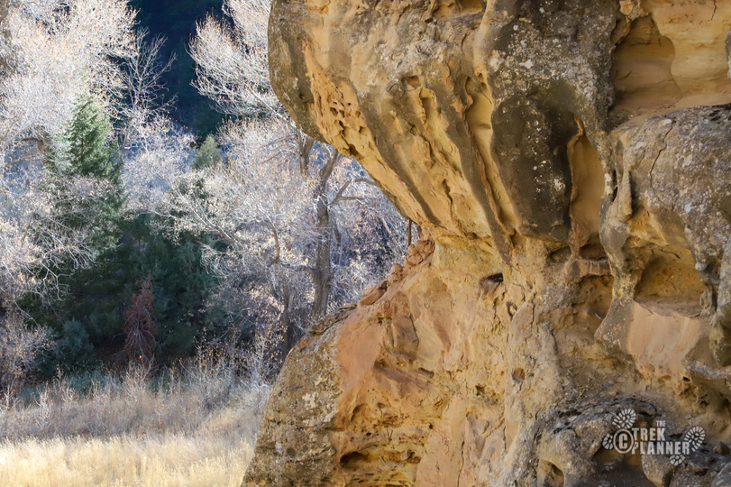
Range Creek, rock art, ruins, canyon environment
Water Info
Bring 2-3 liters of water
Best Season
Spring, summer, fall
Distance
We hiked about 5 miles roundtrip
Time Required
3-5 hours. Could be a multiple day trip
Parking Elevation
6767 ft
Summit Elevation
Varies
Elevation Difference
Varies

Trek Planner Maps
The trail map is only from the North Gate to Range Creek Ranch. The canyon continues to the Green River.
Horse Canyon Entrance: 39.46555, -110.34601
Range Creek Parking and Camping Area: 39.47602, -110.24694
GPS Coordinates to some of the petroglyphs, pictographs, and granaries along the first few miles of the trail:
Only Trek Planner Insiders can view the GPS coordinates below
(memberships are currently unavailable)This content is locked

Experience. Discover. Explore.
Follow along on our adventure then go out on your own!


This guide is only for the first few miles of Range Creek. You aren’t allowed to bring your own vehicles inside the canyon so you are forced to walk (unless you go through the trouble of bringing a horse). If you book a private tour you travel on their vehicles. Private tours can be hundreds of dollars.
Horse Canyon Road is the road just off of Highway 191. There is a rest area just off 191, but keep going down this road until you come to the entrance of the canyon. Continue in the canyon and you will pass by some very large old abandoned buildings on the right. Keep going down the road until the fork. Take the left fork to continue down Horse Canyon Road. From the entrance of the canyon to where you park in Range Creek is just over 10 miles.
Note: Please be respectful of the rock art, ruins, wildlife, and everything in Range Creek. Do not deface the rock art or take or mess with the artifacts.
The Fremont Indians lived in Range Creek by the hundreds and created many granaries, rock art, and other structures, many of which still stand today. This area is still relatively newly discovered by archaeologists which explains the rigid and strict permit system. This area is so untouched that archaeologists want to document and survey as many of these sites as they can before the idiots arrive to scratch their names on the rocks and loot and ultimately destroy the sites.
Range Creek Canyon is a remote location with no services. You need to be self-sufficient before you head out so you can be prepared for just about anything. You will need a high-clearance vehicle, a full tank of gas, food, water, spare tire, camera, and the rest of your gear for this adventure. The road to get to the actual Range Creek Canyon might turnoff some explorers before they get there due to the steepness of the road but overall it is not bad.
The permits to get into Range Creek are administered and managed by the Natural History Museum of Utah at the University of Utah. You will need to create an account on their website, purchase a season pass (it was $1 per person), select the date(s) you want to visit, and print out your permits. You can only visit 5 consecutive days at a time, but your season pass is good all year long. I know…It’s a confusing system, but it’s the only way to get a permit.
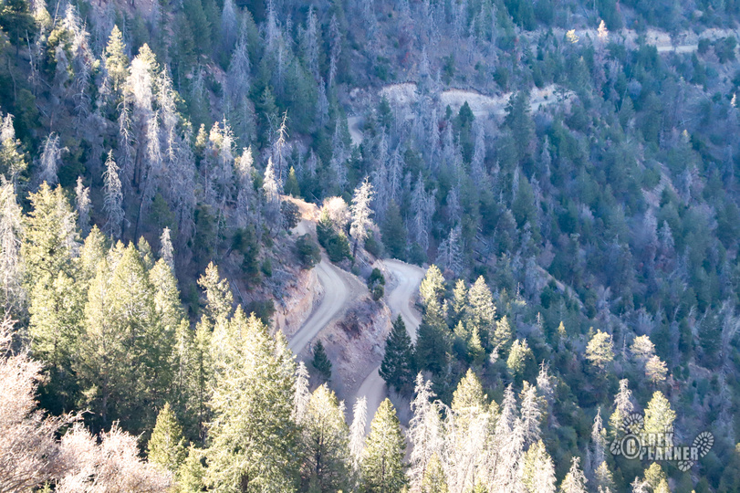
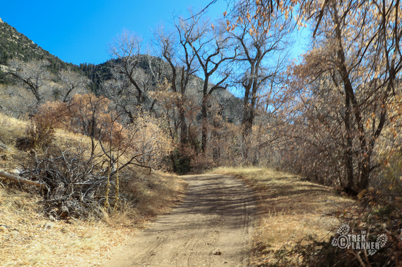
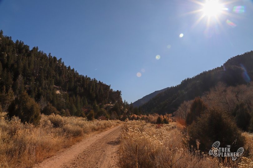
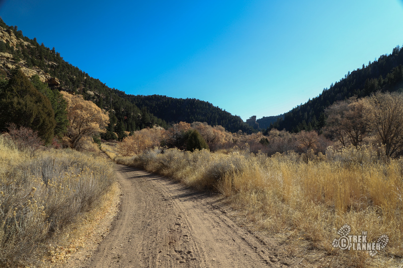
Range Creek Canyon is located east of the Book Cliffs near Price. To get into Range Creek Canyon you need to take the Horse Canyon Road. The road is narrow and steep with lots of sharp turns. If there has been recent rain I would not attempt this adventure until it’s dryer. The dirt on the roads is fine and powdery and will stick to your vehicle and your clothes and if it is muddy then this road could be impassible.
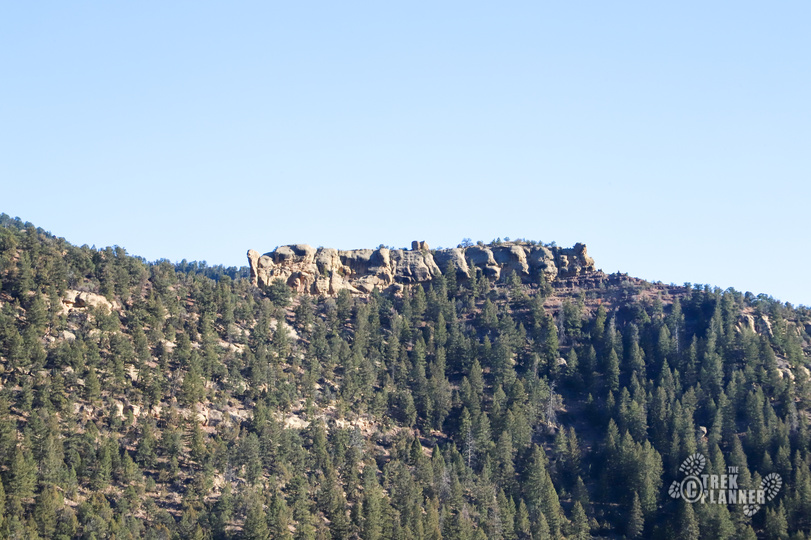
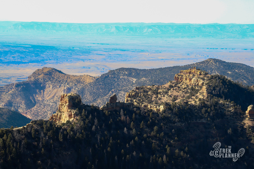
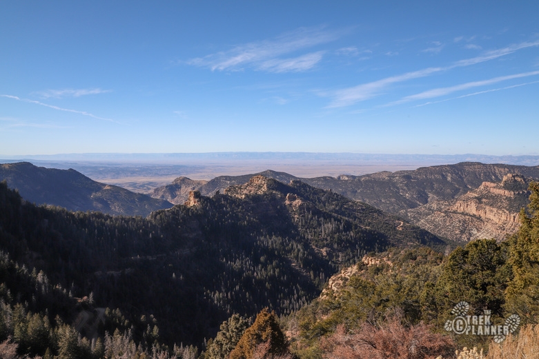
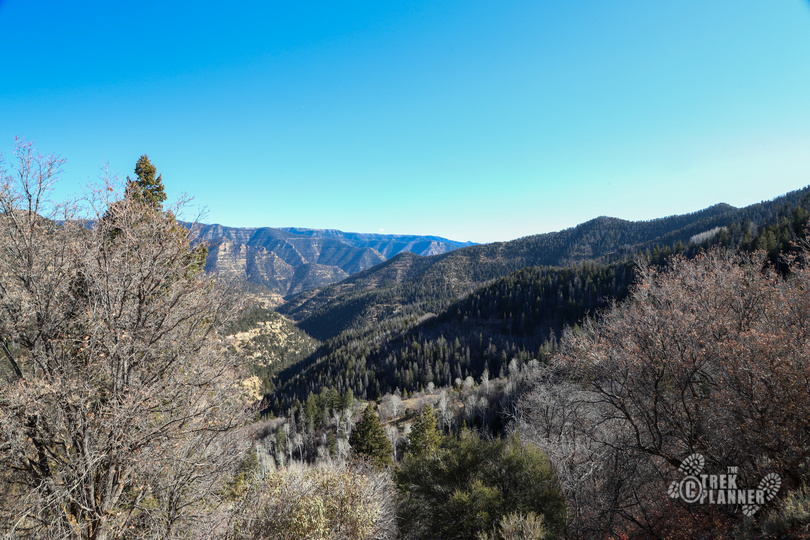
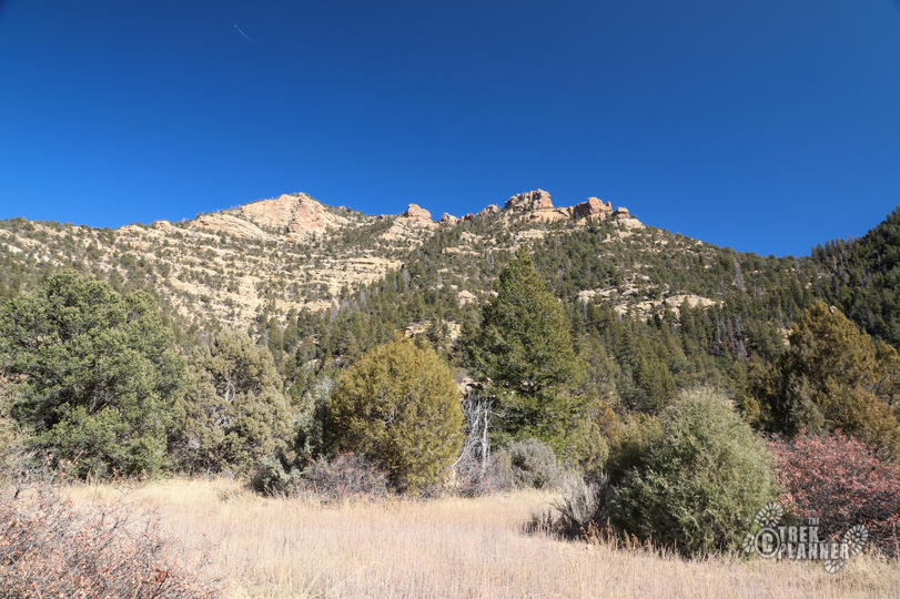
At the summit of the road you will come between a small gap in the mountains where you can see the canyons to the east and west. At the entrance to Horse Canyon you will be at about 6291 ft. Once you reach the gap in the mountains, you will be at approximately 8519 ft! It’s an absolutely beautiful road which goes through many trees so go slow and be careful and enjoy it!
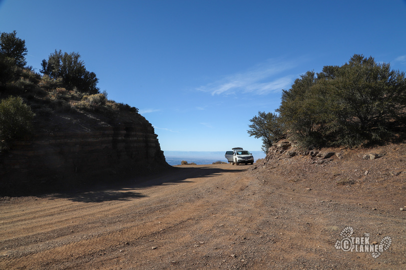
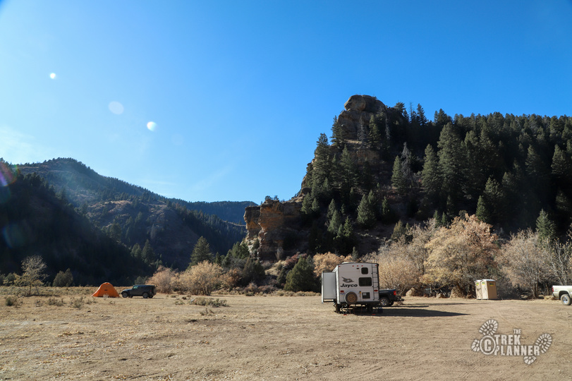
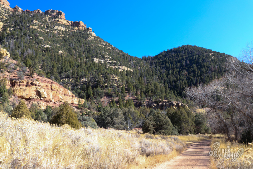
Once you begin your descent on the east side it won’t be much longer until you come to the gate and camping area. In total, you will have driven about 10 miles from the start of Horse Canyon until this point.
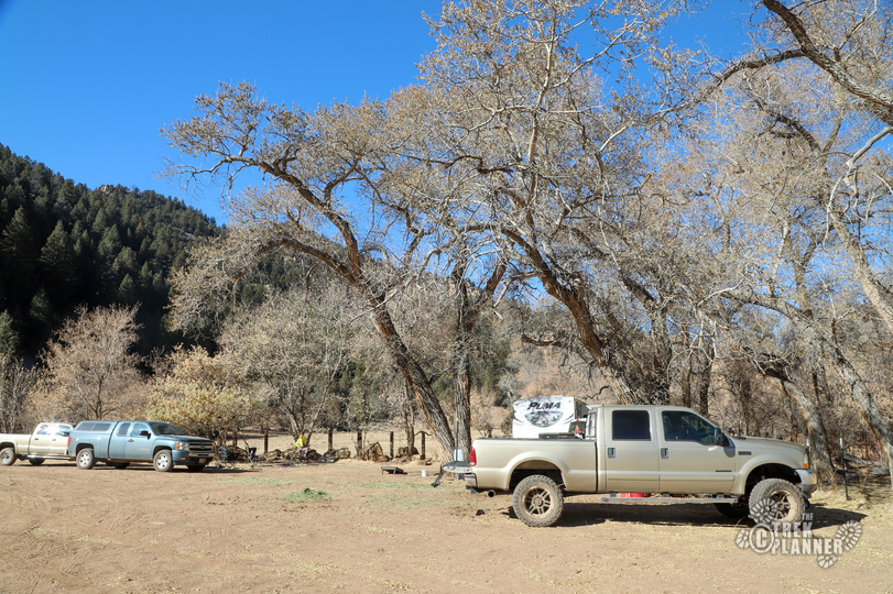
When we got to the gate, we saw multiple cars and RVs. Some of these people were hunters and some were explorers like us. The green gate on the north side of the fence is closed and only researchers, residents, and commercial tour groups are allowed to drive past this point. If you are camping you simply just find a level spot here and put up your tent or setup your RV. There were two outhouses (portipotties) near the north gate. There are some fire rings around and fires are only allowed in those rings.
There isn’t some guard station with a ranger waiting to check your permits or check you in. You simply just park, carry your permits with you, and if a ranger or someone stops and asks to see your permit you are required to show them. The canyon is patrolled daily so you will probably see rangers and some archaeologists driving around.
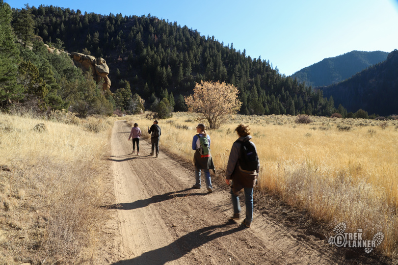
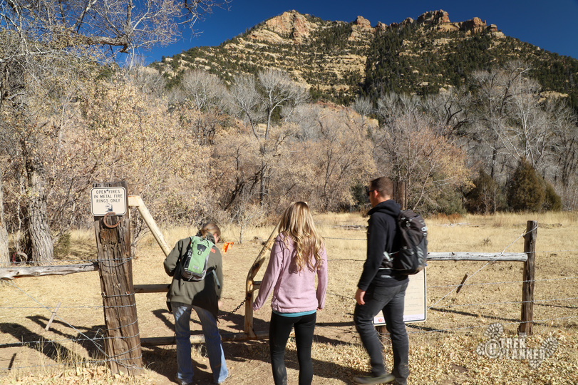
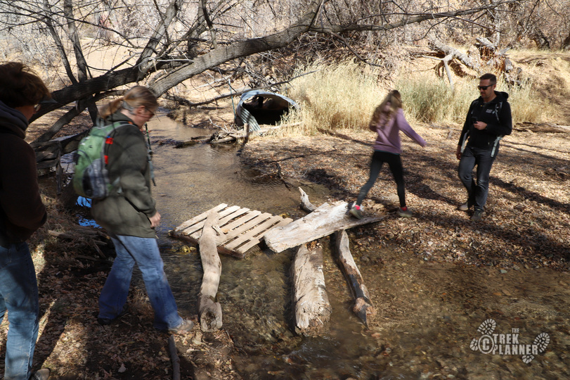
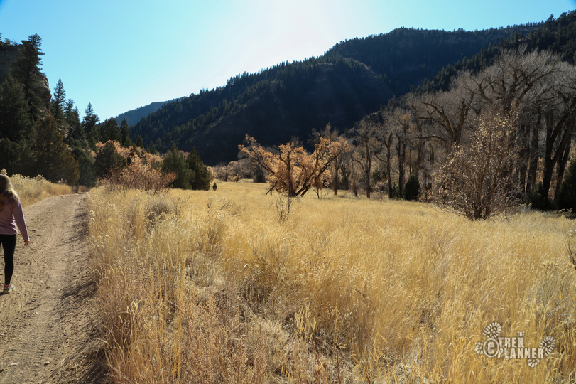
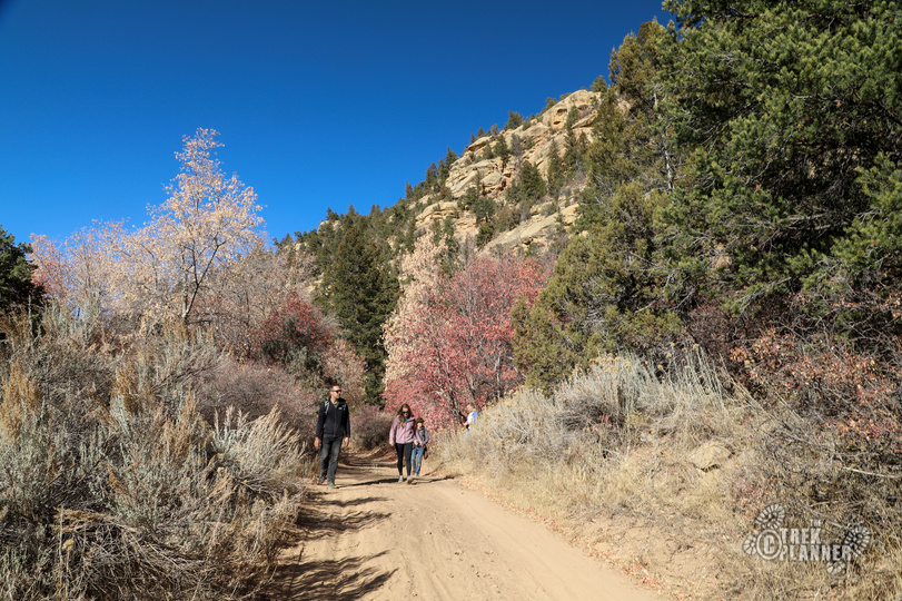
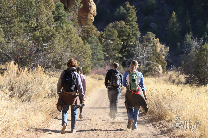
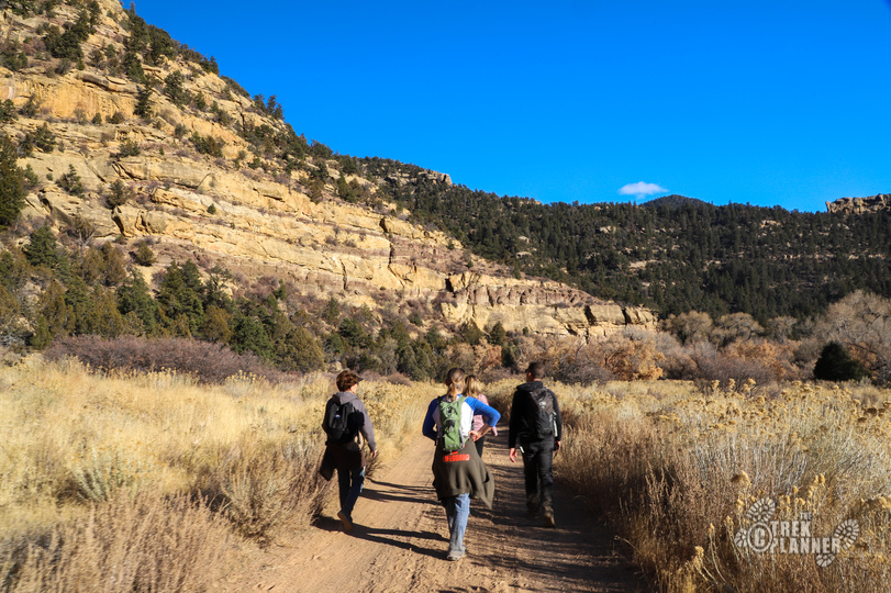
What we did was we parked our car, filled up our backpacks with food and water, and headed out on the east side hiker’s gate. We read the rules and of course carried our permits and IDs just in case a ranger comes upon us. There is not information on the canyon so if you just randomly drive down this canyon, you would have no idea there are tons of archaeological sites in it. Range Creek is purposely designed this way so as to protect all the sites from looters and other idiots. You must travel by foot (or horse) the rest of the way. You can go as far as you’d like to go, but there is no camping outside the official camping area at the north gate.
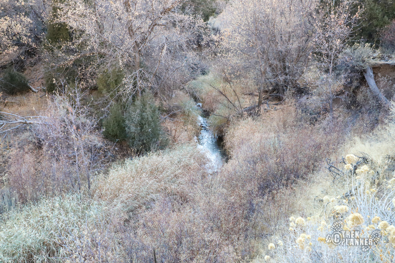
From the hiker’s gate, you will need to cross over the actual Range Creek in order to make it to the road on the other side. The creek isn’t that large but it is a perennial source of water for the canyon.
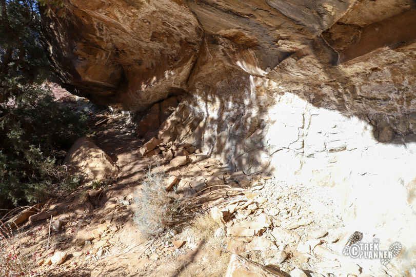
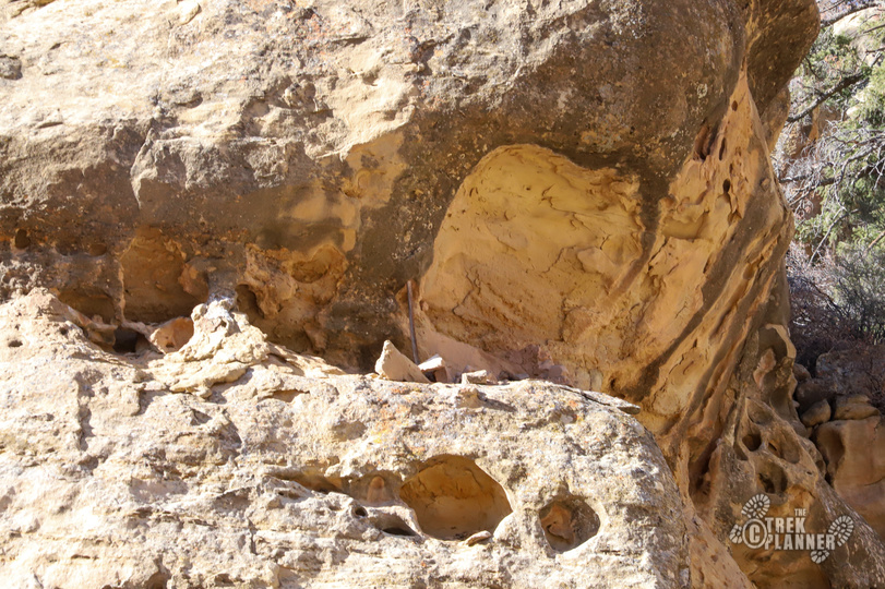
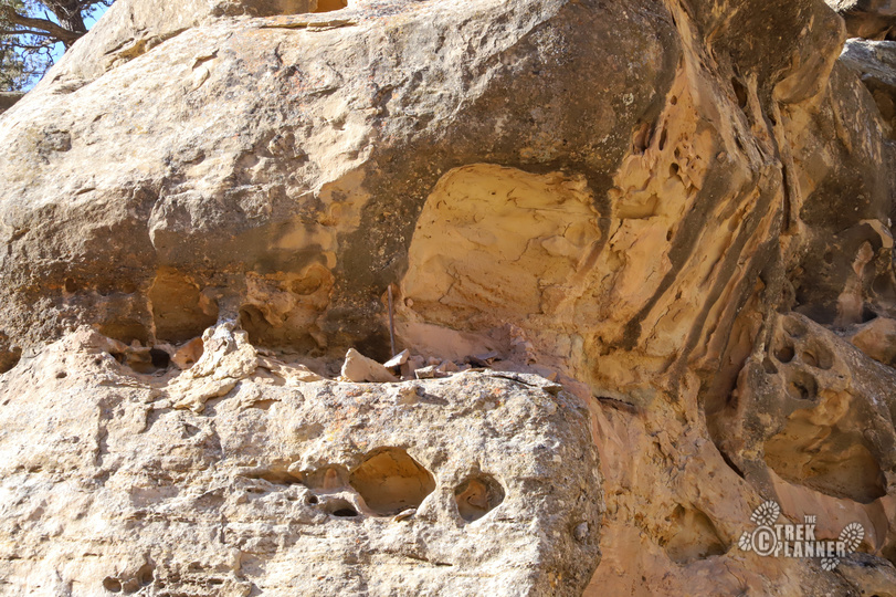
When we visited, I only knew the location of one archaeological site; everything else was discovered by accident and not from a guide. If you are expecting ruins such as those in Chaco Canyon or Mesa Verde you will be severely disappointed. The Fremont Indians built very subtle structures with rocks and mud hiding them in cliffs, alcoves or on precarious ledges. Many of the granaries are impossible to get to now without ropes and harnesses, so do not attempt to climb to any of them if you’re lucky enough to spot them.
During our visit, we simply just hiked down the road with our eyes peeled on the canyon walls. There isn’t much to be found if you don’t know what you’re looking for. When I purchased our permits online, I called a number and spoke to a lady about the canyon. She told me she can’t tell where the sites are located, but that there are a few “small” things to be seen within the first few miles of where you park. I asked her for some type of literature or guide or something and she said that there are none created by them – you are literally left to discover things on your own.
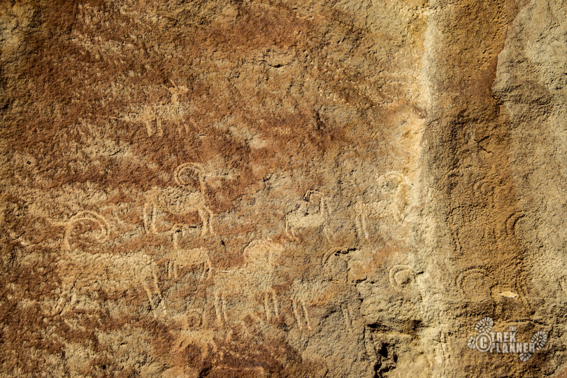
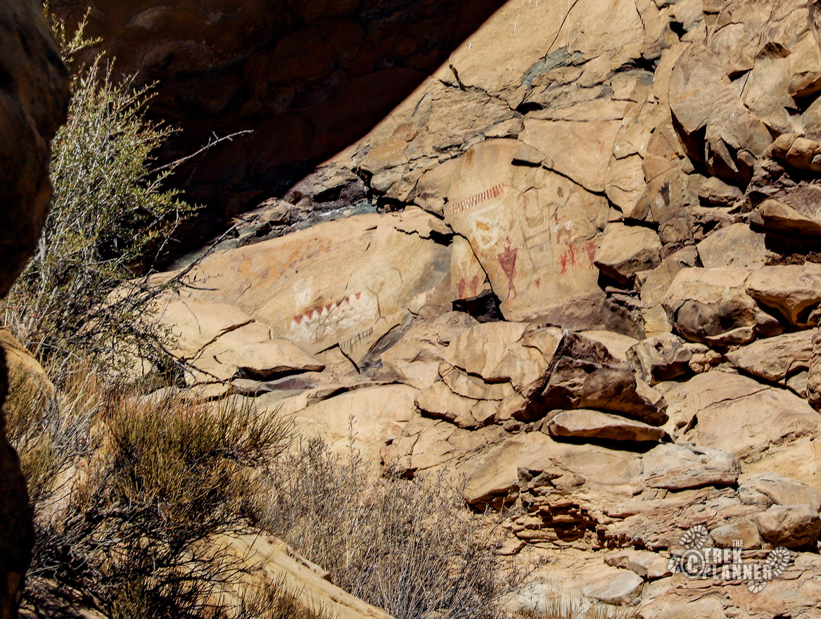
We didn’t have high expectation since we were told not to expect much. There isn’t much to be found since the Fremont lived in pit houses which have long been destroyed or are just piles of small rocks now. There are some petroglyphs and pictographs to be found though, many of which are hidden behind tall trees or under ledges. Don’t expect to see tons of rock art like you would in the nearby 9 Mile Canyon. 9 Mile Canyon has way more rock art that is more easily accessible than Range Creek. Range Creek is still in the beginning stages of being discovered and studied.
A few petroglyphs can be seen near the parking area and we periodically found some as we were hiking south in the canyon. You can see a few granaries too along the way. I highly recommend bringing binoculars or a zoom lens for your camera. If not, you will miss out on some things. I posted the GPS coordinates to the things we found, but these are available to Trek Planner Insider Members only.
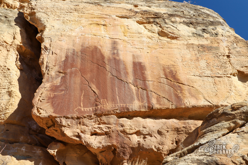
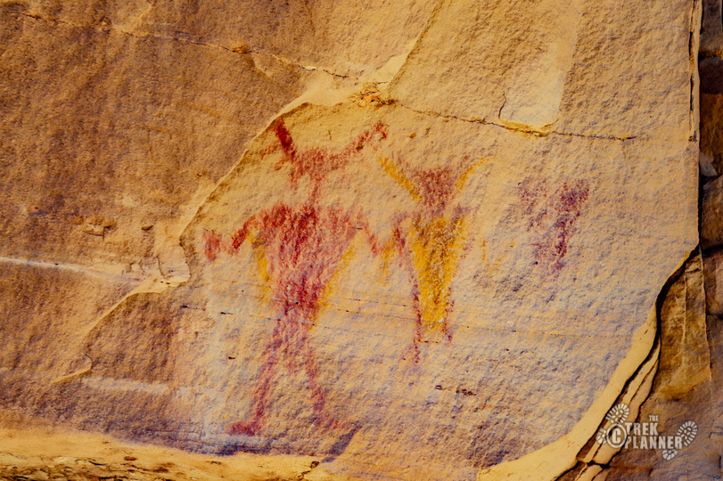
While we were walking down the road, my brother decided to follow up an incline on what appeared to be a narrow trail. He followed the trail a little ways and stumbled upon some petroglyphs and what appeared to be an alcove with perhaps some structural remains! We also found a small red squiggly line with a red circle. Really cool and totally unexpected!
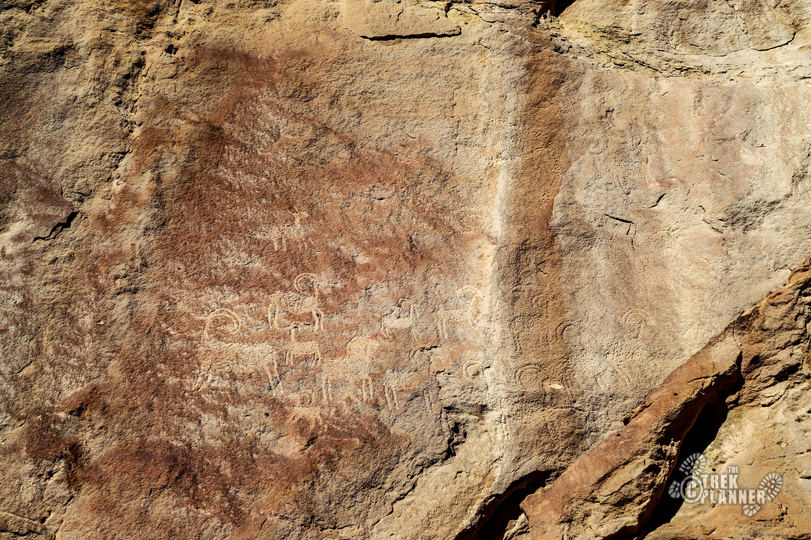

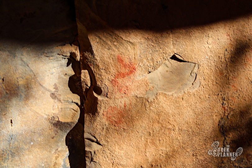
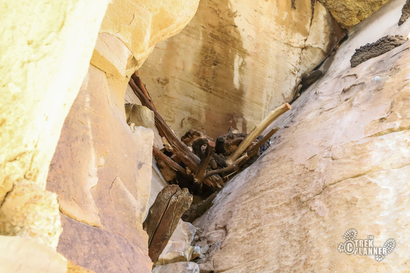
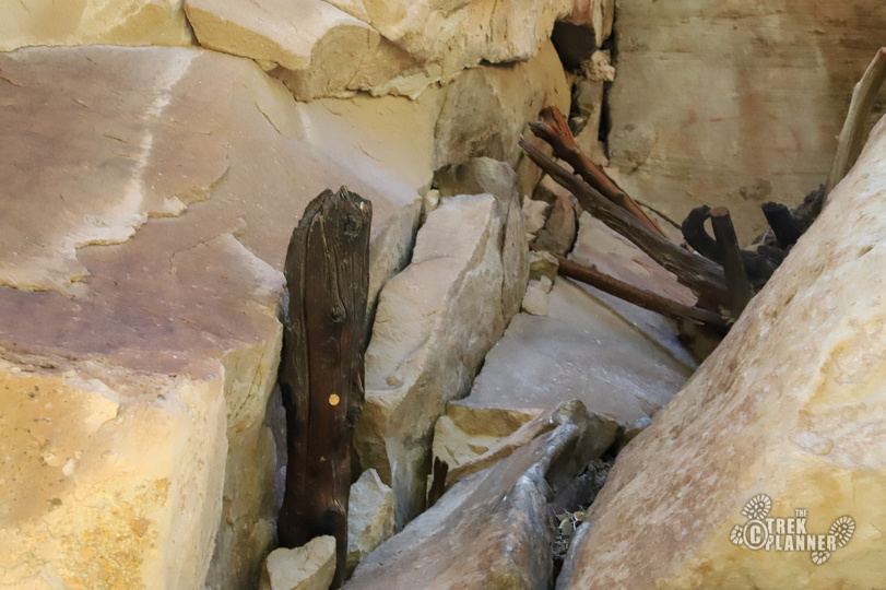
We continued down the main road and found a granary and some more pictographs!


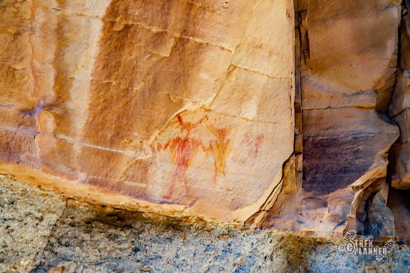
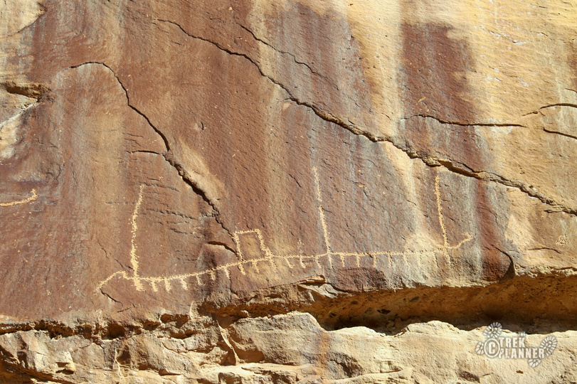
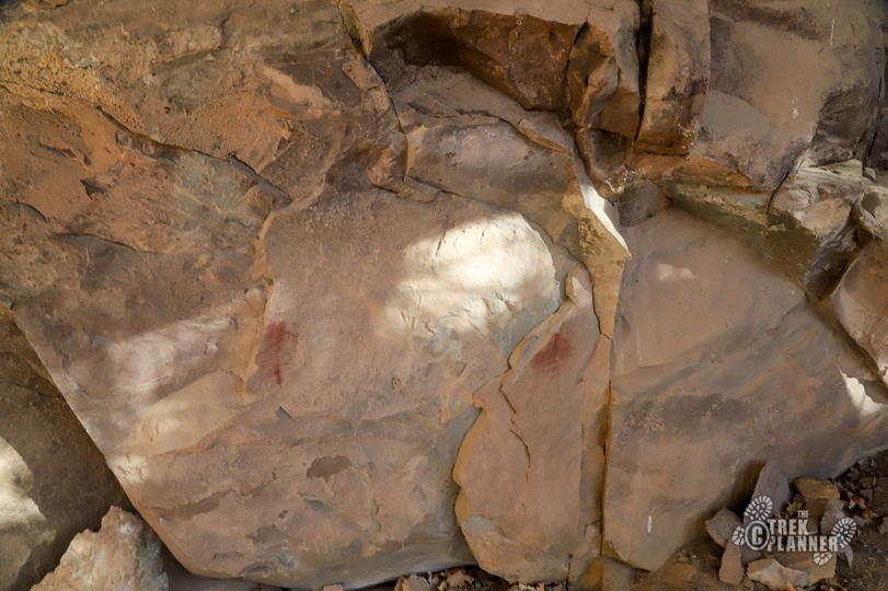
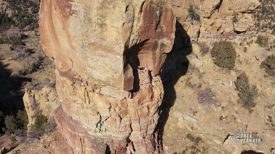
After hiking about 1.5 miles we came to another outhouse. This seemed like a good turning around spot since it was getting late in the day, but we felt like we should continue hiking a little farther. Good thing we did because we found an amazing pictograph panel way high up on the cliffs! You wouldn’t even see it unless you have binoculars. I tried hiking up to the panel to get some close pictures but the steep cliffs kept me from getting too much closer.
I then took the long way down and discovered some living areas under some giant boulders. These were marked by some metal markers in the ground.
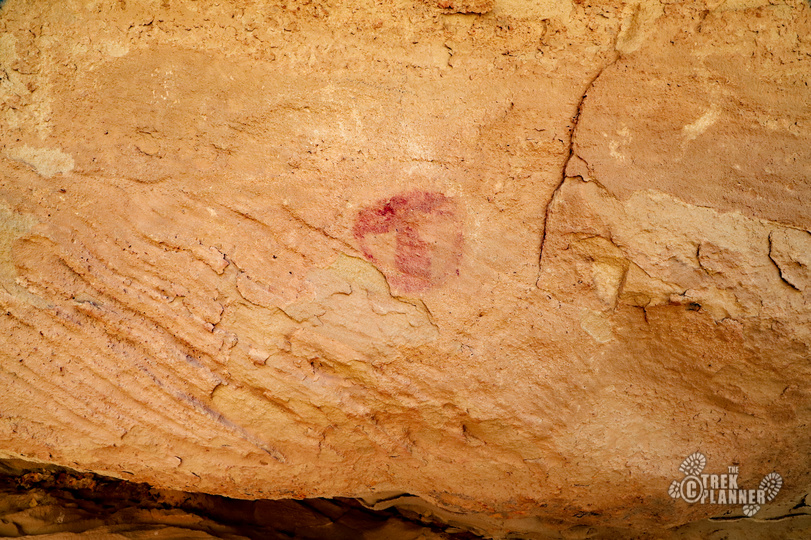
The panel in the below picture is very high up and hard to access. I tried hiking as close as I could, but it’s too steep.
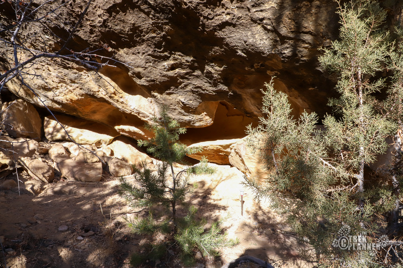
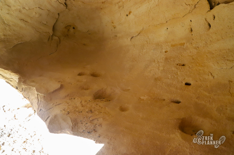

Beyond the panel, we found an incredible granary high up on a cliff that was still in incredible condition. It’s crazy to think that this granary is more than 10 centuries old! It’s impossible to get to now and it makes you wonder how the Fremont got up there and how many trips it took to get water and material to make it.
After viewing the granary we decided to go back to the car since it was getting dark. In all, we hiked about 4 miles roundtrip and saw some great things!

Personal Thoughts
The best way to see Range Creek is by spending a few days there exploring. If you visit for a few hours you could see a few things but if you spend a few days you could really go a long way and hopefully see lots more! This was a great adventure since I didn't know what to expect, but I was just surprised by the lack of information out there on Range Creek. If you type in Range Creek in Google, you will see some rock art and granaries, but there really isn't good information that can tell you the best way to see the canyon. Hopefully, this short guide was some help to you. I will add more content on my next visit.


Hi Jeff…I am a new member to your site. I have been to 9 mile canyon, but never visited Range Creek. I drive a stock Subaru Outback…would it be sufficient to get me to the trailhead and camping area at Range Creek? Thanks! Tom McCoppin, Lake McQueeney, Texas; sunsetpar@gmail.com; http://www.mccuration.com
Hi Tom! Thank you very much for being a member on our site! We hope you enjoy it! If there isn’t snow I would say your stock Outback would get there just fine. We have been there in a stock CRV that only had front-wheel drive and got there with no trouble. The road is just good, but it winds around on a steep path. We didn’t encounter any obstacles other than some of us got car sick from all the sharp turns. I hope this helps you!
If any if you are interested you might look into staying a night or 2 at the Tavaputs Ranch as Butch and Jeanne Jensen are stewards of Range Creek and can take you on a days tour through most of the Canyon and they know where all the good sites to be seen are and they spread out a great lunch for everyone. It is worth it just to see the ranch but when you include the Range Creek tour by vehicle you cannot go wrong. Do a search on Tavaputs Ranch.
Jeff we are headed up on the 8th of Sept. Can we help provide any information for the site? If so, what would be the most beneficial?
Hi Chad! Make sure you get a permit before heading out. Also, bring enough fuel, food, and water to last the duration of your trip including tire changing equipment and a full sized spare (if you have one). You are only allowed to hike and bike on the road in Range Creek, so I would highly recommend bringing mountain bikes. If you book a guided tour with one of the companies then they can take their truck through it. ALL of the archeological sites aren’t marked, so you will be left to find everything on your own. There could be… Read more »